What We Do
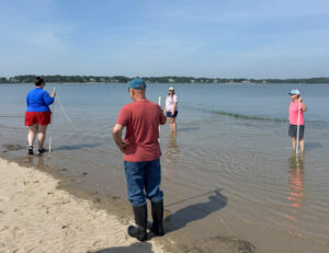
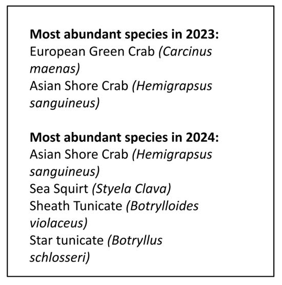
Our marine invasives volunteers monitor both intertidal sites (Third Cliff, Fourth Cliff, and Brant Rock) and docks (Scituate Harbor, Green Harbor, and Duxbury Harbor) for presence and relative abundance of non-native creatures like crabs, tunicates, and algae. We are part of a larger group coordinated through Mass. Coastal Zone Management (CZM), the Marine Invader Monitoring and Information Collaborative, that collects similar data along the New England coastline.

Asian shore crab Club tunicate
Check out a StoryMap of MIMIC data
Contribute to marine invasives data through the MIMIC iNaturalist project
Purple Loosestrife
Purple loosestrife is an invasive plant that can dominate wetlands. We collected Galerucella sp. beetles from the Mill Pond dam removal site, on the Third Herring Brook, where they had been used to control purple loosestrife previously, raised them, and transplanted them to Jacobs Pond where purple loosestrife has become a concern for the Town of Norwell. NSRWA continues to document their presence and initial success.

Sign up to volunteer and Download the 2023-24 Annual Citizen Science Monitoring Report here.
![]()