What We Do
Sea level rise is expected to affect our marshes in multiple ways, some of which coastal residents have already started to anecdotally observe on their own properties. Our Salt Marsh Sentinels (SMS) project is intended as a way for citizen scientists with docks along the river to gather basic data on the changes that are occurring right in their front or back yards.
Every fall, dock owners along the North and South Rivers work with our ecologist to document shifts in vegetation from the river to upland that can be an indicator of sea level rise due to climate change. Docks are located from near the mouth all the way past Route 53, so we are also able to set a baseline to document marsh migration up the river corridor as sea level rise causes brackish marsh to convert into salt marsh.
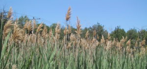
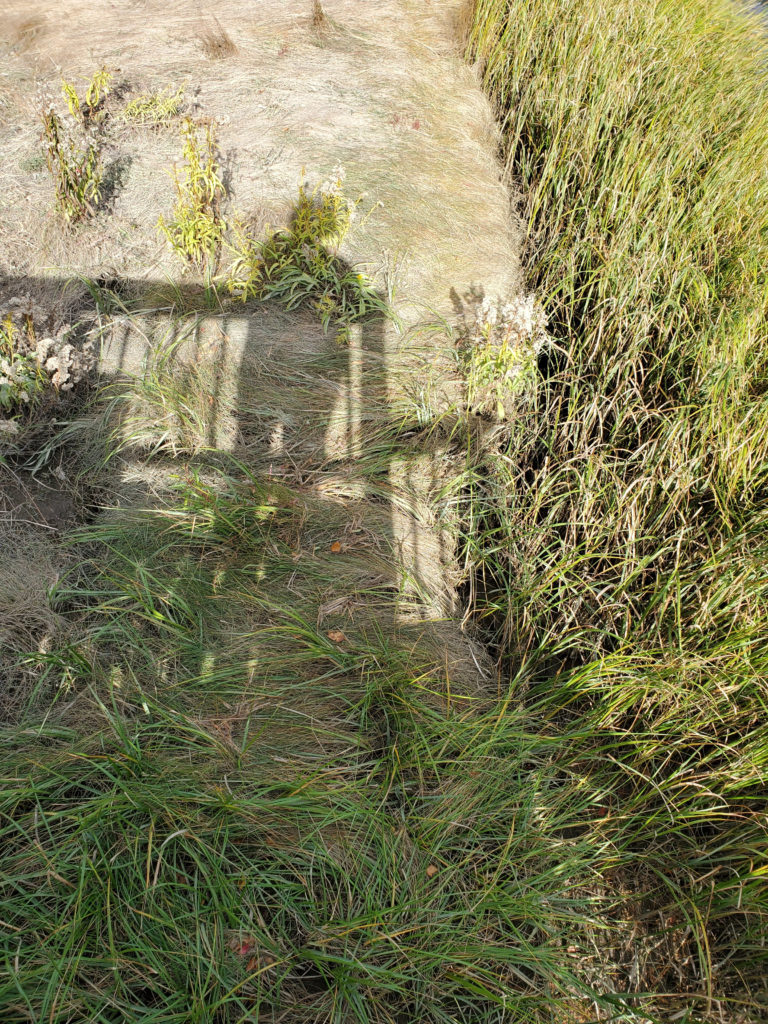 Salt marshes have distinct vegetation zones that define the low marsh (dominated by salt marsh cordgrass, or Spartina alterniflora) and high marsh (dominated by salt marsh hay, or Spartina patens.) Our SMS project asks dock owners to document the borders between these zones, as well as the upland edge, the edge of vegetation near the river, and the edge of the bank. With greater amount of time submerged at high tide, we would expect that the high marsh might start to migrate into the upland if it isn’t limited by the slope of the land, and that low marsh might start to replace high marsh. Dock owners also collect additional information on creeks (which may widen with sea-level rise), pannes, and pools. The project also extends into freshwater marsh higher upstream on the North and South Rivers, where we might start to see transition of freshwater marsh to brackish marsh and brackish marsh to salt marsh. We are in a unique location to study this because the North River is undammed along its entire extent.
 In 2022, 11 docks were surveyed, 5 of which were new sentinels we welcomed to the program. That brings the total number of active salt marsh sentinels (surveyed within the past 3 years) to 24. Of the 6 that were re-surveyed, 3 had data from 2018. Over the 5-6 years of this project, we have seen small shifts in zonation. In the sites above, we have seen an increase of 1.5 feet of upland border vegetation (like Phragmites), a slight gain of 0.5 feet of high marsh vegetation (extending into previously non-wet areas), and a loss of -2.1 feet of low marsh (mostly a loss of bank edge dominated by a few sites).
In addition, there is a way that any property owner or river steward along the river can assist in documenting these changes. When saltwater moves closer to the land or the ground becomes too wet, it can often kill trees, resulting in “ghost trees” along the edge of the upland at the marsh margin. If you notice trees dying along the upland edge, please contact Alex Mansfield at our office (alex@nsrwa.org, 781-659-8168) so we can map them.
Download the 2022 Annual Citizen Science Monitoring Report here.
![]()
You can help advance science from your own backyard. All you have to do is spend about 30 minutes once a year, standing on your dock and answering a brief questionnaire about what you see when you look out at the marsh. Your observations, at the same time, in the same place, once a year for 30 minutes is all it takes to help us understand the health of our estuaries.
 What does a Salt Marsh Sentinel do?
As a Salt Marsh Sentinel, you will collect data and record it on an NSRWA datasheet once a year between August and September at low tide. Your quick observations from your dock, over multiple years, will be invaluable to our efforts to protect the local watershed.
When you volunteer, NSRWA will place a few small markers (colored pushpins) on your dock floor to mark specific distances from the bank of the river. Alex Mansfield, NSRWA’s watershed ecologist, will show you what to monitor, what information to gather, and how to record it. We will pool the data collected for analysis. Your dock will be used only as a viewing platform along the river; it will not be associated in any way with the data we collect.
As a Salt Marsh Sentinel, you will receive:
• A banner for your dock to showcase your participation in this exciting new study
• An annual report with an update on this exciting new initiative
Why study the salt marsh?
Salt marshes are in peril. We are starting to see concerning change and loss in the marches along the North and South Rivers estuaries. The major threats are sea level rise and physical obstacles to marsh migration, over-flooding, pollution and nutrients from fertilizers, boat traffic, and invasive species such as the green crab. These threats are causing our local salt marshes to lose their structure and fall apart.
Salt marshes serve important ecological functions. They protect our waters by absorbing nutrients from the land; offer nursery habitat and shelter for a variety of fish like striped bass, bluefish, and herring; and they provide food for birds, fish, and other creatures. Marshes also help sequester carbon—“blue carbon,” which is another way of saying that marine plants help mitigate climate change.
Why should I be a Salt Marsh Sentinel?
The health of our local estuaries, now and for years to come, relies on your help in this project. As someone who lives near a salt marsh, you appreciate how beautiful and important they are. As part of a New England-wide effort, the NSRWA collects scientific data on local salt marshes to inform management decisions and broad policy efforts. With your help, we will be able to assess changes in the marsh over time. This information is essential in our efforts to protect the estuary and the hundreds of creatures that make it their home.