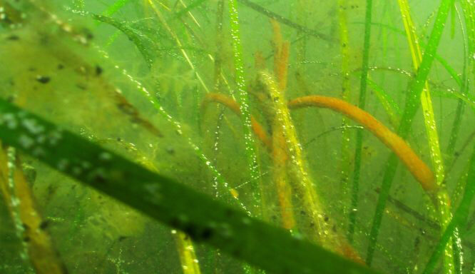
Duxbury, Kingston, and Plymouth Bays have experienced severe declines in eelgrass coverage over the last several decades. Monitoring these changes allows us to assess the health and current status of eelgrass within the embayment and find out what might be driving the losses. We collect this data using a drop camera to measure eelgrass percent cover at 119 sites throughout the bays, on boats captained by volunteers. We also selectively collect and measure eelgrass shoots and assess them for wasting disease and growth of organisms on the eelgrass blade. The data is entered into the iSeaGrass app, which was created in partnership with Mass. Division of Marine Fisheries (DMF).
 NSRWA and MassBays conducted monitoring of these eelgrass beds from 2008 to 2025. We hope to keep this project going into the future.
To stay in the loop sign up on our volunteer page.
See the iSeaGrass storymap with QR code below.