
Marshfield Conservation: 781-834-5573
Owned By: Town of Marshfield
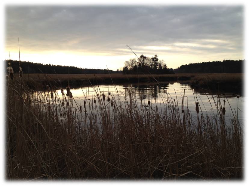
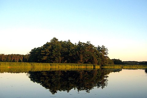
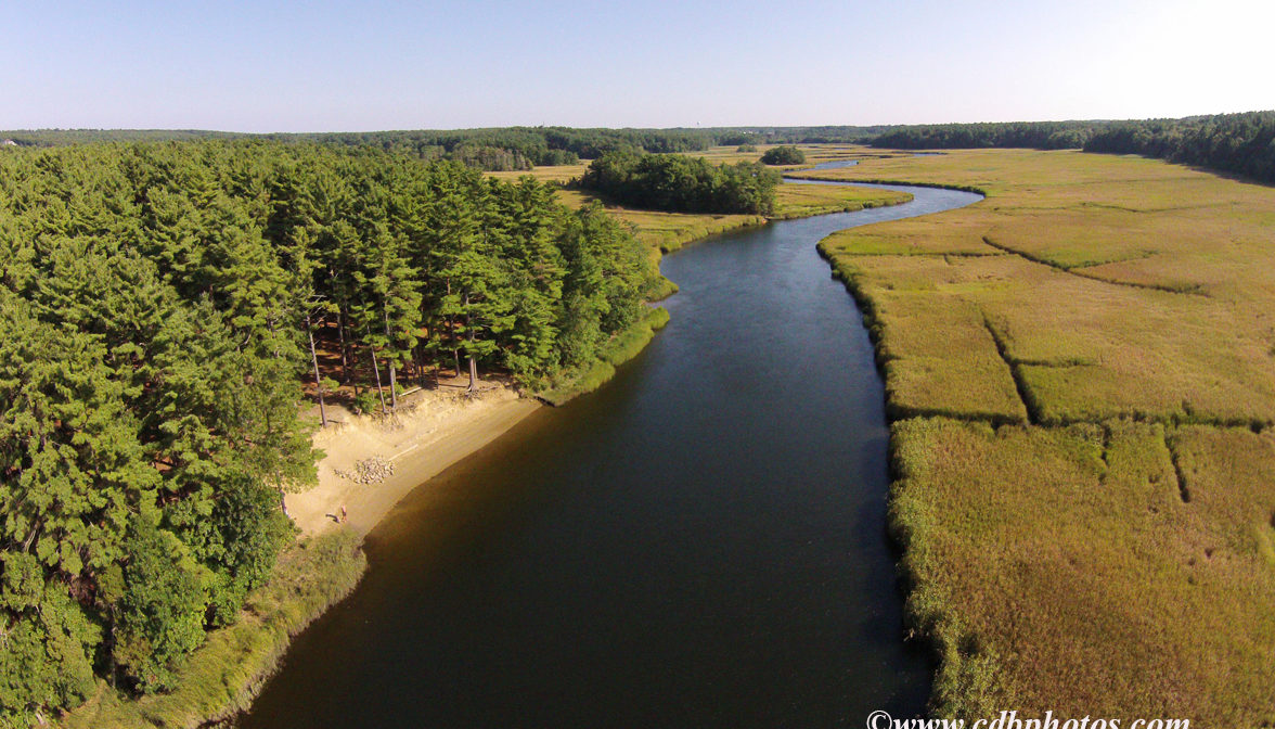
Blueberry Island is 4 acres of upland surrounded by 12 acres of marsh, situated directly on the North River in Marshfield. It is a popular picnic and camping area, and a great place to pause during a paddling trip. Take care, as the river current can be strong and unpredictable! Couch Beach — another popular camping and picnic spot — is just a short paddle downstream. Little Blueberry Island, considerably smaller but also inviting, is located just a little bit farther upstream.
CAMPING: Camping is allowed, but reservations are required. Apply for a permit at Marshfield’s Conservation Office. Water access only. IMPORTANT: Please “leave no trace,” and carry out all trash and waste. Careless overuse is endangering this much-loved spot!
FISHING ADVISORY: It’s important to know that some of our freshwater fisheries are contaminated with mercury, PFAS and/or other concerning substances. The Massachusetts Department of Public Health maintains an online database with up-to-date advisories regarding fish consumption, sorted by location. We recommend you consult this valuable resource when planning a fishing excursion.
Hunting is not permitted on Marshfield Conservation properties.
SWIMMING: Massachusetts routinely checks water quality at public swim spots and shares the data in an online database. Save this link so you can check water quality before you go.
Features
Just upstream from Couch Beach, Blueberry Island is a worthy destination for those traveling by canoe or kayak. There are two access points to the boomerang-shaped island. One in on the island’s northern tip and one is on the southern half, facing Norwell. Pull up your boat and pause for a snack or to stretch your legs. The water access point for Little Blueberry Island, a little farther upstream, also faces Norwell.
In earlier days, Blueberry Island and Little Blueberry Island were known as Onion and Potato Island. The larger island, Onion, often had cattle pastured on it.
This land is within the region of the Massachusett (or Massachuseuk). To learn more about local Native American tribes, we encourage you to interact with their members. The Massachusett tribe at Ponkapoag and the Mattakeeset band of the Massachusett share information on their websites.
Trail Description
Blueberry Island is only 4 acres, but it’s a fun place to explore. Two short (0.1 mile) trails lead in two directions — one to the top of a hill overlooking the river valley, and one along the island’s outer perimeter. Be on the lookout for poison ivy!
Accessing Blueberry Island on foot is not recommended, as it requires walking over sensitive marsh habitat.
Habitats and Wildlife
Blueberry Island and Little Blueberry Island are both small upland forests surrounded by marsh. Trees and shrubs on the islands include oak, sumac, holly, cedar, viburnum, and sweet pepper bush. In season, look for wild blueberries growing in the upland forest, especially on the hill. White tail deer are commonly spotted in the marsh along the forest’s edge.
Blueberry Island is located on the North River. Approximately 10 miles in length, the North River begins at the confluence of the Indian Head River (Hanover) and Herring Brook (Pembroke). From there it flows through the towns of Hanover, Pembroke, Marshfield, Norwell, and Scituate. It empties into the Atlantic Ocean between Third and Fourth Cliffs, draining approximately 59,000 acres along the way.


Historic Site: No
Park: No
Beach: No
Boat Launch: No
Lifeguards: No
Size: 4 acres
Hours: Dawn to Dusk
Parking: No parking. Water access only.
Cost: Free
Trail Difficulty: Easy, Medium
Facilities:
Geocache location.
Dogs: Dogs must remain on leash. Please clean up after your pet!
Boat Ramp: No
ADA Access: No
Scenic Views: Yes
Waterbody/Watershed: North River