
83 Wapping Rd, Kingston, MA 02364, USA
Town of Kingston: 781-585-0500
https://www.sites.google.com/view/kingstonconservation/hathaway-preserve
Owned By: Town of Kingston
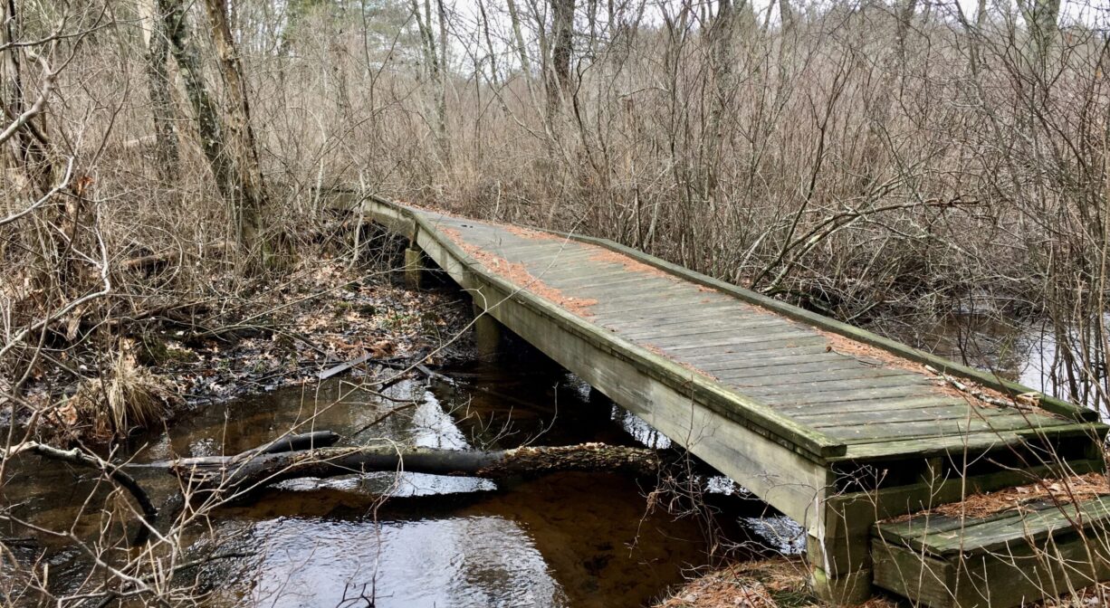
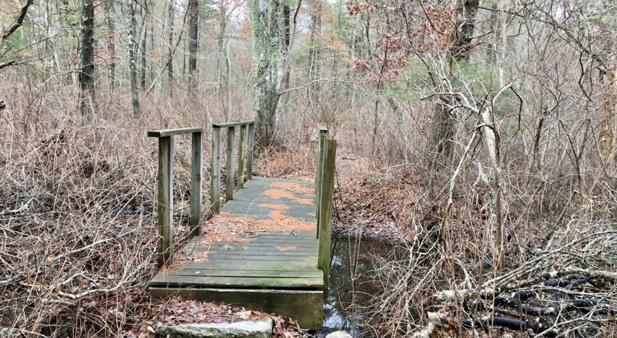
Kingston’s 77-acre Hathaway Preserve features 2 miles of established trails along Spring Brook and the Jones River, with four bridges and a boardwalk, and a section of the Bay Circuit Trail. The property’s access road may not be suitable for all vehicles. Please proceed with caution!
HUNTING: Hunting is allowed, in season, by licensed persons in compliance with Massachusetts law. Please be sure to understand state and local hunting guidelines before proceeding. Non-hunters, be mindful of hunting seasons, and wear bright orange if you’re entering the property during those times. Hunting is not permitted on Sundays.
Features
The Town of Kingston used surplus funds and a state Self-Help Grant to purchase the property from Isaac Hathaway in 1996. Farther back in time, in the mid-1700’s, Steven Bradford, the grandson of Governor William Bradford, was granted rights to the property and a section of the Jones River. Back then it was called Steven Bradford’s Privilege, referring to the sawmill the family operated on the northerly branch of the river. While the sawmill ceased operations around 1900, you can see evidence of it from one of the bridges. Look for cut granite blocks lining the sluiceway.
The Bradford family also made red-ware pottery, using iron-rich clay, extracted from a vernal pool on site. The foundation from a kiln has been documented on site as well, and shards of red clay were found while constructing the boardwalk over Spring Brook (late 1990s). These areas are now environmentally-protected wetlands. Please do not attempt to dig clay on your own! (Source: Wicked Local “Follow Kingston’s Rivers Through Hathaway Preserve;” October 24, 2010.)
The Patuxet, members of the Wampanoag tribe, made their home in the area now known as Duxbury, Kingston and Plymouth. Numerous artifacts have been found throughout the region surrounding the Jones River. To learn more about local Native American tribes, we encourage you to interact with their members. The Mashpee Wampanoag and the Herring Pond Wampanoag share information on their websites.
Trail Description
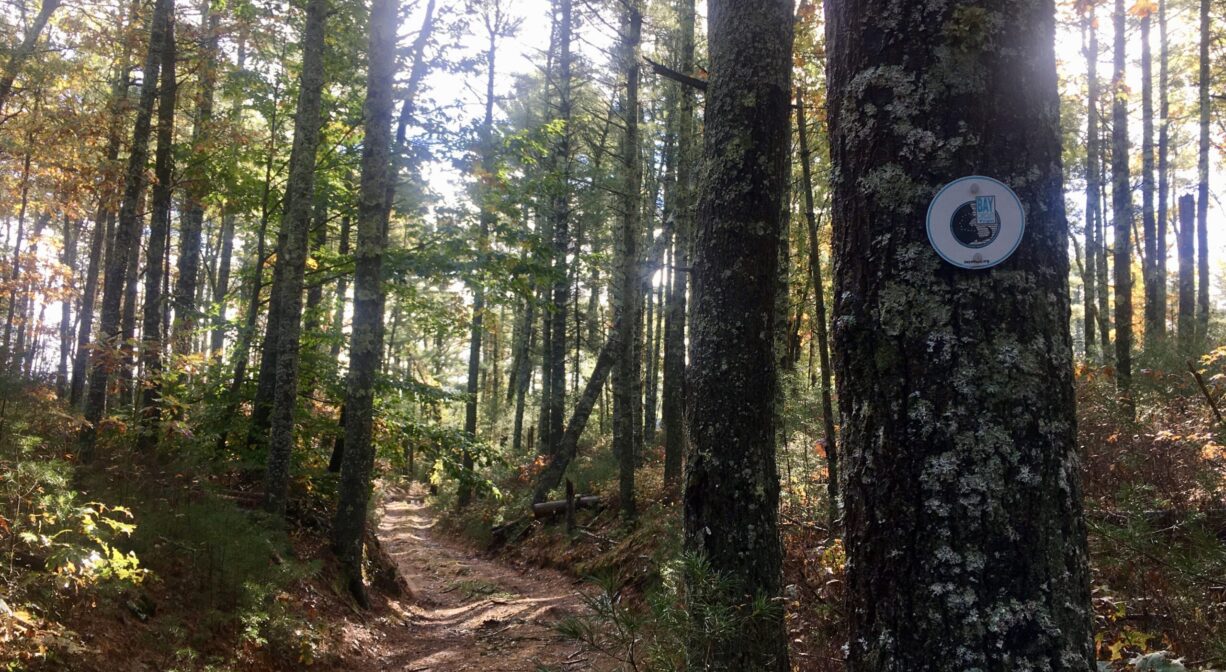
Four trails extend from the access road. On the map, they are marked in red, blue, green and orange. On the property itself, look for the small metal squares that mark the trails. The blue trail begins at the parking area. Heading away from the entrance road, it eventually comes to an intersection with the white/orange trail, which goes off to the left. This is a 0.3-mile out-and-back trail that leads to the Jones River. It crosses Spring Brook and includes a boardwalk.
The blue trail continues through a power easement to an intersection with the red trail, which forms a loop back to the parking area. However there is also a short spur at the end of the blue trail that leads to a different spot on the Jones River. Here you’ll find three additional bridges. The total distance on the blue trail from the parking area through the blue/red intersection, and across the final bridge, is just over 0.5 miles. Also along this spur is an intersection with the yellow trail, which takes a wider arc back to the access road.
A section of the Bay Circuit Trail extends through this property. It is marked in white and includes a bridge across the Jones River to the adjacent 5-acre Garland Property.
Habitats and Wildlife
Some of the wildlife commonly found here include eastern box turtles, great blue herons, little blue herons, woodpeckers, kingfishers, mockingbirds and chickadees. Also, white-tailed deer, red fox, bobcats, skunks, raccoons, cottontail rabbits, and bats. Listen for spring peepers in the wetland areas, and look for red-backed and spotted salamanders in the vernal pool.
According to Kingston’s 2015 Open Space and Recreation Plan Update, Three Rivers Basin, a 29-acre former cranberry bog along Pine Brook, connects the Hathaway Preserve to the Cranberry Watershed Preserve. Three Rivers Basin is permanently protected, and provides an important corridor for wildlife between the two properties.
The woodland here is mostly mature pine-oak forest, with some maple and yellow birch. There are also occasional beech trees. Most of this property is upland, but there are some forested wetland areas as well. Spring Brook flows through this property, as well as a 1.2 mile stretch of the Jones River.
The Jones River finds its source at Silver Lake and other brooks and springs in Pembroke, Halifax and Kingston. It flows for 7.5 miles through Kingston, and drains into the Atlantic Ocean at Kingston Bay. We encourage you to follow and support the Jones River Watershed Association.


Historic Site: No
Park: No
Beach: No
Boat Launch: No
Lifeguards: No
Size: 77 acres
Hours: Dawn to Dusk
Parking: The entrance is located on the northern side of Wapping Road (Route 106) along a line of cedar trees just north and west of the cranberry bogs. Follow the dirt road over the hill and then look for the parking area. Be advised that there is two-way traffic on narrow entrance road. Proceed with caution!
Cost: Free
Trail Difficulty: Easy, Medium
Facilities:
Informational kiosk in parking area. Geocache location.
Dogs: Dogs must remain on leash. Always clean up after your dog!
Boat Ramp: No
ADA Access: No
Scenic Views: Yes
Waterbody/Watershed: Spring Brook (Jones River watershed)