
1130 Main St, Hingham, MA 02043, USA
Owned By: Town of Hingham
Marchesiani Farmlands in Hingham features just over a half mile of trails through 25 acres of historic farmland and woods, and up-close views of Accord Brook. It connects to McKenna Marsh Conservation Area, where you’ll find another mile or so of trails. Some sections are suitable for equestrians.
HUNTING: Limited bow hunting is allowed, by Special Permit only, through the Hingham Conservation Commission. For more information, go to Hingham Conservation Land/Hunting. Non-hunters, be mindful of hunting seasons, wear bright orange if you’re entering the property during those times, and leash your dogs. Hunting is not permitted on Sundays.
Features
For many years, these lands were kept open for pasture and agriculture. They were part of Pushcart Farm, purchased by the Marchesiani family in 1934. According to the Hingham Conservation Land Trust, “More than 10,000 tomato plants were grown here, along with cucumbers, strawberries and other vegetables.”
Hingham obtained this land in 2001, thanks to the goodwill of the Marchesiani family and the developer of Black Rock Golf Course (it was exchanged for an inaccessible conservation tract on Old Ward Street).
This land is within the region of the Massachusett (or Massachuseuk). To learn more about local Native American tribes, we encourage you to interact with their members. The Massachusett tribe at Ponkapoag and the Mattakeeset band of the Massachusett share information on their websites.
Trail Description
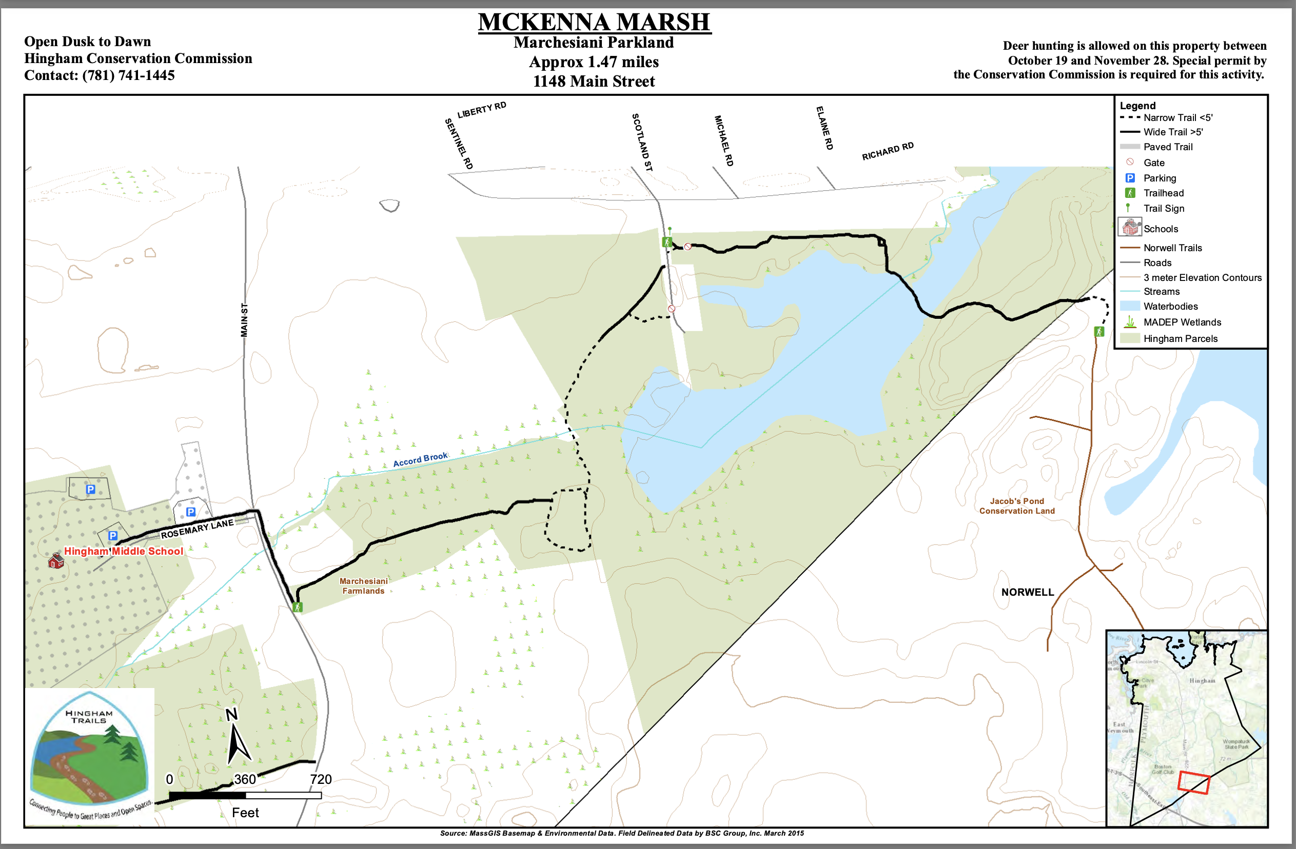
Park at the Hingham Middle School (when school is not in session), and walk up Rosemary Lane to Main Street. Use the crosswalk to cross, and then turn right, following the sidewalk to the property sign for Marchesiani Farmlands. Two granite posts mark the entrance. The distance from HMS to the sign is about 0.25 mile. Along the way, you’ll cross Accord Brook via Gardner’s Bridge. From there, the trail leads around the edge of a meadow, and eventually into the woods. After crossing a small stream, you’ll arrive at a short loop trail. Turn left, and you’ll soon be on a bridge over Accord Brook. This connects to an old farm road through another meadow. The trail ends on Scotland Street, another place to consider parking, as there are a few spots available. Some, but not all, of the trails are blazed with white wooden rectangles.
Continue your walk across Scotland Street to the entrance to the McKenna Marsh Conservation Area. This offers at least another mile of woodland/wetland trail, and another crossing of the brook. On the other side of McKenna Marsh is a large property owned by the Norwell Water Department, with dirt roads (and perhaps additional walking).
Habitats and Wildlife
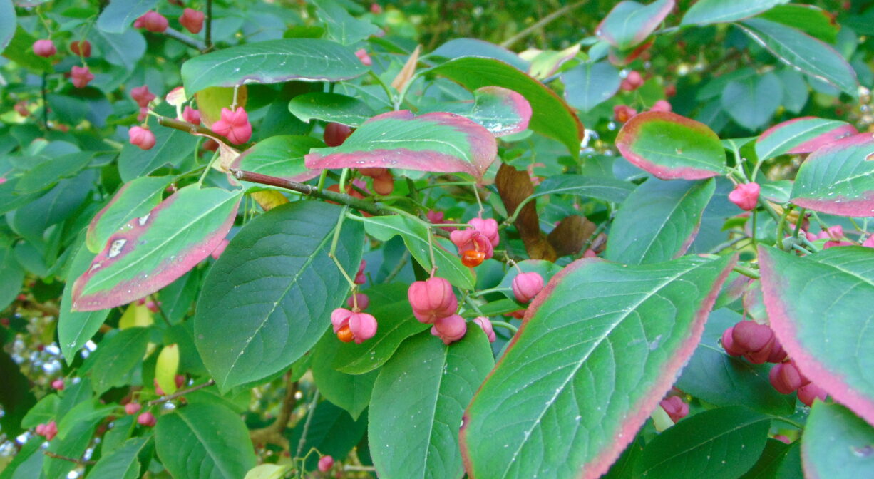
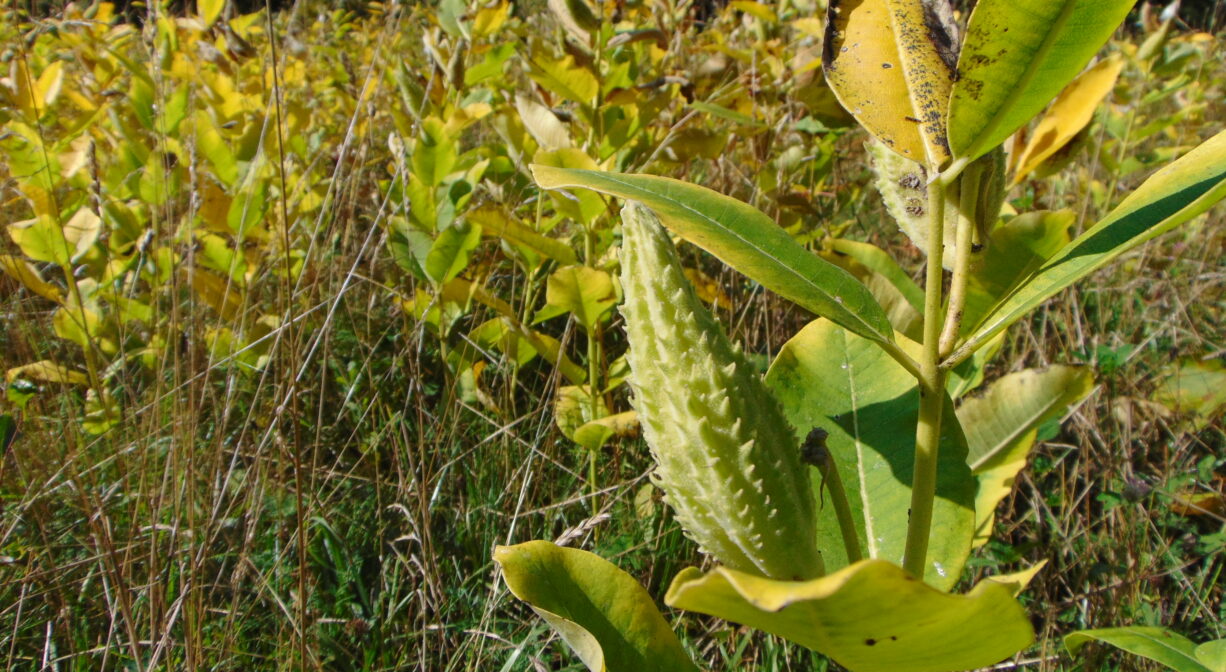
This property is comprised of both open grassy fields and forests of pine, oak, beech, maple, holly, catalpa, wahoo, and juniper. Wildlife commonly observed here include deer, raccoons, wild turkey and hawks. Listen for white breasted nuthatches, chickadees, pine warblers, woodpeckers and tufted titmice. Look for butterflies and dragonflies in the fields.
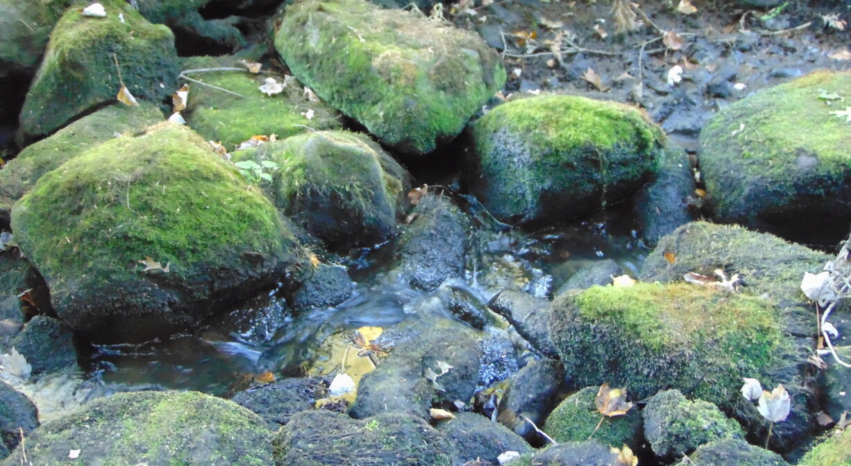
Accord Brook flows through this property and eventually into Wompatuck State Park, through Triphammer Pond, to the Weir River.
Formed at the confluence of Crooked Meadow River and Fulling Mill Brook, the Weir River flows north through Hingham, with Tower Brook and Accord Brook joining it in its first mile. It gradually turns northeast and flows for another 1.4 miles, through Weir River Farm and eventually into Foundry Pond. The Weir River Estuary, designated by the Commonwealth of Massachusetts as an Area of Critical Concern, begins just below the manmade dam at the pond. The mile-wide estuary — with numerous acres of undisturbed salt marsh — forms the border between Hingham and Hull, and empties into Hingham Bay. We encourage you to follow and support the Weir River Watershed Association.


Historic Site: No
Park: No
Beach: No
Boat Launch: No
Lifeguards: No
Size: 25 acres
Hours: Dawn to Dusk
Parking: Very limited parking at trailhead on Scotland Street. Parking also available at Hingham Middle School, when school is not in session.
Cost: Free
Trail Difficulty: Easy
Dogs: Dogs must remain on leash. Always clean up after your dog!
Boat Ramp: No
ADA Access: No
Scenic Views: Yes
Waterbody/Watershed: Accord Brook (Weir River watershed)