
24 Plain St, Braintree, MA 02184, USA
Town of Braintree: 781-794-8000
Owned By: Town of Braintree
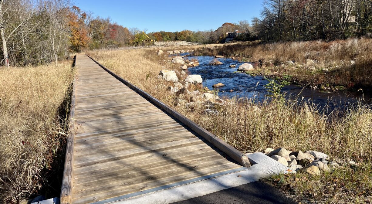
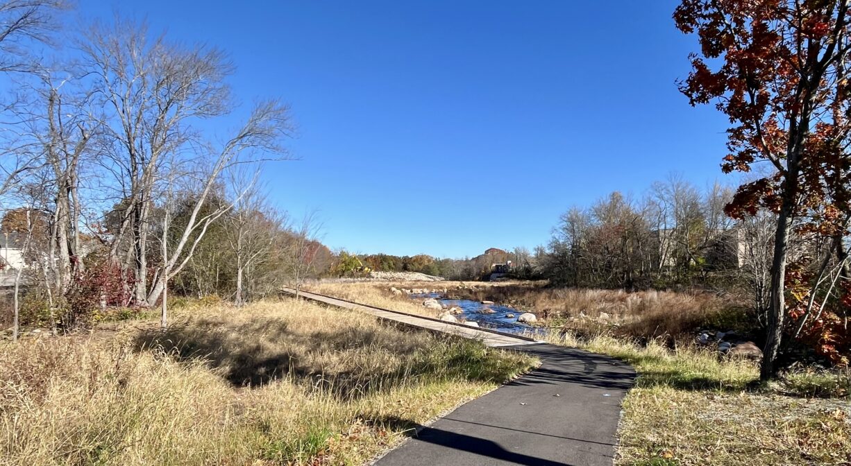
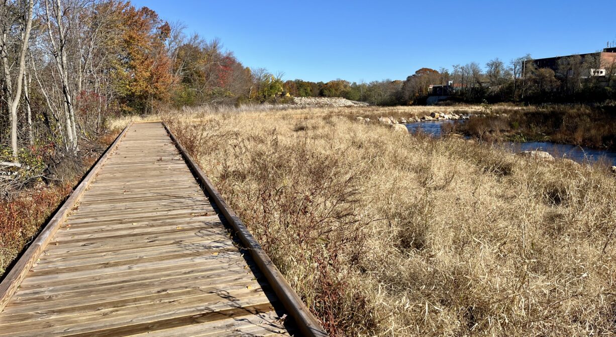
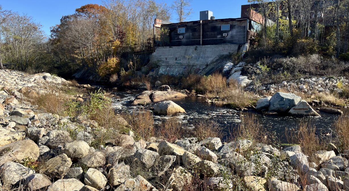
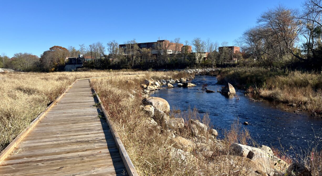
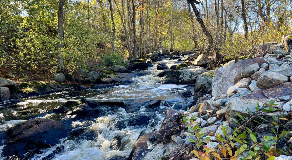
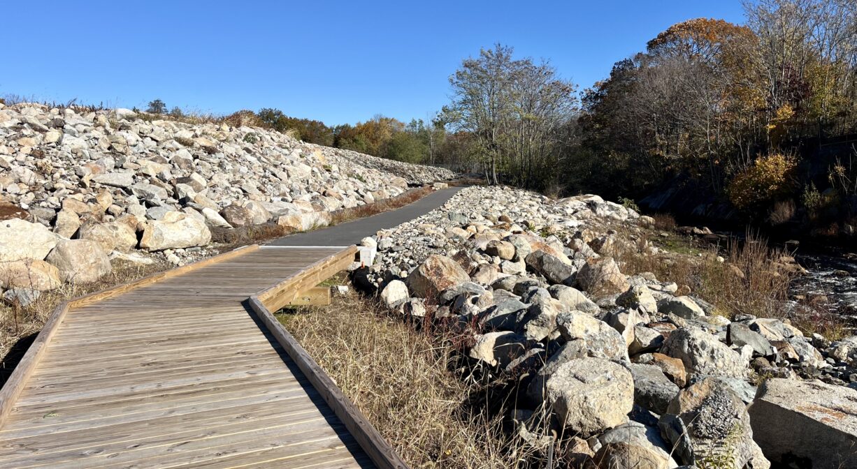
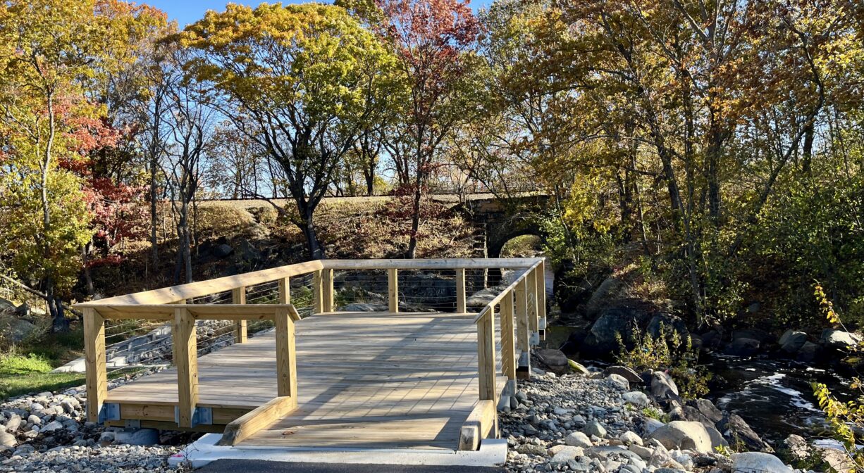
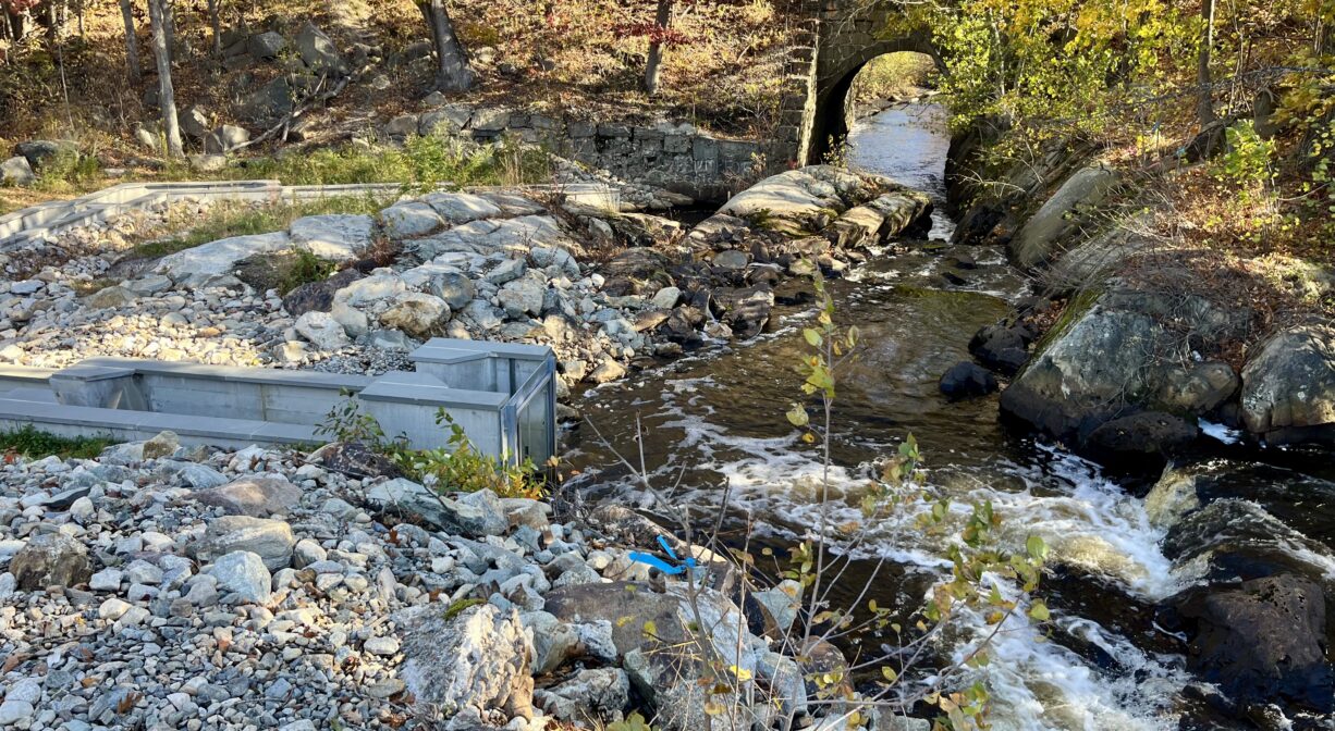
Located at the intersection of Plain and Hancock Streets in Braintree, the Monatiquot River Walkway is an ADA-compliant, 0.33-mile trail and boardwalk that extends along the river, past the sites of the former Armstrong and Ames Dams, to a scenic rock falls area. A platform offers views of a fish ladder that helps migratory species swim upstream to their spawning grounds. Stop by in the mid-to-late spring and look for herring!
Hunting is not allowed on this property.
Features
For more than two decades, a large scale river restoration project took place at this site. As a result, in 2025, river herring were able to swim upstream through Braintree for the first time in 200 years! The state and federal governments, the National Fish Habitat Partnership, the Town of Braintree, the property owner, and others provided $5.5 million in funding.
Industrial use of this spot on the Monatiquot River began in the Colonial era, starting with a grist mill and sawmill. In 1823, Paul Revere and Co. purchased the property to establish a copper foundry. (Paul Revere and Co. was a copper and brass manufacturer, founded by the renowned patriot.) Mark Hollingsworth purchased the property in 1832, and operated a paper mill on site for 70 years. Next came a series of rubber companies. The Armstrong Co. purchased the property in the 1930’s, and established a sprawling cork manufacturing plant, which operated until 1995. The abandoned factory buildings were torn down between 2018 and 2025.
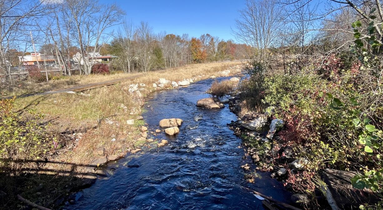
These various industries created longterm obstacles in the river for migrating fish. Two dams, Armstrong and Ames, along with the 1800’s construction of a railroad bridge (which altered the bedrock at Rock Falls) disrupted historic herring runs and made it impossible for fish to swim upstream to their spawning grounds at Great Pond on the Braintree/Randolph line.
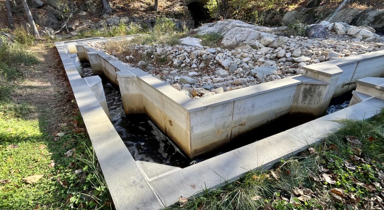
The Armstrong Dam — which measured 12 feet in height and 92 feet in length — was removed in 2023, along with 6800 cubic yards of contaminated sediment. The Ames Dam was removed in 2024. A pool and weir fishway was installed around Rock Falls. The 2025 completion of the project resulted in the restoration of 180 acres of habitat for river herring and American eels, with 36 miles of unimpeded stream access. Additional benefits include: enhancement of recreational opportunities, increase of the river’s floodplain, and the elimination of the potential for a catastrophic dam failure during a severe storm. The walkway opened to the public toward the end of 2025. Visit the Town of Braintree’s website to learn more.
This land is within the region of the Massachusett (or Massachuseuk). To learn more about local Native American tribes, we encourage you to interact with their members. The Massachusett tribe at Ponkapoag shares information on its website.
Trail Description
A paved trail leads to a wide wooden boardwalk that extends along the Monatiquot River from Plain Street, heading north. After 0.15 miles, the trail becomes pavement again. It leads to a scenic spot with a viewing platform overlooking a fish ladder. Total trail length: 0.33 miles.
Habitats and Wildlife
Thanks to the 20+ year restoration project at this site, river herring have access to 36 miles of high-quality spawning habitat for the first time in 200 years. Especially when the herring are running, look for osprey and herons fishing along the edge of the river, along with such mammals as otters.
The Monatiquot River rises in Braintree, at the confluence of the Farm and Cochato Rivers, within the Braintree Municipal Golf Course. It flows northeast for 4.9 miles before merging with Smelt Brook to form the Fore River. The Fore River serves as the boundary between the towns of Weymouth and Braintree. It flows for about 3 miles, into Quincy, where it meets Town River, and then continues for another 2 miles into Hingham Bay. In its final few miles, the Fore River is nearly a mile wide in some places.

Historic Site: No
Park: No
Beach: No
Boat Launch: No
Lifeguards: No
Hours: Dawn to Dusk
Parking: Ample on-site parking at Armstrong Park, at the corner of Plain and Hancock Streets.
Cost: Free
Trail Difficulty: Easy
Facilities:
ADA-compliant wooden boardwalk and paved trail, observation platform, benches, fish ladder, informational kiosk.
Dogs: Dogs must remain on leash. Always clean up after your dog!
Boat Ramp: No
ADA Access: The one-third mile trail will be fully compliant with the Americans with Disabilities Act.
Scenic Views: Yes
Waterbody/Watershed: Monatiquot River (Fore River watershed)