
18 Dover St, Norwell, MA 02061, USA
http://www.thetrustees.org/places-to-visit/south-of-boston/norris-reservation.html
Owned By: The Trustees
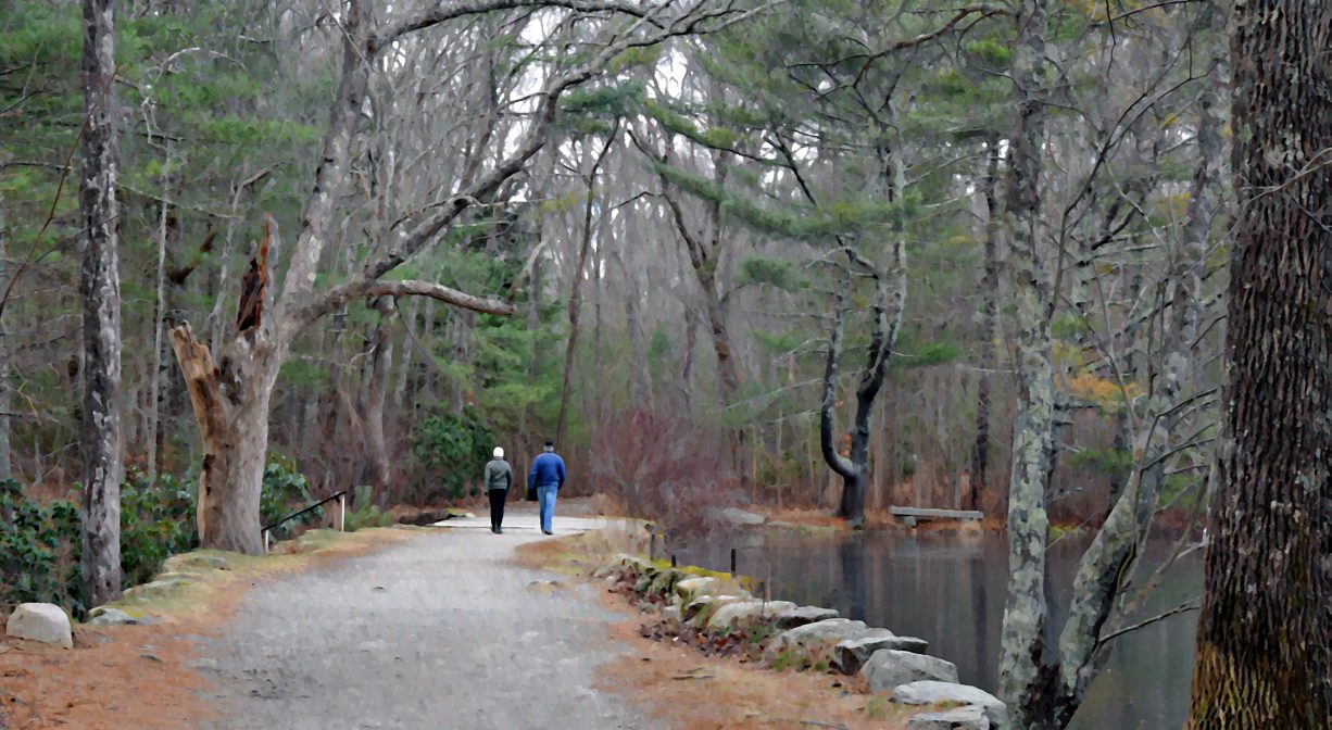
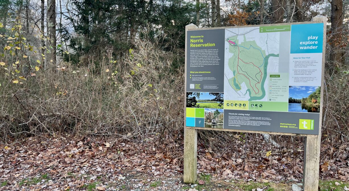
Norwell’s gorgeous 129-acre Norris Reservation, with over a mile of North River frontage, offers 2.4 miles of trails, plus a boat house with water views. Second Herring Brook flows through the property, which is owned by the Trustees (formerly Trustees of Reservations). Stroller-friendly in some sections. Motorized vehicles are not allowed on the trails.
FISHING ADVISORY: It’s important to know that some of our freshwater fisheries are contaminated with mercury, PFAS and/or other concerning substances. The Massachusetts Department of Public Health maintains an online database with up-to-date advisories regarding fish consumption, sorted by location. We recommend you consult this valuable resource when planning a fishing excursion.
Hunting is not allowed on this property.
Features
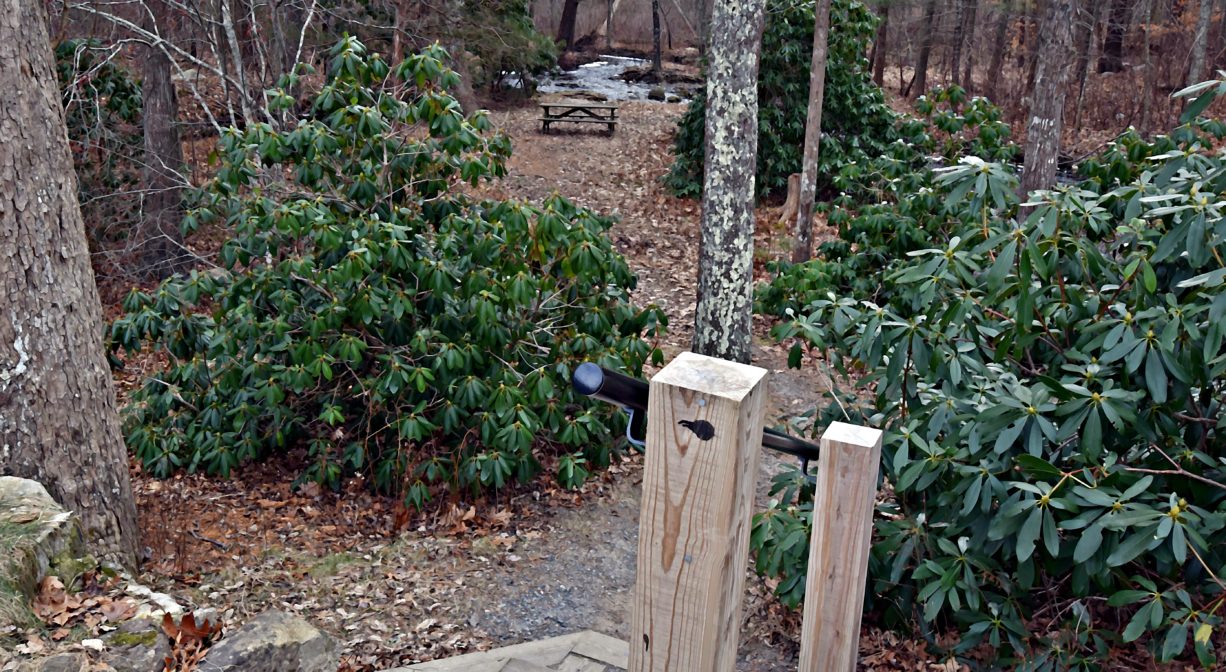
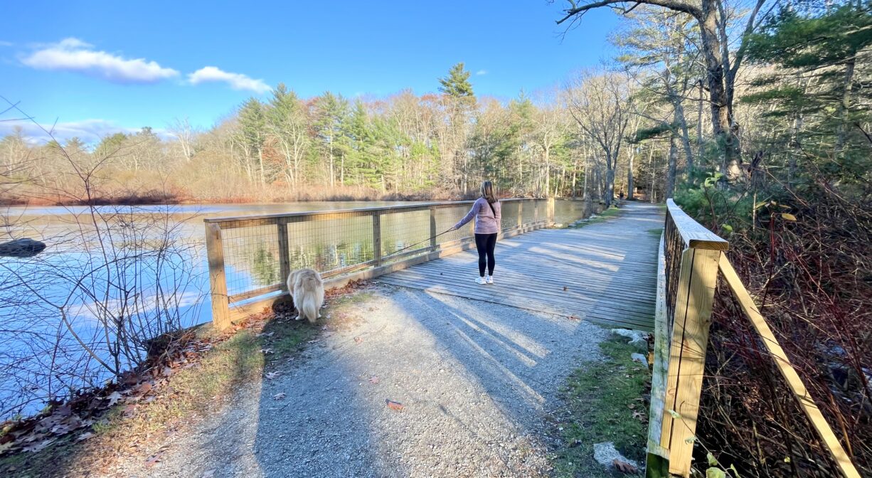
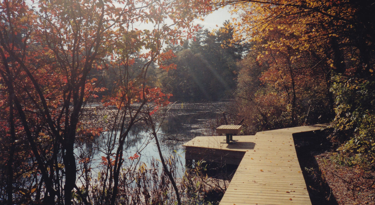
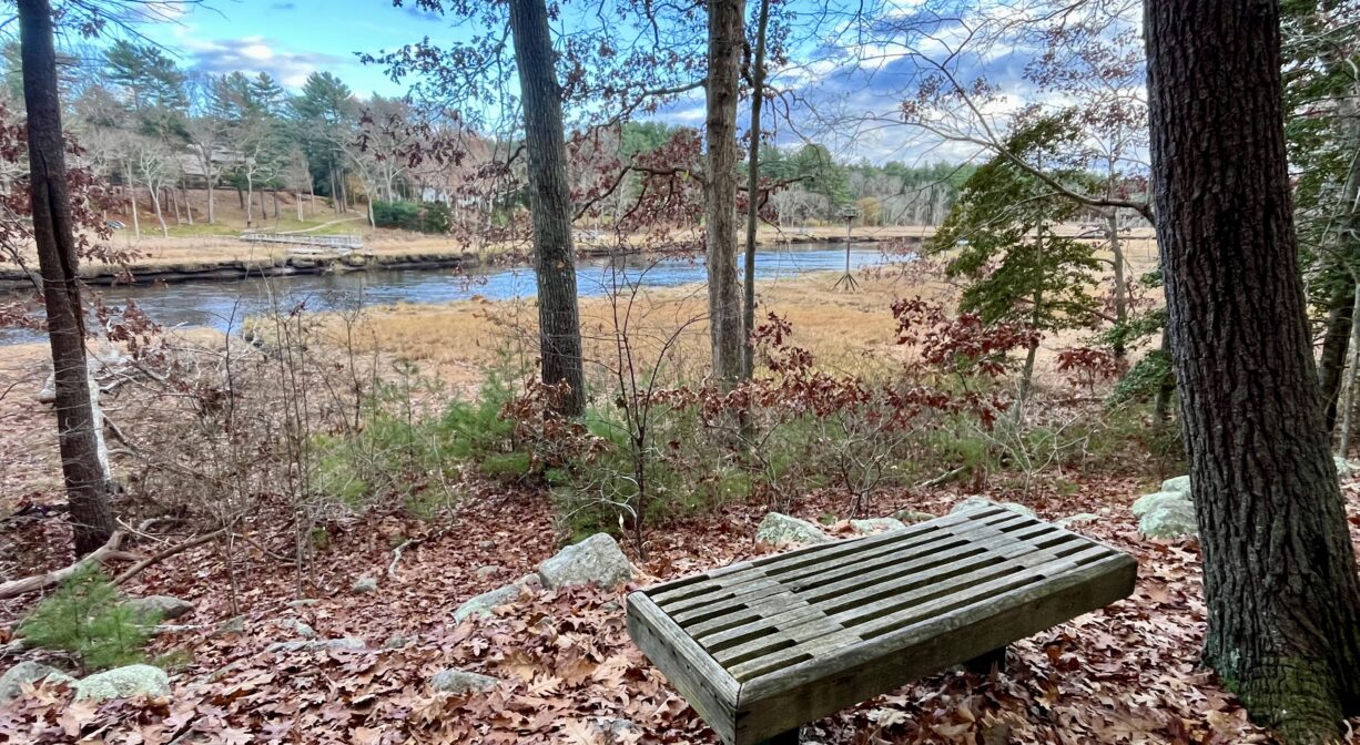
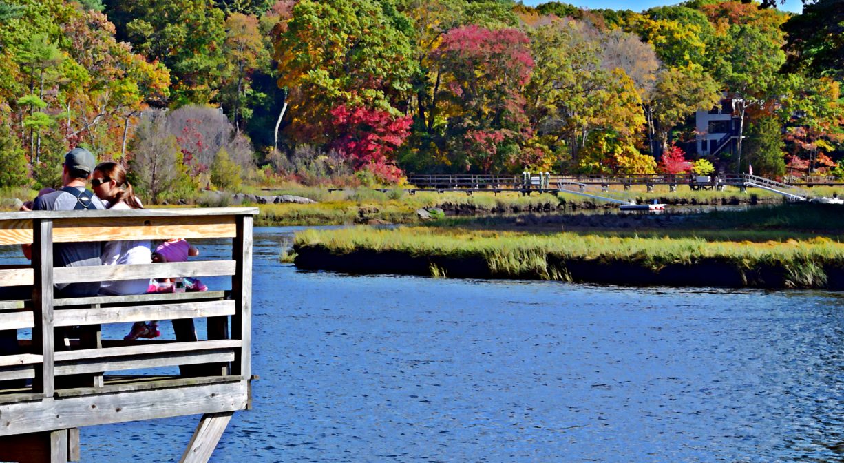
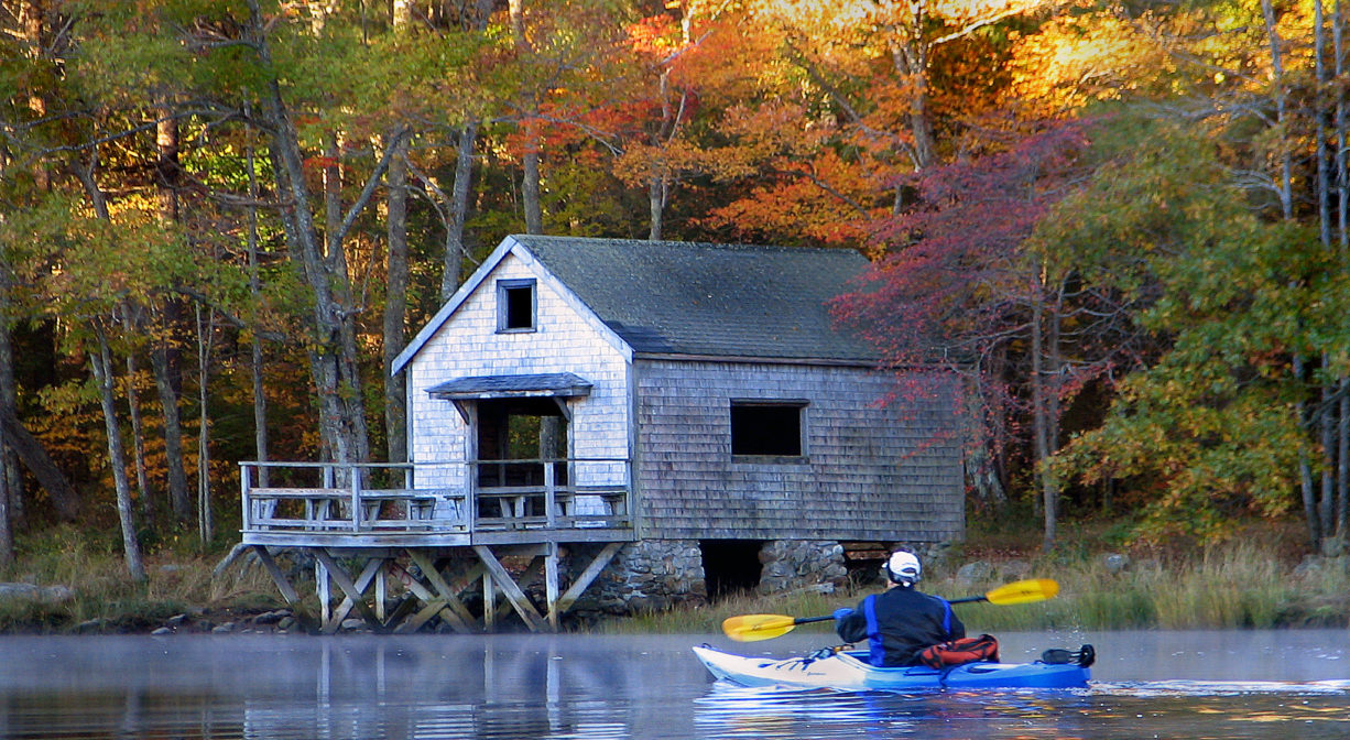
This property offers a variety of natural features, with views of the salt marsh, Second Herring Brook, and the North River. Manmade amenities include a mill pond, boardwalks, cart paths, and narrow footpaths through forests of pine and oak. Watch for glacial erratic boulders along the way. Be sure to stop at the boat house, which offers a captivating view of the North River, just above The Rapids, a section of the river with a particularly swift flow. You can walk straight through the boat house to a deck perched directly above the water.
The mill pond was created in 1690, when John Bryant built a dam and erected a grist mill on Second Herring Brook. Around 1770, either Thomas Sylvester or Hawkes Cushing erected a sawmill on the site. Around 1805, David W. Turner tore down the sawmill and replaced it. After a 1927 fire, the mills ceased operations. Beside the bridge by the mill pond, some vestiges of the mill works remain. Mrs. Albert Norris donated the original parcel to The Trustees in 1970. The property was expanded in 1992 with a gift of land from the McMullen family, and again in 2000 with a gift of land from the Gordon Family.
This land is within the region of the Massachusett (or Massachuseuk) Native American tribe. For thousands of years, the land today known as Norwell was inhabited by indigenous people who grew crops, foraged, hunted, and fished in the Assinippi and North River areas. Circa 1617, a major outbreak of disease decimated an estimated 90% of the native population in New England. Descendants of these original inhabitants are living here today. They are known as the Mattakeesett Tribe of the Massachusett Indian Nation, the Massachusett Tribe at Ponkapoag, the Herring Pond Wampanoag, and the Mashpee Wampanoag tribe.
Trail Description
The main trail from the parking area leads to a former mill pond. Second Herring Brook flows through the pond. A wide bridge crosses the brook, and offers up-close views of the bubbling (and sometimes gushing) stream. From the pond, there are trails to the left and to the right, part of an extensive network of cart paths and narrow footpaths. Both trails lead eventually to the North River, through upland and wetland, with the occasional boardwalk. The Gordon’s Pond boardwalk leads across and around a large impoundment of Second Herring Brook.
Habitats and Wildlife
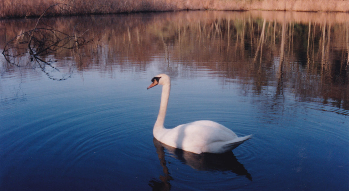
The forest here is predominantly pine and oak, with some maple, hickory, and beech. Ducks are a common sight on Gordon’s Pond. Take a seat on a trailside bench, or at the boathouse, and be on the lookout for wading birds, hawks, and kingfishers. It’s common to see osprey and red-tailed hawks here, hunting for fish and small animals. In the wetlands, look for beaver dams and fiddlehead ferns. Toward the end of the day, listen for the hooting of owls and the peeping of frogs. In the cooler months, especially on sunny days, you might see harbor seals in the water, or sunning themselves on the rocks near the boat house.
Mass Wildlife stocks the ponds here with rainbow and Eastern brook trout.) Look for striped bass in the North River.
Second Herring Brook flows through the Norris Reservation. It originates north of Cross Street in Norwell and flows south through Turner Pond and Torrey Pond. Below Torrey Pond, it is joined by Trout Brook. Second Herring Brook continues through Norwell Center and the Norris Reservation, and then empties into the North River. Some of the lands that border Second Herring Brook within the Norris Reservation are defined as an acidic shrub fen — acidic peatlands dominated by deciduous shrubs.
The North River rises from marshes and springs in Weymouth, Rockland and Hanson. It is approximately 10 miles in length, with its source at the confluence of the Indian Head River (Hanover) and Herring Brook (Pembroke). From there it flows through the towns of Hanover, Pembroke, Marshfield, Norwell, and Scituate to the Atlantic Ocean between Third and Fourth Cliffs, draining approximately 59,000 acres along the way.
Herring swim up the North River and into Second Herring Brook to spawn. This run is now fairly depleted, and not monitored. The best chance of seeing herring at this site is in May, look for blueback herring in the flowing waters downstream of the Gordon Pond dam (they run later in the season than alewives). Stand on the dam and look downstream, and let us know if you see any! Unfortunately, expanding the spawning area above the dam is not advisable at this time. The pond is beloved, and the dam is not appropriate for a fish ladder.


Historic Site: No
Park: No
Beach: No
Boat Launch: No
Lifeguards: No
Size: 129 acres
Hours: Dawn to Dusk
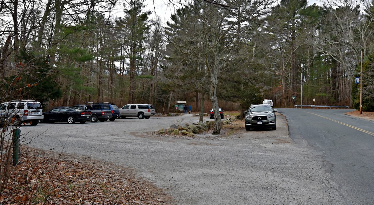
Parking: Limited on-site parking. Look for the parking lot at 18 Dover Street, across from the Norwell Post Office.
Cost: Free
Trail Difficulty: Easy
Facilities:
Benches, informational kiosks, trash receptacles. A boat house directly on the North River (tie-ups not permitted). Geocache locations.
Dogs: Dogs must remain on leash. Always clean up after your dog!
Boat Ramp: No
ADA Access: Accessible only from the parking area to the mill pond.
Scenic Views: Yes
Waterbody/Watershed: Second Herring Brook, North River (North River watershed)