
Hanson Conservation: (781) 294-4119
https://hike.hanson-ma.gov/philip-clemons.html
Owned By: Town of Hanson
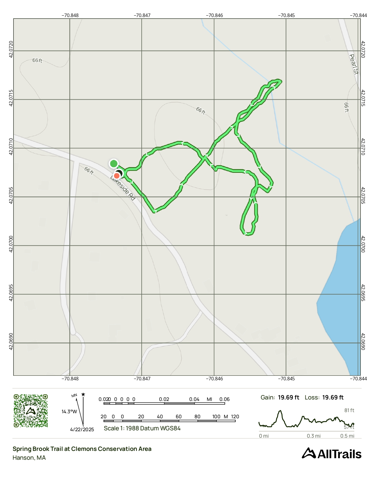
The 26-acre Philip Clemons Conservation Area in Hanson offers a half-mile loop trail through woods and wetlands, with two stream crossings plus distant views of Oldham Pond.
HUNTING: Hunting is allowed, in season, by licensed persons in compliance with Massachusetts law. Please be sure to understand state and local hunting guidelines before proceeding. Non-hunters, be mindful of hunting seasons, and wear bright orange if you’re entering the property during those times. Hunting is not permitted on Sundays.
Features
The land that is now the Philip Clemons Conservation Area was deeded to the Town of Hanson in 2018. In 2025, it was officially dedicated to Mr. Clemons, a longtime member and chair of the Hanson Conservation Commission.
This land is within the region of the Massachusett (or Massachuseuk). To learn more about local Native American tribes, we encourage you to interact with their members. The Massachusett tribe at Ponkapoag and the Mattakeeset band of the Massachusett share information on their websites.
Trail Description
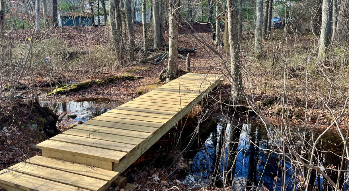
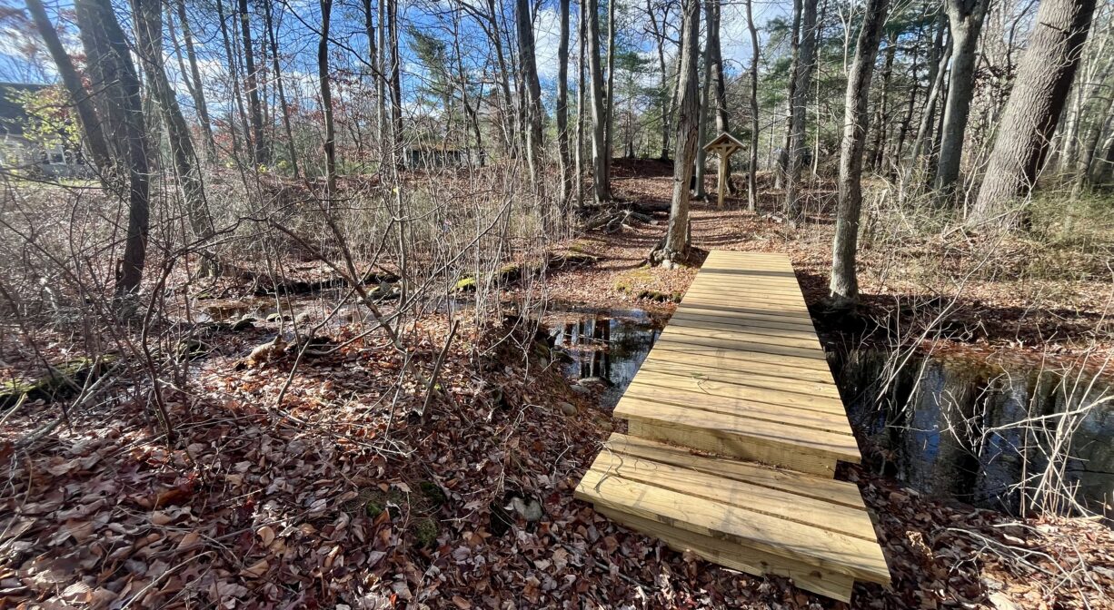
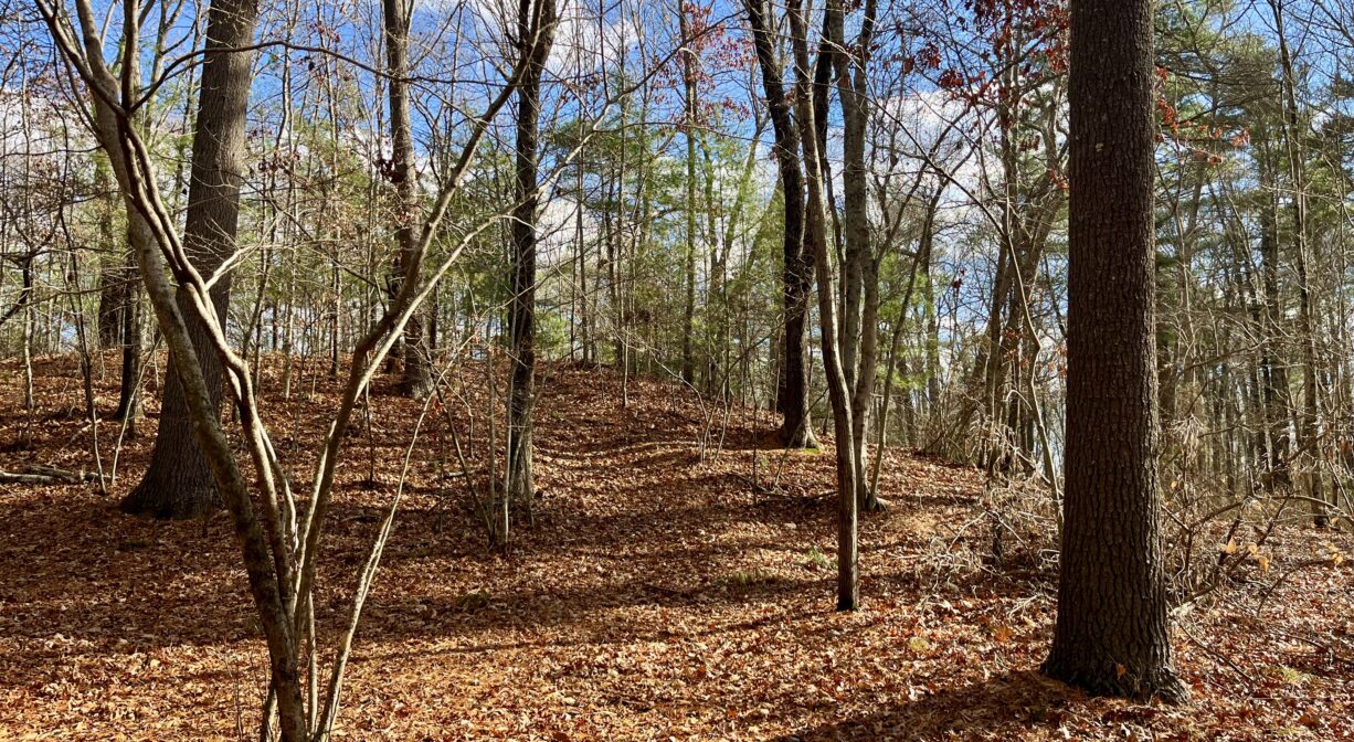
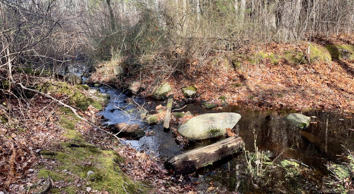
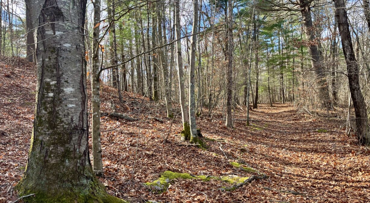
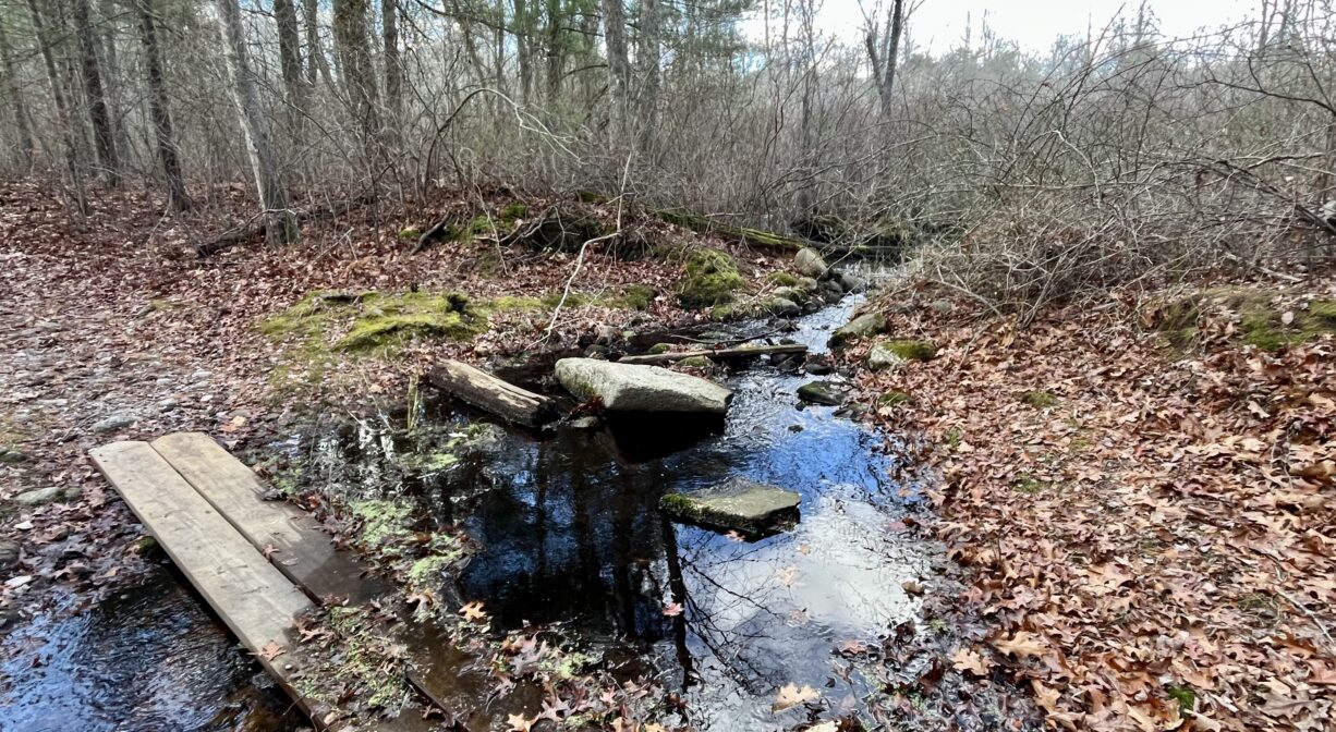
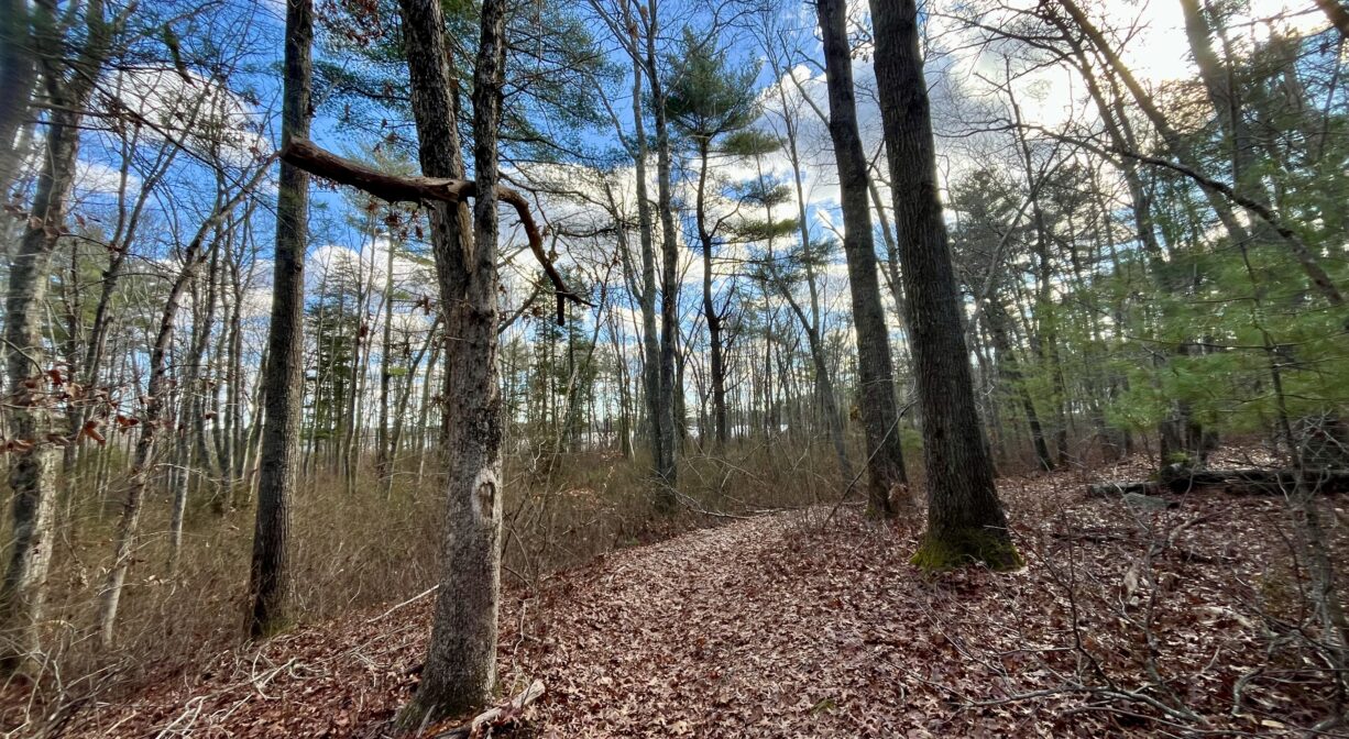
Much of this property is wetlands, but a half-mile trail system has been created in an upland area in the southern corner. The 0.5-mile Spring Brook Trail begins at the Lakeside Road trailhead, crosses a footbridge, and climbs gently through a woodland, eventually arriving at the base of a hill. You can follow the trail around the hill. Along the way you’ll see wetlands, plenty of moss, and the occasional quartz. There’s a second loop trail with bog boards and two stream crossings, plus an additional loop with distant views of Oldham Pond. In addition, there are numerous short spur trails, none of which lead all the way to the pond. While some of the terrain is even, other sections have rocks and roots.
Habitats and Wildlife
The forest here includes oak, beech, birch and pine trees, along with wetland shrubs. Spring Brook and a second unnamed stream both flow through this property into Oldham Pond. The wetlands here also feed the pond.
Oldham Pond is a headwater to Herring Brook. Herring Brook flows through Pembroke and joins with the Indian Head River on the Hanover/Pembroke town line to form the North River. The North River flows for 10 miles through the towns of Hanover, Pembroke, Marshfield, Norwell, and Scituate. It empties into the Atlantic Ocean between Third and Fourth Cliffs, draining approximately 59,000 acres along the way.
Historic Site: No
Park: No
Beach: No
Boat Launch: No
Lifeguards: No
Size: 26.3 acres
Hours: Dawn to Dusk
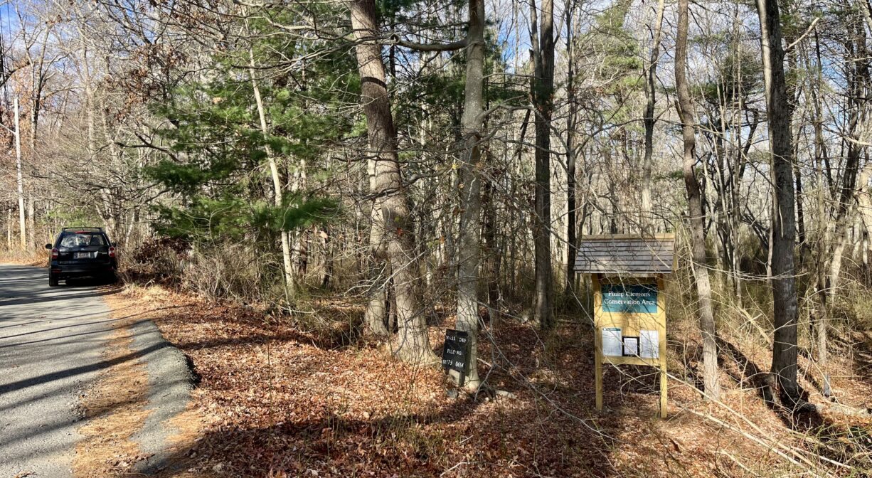
Parking: Limited roadside parking on Lakeside Road, near Lakeside Terrace. Look for the trailhead and informational kiosk. (Approx. location of property is 89 Lakeside Road.)
Cost: Free
Trail Difficulty: Easy
Facilities:
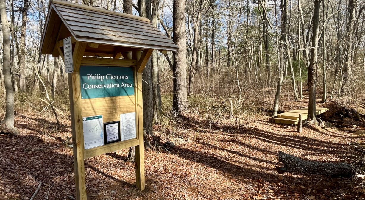
Informational kiosk, footbridges, bog boards.
Dogs: Dogs must remain on leash. Always clean up after your dog!
Boat Ramp: No
ADA Access: No
Scenic Views: Yes
Waterbody/Watershed: Oldham Pond (Herring Brook/North River watershed)