
176 Edgehill Rd, Braintree, MA 02184, USA
Town of Braintree: 781-794-8000
Owned By: Town of Braintree
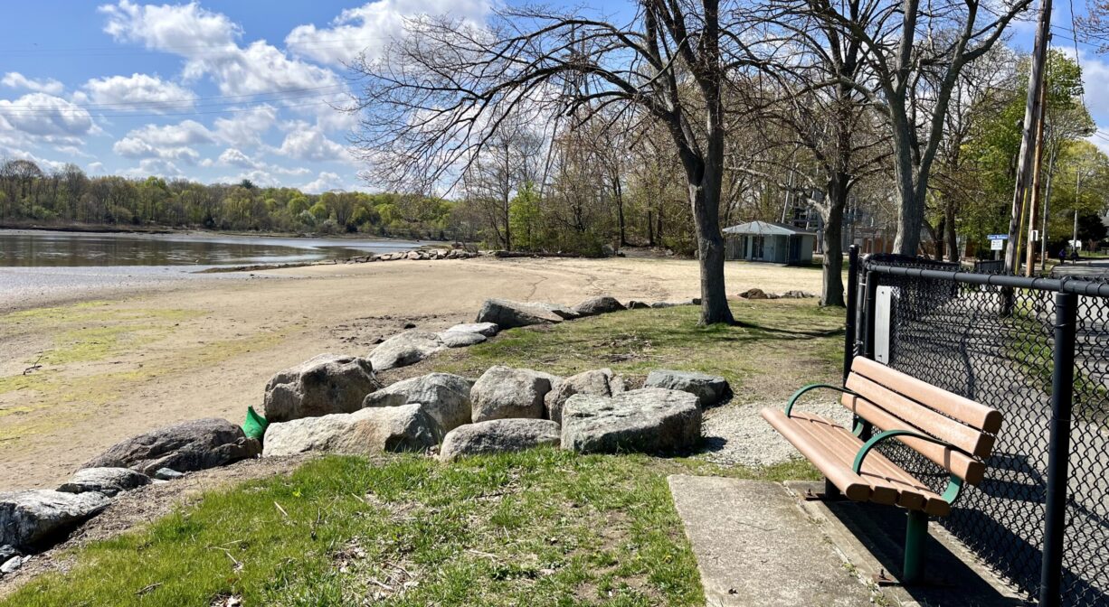
Smith Beach in Braintree is a small sandy beach on the Fore River. It is also known as Swift’s Beach and Lt. G. Murray Smith Beach. A walking trail along the edge of the marsh leads to Watson Park, next door. (Both are part of the 1-mile Monatiquot River Walk.) Fishing is permitted only in the area beyond the west end jetty.
FISHING ADVISORY: It’s important to know that some of our freshwater fisheries are contaminated with mercury, PFAS and/or other concerning substances. The Massachusetts Department of Public Health maintains an online database with up-to-date advisories regarding fish consumption, sorted by location. We recommend you consult this valuable resource when planning a fishing excursion.
Hunting is not allowed on this property.
SWIMMING: Massachusetts routinely checks water quality at public swim spots and shares the data in an online database. Save this link so you can check water quality before you go.
Features
Smith Beach is open 7 hours daily in the summer, depending on the tides. See the schedule posted weekly at the beach to find out when the lifeguards will be on duty. Swimming when the lifeguards are not on duty is not permitted. Dogs are not permitted at Smith Beach.
Canoe/kayak access is not recommended here, due to swift and unpredictable currents. Instead, consider the Weymouth Landing Access Ramp, across the river (about a mile away by car), on Commercial Street in Weymouth, which provides river access in a safer spot.
This land is within the region of the Massachusett (or Massachuseuk). To learn more about local Native American tribes, we encourage you to interact with their members. The Massachusett tribe at Ponkapoag shares information on its website.
Trail Description
From the beach area, look to the right. There is a sign that marks the start of the Monatiquot River Walk. This first section of the 1-mile pathway is known as the Francis Toland Memorial Trail. It connects to Watson Park. The next section of the path is known as Lee’s Way. It extends through Watson Park and then follows the river to the edge of the property, making a sharp turn inland just before the Braintree Yacht Club. After winding between some tennis and basketball courts, and a baseball field, the River Walk turns uphill, opening to the sidewalk on Gordon Road. (This is the halfway point — about 0.5 miles.)
The path continues along Gordon Road to Quincy Ave. Turn left on Quincy Ave., follow the sidewalk across the river, and then look for the continuation of the River Walk just behind the bus shelter at the MBTA Commuter Rail parking lot (you have now walked approx. 0.37 miles of sidewalk). The River Walk zigzags downhill, past the East Braintree/Weymouth Landing MBTA station, and then continues along Smelt Brook and the Fore River for another 0.2 miles, ending at the Weymouth Landing Access Ramp on Commercial Street in Weymouth.
Dogs and bicycles are not permitted on the Francis Toland Memorial Trail, which connects Smith Beach to Watson Park.
Habitats and Wildlife
Smith Beach is an open sandy area at the edge of the Fore River. Please do not feed the waterfowl!
The Monatiquot River rises in Braintree, at the confluence of the Farm and Cochato Rivers, within the Braintree Municipal Golf Course. It flows northeast for 4.9 miles before merging with Smelt Brook to form the Fore River. The Fore River serves as the boundary between the towns of Weymouth and Braintree. It flows for about 3 miles, into Quincy, where it meets Town River, and then continues for another 2 miles into Hingham Bay. In its final few miles, the Fore River is nearly a mile wide in some places.


Historic Site: No
Park: Yes
Beach: Yes
Boat Launch: No
Lifeguards: Lifeguards in season.
Size: 1.6 acres
Hours: Dawn to Dusk.
Parking: On-site parking lot (4 hour maximum) at 176 Edgehill Road.
Cost: Free
Trail Difficulty: Easy
Facilities:
Benches, trash receptacles, picnic tables, seasonal swimming beach, lifeguards and restrooms.
Dogs: No
Boat Ramp: No
ADA Access: No
Scenic Views: Yes
Waterbody/Watershed: Fore River