
Owned By: (Private)
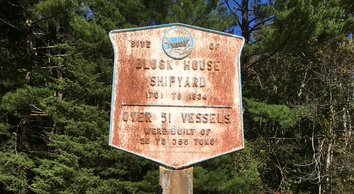
The Block House Yard in Norwell was an active shipyard from 1701 to 1848. It is named for the building that was used as a garrison house, or “block house,” during King Philip’s War. It was located at the elbow, just above The Rapids on the North River. A plaque marks the shipyard site.
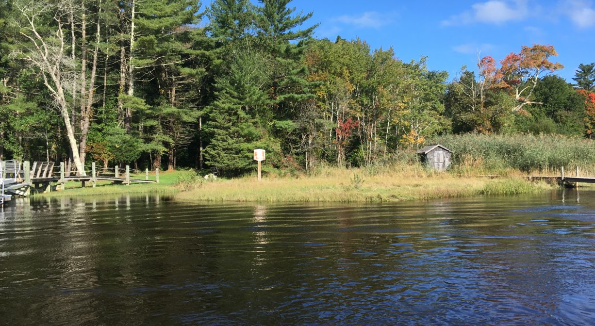
This is a historic site, with no public access, but you can see the site obliquely from the boathouse at the Norris Reservation. You can also view it from the water on the North River.
Features
William James was probably the first shipbuilder at the Block House shipyard site (c. 1701), followed by his son, also William. Jotham Tilden later partnered with James to build ships here. His brother Luther Tilden was also involved. James, George and David Torrey followed in 1806.
The local shipbuilding industry sometimes employed slave labor. Both Boston and Newport were slave trading hubs, and some of the ships built on the North River were use in the slave trade.
This land is within the region of the Massachusett (or Massachuseuk) Native American tribe. For thousands of years, the land today known as Norwell was inhabited by indigenous people who grew crops, foraged, hunted, and fished in the Assinippi and North River areas. Circa 1617, a major outbreak of disease decimated an estimated 90% of the native population in New England. Descendants of these original inhabitants are living here today. They are known as the Mattakeesett Tribe of the Massachusett Indian Nation, the Massachusett Tribe at Ponkapoag, the Herring Pond Wampanoag, and the Mashpee Wampanoag tribe.
Habitats and Wildlife
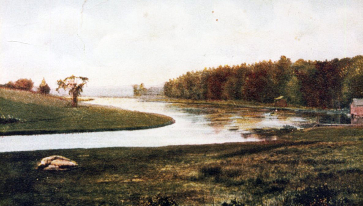
Reverend William P. Tilden, whose father and uncle operated Block House Yard in the 1700s, wrote this description of the terrain. “The Block-house Yard was not well adapted to building. The ground was mostly springy and wet; the way to it was through a rocky pasture, with only a cart path, where deep ruts and frequent stones tried the heavy wheels, loaded with timber, and the necks of the patient oxen, which bore the swinging white oak trunks, planks, and knees. Then, when the timber was in the yard, there was not sufficient room for it. Beside this, when the vessel was launched, she had to run directly across the river into the mud on the other side. . . . Still, there were many vessels built at this yard.”
According to Joseph Foster Merritt (c. 1928), “A never failing spring of water gushes out of a fissure in a granite ledge on the place.” In season, this section of the river can be a good spot to catch striped bass.
There were 24 shipyards along the North River. Together they produced over 1,000 ships. All of those vessels were built with lumber culled from the surrounding forests. By the middle of the nineteenth century, few large trees remained. After the decline of the shipbuilding industry, the forests began to regenerate. Now, thanks in large part to conservation efforts, those forests have grown, providing essential wildlife habitat in the river corridor.
This property is located directly on the North River. The North River rises from marshes and springs in Weymouth, Rockland and Hanson. It is approximately 10 miles in length, with its source at the confluence of the Indian Head River (Hanover) and Herring Brook (Pembroke). From there it flows through the towns of Hanover, Pembroke, Marshfield, Norwell, and Scituate to the Atlantic Ocean between Third and Fourth Cliffs, draining approximately 59,000 acres along the way.


Historic Site: Yes
Park: No
Beach: No
Boat Launch: No
Lifeguards: No
Parking: Water access only. No public parking or access.
Dogs: No
Boat Ramp: No
ADA Access: No
Scenic Views: Yes
Waterbody/Watershed: North River