
145 Elm St, Halifax, MA 02338, USA
https://www.mass.gov/orgs/division-of-fisheries-and-wildlife
Owned By: Commonwealth of Massachusetts
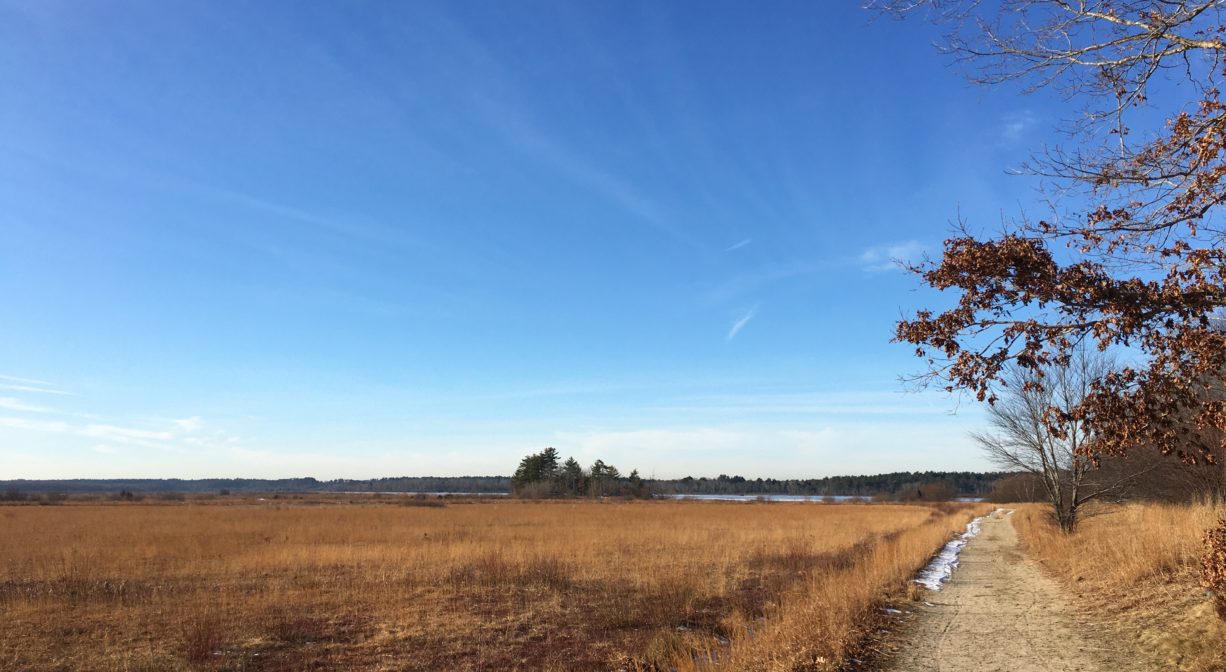
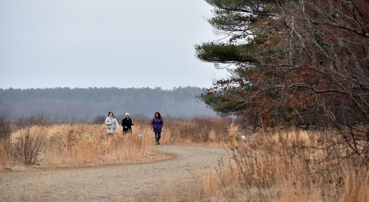
This alternate entrance to the Burrage Pond Wildlife Management Area provides access to over 2,000 acres of ponds, marsh, swamps and retired cranberry bogs with several miles of walking trails. Located on Elm Street in Halifax, it provides access to the southern portion of the property. The Burrage Pond WMA is managed by the state for fisheries and wildlife habitat, as well as open space. It is stroller-friendly, and an excellent spot for bird-watching. Extend your visit at the Indian Crossway Conservation Area or Smith-Nawazelski Conservation Area, both immediately adjacent. There are two additional entrances to the property in Hanson, on Elm Street and on Pleasant Street.
FISHING ADVISORY: It’s important to know that some of our freshwater fisheries are contaminated with mercury, PFAS and/or other concerning substances. The Massachusetts Department of Public Health maintains an online database with up-to-date advisories regarding fish consumption, sorted by location. We recommend you consult this valuable resource when planning a fishing excursion.
HUNTING: Hunting is allowed, in season, by licensed persons in compliance with Massachusetts law. Please be sure to understand state and local hunting guidelines before proceeding. Non-hunters, be mindful of hunting seasons, and wear bright orange if you’re entering the property during those times. Hunting is not permitted on Sundays.
Features
This land is within the region of the Massachusett (or Massachuseuk) Native American tribe. The Mattakeeset band of the Massachusett lived for thousands of years in the North River watershed. Their village included most of today’s Pembroke and Hanson.
To travel between the North River watershed and the Taunton River watershed, the Mattakeeset followed a trail that extended from today’s Indian Head Pond (Main Street, Hanson) to Crooker Place and today’s Indian Crossway Conservation Area, through the great Cedar Swamp (today’s Burrage Pond Wildlife Management Area), through today’s Smith-Nawazelski Conservation Area (Elm Street, Hanson) to East Bridgewater and the Taunton River watershed.
To learn more about local Native American tribes, we encourage you to interact with their members. The Massachusett tribe at Ponkapoag and the Mattakeeset band of the Massachusett share information on their websites.
After Europeans arrived in the area in the 1600s, this property became known as the Great Cedar Swamp and the South Hanson Swamp. It was logged for cedar in the 1700s and 1800s. Stump Pond was formed when Stump Brook was dammed to create water power. In 1905, industrialist Albert C. Burrage began digging peat for use as fuel for his various enterprises.
Burrage founded the Atlantic Dyestuff Company in 1916, with offices in Boston and a 40-acre coal-tar dye manufacturing plant in a place known as Burrage, MA (actually South Hanson). The company quickly became a leading American dye manufacturer. Dyestuffs were in high demand during World War I.
The plant, which was located at the intersection of today’s Hawks Avenue and Pleasant Street in Hanson, included four factory buildings, an office, a hotel, and 34 worker cottages. An explosion in March 1919 resulted in a catastrophic fire. The company decided to expand and rebuild elsewhere. Burrage constructed a new plant on the site of a shipyard in Newington, NH. Two concrete structures — partial remains of Burrage’s power plant — still stand on site, providing an unsightly reminder of the property’s industrial past.
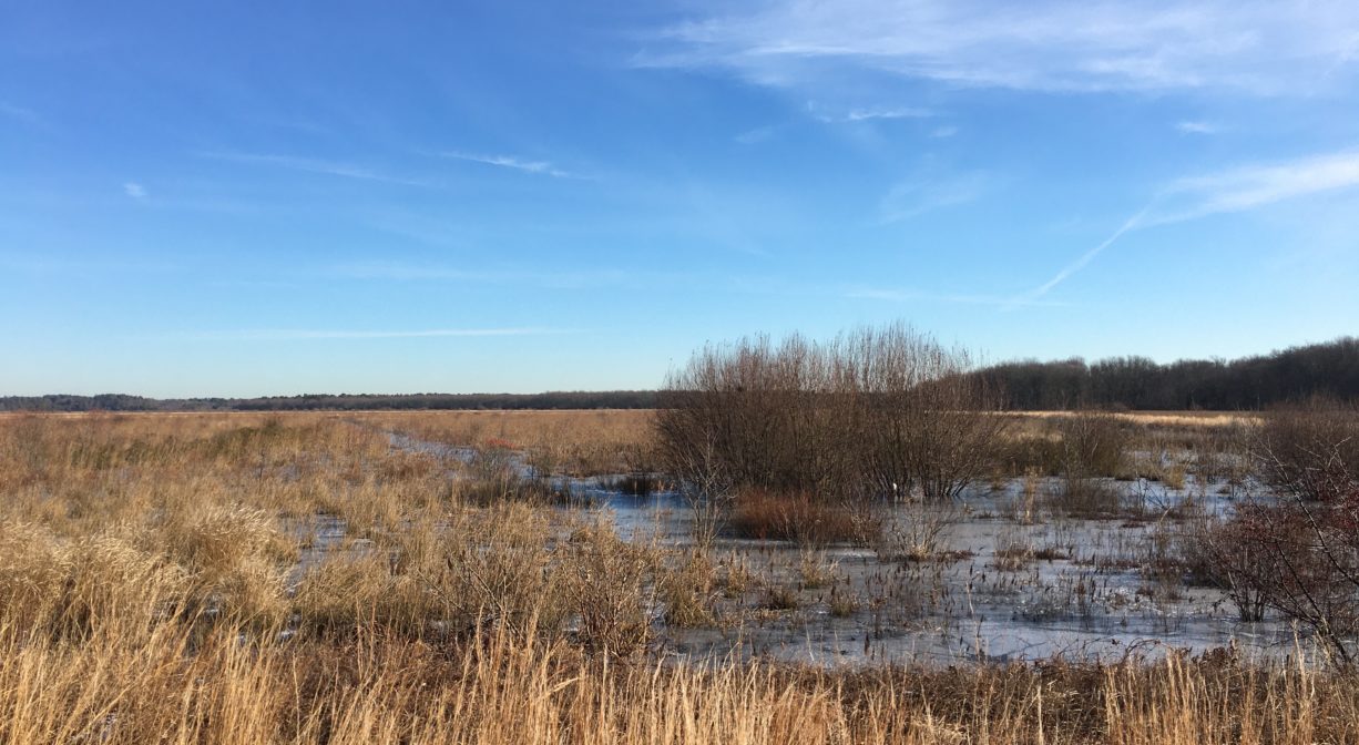
Burrage later converted his Hanson operation to cranberry farming. The succession of ownership is unclear but in 1931, the Hanson Cedar Company sold the land to the United Cope Cod Cranberry Company. A more recent owner was Cumberland Farms. Unfortunately Cumberland Farms converted some of the wetlands into additional bogs between 1977 and 1990. This resulted in an enforcement action by the United States Environmental Protection Agency (EPA). Later Northland Cranberry Company purchased the land. In 2002, the Massachusetts Division of Fisheries and Wildlife acquired the majority of the property. It includes cranberry bogs, the open water now known as Burrage Pond, some Red Maple swamps, some regenerating Atlantic White Cedar, plus grassy freshwater marshes along the small streams. Mass Audubon also owns 600 acres here.
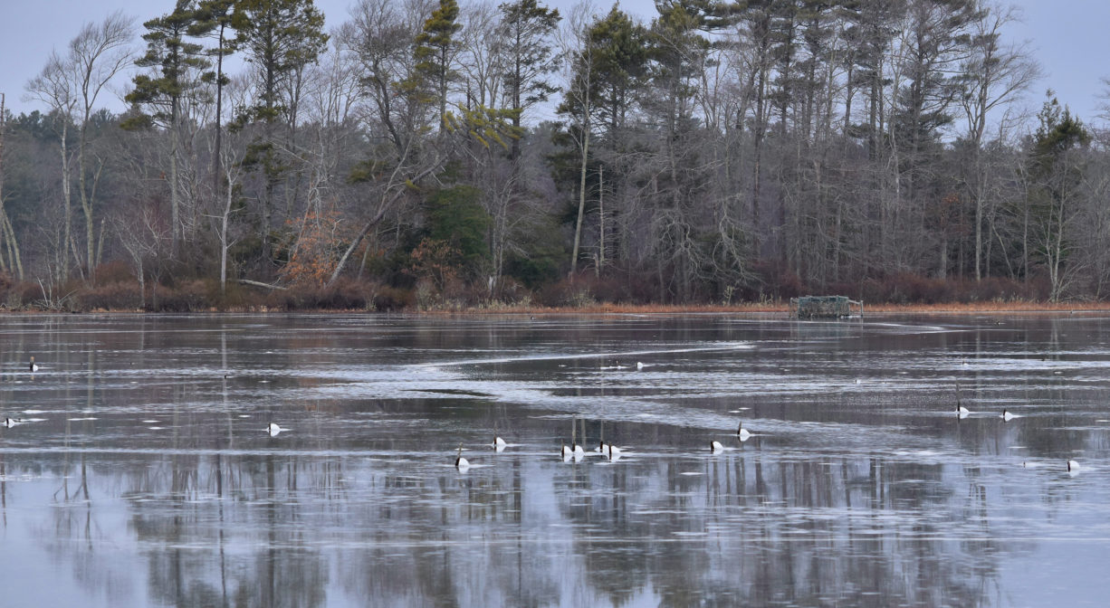
Both Upper Burrage Pond and Lower Burrage Pond offer excellent shoreline fishing from the main dike. The ponds are very shallow (3-4 feet) and weed-filled, and thus difficult to navigate in the summer months. Canoes and small car-top boats can be carried in, but it’s a long walk! Hunting opportunities (in season) include waterfowl in the marsh and bog areas, and deer in the woods.
Trail Description
There are more than 10 miles of public trails on the property. They are primarily the broad and flat dirt roads commonly found around cranberry bogs. This is easy walking, and a popular spot for horses and leashed dogs. There is an additional entrance just up the road, on Elm Street in Hanson, and another on Pleasant Street in Hanson. Additional access via the Indian Crossway Conservation Area on Crooker Place in Hanson.
Habitats and Wildlife
The property was originally a very large Atlantic White Cedar swamp. In 1931, it was diked and otherwise altered for cranberry production. It is now composed of retired cranberry bogs surrounded by ponds and reservoirs, freshwater marsh, Atlantic white cedar swamp, and red maple swamp. The uplands contain the typical pine and oak, as well as some birch. Some of the flora identified here include: large whorled oogonia, calapogon, painted trillium, mountain laurel, bunchberry, and pink azalea.
According to the Massachusetts Division of Fisheries and Wildlife, “Upper and Lower Burrage reservoirs, along with some smaller bogs on the property, offer excellent warmwater fishing from a canoe or kayak or from shore. Anglers can expect to catch largemouth bass, chain pickerel, yellow perch, white perch, black crappie, sunfish, and brown bullhead. The reservoirs are shallow, with exposed and submerged stumps.
For decades this has been an important birding site, for its waterfowl, marsh birds, and migrating passerines. Wood Ducks breed here in good numbers, and Virginia Rails can be heard calling. There is an active colony of Night Heron. Among the 81 species catalogued in 2003 were Osprey, American Kestrels, Eastern Kingbirds, Warbling Vireos, Gray Catbirds, Yellow Warblers, Baltimore Orioles and Orchard Orioles. Also watch for Northern Harriers, Sharp-shinned Hawks, Red-shouldered Hawks, and Merlins, as well as herons, egrets and ibises. You might also see white-tailed deer, coyotes, foxes, wild turkeys, beavers, muskrats, and river otters.
Stump Pond was created when the only natural outlet from Monponsett Pond, known as Stump Brook or Herring Brook, was dammed for water power. Stump Brook flows southwest through the southern portion of the property, to Robbins Pond in Halifax, a source of the Satucket River. The Satucket is a significant headwater tributary to the Taunton River.


Historic Site: No
Park: No
Beach: No
Boat Launch: No
Lifeguards: No
Size: 2014 acres
Hours: Dawn to Dusk
Parking: Limited on-site parking lot. Follow the gravel access road at approx. #145 Elm Street, Halifax. Additional (and ample) parking at the Pleasant Street (Hanson) entrance. Limited on-site parking at the Elm Street (Hanson) entrance, across from the Smith-Nawazelski Conservation Area.
Cost: Free
Trail Difficulty: Easy
Facilities:
Informational kiosk at Elm Street (Halifax) entrance. Additional kiosk at Pleasant Street (Hanson) entrance. One picnic table beside the pond. The regional headquarters for the Massachusetts Environmental Police is located on site. Geocache location.
Dogs: Leash laws strictly enforced — All animals must be under restraint. Please clean up after your pet!
Boat Ramp: No
ADA Access: No
Scenic Views: Yes
Waterbody/Watershed: Stump Brook (Taunton River watershed)