
Donovan Fields, Circuit St, Norwell, MA 02061, USA
Owned By: Town of Norwelll
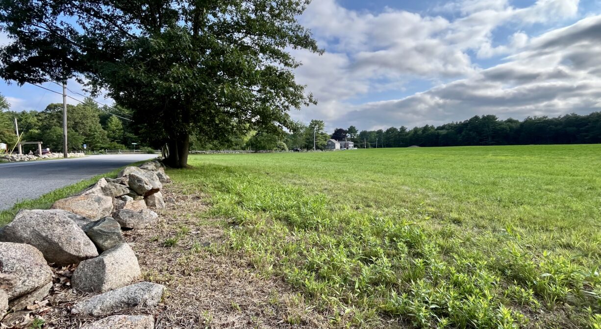
Norwell’s Donovan-Wildcat Conservation Area is a 150-acre property with at least 2 miles of trails through woods and open fields. Located at the intersection of Circuit, Forest, and Pleasant Streets, the 50-acre Donovan Fields are a much-appreciated town landmark, leased out annually for agricultural purposes. The adjacent 100 acres of woodlands provide wildlife habitat and views of Margaret’s Brook.
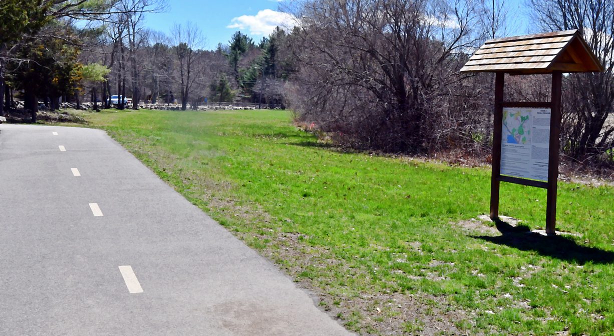
Donovan-Wildcat is one of many access points to Norwell’s Pathway, a paved bike and walking trail. The Norwell Community Gardens are immediately adjacent.
HUNTING: Those who hold town-issued permits may use this property for seasonal hunting and trapping. Hunting is not allowed on, or across, any trail. Visit the hunting page on Norwell’s website for details. Non-hunters, be mindful of hunting seasons, and wear bright orange if you’re entering the property during those times. Hunting is not permitted on Sundays.
Features
The Town of Norwell acquired this property for conservation land in 1997. In earlier times, it was known as White Oak Plain. It was part of a large, Colonial-era land grant to the Clapp family. Cleared for farming in 1820, it later became a commercial apple orchard. Evidence of this exists today — a low brick building that was once used as a cold storage shed. Nearby you can also see a smoke shed and a stone fire pit.
The portion of the property that lies south of Pleasant Street is known as Wildcat Hill. Some of the Clapp family’s freed slaves originally settled these lands. Their community grew as other emancipated families from Hingham, Plymouth, Duxbury, and other towns joined them. Many of these individuals were of African American descent, but some were Native Americans. Click here to learn more about this and other stories on the North River Early Black Heritage Trail.
This land is within the region of the Massachusett (or Massachuseuk) Native American tribe. For thousands of years, the land today known as Norwell was inhabited by indigenous people who grew crops, foraged, hunted, and fished in the Assinippi and North River areas. Circa 1617, a major outbreak of disease decimated an estimated 90% of the native population in New England. Descendants of these original inhabitants are living here today. They are known as the Mattakeesett Tribe of the Massachusett Indian Nation, the Massachusett Tribe at Ponkapoag, the Herring Pond Wampanoag, and the Mashpee Wampanoag tribe.
Trail Description
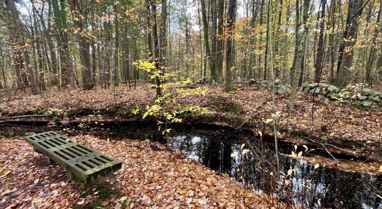
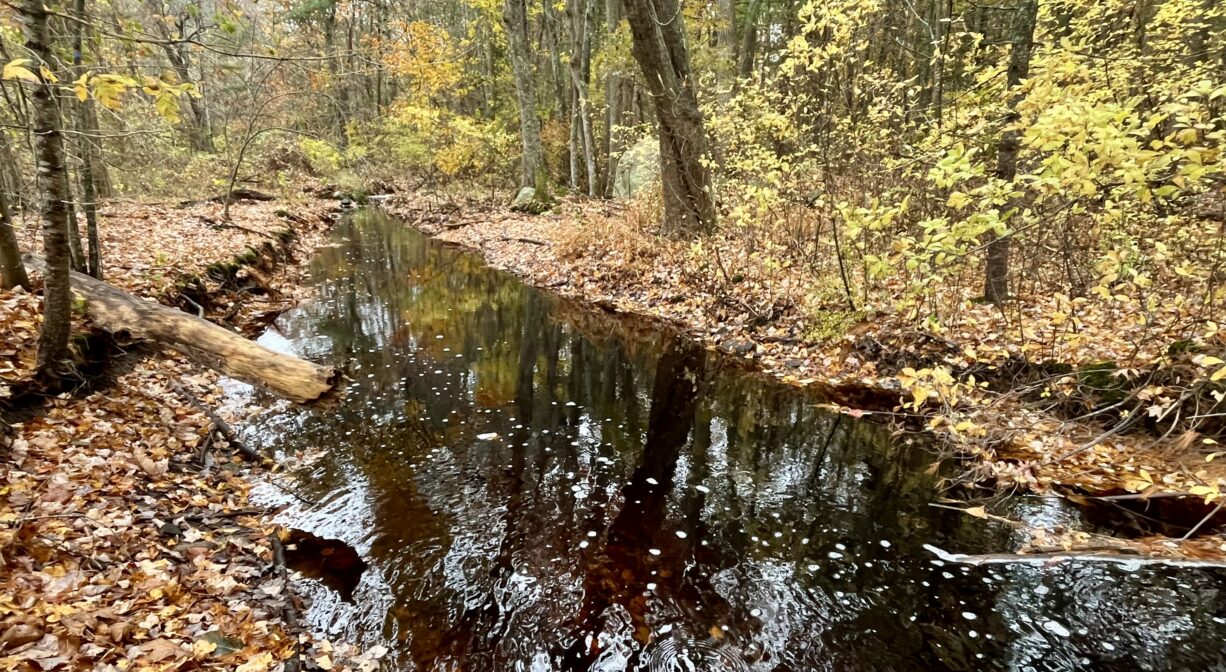
A trail around the Donovan Fields begins at the parking area on Circuit Street. A wide path extends past the Norwell Community Gardens to the Norwell Pathway. Follow the Pathway across Circuit Street and continue along one side of the fields. When you arrive at the trail fork, veer off the Pathway and continue to the left, on the forest trail. It extends along Margaret’s Brook and offers views of an earthen/stone dam and a small pond, along with a pleasant bench. This trail (D1) continues all the way to Pleasant Street, Along the way, look for the smoke house and the cold storage shed at the edge of the field.
There is also a network of trails south of Pleasant Street, through the area known as Wildcat Hill. Past the parking area and across Circuit Street, just a little farther up the road, look for two wooden posts with painted blazes in Norwell’s town colors, blue and gold. This (D2) is one of several trailheads for the Wildcat Conservation Area, which offers a number of intersecting loops trails. You’ll pass along the rear of the Donovan farm, and then into the woods. Route-wise, there are numerous options, and most of them are well-marked with number-and-letter tags — D for Donovan, W for Wildcat, etc.. At a few of the trail intersections, you’ll find a wooden bench for rest or contemplation. Eventually the trails connect with Wildcat Lane, where there is another small parking area. The trails are rough and rooty at some points. While they are relatively flat (with the exception of those that climb Wildcat Hill), they can be rocky. They can be wet and/or muddy at times as well.
For a short loop hike in the Wildcat section, start at the parking area, cross Circuit Street heading away from the Norwell Pathway, and look for the gravel path along the side of the road. In less than 0.1 mile, you will arrive at the D2 trailhead. This trail leads into the woods parallel to private property. After about 0.2 mile, you’ll see a white wooden arrow on a tree, pointing to the right. If you continue straight, you will return to Circuit Street after another 0.2 miles to D4. If you turn right, you’ll continue through the woods for a longer loop. Remaining on the “D” trails past D5, D3 and D6, this is about 0.75 miles.
The “W” trails, accessible from Wildcat Lane, and also from the D5 intersection, offer an additional mile of forest hiking. To explore the Wildcat section, begin as above at the main parking area. Cross Circuit Street, heading away from the Norwell Pathway, and look for the gravel path along the side of the road. In less than 0.1 mile, you will arrive at the D2 trailhead. Turn right here, and then immediately turn left onto the narrow wooded trail that runs parallel to Circuit Street. This will bring you to a sign for the D6 trail. Follow the “D6” and “6” signs to the intersection with the D4 trail. Go left at this intersection. The trail is wide and grassy here — a great spot for cross-country skiing. It continues to the D5 intersection, where if you bear to the left, you’ll be headed toward the Wildcat area. The D6 trail soon meets up with the W1 trail, and shortly thereafter, an intersection of W1, W2 and W4. Those trails form a loop. If you bear left on W2, the trail leads to the Wildcat Lane entrance to the property. Continue past this entrance, following the W3 trail, which also leads out to Wildcat Lane. At the next intersection, you’ll find a bench and some options — W5 and W4. The W5 trail is a spur that leads to yet another spot on Wildcat Lane, and the W4 trail loops back around to the W1/2/4 intersection. If you follow W4, and then retrace your steps back to the parking lot, the total distance is just under 2 miles.
Habitats and Wildlife
The woodlands at Donovan-Wildcat are diverse – some pine, maple, oak and beech, plus the occasional holly and lots of fern. Watch for red fox as they hunt for smaller mammals such as mice and rabbits. White tailed deer enjoy the fields for grazing and the forest for protection. The brook and surrounding wetlands are perfect for such local amphibians as spring peepers.
The Donovan Fields, defined as a Cultural Grassland because of their creation by humans (as opposed to natural conditions) and their sandy, low nutrient soils, are an important habitat for grassland bird communities.
Margaret’s Brook flows south from Hoop Pole Swamp, through this property. Just south of Pleasant Street, it empties into Wildcat Brook, which eventually joins with Wildcat Creek and flows into Third Herring Brook, a major tributary to the North River. Third Herring Brook forms much of the town line between Norwell and Hanover.
The North River rises from wetlands and springs in Weymouth, Rockland and Hanson. It is approximately 10 miles in length, with its source at the confluence of the Indian Head River (Hanover) and Herring Brook (Pembroke). From there it flows through the towns of Hanover, Pembroke, Marshfield, Norwell, and Scituate to the Atlantic Ocean between Third and Fourth Cliffs, draining approximately 59,000 acres along the way.


Historic Site: No
Park: No
Beach: No
Boat Launch: No
Lifeguards: No
Size: 150 acres
Hours: Dawn to Dusk
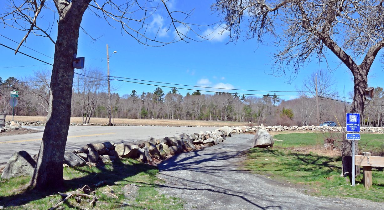
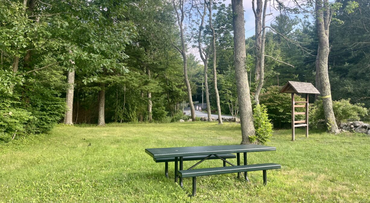
Parking: Limited on-site parking lot on Circuit Street, near the intersection with Pleasant Street. Additional parking off Wildcat Lane.
Cost: Free
Trail Difficulty: Easy, Medium
Facilities:
Informational kiosk and picnic table at the main parking area. Benches at some of the trail intersections. Several benches along Margaret’s Brook. Geocache locations.
Dogs: Dogs must remain on leash. Always clean up after your dog!
Boat Ramp: No
ADA Access: No
Scenic Views: Yes
Waterbody/Watershed: Margaret's Brook (North River watershed)