
Norwell Conservation: (781) 659-8022
Owned By: Town of Norwell
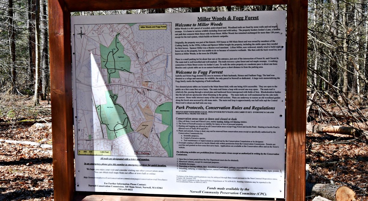
The combined Fogg Forest and Carleton Property in Norwell provide 154 acres of contiguous conservation land, and at least 2 miles of trails. Look for the trailhead at the rear of the field on Main Street, at the edge of the woods, just outside the town center. In the forest, you’ll find a mix of white pine, oak, beech, and maple, plus views of Trout Brook. Stop by in the spring to see the rhododendrons in bloom. And don’t miss the new Cow Path Trail, added in 2024 at the corner of Main and Lincoln Streets.
HUNTING: Those who hold town-issued permits may use the Carleton Property for seasonal hunting and trapping. Please note that hunting is prohibited in the Fogg Forest section of the property. Hunting is not allowed on, or across, any trail. Visit the hunting page on Norwell’s website for details. Non-hunters, be mindful of hunting seasons, and wear bright orange if you’re entering the property during those times. Hunting is not permitted on Sundays.
Features
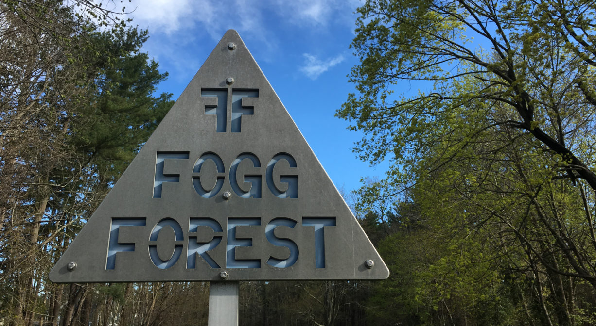
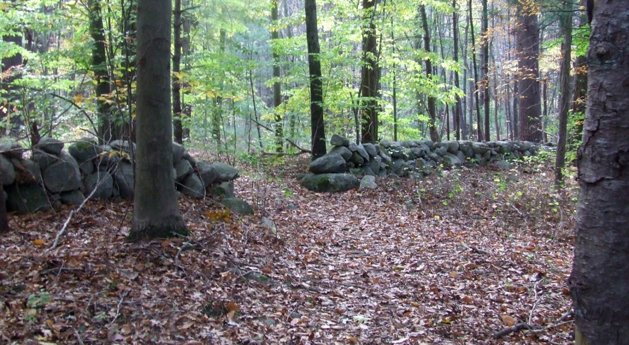
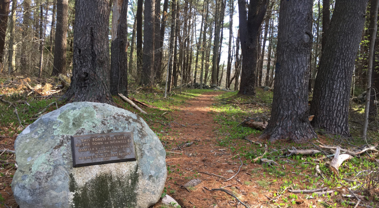
This property is named for the Fogg Family. You’ll see their names on the large rock at the trailhead. The parcel was donated to the Town of Norwell in 1972 by Isabella and Helen Fogg, in honor of their husbands, Horace and Faulkner, with the aim of providing and protecting habitat for wildlife. Old stone walls remind us that these woods were once farmland. Deep within the property, near the brook, look for concrete remnants from the days when there was a manmade pond here.
The Carleton Property was acquired by the town of Norwell in 2019, adding over 100 acres to the conservation parcel. Within this section of the property there is an impressively large and well-preserved stone wall. According to the Town of Norwell, in 1707, Joseph Cushing purchased this land, known at the time as Henchman’s Corner. He and his wife Mary established a homestead which eventually became the property of Nathan Cushing, who became a Justice of the State Supreme Court. The land remained in the Cushing family through the 1990’s. There is a historic marker noting the former location of the house on Main Street. The Carleton name derives from Elizabeth Cushing, who lived adjacent to the property and married Francis Cogswell Carleton. Elizabeth later married Clark Whiting. The historic fields along Main Street — known as Whiting Fields — are named in his honor. Elizabeth’s son, Charles Carleton, passed away in 2004, and left the Carleton property to his three children, who in turn sold it to the Town of Norwell in 2019.
This land is within the region of the Massachusett (or Massachuseuk) Native American tribe. For thousands of years, the land today known as Norwell was inhabited by indigenous people who grew crops, foraged, hunted, and fished in the Assinippi and North River areas. Circa 1617, a major outbreak of disease decimated an estimated 90% of the native population in New England. Descendants of these original inhabitants are living here today. They are known as the Mattakeesett Tribe of the Massachusett Indian Nation, the Massachusett Tribe at Ponkapoag, the Herring Pond Wampanoag, and the Mashpee Wampanoag tribe.
Trail Description
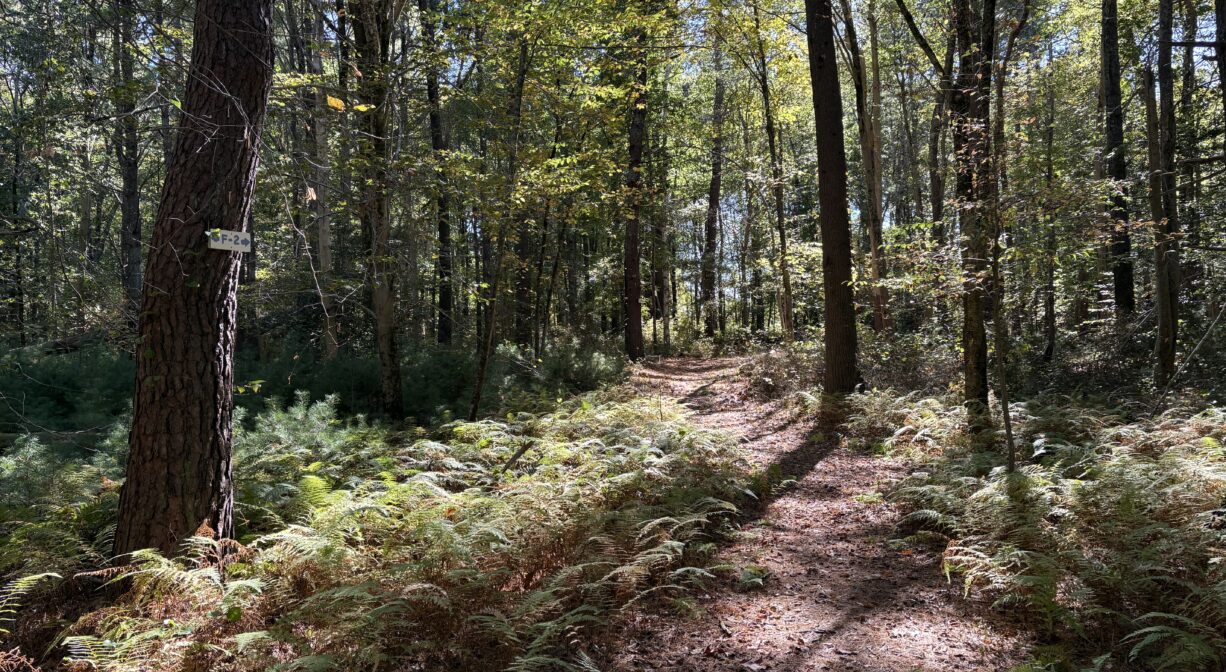
The trails here are generally clear and well marked. To find the main trailhead, look for the large rock at the rear of the field where the parking area is located. This leads to an approx. 1-mile loop trail. One spur trail (FF5) leads to private property and some llamas after about 1/3 mile. Another spur trail (FF3) features several small bridges and stream crossings, exiting after about 0.35 miles to Central Ave. Yet another spur trail leads into the Carleton Property, where there is an additional 1-mile loop with its own spur trails. There are also trails that lead to Trout Brook. Pedestrian access is also available from Central Street and from Main Street, closer to Lincoln Street. Watch for a new trail connection to the adjacent Gould Property in the future!
Habitats and Wildlife
In a white pine and oak forest like Fogg, you are very likely to see squirrels frolicking among the branches of the trees overhead. You might also catch a glimpse of mice, shrews, and chipmunks. Look for white tail deer at dawn and dusk, especially in the field. Common bird sightings in this type of forest include Eastern Wood-Pewee, Red-eyed Vireo, Brown Creeper, Hermit Thrush, and Red-tailed Hawk. Watch for wild turkeys too. They can be especially captivating in the spring, when the males (aka “toms”) puff themselves up to attract a mate.
Fogg Forest is especially appealing in the late spring, when the rhododendron that grow there are in bloom. In season, there is also a lot of fern. Beech trees are a common sight as well.
Trout Brook flows through the rear section of Fogg Forest. It is part of the Second Herring Brook watershed. Second Herring Brook originates north of Cross Street in Norwell and flows south through Turner Pond and Torrey Pond. Below Torrey Pond, it is joined by Trout Brook. Second Herring Brook continues through Norwell Center and the Norris Reservation, and then empties into the North River.
The North River rises from marshes and springs in Weymouth, Rockland and Hanson. It is approximately 10 miles in length, with its source at the confluence of the Indian Head River (Hanover) and Herring Brook (Pembroke). From there it flows through the towns of Hanover, Pembroke, Marshfield, Norwell, and Scituate to the Atlantic Ocean between Third and Fourth Cliffs, draining approximately 59,000 acres along the way.


Historic Site: No
Park: No
Beach: No
Boat Launch: No
Lifeguards: No
Size: 154 acres
Hours: Dawn to Dusk
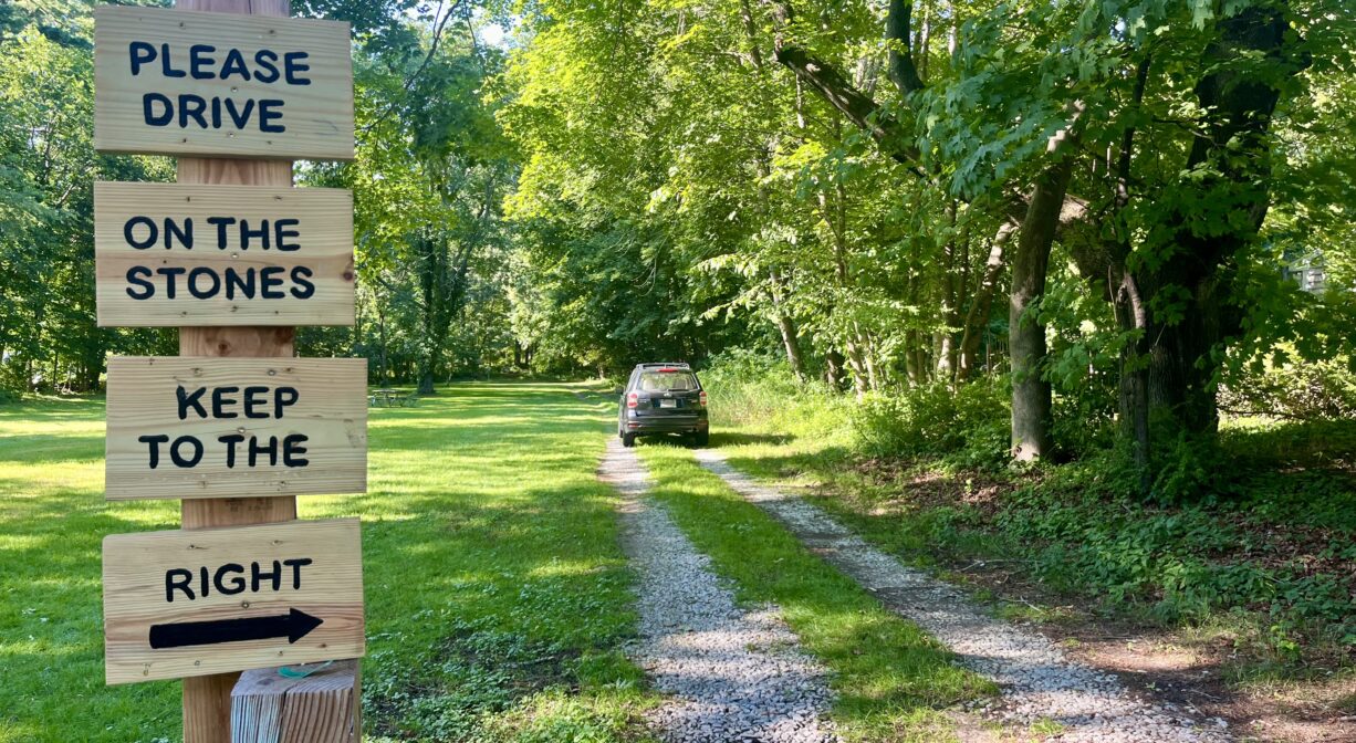
Parking: On-site parking at 605 Main Street. Please note that there is only a partial curb cut! Drive over the stones along the right side of the field, and park at the rear of the field. Additional pedestrian access from Central Street and from Main Street, near Lincoln Street.
Cost: Free
Trail Difficulty: Easy
Facilities:
Benches in various locations, 2 picnic tables in the field. Geocache locations.
Dogs: Dogs must remain on leash. Always clean up after your dog!
Boat Ramp: No
ADA Access: No
Scenic Views: Yes
Waterbody/Watershed: Trout Brook (North River watershed)