
326 Plymouth St, Abington, MA 02351, USA
Town of Abington: (781) 982-2100
Owned By: Town of Abington
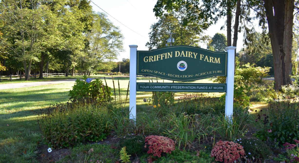
Griffin Dairy Farm is a 64-acre, town-owned conservation property in agricultural setting in Abington. It features a half-mile flat gravel walking path, an athletic field, and a small picnic area. Extend your walk along the Rockland Rail Trail, just around the corner on Charles Street.
Hunting is not allowed on this property.
Features
Purchased by the town of Abington in 1998 for open space and recreation, this property was renovated for public use in 2017, adding a picnic area, an athletic field and a walking trail. It sometimes goes by the name Griffin Dairy Park. Some of the land is actually in Rockland, but Abington oversees it.
With the help of their children, Lawrence & Annie Griffin operated a dairy farm here for 40 years, beginning in 1925. The farm produced bottled milk and other dairy products, and offered delivery. It also grew its own corn and hay. In later years, the HP Hood Company leased a small portion of the property, departing in 2010. A weekly farmers market is now held here in the summer. The Abington Community Garden is located on site as well. Bicycles welcome. No horses.
This land is within the region of the Massachusett (or Massachuseuk) tribe. According to Martha Campbell’s Remembering Old Abington, the original town of Abington included today’s Abington and Rockland as well as most of Whitman. In the 1660s, European settlers from Weymouth began establishing homesteads within the town. While the settlers came from Massachusetts Bay Colony, the land was part of Plymouth Colony. All of the 18 original land grants were along the Satucket Path, a trail established by Native Americans that extended from Wessagusset in North Weymouth to Robbins Pond in East Bridgewater.
Campbell also explains how the Native American name for the town was Manamooskeagin, translated from the Algonquin as “great green place of shaking grass.” The Abington town seal incorporates its Algonquian name.
To learn more about local Native American tribes, we encourage you to interact with their members. The Mattakeeset band of the Massachusett and the Massachusett tribe at Ponkapoag share information on their websites.
Trail Description
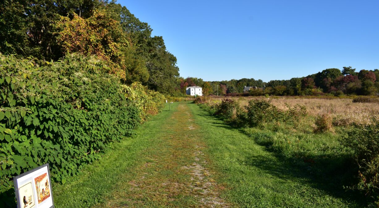
The property features a flat gravel loop trail of about a half mile, with a few spurs that lead to parking areas on Plymouth Street and Pattison Street, and also to Charles Street, and into the woods. Some of the spurs are mowed grass instead of gravel.
You can easily access the Rockland Rail Trail from here. As you exit the property at the Pattison Street lot, turn right on Pattison, and then turn left on Charles Street. The Rail Trail crosses Charles a little bit farther up the road.
Habitats and Wildlife
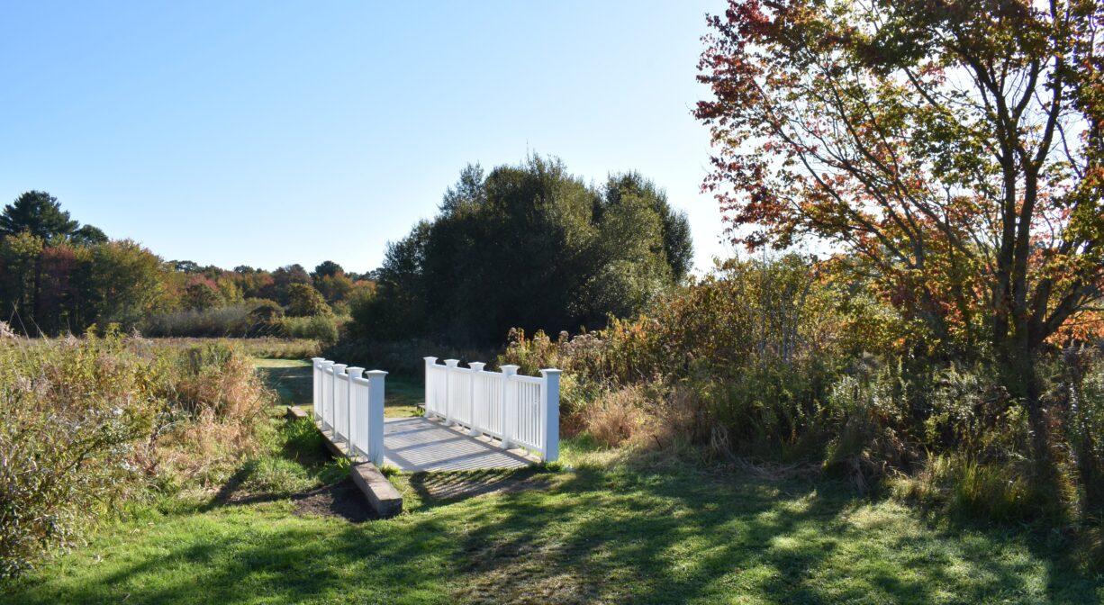
The property features a wide open meadow with some wetland areas. The trees that surround the meadow include maple, beech, and oak. There are also some grapevines and nesting boxes.
An intermittent stream cuts across the meadow at the center of the property. Footbridges allow for trail crossings. The streams and wetlands here drain to the Shumatuscacant River.
The Shumatuscacant River flows for 8.8 miles through Abington and Whitman. In Hanson’s Poor Meadow Brook Conservation Area, it joins with Poor Meadow Brook. The stream continues to Robbins Pond in East Bridgewater, where it empties into the Satucket River, part of the Taunton River watershed.
The word “Schumatuscacant” has been translated from the Algonquin as “beaver stream with the stepping-over place.” It originally referred to a specific spot on the Satucket Path where the river could be crossed easily. A similar word, “Schumacastcacut,” has been translated as “beaver stream always dependable.”
We encourage you to follow and support the Taunton River Watershed Alliance.


Historic Site: No
Park: Yes
Beach: No
Boat Launch: No
Lifeguards: No
Size: 64 acres
Hours: Dawn to Dusk
Parking: Located on Route 58. Limited on-site parking at 326 Plymouth Street, and on Pattison Street.
Cost: Free
Trail Difficulty: Easy
Facilities:
Benches, picnic tables, trash receptacles, Little Free Library.
Dogs: Dogs are permitted but must remain on a short leash at all times. Always clean up after your dog!
Boat Ramp: No
ADA Access: Yes
Scenic Views: Yes
Waterbody/Watershed: Shumatuscacant River/Taunton River watershed