
149 Barker St, Pembroke, MA 02359, USA
Pembroke Town Manager: 781-293-3844
https://www.pembroke-ma.gov/sites/pembrokema/files/uploads/pembroke_herring_run_history_booklet.pdf
Owned By: Town of Pembroke
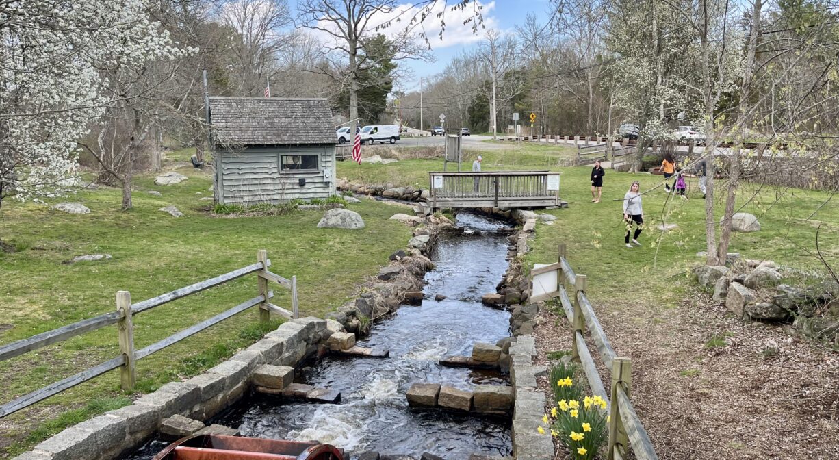
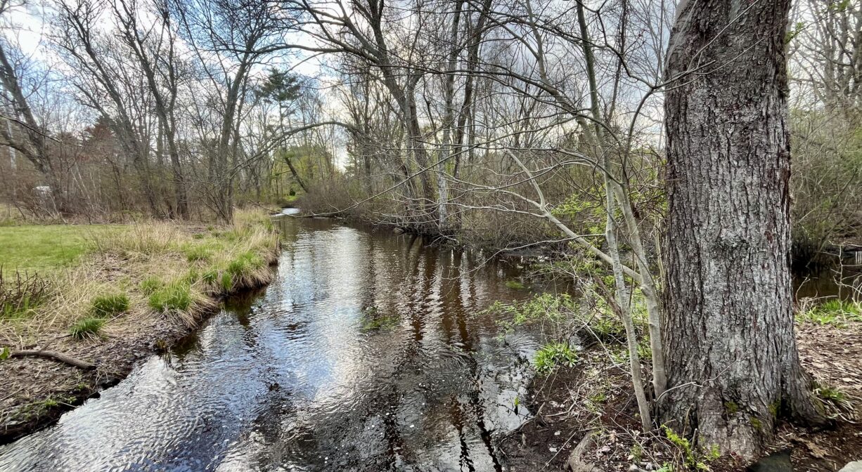
Herring Run Park in Pembroke is a large, grassy town-owned park that stands on both sides of Herring Brook, off Barker Street. Herring begin their annual migration through this property in the springtime, usually in April. Starting from Massachusetts Bay, they swim up the North River for 12 miles to this site and beyond. They are on their way to their spawning grounds at Gorham Mill Pond, Oldham Pond, and Furnace Pond.
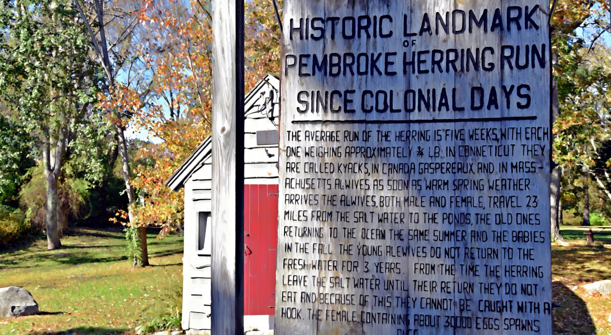
You can view migrating herring here at Herring Run Park, usually in mid-to-late April! In some places, the brook is only about six inches deep, and a few feet wide. Look for silvery-blue (or purplish) fish, about a foot in length. They often gather in large numbers to rest, just before a riffle, before attempting to swim upstream. They can be difficult to spot at first, as they are well-camouflaged to blend in with the river bottom.
Fishing is not permitted in Herring Run Park while the herring are running.
FISHING ADVISORY: It’s important to know that some of our freshwater fisheries are contaminated with mercury, PFAS and/or other concerning substances. The Massachusetts Department of Public Health maintains an online database with up-to-date advisories regarding fish consumption, sorted by location. We recommend you consult this valuable resource when planning a fishing excursion.
Features
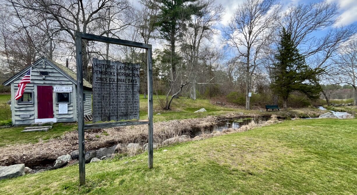
This park’s official name is the Thomas Reading Memorial Herring Run Park.
In earlier times, Herring Brook was known as Barker’s River, and also the Namassakeeset River. Namassakeeset means “place of much fish.” Long before Pembroke was incorporated in 1711, there was a large Native American settlement on the north side of Herring Brook — the Mattakeeset band of the Massachuseuk (or Massachusett) Native American tribe, who lived for thousands of years in the North River watershed. Their village included most of today’s Pembroke and Hanson.
Herring Brook is also part of the historic Wampanoag Commemorative Canoe Passage, which extends for 70 miles from Scituate/Massachusetts Bay to Berkley/Narragansett Bay. It was originally a water trail used by the Native American tribes who inhabited our region, and was re-established by the Plymouth County Development Council and local officials for educational and recreational purposes.
Please bear in mind that Native American cultures often favor oral histories to written ones. Much of what’s recorded about the history of the South Shore is from the perspective of European settlers. It’s not the whole story. To learn more about local Native American tribes, we encourage you to interact with their members. The Mattakeeset band of the Massachusett, the Massachusett tribe at Ponkapoag, the Herring Pond Wampanoag, and the Mashpee Wampanoag also share information on their websites.
According to the book Pembroke: Ancient Trails to the 21st Century, c. 1698, a fishing weir established by Native American peoples was situated on Herring Brook, and used through the first third of the 1700’s, until the town monopolized the herring fishery. There is also evidence of a public weir that existed in 1920 for an unknown duration.
Upstream of this site, at Furnace Pond, there was an early smelting furnace and iron works. It was erected in 1702 by Lambart Despard and the Barker Family. They would scrape bog iron from the bottom of the pond, as well as from numerous bogs in the area. The furnace itself was on Herring Brook, just a few rods downstream of the pond.
A quarter mile farther downstream there was a dam with a sawmill and grist mill, established by Nathaniel Ford around 1820. Later the same spot was home to a box factory owned by John Gorham and Jarius Howland, but it was destroyed by fire. Simeon Chandler also operated a mill at the site.
Downstream of Herring Run Park, Pudding Brook flows into Herring Brook from the east. Shortly thereafter, Cedar Swamp Brook flows in from the southwest. In 1837, there were several mills on Pudding Brook, including a cotton mill, a cupola furnace, two tack factories, and two shingle mills. Goods produced included satinets, shoeboxes, bombards, water pails, covered buckets and mackerel kitts.
Plymouth Colony had fish protection laws dating back to 1623, with legislation stipulating that fish passage be kept open during spawning time. According to Pembroke: Ancient Trails to the 21st Century, at one of the earliest Pembroke Town Meetings, in 1717, Isaac Barker and Ephraim Nichols were empowered to work with the neighboring Native American people to clear streams of obstructions. Beginning in 1742, mills on Herring Brook and its tributaries were required by local law to keep their gates open during the annual herring run, so as not to block the fish from accessing their spawning grounds. The specifics of such laws fluctuated over time. Pembroke began regulating the harvesting of herring in 1741, charging fees, requiring permits, and limiting the size of each individual’s catch. These regulations were likely tied to fluctuations in the size of the local herring population.
Trail Description
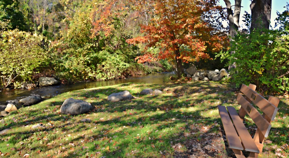
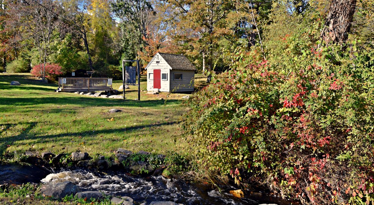
There aren’t any trails on the Barker Street section of this property, but it’s open and grassy and there are footbridges across Herring Brook. There is also a giant glacial erratic boulder. At a different corner of the property, off Little’s Avenue, the Bicentennial Nature Trail leads across the upland and into a dense freshwater marsh for about 0.4 miles. There is one bench shortly before the end of the trail. Along the trail are numerous stone walls, and curious arrangements of rocks (including some quartz). The trail ends at the edge of a brook, and does not connect with the grassy section of the park.
Habitats and Wildlife
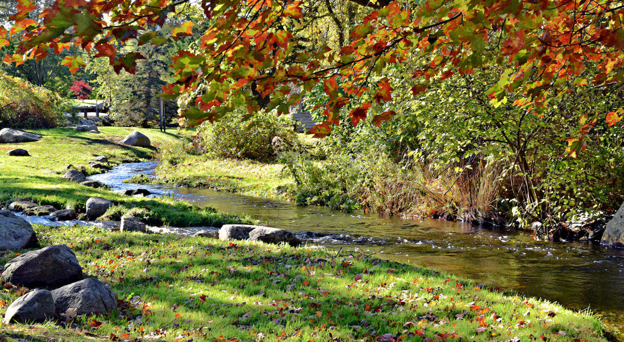
The section of the property on Barker Street is open and grassy, with some maple, oak, and silver birch trees, along with wildflowers and wild shrubs. The forest through which the Bicentennial Nature Trail extends is primarily pine, with some oak, birch, holly, hemlock and hickory, plus wintergreen, princess pine and greenbrier.
Herring Brook rises from Furnace Pond in Pembroke. Joined by Swamp Brook and Pudding Brook, it flows through the town for a few miles before it merges with the Indian Head River, to form the North River, at a place called The Crotch.
The North River is approximately 10 miles in length. It flows through the towns of Hanover, Pembroke, Marshfield, Norwell, and Scituate to the Atlantic Ocean between Third and Fourth Cliffs, draining approximately 59,000 acres along the way.
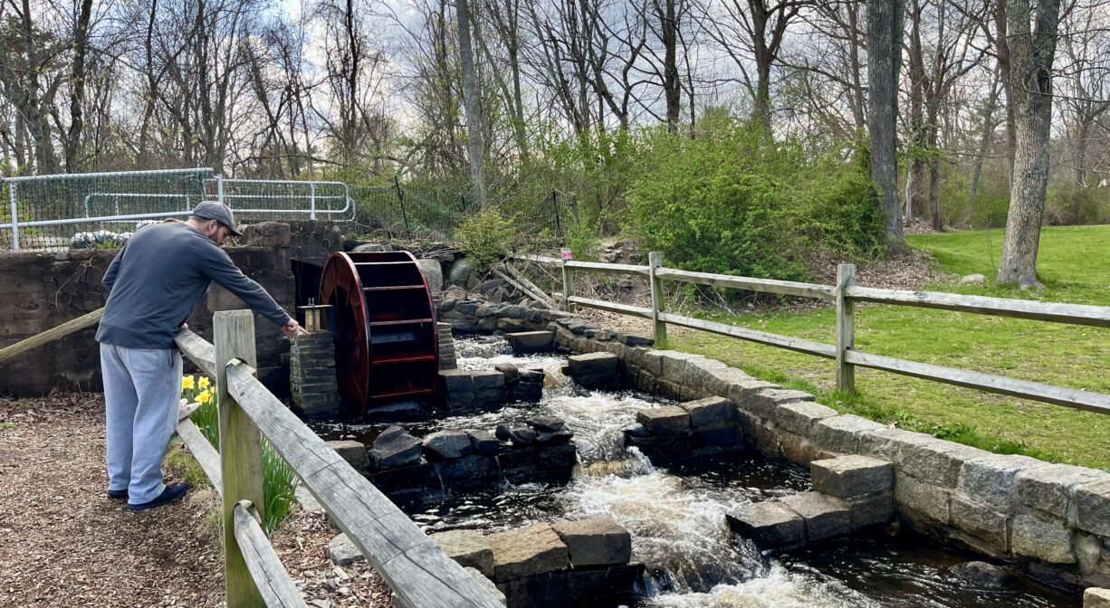
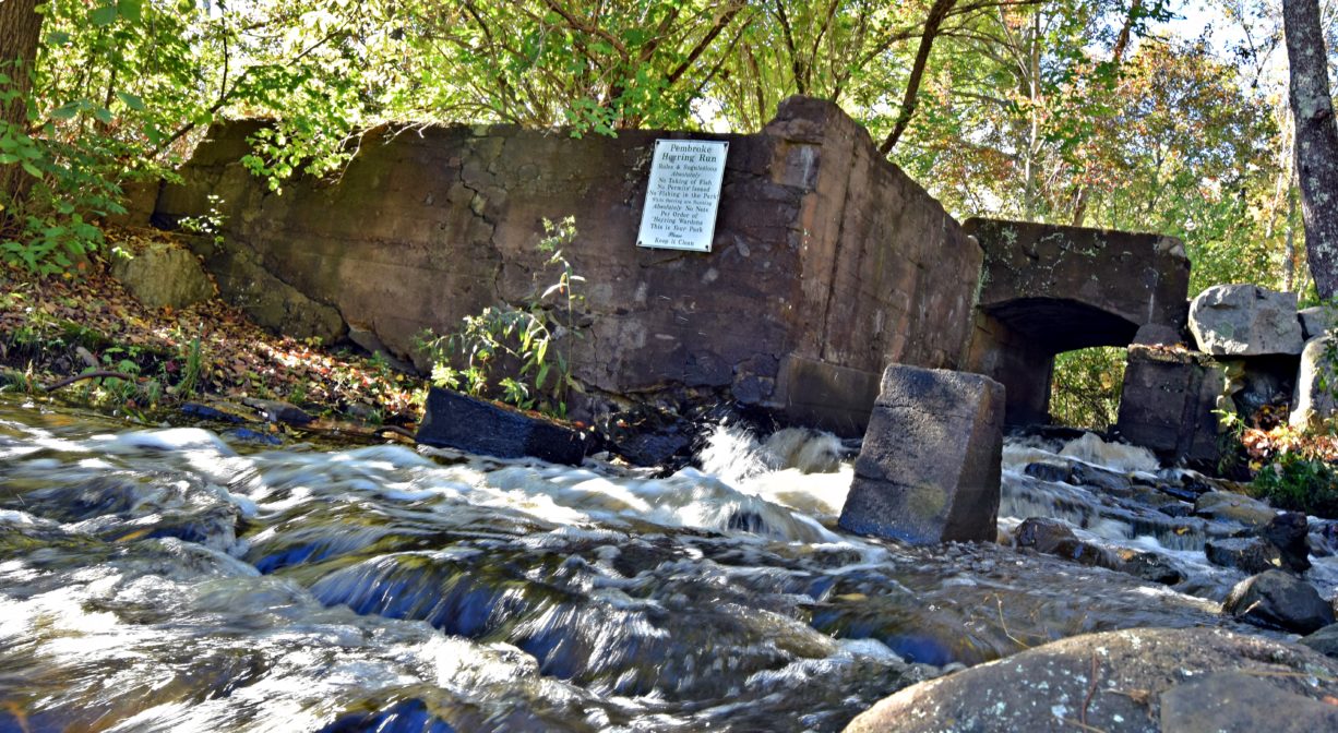
Within the watershed of the North and South Rivers, the Pembroke Herring Run is the best place to view migrating alewife herring, as populations are highest here. On their journey from the ocean to their spawning grounds upstream, herring encounter several obstacles in the form of dams and fish ladders. Fish ladders are intended to help fish scale dams and other obstacles, but if they aren’t maintained well, they can instead serve as a barrier. Here at Herring Run Park, the fishway is managed very well. A group of dedicated volunteers – the Pembroke Herring Fisheries Commission — monitors the flow of water in the stream, ensuring that all obstructions are removed. Thanks to their efforts, the herring run appears to be rebounding!
In the 1600s and 1700s, herring were abundant here. They were a major food source for native tribes as well as for European colonists. Even when mills were established on Herring Brook, measures were taken to ensure that the migrating herring could swim upstream. Pembroke began maintaining its herring run as early as 1717. By 1741, the town not only regulated the harvesting of herring, but also required mills to keep their gates open during spawning time, to ensure fish passage. As early as 1782, Pembroke began restocking herring populations in the ponds upstream.
The local population of herring fluctuates, and over the centuries, there were always periods of decline, followed by regrowth. However by the 1900s, the decline of herring populations appeared to be permanent. Four major factors contribute to the decline of herring populations: destruction of spawning grounds, pollution of streams, overfishing, and poor regulation. Decades passed. It appeared that the herring population at this site was decimated. However in the years 1995-1997, efforts were made to restock herring in their spawning grounds. In the two decades since, the fish population has grown significantly. Carefully maintained fish ladders help the herring to scale the now-obsolete industrial dams.
The Pembroke Herring Fisheries Commission was established in 1998. Its responsibilities include the study, repair, and maintenance of the waterways in town, so as to restore the river herring population to self-sustaining levels. They are a dedicated crew! One year, with the assistance of the Massachusetts Fisheries Commission, they hand-lifted herring over the Upper Mill Pond Dam! A fish ladder upstream on Mill Street was completed in 2011.

Historic Site: Yes
Park: Yes
Beach: No
Boat Launch: No
Lifeguards: No
Size: 59 acres
Hours: Dawn to Dusk
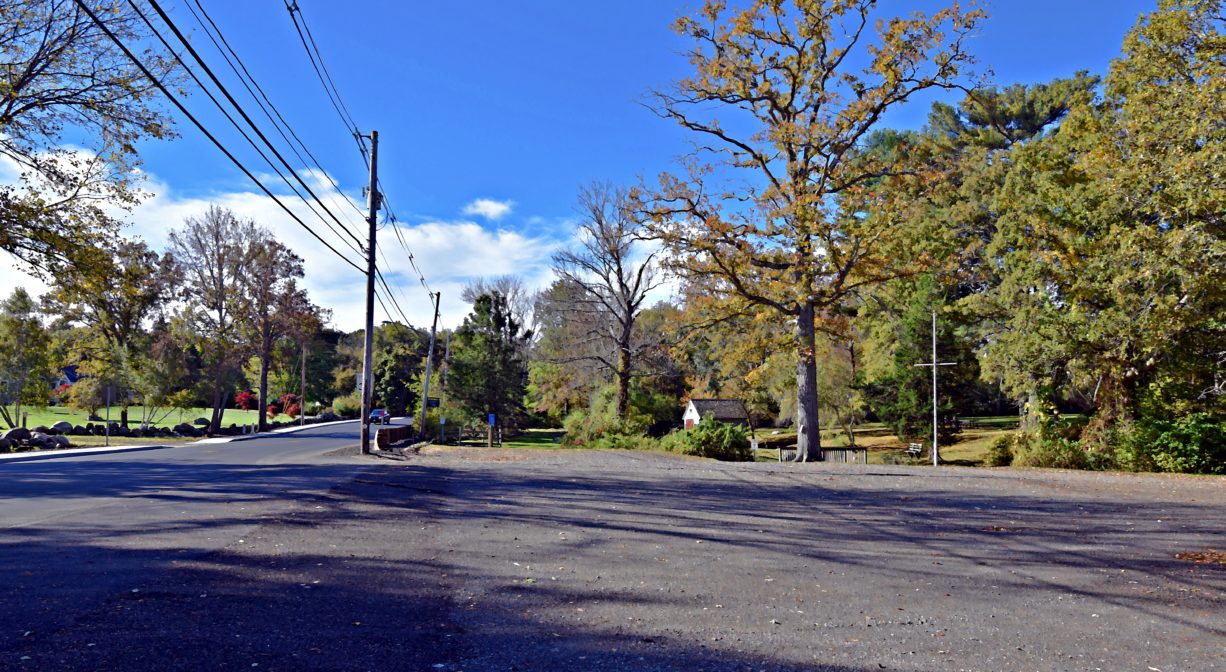
Parking: On-site parking for 35 vehicles at 149 Barker Street. Additional access on Little’s Avenue (but no formal parking area).
Cost: Free
Trail Difficulty: Easy
Facilities:
Benches, picnic tables, brick grilling area, footbridges, historic marker, flagpole. Geocache location.
Dogs: Only service dogs are permitted. Always clean up after your dog!
Boat Ramp: No
ADA Access: No
Scenic Views: Yes
Waterbody/Watershed: Herring Brook (North River watershed)