
1 bridge street, weymouth ma
Town of Weymouth: (781) 335-2000
Owned By: Town of Weymouth
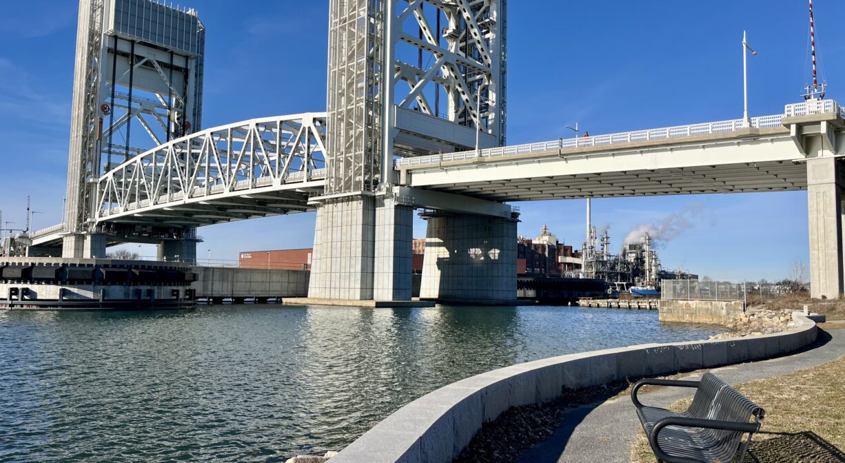
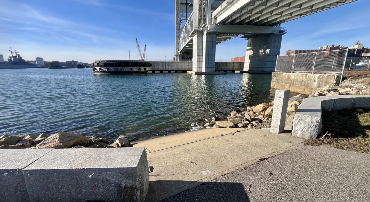
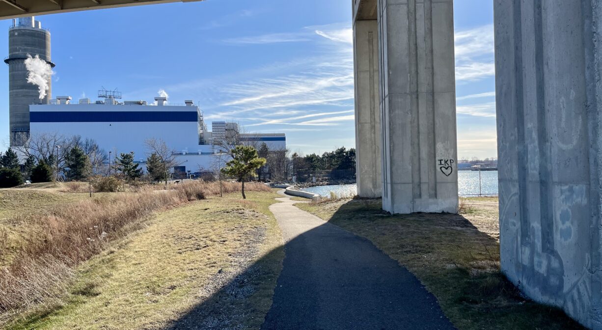
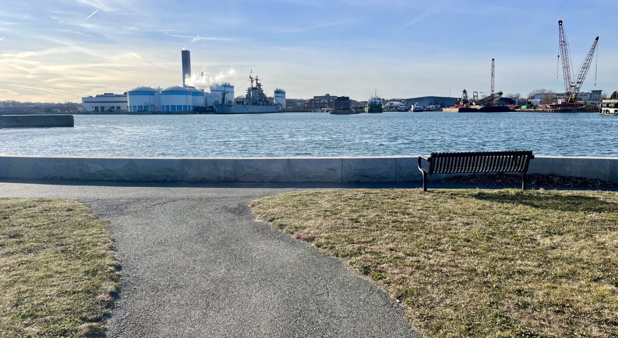
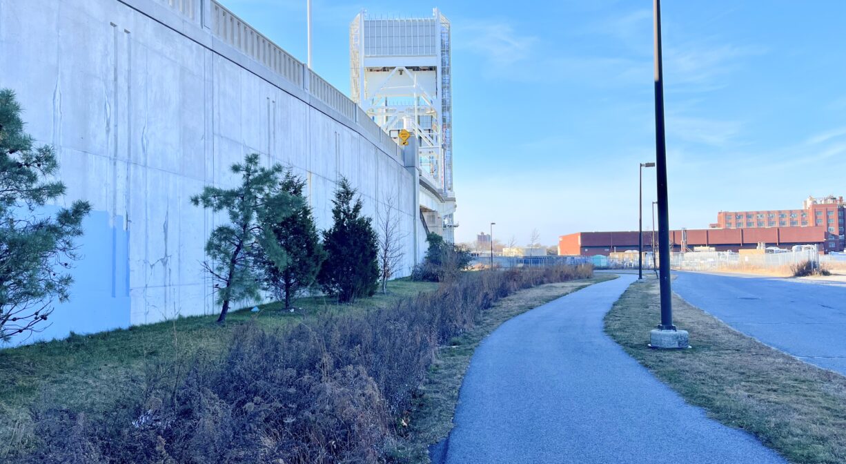
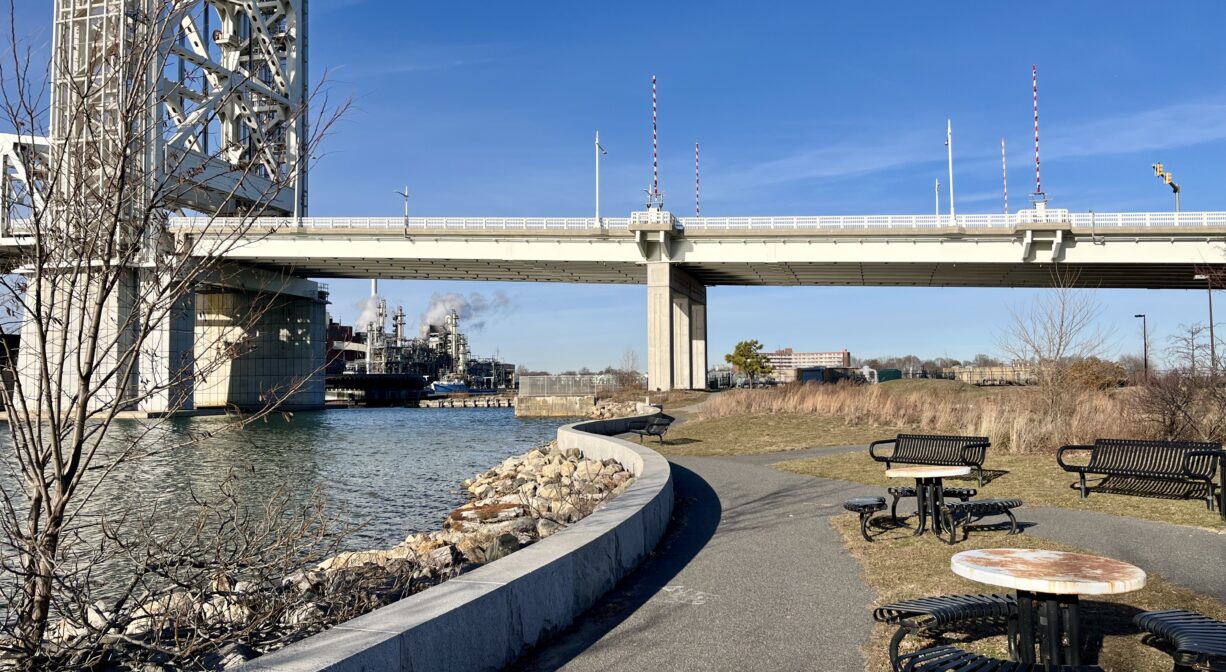
Situated at the foot of the Fore River Bridge in Weymouth, Lovell’s Grove Park features 0.5 miles of paved trails with water views and a launch ramp for canoes and kayaks. It is immediately adjacent to King’s Cove Park, with a paved trail connection.
Hunting is not allowed on this property.
Features
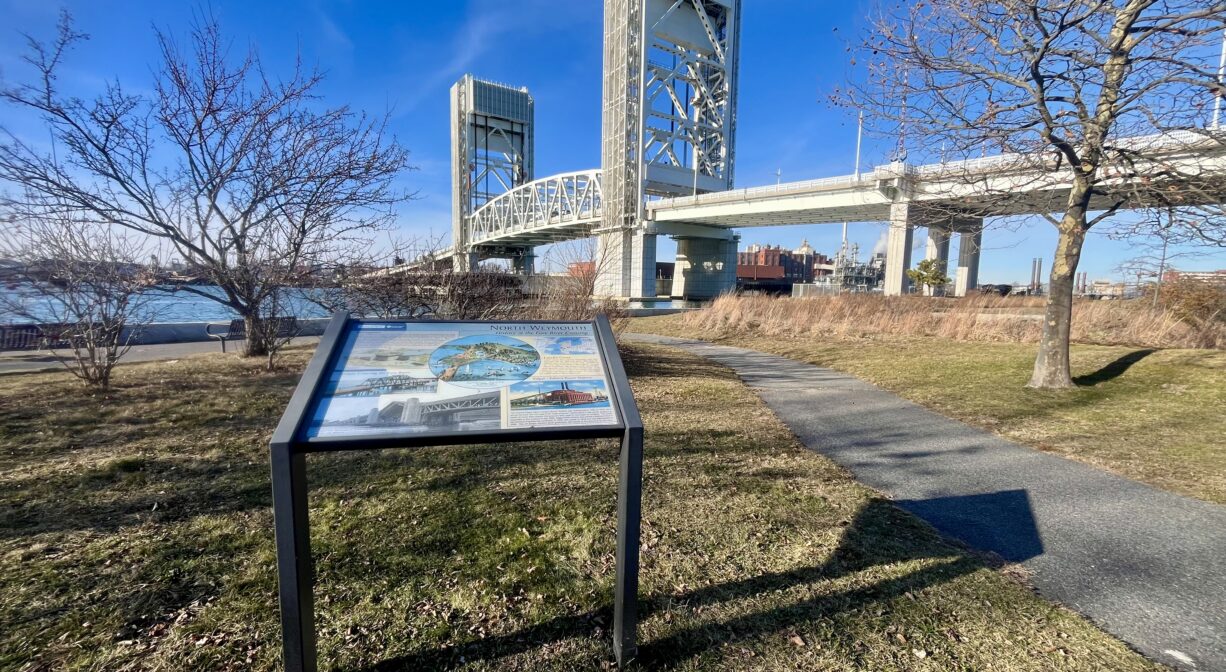
According to interpretive signage on site, Lovell’s Grove was a 10-acre amusement park that operated from the 1860’s until about 1909, along the original south shoreline of King’s Cove on the Fore River. The park’s amenities included: a carousel, a dance hall, bowling alleys, pleasure boats, a shooting gallery, swings, promenades, picnic grounds, a duck pond, and a viewing tower. Three daily steam ferries transported visitors from Boston and Quincy to enjoy North Weymouth’s parks, ocean beach, and seaside hotels.
In 1925, the Charles Edgar-Edison Electric Power Station was constructed on filled land along the river, the first coal-fired “high-pressure” power plant in the world. The plant was expanded in the 1950’s and named a National Historic Mechanical Engineering Landmark in 1976. It closed in 1978 and was demolished in 2000. The old power station’s brick gatehouse can be viewed at the park entrance.
The Massachusett tribe were first human inhabitants of the Fore River area. Thomas Weston established the colony of Wessagusset, the second-oldest European settlement in the United States, on the Fore River in 1622. The Neponset band of the Massachusett tribe already inhabited the region, and gave the area its name, meaning “place where the rocks meet the water.” The Neponset established villages inland and migrated seasonally to the coast to fish, hunt and grow crops. However due to a widespread plague of smallpox c. 1616-1619, the Native American population was greatly reduced by the time Weston arrived.
A marker at Great Hill Park nearby describes the tense relationship between European settlers and native tribes in the 1600’s. The marker was placed in 1923, and re-dedicated in 1998. It focuses on the victory of Myles Standish and other European settlers over aboriginal leaders such as Wituwamat and Pecksuot.
While Standish has historically been regarded as a hero of Plymouth Colony, it’s important to acknowledge that he was a destructive force with regard to the native tribes that inhabited the region prior to, and during the time of, European colonization. In particular, consider the 1623 Massacre at Wessagusset, at which Standish lured members of the Neponset band of the Massachusett tribe into a small building and then attacked them, fatally wounding several. Standish was concerned that tribe members, especially Wituwamat, were conspiring against the colonists. Scholars have found no evidence of this plot. A memorial service was held in 2023 to mark the 400th anniversary of the massacre, with the Massachusett Tribe at Ponkapoag participating.
More detailed information about the Native American history of the Weymouth area can be found at King Oak Hill Park. The remains of Wituwamat and Pecksuot are now interred at Weymouth’s Old North Cemetery. In 1635, Joseph Hull and a group of 106 settlers were granted permission to establish a new village at Wessagusset. They called it Weymouth. The two settlements did well, and the town continued to grow through the 17th and 18th centuries.
Please bear in mind that Native American cultures often favor oral histories to written ones. Much of what’s recorded about the history of the South Shore is from the perspective of European settlers. It’s not the whole story. To learn more about local tribes, we encourage you to interact with their members. You can learn more about the Massachusett tribe on their website.
Trail Description
A 0.5-mile paved trail winds from the parking area, through a grassy park beside the river, under the Fore River Bridge, and along a roadway to King’s Cove Park, just downstream.
Habitats and Wildlife
This grassy property with ornamental plantings, pitch pine, oak and sumac is situated directly on the Fore River, beside and underneath the Fore River Bridge. The Fore River serves as the boundary line between the towns of Weymouth and Braintree. It flows for about 3 miles, into Quincy, where it meets the Town River, and then flows for another 2 miles into Hingham Bay. In its final few miles, the Fore River is nearly a mile wide in some places. We encourage you to follow and support the Fore River Watershed Association.
Historic Site: No
Park: Yes
Beach: No
Boat Launch: Yes
Lifeguards: No
Hours: Dawn to Dusk
Parking: On-site parking lot for 18 vehicles at 1 Bridge Street.
Cost: Free
Trail Difficulty: Easy
Facilities:
Picnic tables, benches, bicycle rack, paved trails, interpretive signage, trash receptacle, launch ramp for canoes and kayaks.
Dogs: Dogs must remain on leash. Always clean up after your dog!
Boat Ramp: No
ADA Access: Yes
Scenic Views: Yes
Waterbody/Watershed: Fore River