
88 Masthead Dr, Norwell, MA 02061, USA
Norwell Conservation: (781) 659-8022
https://www.townofnorwell.net/conservation-commission
Owned By: Town of Norwell
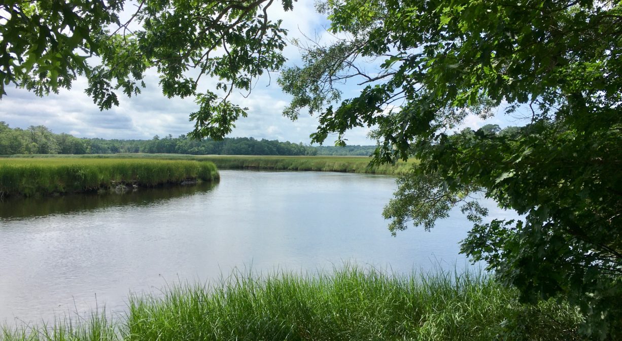
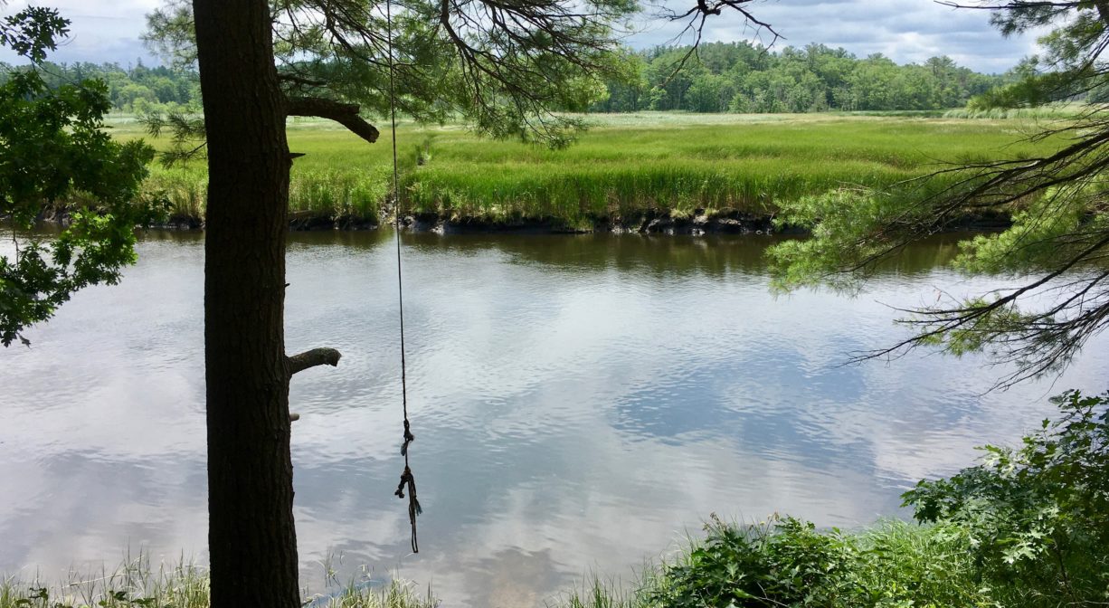
The Masthead Drive Trail is an 11-acre property in Norwell with a 0.4-mile trail that extends through the woods to the North River. Situated just west of the Route 3 Bridge, it may not be the quietest place, but the view of the river and marshes at the end of the trail is not to be missed! The area is also an unmarked historic site, known as Bald Hills/Stetson Shipyard.
HUNTING: Hunting is allowed, in season, by licensed persons in compliance with Massachusetts law. Please be sure to understand state and local hunting guidelines before proceeding. Those who hold town-issued permits may use this property for seasonal hunting and trapping. Hunting is not allowed on, or across, any trail. Non-hunters, be mindful of hunting seasons, and wear bright orange if you’re entering the property during those times. Hunting is not permitted on Sundays.
Features
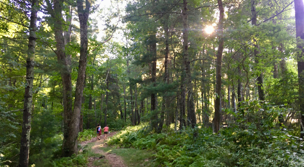
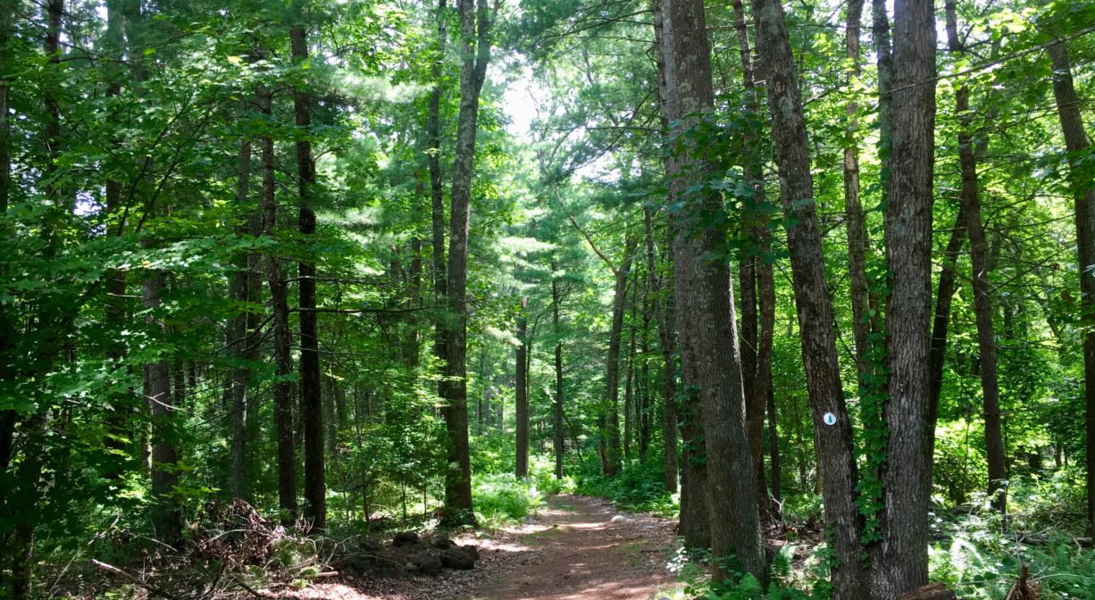
The trail is maintained by Norwell Conservation. It runs directly behind a rest area on Route 3 southbound. The highway is visible at times through the trees, and also quite audible! At the end of the trail, there are three separate overlooks on the North River. All three might be suitable for swimmers. Rope swings are known to be present at this spot but their presence (and safety) is unreliable.
An archaeological excavation conducted from 1962-1965 on or close to this property at “The Oak Island Site” revealed numerous artifacts from the early Archaic period through the 17th century.
Also known as Bald Hill, this area is the site of an early Stetson Family shipyard. Records indicate that the hill was in fact bald, although now it is well-forested. The shipyard was not included in Briggs’ iconic History of Shipbuilding on North River, but Stetson family papers prove its existence.
Benjamin Stetson may have been the original owner of the shipyard, and three generations of Stetsons worked there. The shipyard was eventually taken over by Nathaniel Church, who built vessels there in 1746. The shipyard was eventually sold to Michael Ford, who also built ships farther upstream, at Fox Hill. Three generations of the Ford Family succeeded him. Both the Stetson and the Ford shipbuilding enterprises began with small open boats called shallops. Usually about 30 feet in length, these were ideally suited for coastal travel.
This land is within the region of the Massachusett (or Massachuseuk) Native American tribe. For thousands of years, the land today known as Norwell was inhabited by indigenous people who grew crops, foraged, hunted, and fished in the Assinippi and North River areas. Circa 1617, a major outbreak of disease decimated an estimated 90% of the native population in New England. Descendants of these original inhabitants are living here today. They are known as the Mattakeesett Tribe of the Massachusett Indian Nation, the Massachusett Tribe at Ponkapoag, the Herring Pond Wampanoag, and the Mashpee Wampanoag tribe.
Trail Description
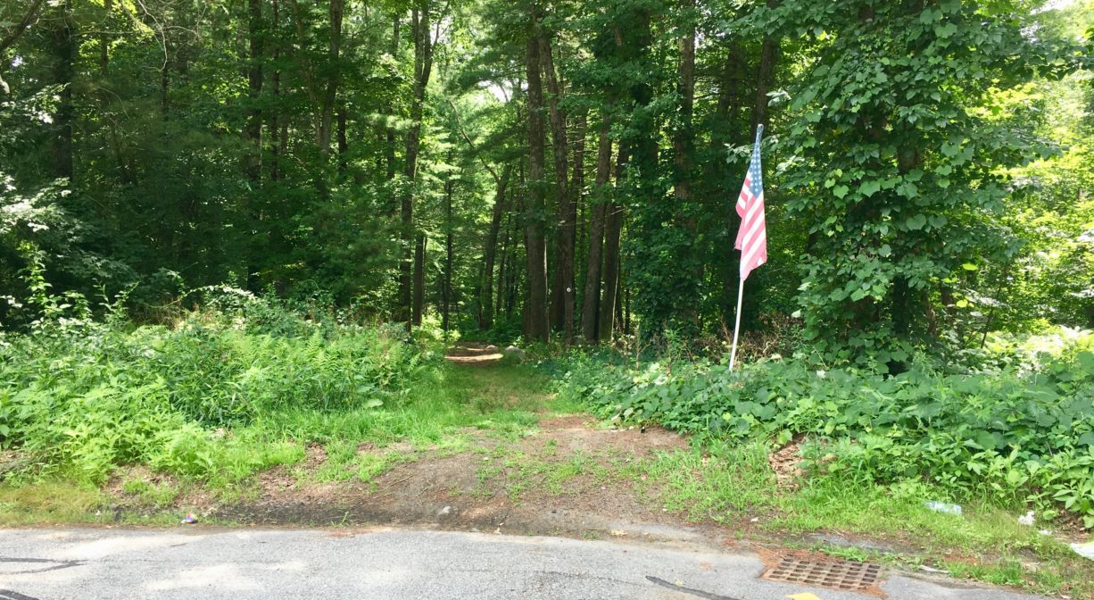
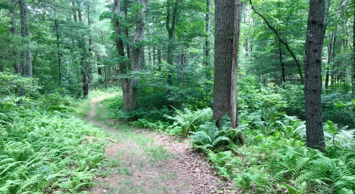
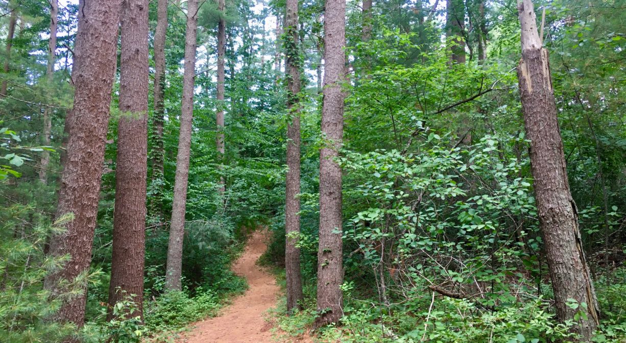
Park in the cul de sac at the end of Masthead Drive. Look for the trailhead, just behind the storm drain grate. The trail is marked with a single white Norwell Conservation blaze. Follow the trail up and down a couple of small drumlin hills and across a small stream (there is a bridge). At the fork, you can go right to access the first North River overlook, where there is a bit of a drop to the water’s edge. Or go left to access two additional overlooks, closer to water level. Total trail distance is about 0.4 miles.
Habitats and Wildlife
The forest here is primarily pine, with some beech, maple, oak, hemlock, plus ferns and sweet pepper bush. The end of the trail directly abuts the North River.
The North River rises from marshes and springs in Weymouth, Rockland and Hanson. It is approximately 10 miles in length, with its source at the confluence of the Indian Head River (Hanover) and Herring Brook (Pembroke). From there it flows through the towns of Hanover, Pembroke, Marshfield, Norwell, and Scituate to the Atlantic Ocean between Third and Fourth Cliffs, draining approximately 59,000 acres along the way.


Historic Site: No
Park: No
Beach: No
Boat Launch: No
Lifeguards: No
Size: 11 acres
Hours: Dawn to Dusk
Parking: Limited parking in the cul de sac at the end of Masthead Drive.
Cost: Free
Trail Difficulty: Easy
Facilities:
Picnic table.
Dogs: Dogs must remain on leash. Always clean up after your dog!
Boat Ramp: No
ADA Access: No
Scenic Views: Yes
Waterbody/Watershed: North River watershed