
Misty Meadows Conservation Area, 34 Ingham Way, Pembroke, MA 02359, USA
Pembroke Conservation: (781) 293-4674
Owned By: Town of Pembroke
Pembroke’s 153-acres Misty Meadows Conservation Area features 2 miles of trails through upland forest and freshwater wetland. One trail leads to a bench overlooking Herring Brook. Another leads to the Willow Brook Farm Preserve. A third trail leads to Kings Terrace. This property is an excellent place to experience the rare tidal freshwater marsh of the Herring Brook Valley, renowned as one of the most diverse and interesting inland natural areas in Southeastern Massachusetts.
HUNTING: Hunting is allowed, in season, by licensed persons in compliance with Massachusetts law. Please be sure to understand state and local hunting guidelines before proceeding. Non-hunters, be mindful of hunting seasons, and wear bright orange if you’re entering the property during those times. Hunting is not permitted on Sundays. Please note that hunting is not permitted within the adjacent Willow Brook Farm Preserve.
Features
The Misty Meadows Conservation Area is bordered on one side by Herring Brook. In earlier times, Herring Brook was known as Barker’s River, and also the Namassakeeset River. Namassakeeset means “place of much fish.” The property includes vestiges of a house and well built by Thomas Magoun (early 1800s) and later owned by Kate Fiske.
This land is within the region of the Massachusett (or Massachuseuk) Native American tribe. The Mattakeeset band of the Massachusett lived for thousands of years in the North River watershed. Their village included most of today’s Pembroke and Hanson. Herring Brook is also part of the historic Wampanoag Commemorative Canoe Passage, which extends for 70 miles from Scituate/Massachusetts Bay to Berkley/Narragansett Bay. It was originally a water trail used by the Native American tribes who inhabited our region, and was re-established by the Plymouth County Development Council and local officials for educational and recreational purposes. To learn more about local Native American tribes, we encourage you to interact with their members. The Massachusett tribe at Ponkapoag and the Mattakeeset band of the Massachusett share information on their websites.
Far upstream on Herring Brook, at Furnace Pond, a smelting furnace and iron works was erected in 1702 by Lambart Despard and the Barker Family. Their raw material was the naturally-occurring iron at the bottom of the pond, as well as in numerous bogs in the area. The furnace was on Herring Brook, just a few rods downstream of the pond.
A quarter mile downstream there was a dam with a sawmill and grist mill, established by Nathaniel Ford around 1820. Later the same spot was home to a box factory owned by John Gorham and Jarius Howland, but it was destroyed by fire. Simeon Chandler also operated a mill at this site. Below this spot, Herring Brook flows through Pembroke’s Herring Run Park, and as it passes through the Willow Brook Farm Preserve, Pudding Brook flows in from the east. Shortly thereafter, Cedar Swamp Brook flows in from the southwest. In 1837, there were several mills on Pudding Brook, including a cotton mill, a cupola furnace, two tack factories, and two shingle mills. Goods produced included satinets, shoeboxes, bombards, water pails, covered buckets and mackerel kitts.
Plymouth Colony had fish protection laws dating back to 1623, with legislation stipulating that fish passage be kept open during spawning time. According to Pembroke: Ancient Trails to the 21st Century, at one of the earliest Pembroke Town Meetings, in 1717, Isaac Barker and Ephraim Nichols were empowered to work with the neighboring Native American people to clear streams of obstructions. Beginning in 1742, mills on Herring Brook and its tributaries were required by local law to keep their gates open during the annual herring run, so as not to block the fish from accessing their spawning grounds. The specifics of such laws fluctuated over time. Pembroke began regulating the harvesting of herring in 1741, charging fees, requiring permits, and limiting the size of each individual’s catch. These regulations were likely tied to fluctuations in the size of the local herring population.
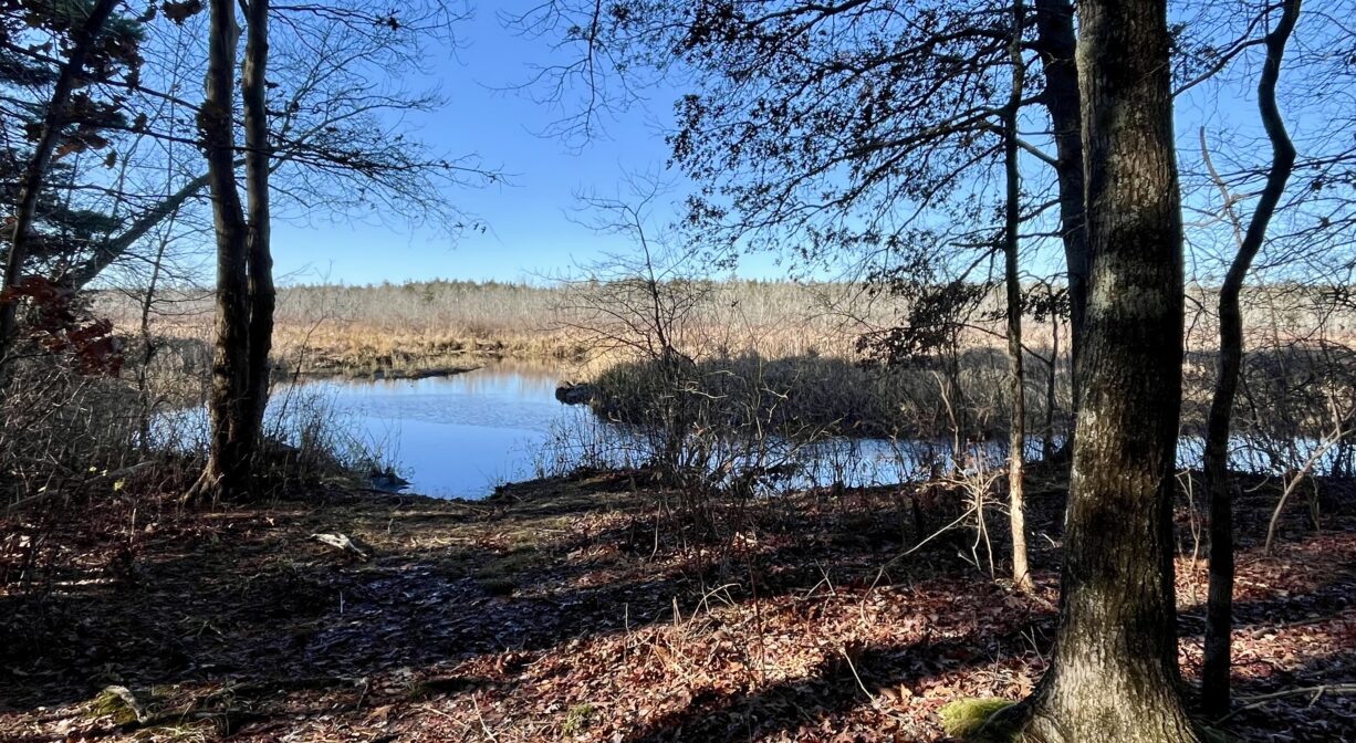
The final section of Herring Brook, as it flows through Misty Meadows, and before it joins the Indian Head to form the North River, is a large freshwater marsh and swamp.
Trail Description
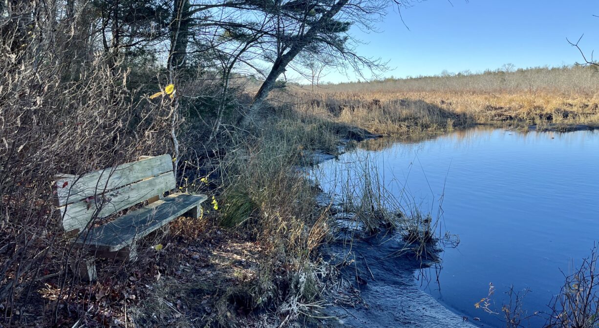
The Misty Meadows Conservation Area is accessible by land and by water. In a canoe or kayak, you can paddle up Herring Brook and hop out at the end of the property’s North River Trail. Look for a wooden bench at the water’s edge.
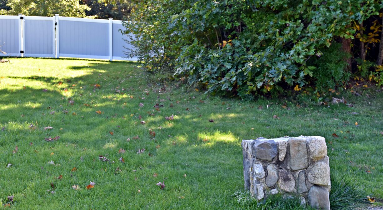
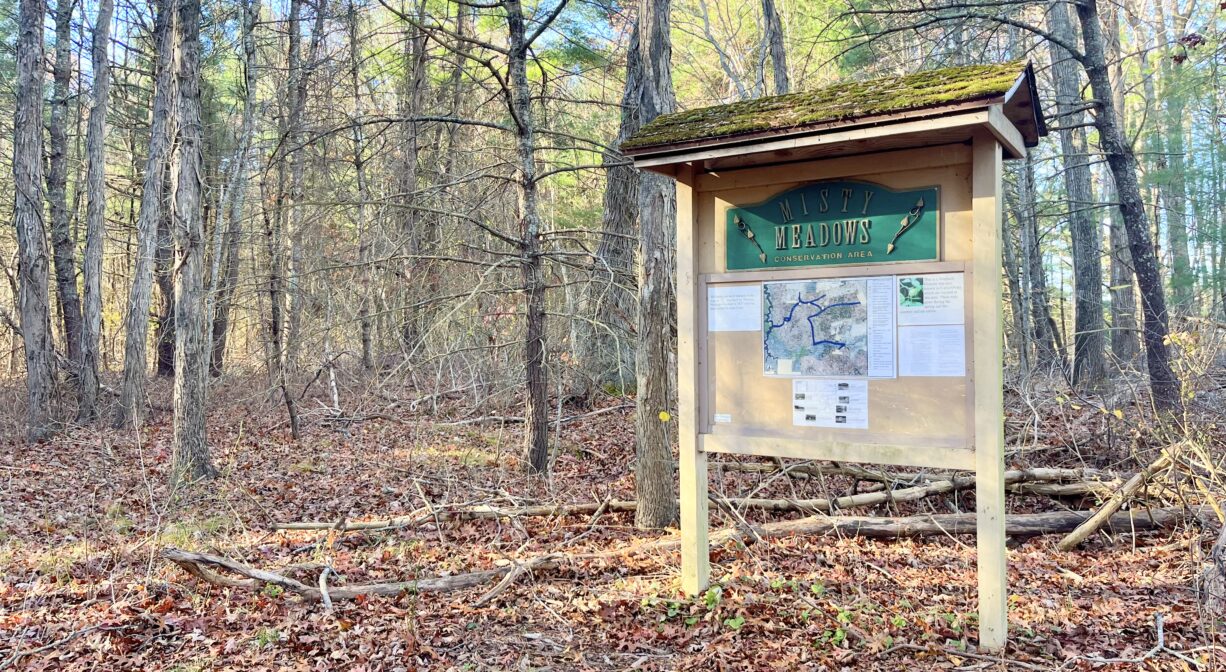
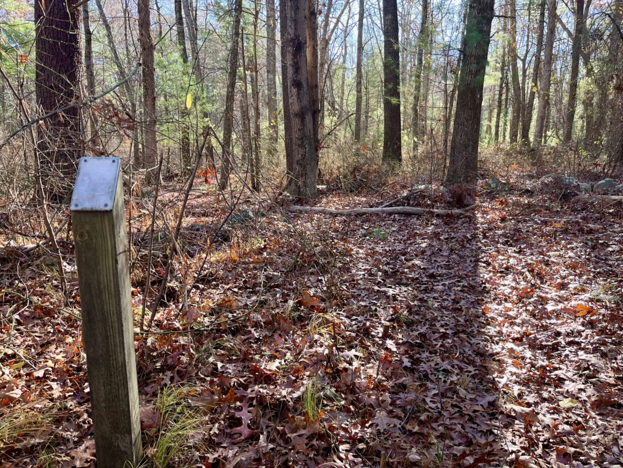
By land, the access point is on Ingham Way, between #34 and #42. Look for two rustic rock and concrete pillars at the side of the road. A short distance beyond them, you’ll find a metal gate. The entrance trail is bordered on one side by the fence for #34 Ingham Way. After 0.1 mile, you will arrive at the informational kiosk.
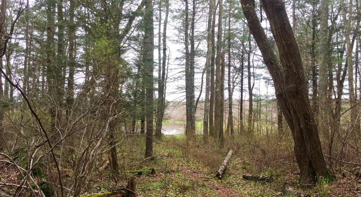
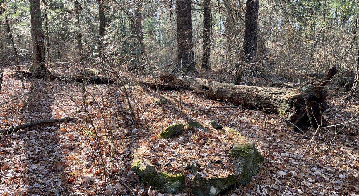
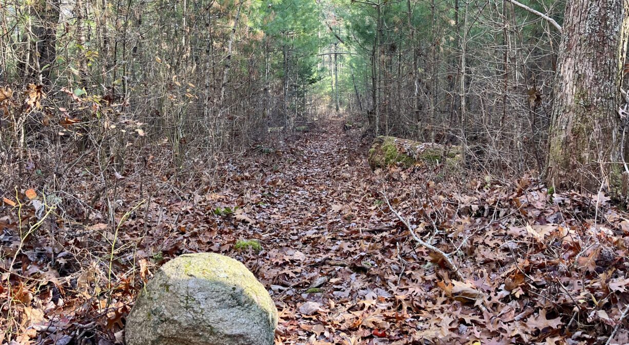
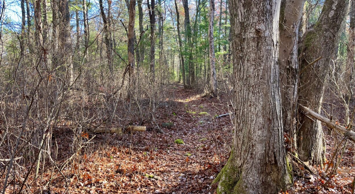
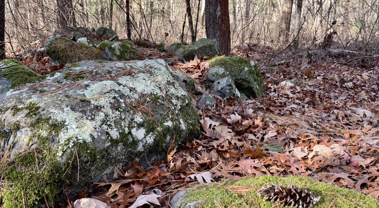
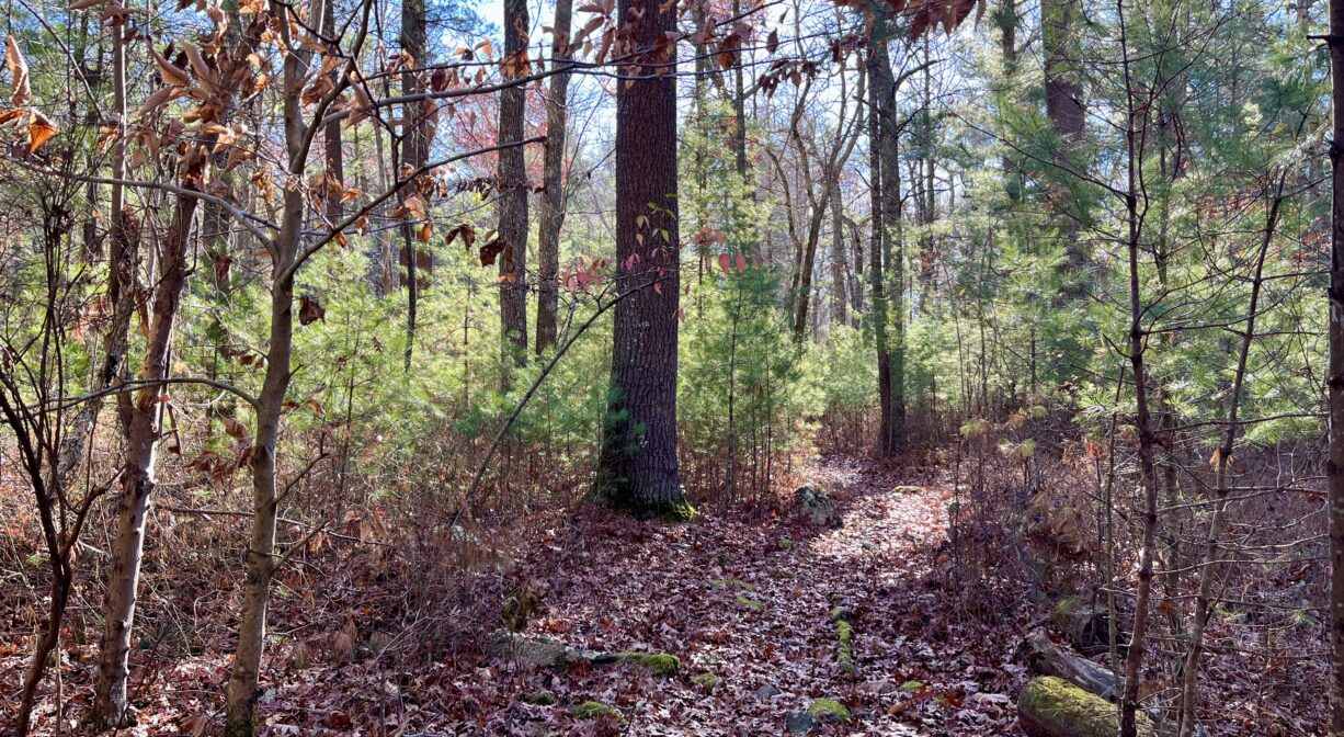
• Turn right to follow the North River Trail (0.39 miles) through a mature oak-hickory forest. The trail is often rocky and uneven, with tree roots and moss-covered old stone walls. It eventually tilts downhill, through a grove of hemlock, ending with a bench on Herring Brook and a view of the freshwater tidal marsh. Also in this area, look on the ground for what appears to be an old well. A little farther downstream, Herring Brook and the Indian Head River flow together to form the North River.
• From the informational kiosk, you can also take a trail to the left. After 0.1 mile, you will arrive at a junction. Bear left to explore a short (0.17) mile trail that leads to Kings Terrace. Or bear right to explore a much-longer trail. After 0.14 miles on this trail, you will arrive at the property boundary, but you can continue along what becomes the Todd Trail, which is part of the adjacent Willow Brook Farm Preserve.
Habitats and Wildlife
Some of the trees and shrubs on this property include maple, pine, oak, and sweet pepperbush.
Abundant wildlife make their home here in the Herring Brook Valley. Even though it lies 11 river miles upstream of the ocean, the water level in the freshwater marsh still rises and falls with the tides, with a 3-foot difference between high and low.
More than 2,000 acres of undeveloped land and freshwater swamp provide an ideal habitat for mammals, amphibians, and birds — both common species and also those deemed “at risk” by Partners In Flight. Listen for the hooting of owls. Look for painted turtles basking on fallen logs, and great blue herons hunting the shallow waters. You might even spy a river otter! In the woods, you might see deer, red or gray fox, coyotes, fishers. Some of the trees present here include oak, hickory, beech, pine, and holly. There are also some low rocky outcroppings, moss-covered rocks, and old stone walls.
Herring Brook itself rises from Furnace Pond in Pembroke, and flows through the town for a few miles before it merges with the Indian Head River, to form the North River, at a place called The Crotch. The North River flows for 12 miles through Pembroke, Hanover, Norwell, Marshfield, and Scituate to the Atlantic Ocean at Fourth Cliff.

Historic Site: No
Park: No
Beach: No
Boat Launch: No
Lifeguards: No
Size: 153 acres
Hours: Dawn to Dusk
Parking: Trail access from a gravel path between #34 and #42 Ingham Way, or through the Willow Brook Farm Preserve. No formal parking area.
Cost: Free
Trail Difficulty: Easy
Facilities:
Informational kiosk. Bench with a view of the Herring Brook. Geocache location.
Dogs: Dogs must remain on leash or under immediate and effective control of the handler. Always clean up after your dog!
Boat Ramp: No
ADA Access: No
Scenic Views: Yes
Waterbody/Watershed: Herring Brook (North River watershed)