
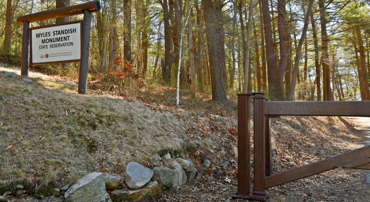
Crescent St, Duxbury, MA 02332, USA
(508) 208-0675; (508) 747-5360
https://www.mass.gov/locations/myles-standish-monument-state-reservation
Owned By: Massachusetts Department of Conservation & Recreation
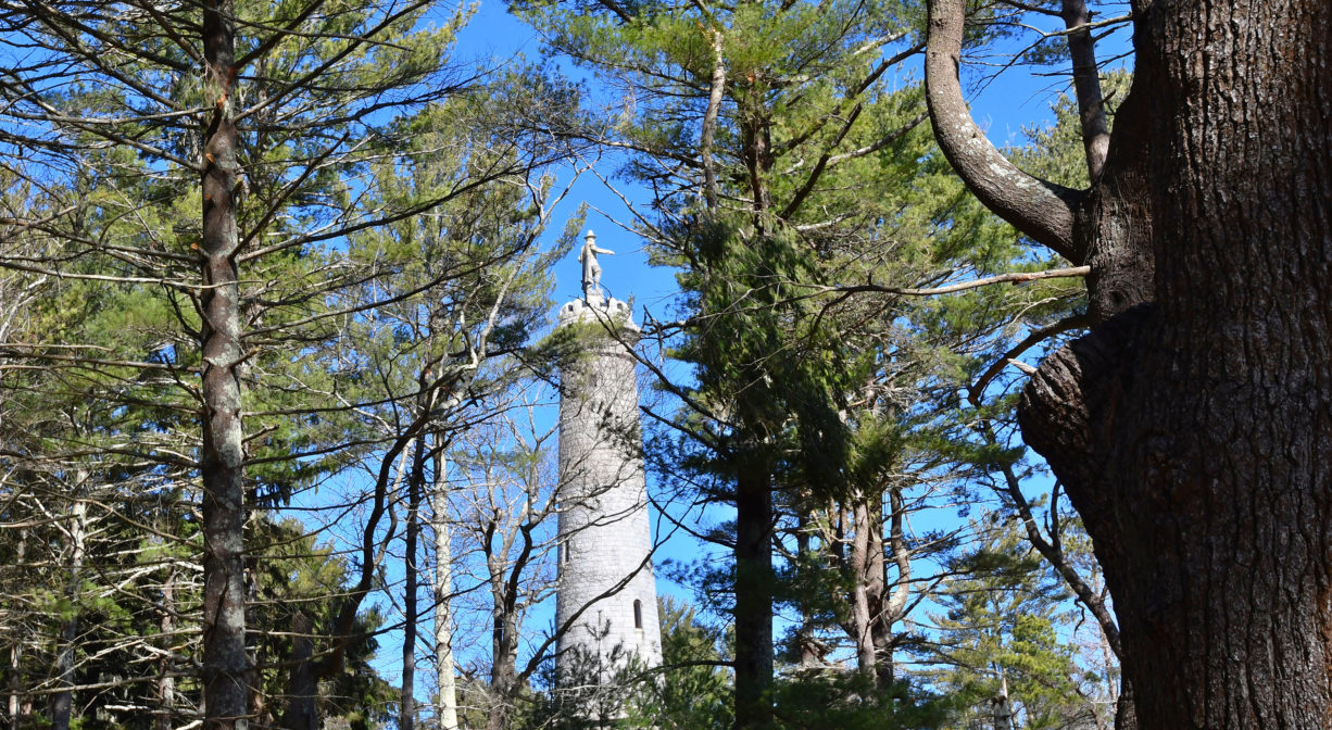
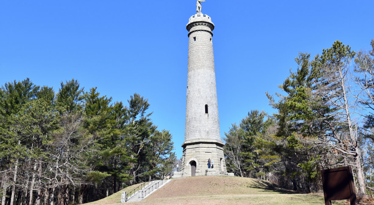
The Myles Standish Monument State Reservation in Duxbury features a tall tower and memorial to Myles Standish. It stands at the top of Captain’s Hill. Drive up (in season) or hike up the forest trail to enjoy a panoramic view up and down the coast. The tower is open seasonally, on weekends, but you can hike up the hill anytime.
Hunting is not allowed on this property.
Features
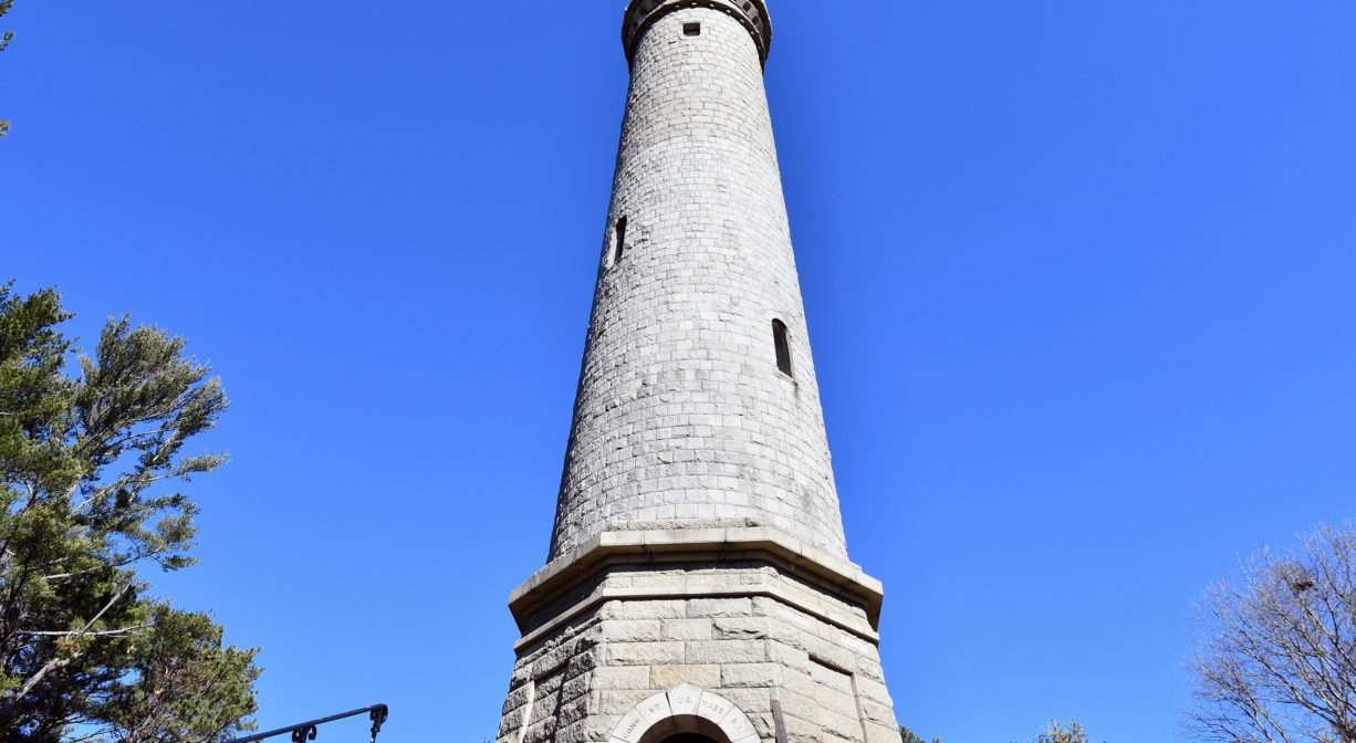
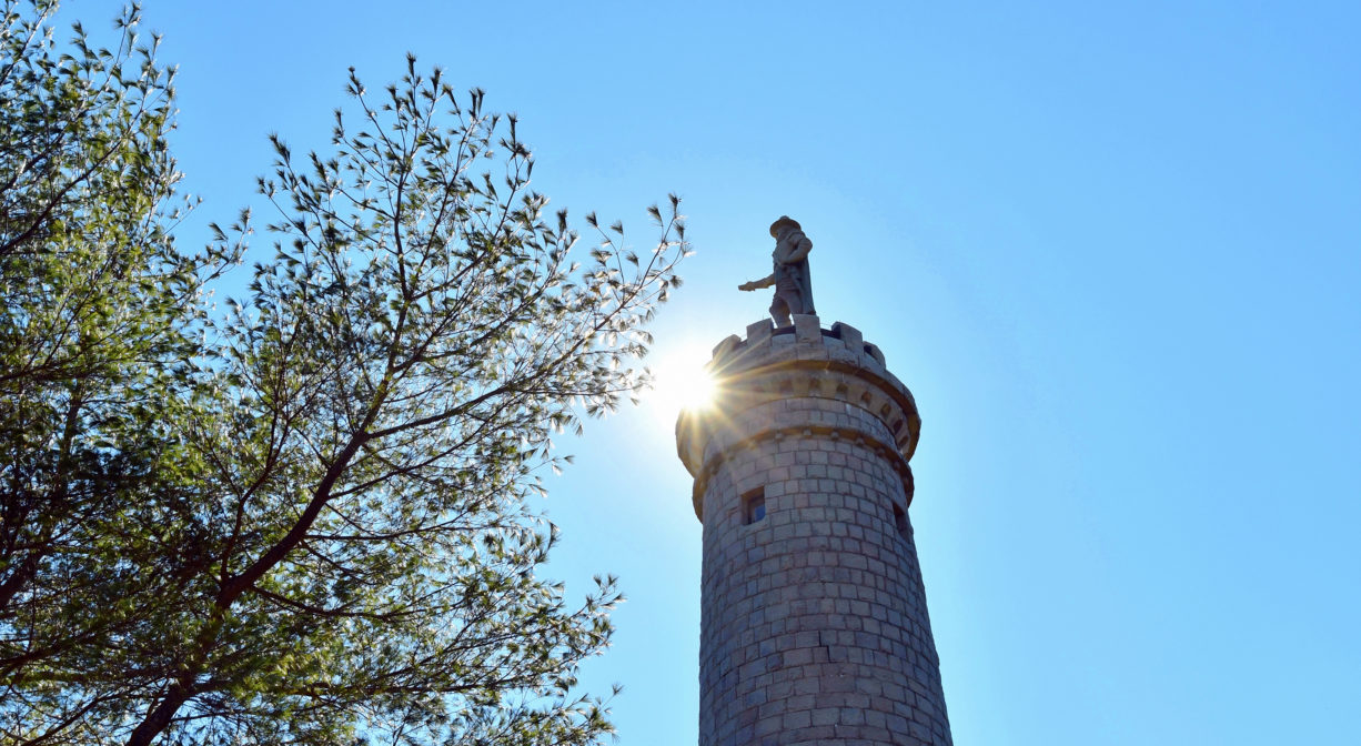
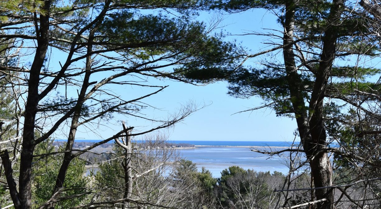
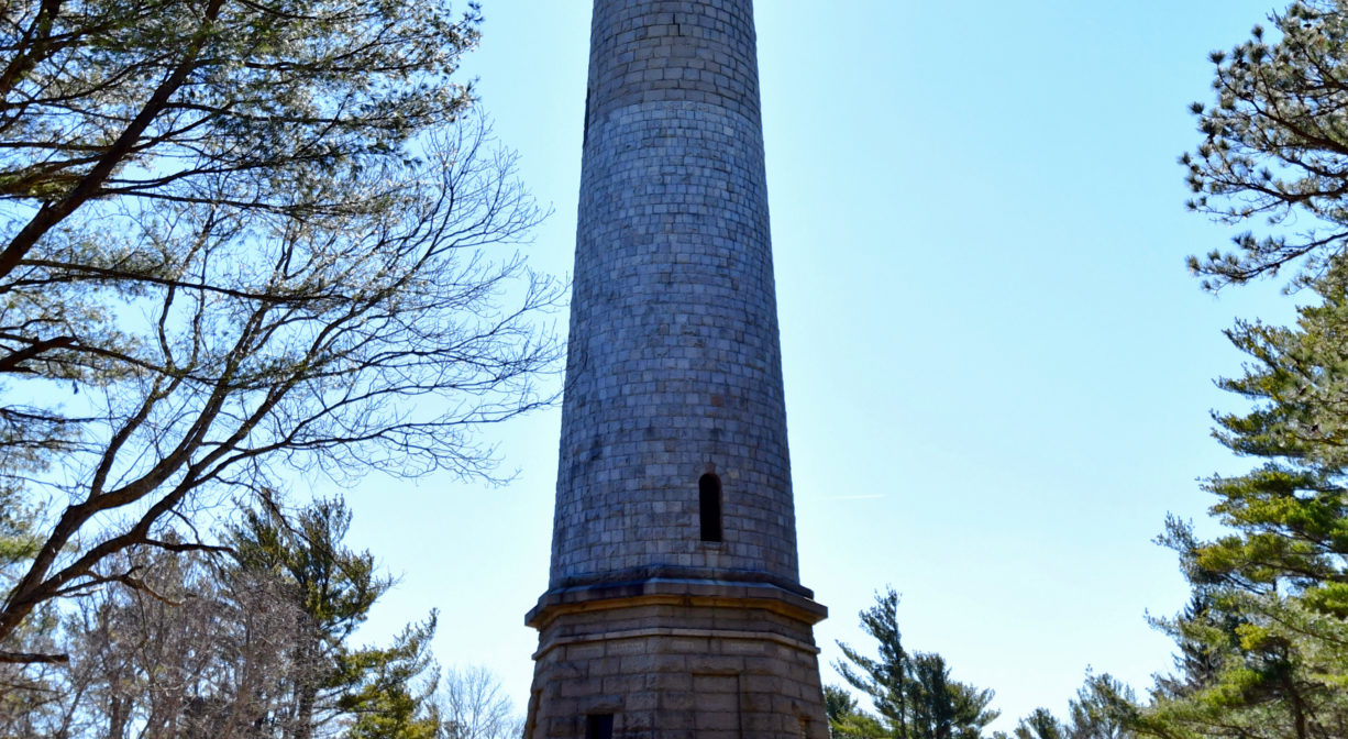
Situated 180 feet above sea level, the Myles Standish Monument is a 116-foot-tall granite shaft topped with a 14-foot statue of Captain Myles Standish (1584-1656), military leader of Plymouth Colony. When the tower is open, visitors can climb 125 steps to a small viewing area at the top. The spectacular view includes church spires, lighthouses, Plymouth Harbor, Cape Cod, and even the Blue Hills. All children must be accompanied by an adult. In inclement weather, call first to see if the monument is open.
The tower was completed in 1898, after 26 years of construction.
This land is within the region of the Patuxet, members of the Wampanoag tribe, who inhabited the area around the Jones River now known as Duxbury, Kingston and Plymouth. While Standish has long been regarded as a hero of Plymouth Colony, it’s important also to acknowledge that he was a destructive force with regard to the native tribes that inhabited the region prior to, and during the time of, European colonization. In particular, consider the 1623 Massacre at Wessagusset, at which Standish lured members of the Neponset band of the Massachusett tribe into a small building and then attacked them, fatally wounding several. Standish was concerned that tribe members, especially Wituwamat, were conspiring against the colonists. Scholars have found no evidence of this plot.
To learn more about local Native American tribes, we encourage you to interact with their members. The Mashpee Wampanoag and the Herring Pond Wampanoag share information on their websites.
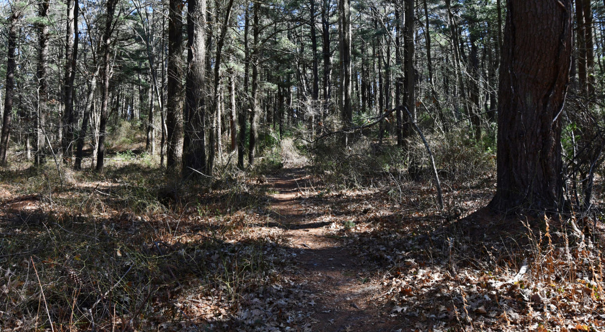
Trail Description
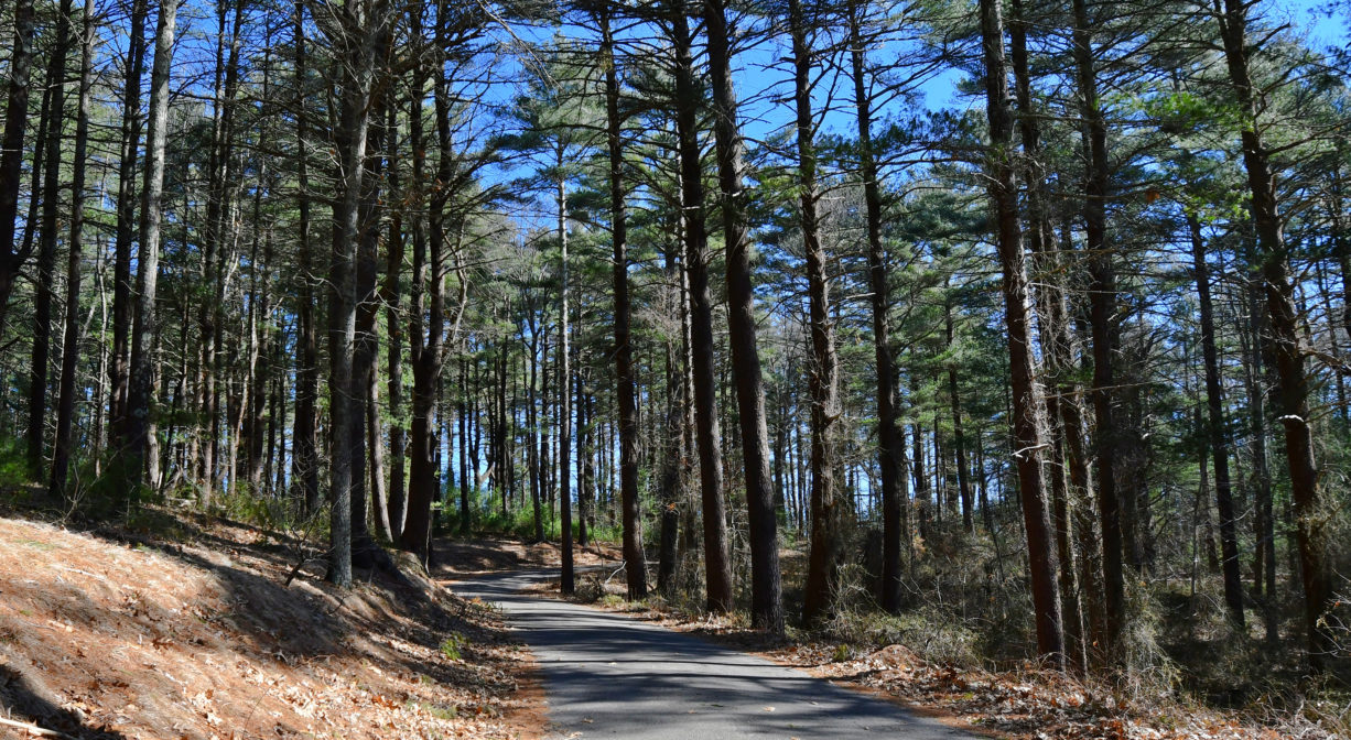
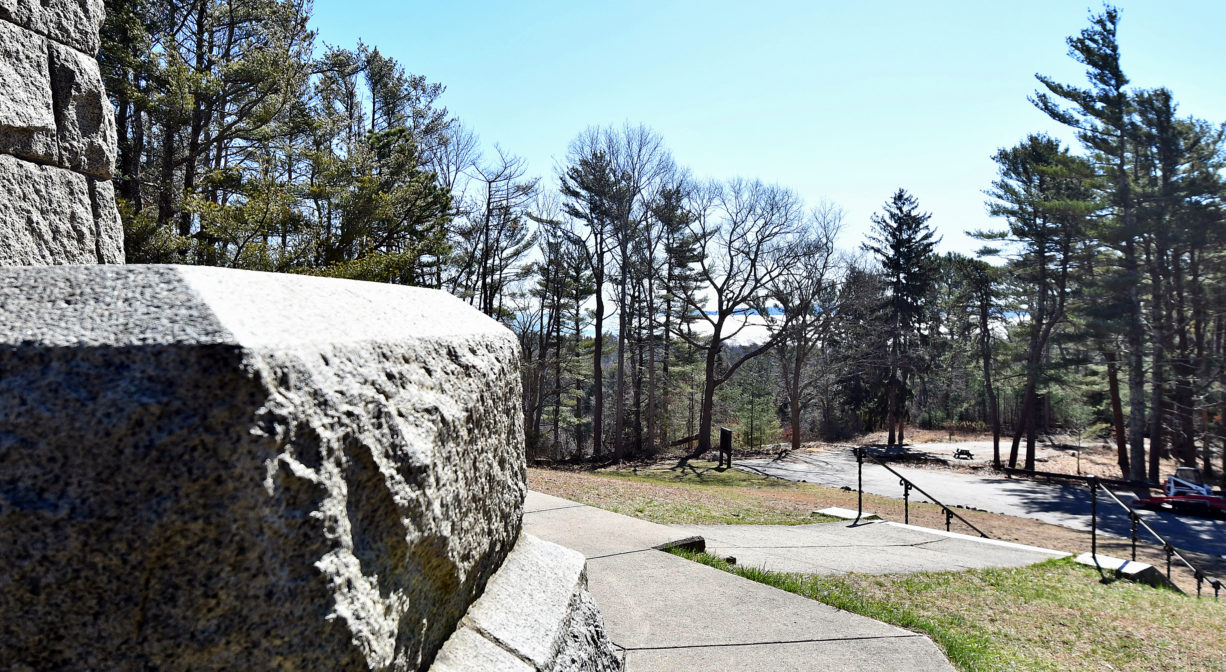
Hike up the paved access road, or follow either of the two woodland trails to the top of the hill (one from Crescent Street, and the other from the access road, not far from the gate).
Habitats and Wildlife
The forest here is mostly pine, with some hemlock and beech. At the top of the hill there is a broad lawn. The views from the top are stunning! The land is within the watershed of Kingston Bay.
Historic Site: Yes
Park: Yes
Beach: No
Boat Launch: No
Lifeguards: No
Size: 28 acres
Hours: Pedestrian access daily from dawn to dusk. The park road and tower are open seasonally, weather permitting.
Parking: Limited on-site parking.
Cost: Free
Trail Difficulty: Easy, Medium
Facilities:
Informational kiosk, Geocache location.
Dogs: Dogs must remain on leash at all times. Always clean up after your dog!
Boat Ramp: No
ADA Access: No
Scenic Views: Yes
Waterbody/Watershed: Kingston Bay watershed