
370 Powder Point Ave, Duxbury, MA 02332, USA
Town of Duxbury: (781) 934-1100
Owned By: Town of Duxbury
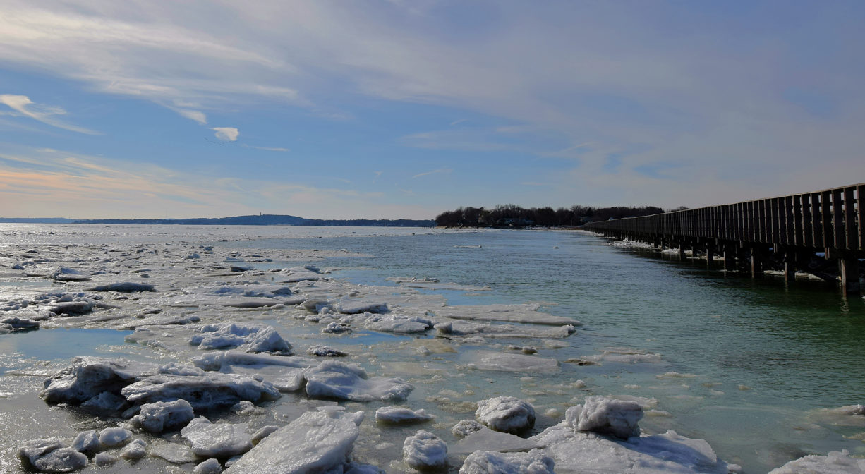
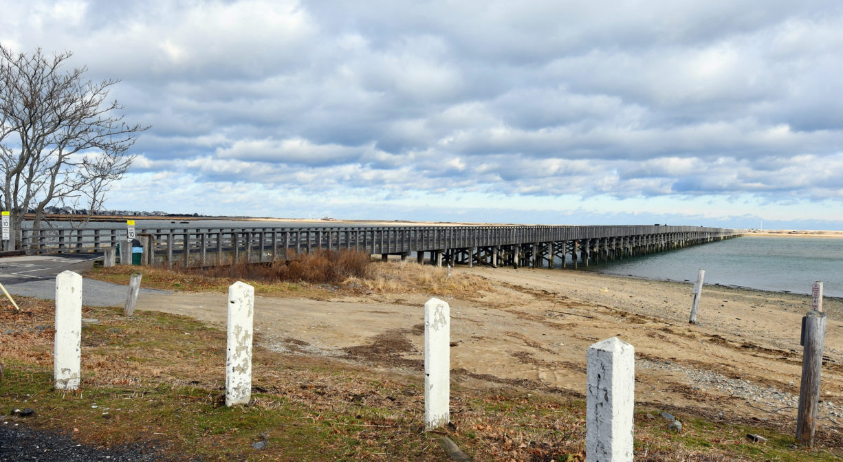
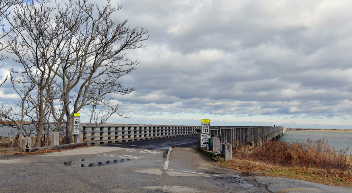
The Powder Point Bridge, open to the public, is a historic landmark that offers gorgeous views of Duxbury Bay and access to Duxbury Beach Park and Duxbury Beach Reservation.
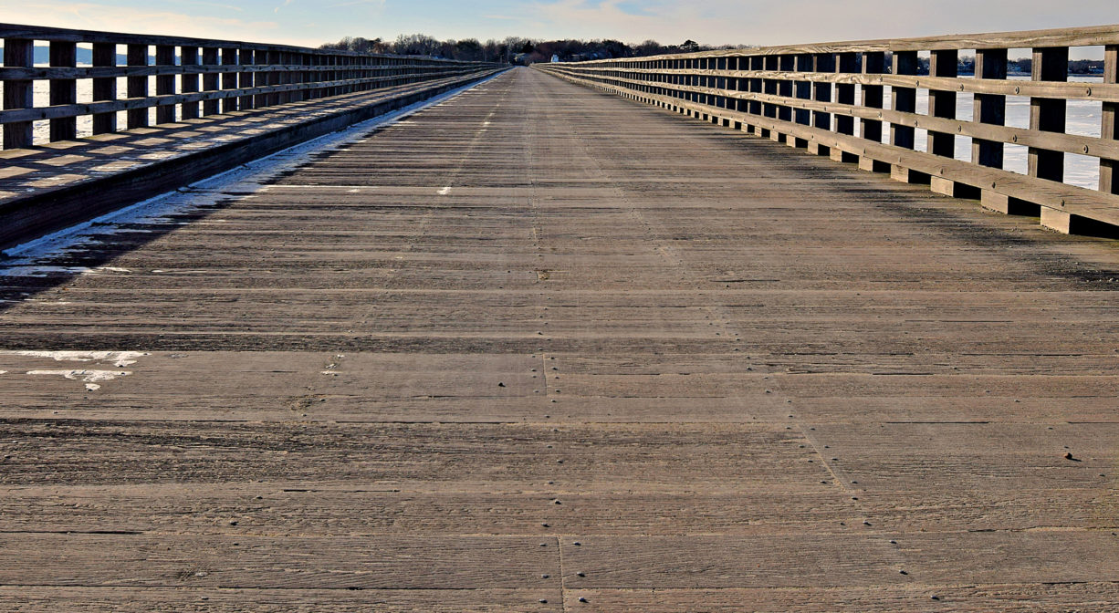
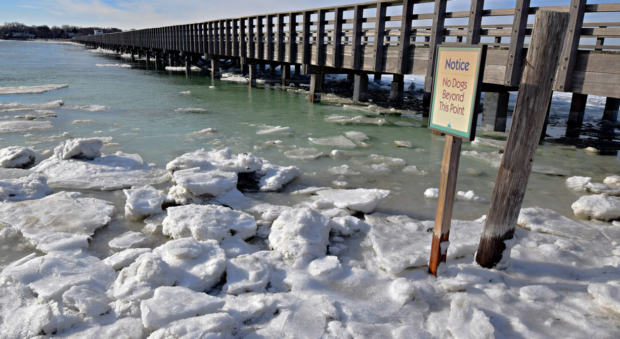
The wooden plank sidewalk is a popular spot for fishing. Launch your canoe, kayak, paddle board, rowing shell, or small sailboat from the shore at the west end of the bridge. Pedestrian access to Duxbury Bay for shellfishing is available here as well. Swimming, diving and jumping from the Powder Point Bridge are strictly prohibited.
FISHING ADVISORY: It’s important to know that some of our fisheries are contaminated with mercury, PFAS and/or other concerning substances. The Massachusetts Department of Public Health maintains an online database with up-to-date advisories regarding fish consumption, sorted by location. We recommend you consult this valuable resource when planning a fishing excursion.
SWIMMING: Massachusetts routinely checks water quality at public swim spots and shares the data in an online database. Save this link so you can check water quality before you go.
Features
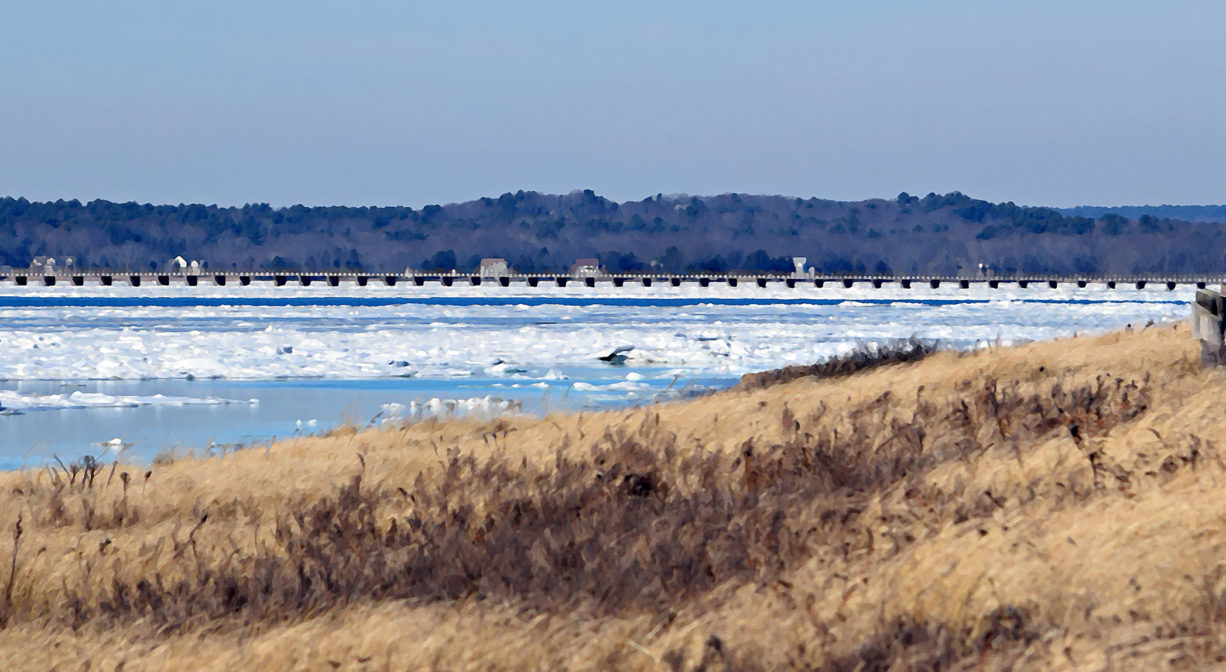
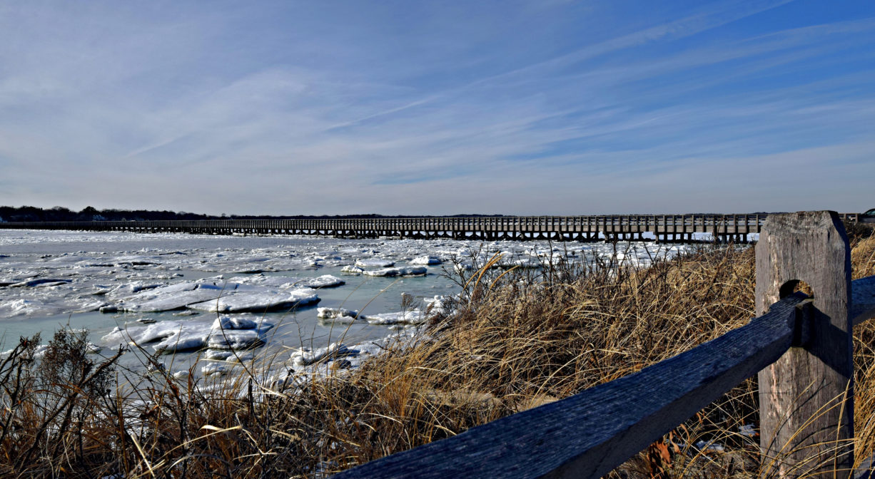
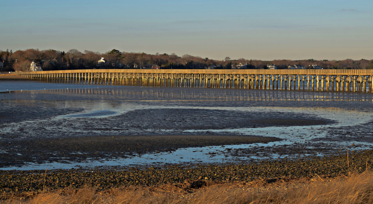
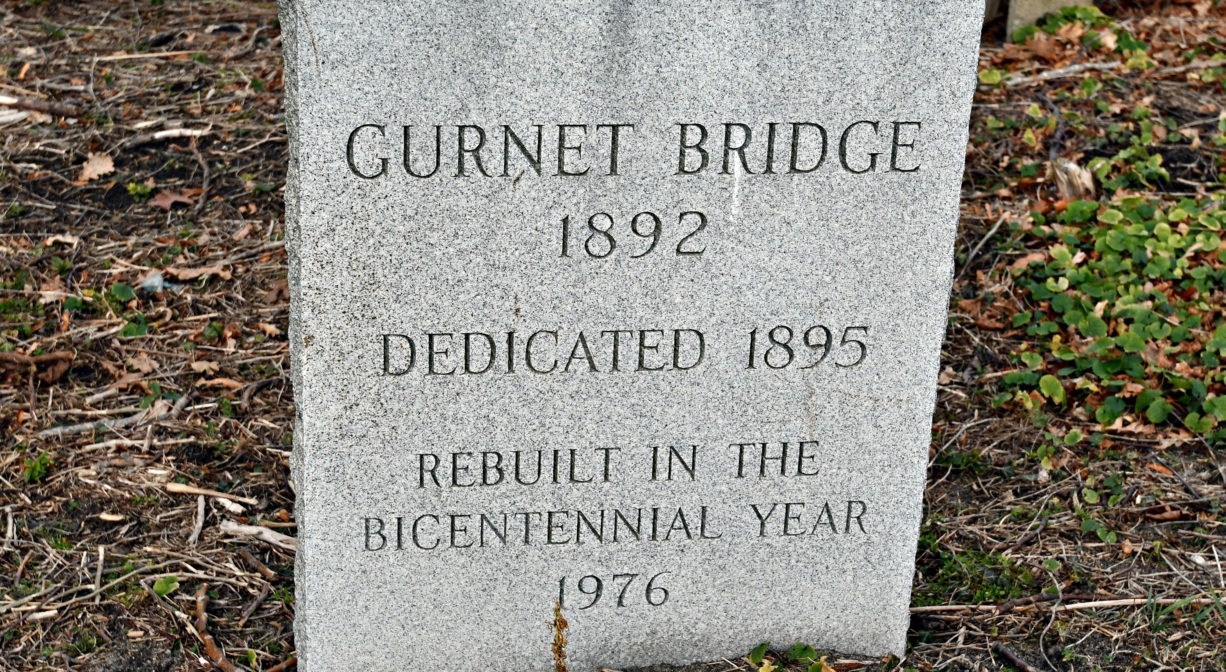
The 2,200-foot wooden bridge was originally constructed in 1892. After sustaining fire damage in 1985, it was rebuilt the following year. It is also known as Duxbury Bridge, Gurnet Bridge, Black River Bridge, Long Bridge, and King Caesar Road Bridge. Small boat access to Duxbury Bay is available at the western end of the bridge.
According to Dorothy Wentworth’s Settlement and Growth of Duxbury 1628-1870, the name’s origin is unknown. It was written as “Poulder Point” on a 1637 land grant to George Soule, a Pilgrim. The town’s supply of gunpowder was not stored there, but instead in the Meeting House. The original European settlers on Powder Point were George Soule, John Peterson and Henry Sampson.
This land is within the region of the Patuxet Wampanoag tribe, who for centuries have inhabited the area around the Jones River now known as Duxbury, Kingston and Plymouth. Numerous Native American artifacts have been found on Clark’s Island, nearby. To learn more about local Native American tribes, we encourage you to interact with their members. The Mashpee Wampanoag and the Herring Pond Wampanoag share information on their websites.
Trail Description
Wooden bridge includes a raised sidewalk for pedestrians and fishermen. The bridge is also a public roadway with vehicle access.
Habitats and Wildlife
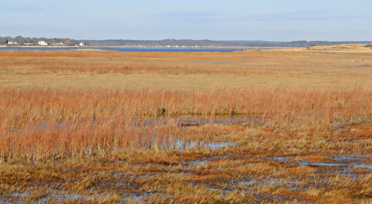
Waters flowing from an extensive salt marsh in Green Harbor and along the Marshfield-Duxbury line, as well as from the Cut River and the Duck Hill River, join together to form Duxbury’s Back River, which enters Duxbury Bay at the Powder Point Bridge, and then empties into Cape Cod Bay. The Back River is visible from the “back” (as opposed to oceanfront) side of Duxbury Beach Reservation.
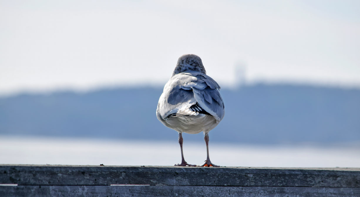
A 2018 survey indicates that the numbers of species observed on Duxbury Beach are as follows. Birds: 127, Mammals: 8, and Plants: 36. Some notable visitors are horseshoe crab, snowy owl, piping plover, and least tern. The latter two have been designed protected species by state and/or federal law. Duxbury Beach Reservation’s Endangered Species Program offers protection for nesting piping plover and least tern during the spring and summer.
Like all barrier beaches, Duxbury Beach is dynamic. Sand arrives and departs at a slow pace. Here at Duxbury, the beach is moving westward toward the mainland. Unfortunately, due to heavy armoring of beaches to the north (seawalls), Duxbury Beach is not receiving natural nourishment of sand. There are seasonal dynamics as well. In the winter and spring, the beach is rocky, as northeasterly winds pull the sand out. In the summer and fall, the sand returns, carried in by gentle waves.
While storm damage has long been an issue, rising sea levels and intensified storms now are cause for major concern. In 2019, DBR started the permitting process for proactive dune and beach nourishment projects so the organization is now able to plan and complete beach work before storms occur instead of reacting after the storm has done its damage. Information on this coastal resiliency work is available at: www.duxburybeachreservation.org

Historic Site: Yes
Park: No
Beach: No
Boat Launch: Yes
Lifeguards: No
Size: 2200 feet
Hours: Always open.
Parking: Small on-site public parking lot at the western end of the bridge at 370 Powder Point Ave.
Cost: Free
Trail Difficulty: Easy
Facilities:
Portable toilets, in season, at the eastern end of the bridge.
Dogs: Dogs must remain on leash. Always clean up after your dog! Please be mindful of seasonal dog walking regulations at Duxbury Beach.
Boat Ramp: No
ADA Access: Yes
Scenic Views: Yes
Waterbody/Watershed: Duxbury Back River / Duxbury Bay watershed