123 Rockland St, Hingham, MA 02043, USA
Owned By: Town of Hingham
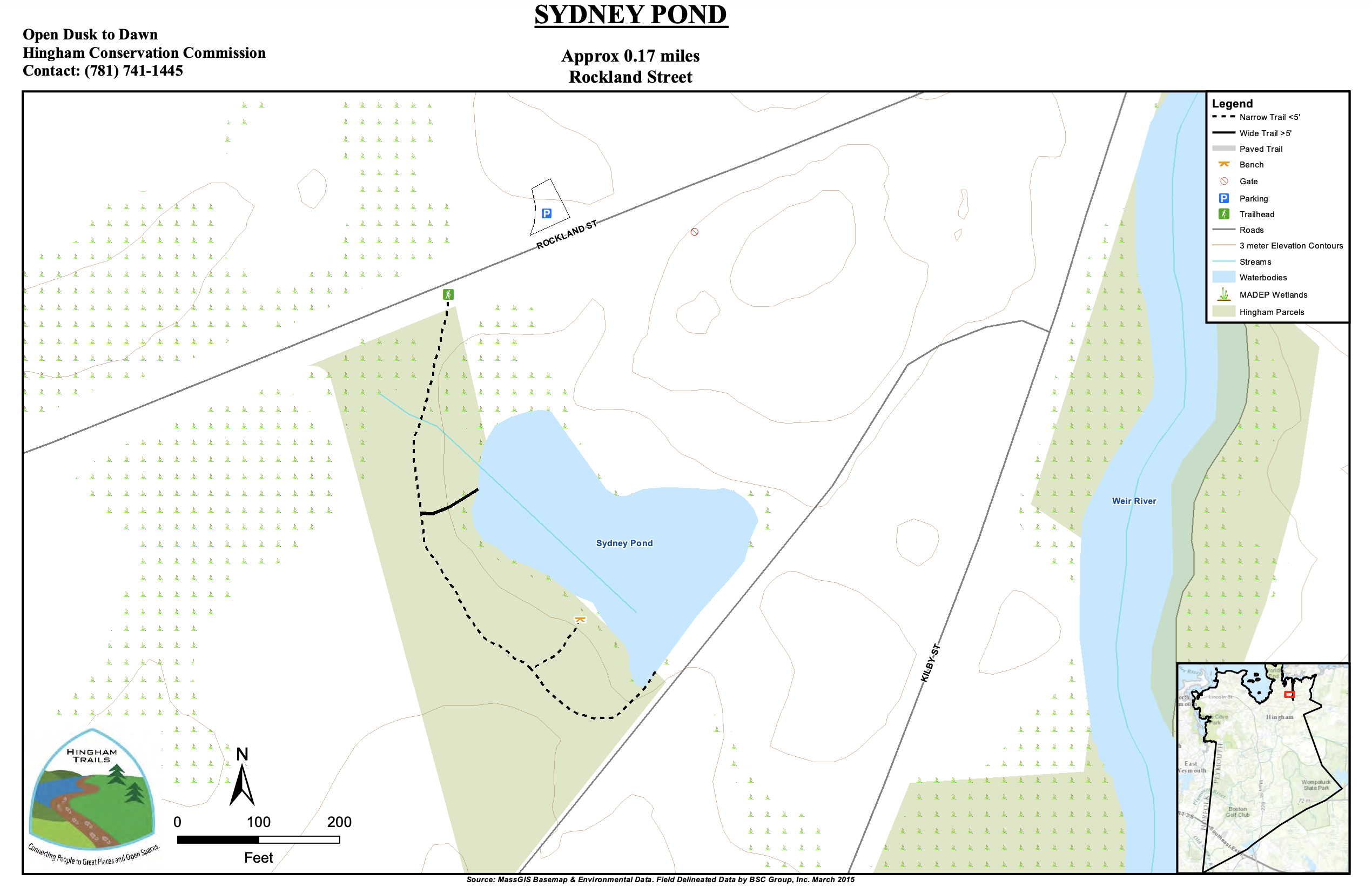
The 5.1-acre Sidney’s Pond property on Rockland Street offers a 0.17-mile walk through the woods with pond and wetland views. Ice skating is available in the winter. The former site of an ice business, it is also known as Sydney Ice Pond. Located within the Weir River Area of Critical Environmental Concern. Just up the road on Glacier Lane, don’t miss the Glacial Boulder, a “great and impressive rock,” adorned with an historic plaque.
It’s important to know that some of our freshwater fisheries are contaminated with mercury, PFAS and/or other concerning substances. The Massachusetts Department of Public Health maintains an online database with up-to-date advisories regarding fish consumption, sorted by location. We recommend you consult this valuable resource when planning a fishing excursion.
Features
This land is within the region of the Massachuseuk (or Massachusett) Native American tribe. The property was donated to the Town of Hingham by the Noonan Family.
Also of interest nearby: just up the road, on Glacier Lane, off Rockland Street, stands an immense glacial erratic boulder. There is a plaque secured to it which reads: “This great and impressive rock — perhaps the largest boulder in Hingham, — was brought here thousands of years ago by a glacier. The typical scratches were found upon its surface by Thomas T. Bouve, then President of the Boston Society of Natural History, and by William O. Crosby of the Massachusetts Institute of Technology. The original location is not known, but was undoubtedly thousands of miles north of here. It is given with the small park on which it stands to the inhabitants of the Town of Hingham in loving memory of Thomas T. Bouve and Emily G. Bouve, both ardent lovers of nature and former owners of the property, by their children, upon the condition that it and the land enclosed with it shall never be alienated, and that the town shall forever preserve the Glacial Boulder in its present condition.”
Trail Description
A 0.17 mile trail extends from the property sign, and along one side of the pond.
Habitats and Wildlife
Mostly upland, with some wetlands and pond frontage, this property is part of the Weir River watershed. Formed at the confluence of Crooked Meadow River and Fulling Mill Brook, the Weir River flows north through Hingham, with Tower Brook and Accord Brook joining it in its first mile. It gradually turns northeast and flows for another 1.4 miles, through Weir River Farm and eventually into Foundry Pond. The Weir River Estuary, designated by the Commonwealth of Massachusetts as an Area of Critical Concern, begins just below the manmade dam at the pond. The mile-wide estuary — with numerous acres of undisturbed salt marsh — forms the border between Hingham and Hull, and empties into Hingham Bay. For more information about the Weir River, follow the Weir River Watershed Association.
The woodlands here are composed mostly of oak, maple, beech, and pine. Scattered throughout are moss-covered rocky outcroppings and glacial erratic boulders. There is also an old stone wall and the vestiges of a narrow gauge railroad.


Historic Site: No
Park: No
Beach: No
Boat Launch: No
Lifeguards: No
Size: 5.1 acres
Hours: Dawn to Dusk
Parking: Very limited roadside parking on Rockland Street.
Cost: Free
Trail Difficulty: Easy
Facilities:
Informational kiosk.
Dogs: Dogs must remain on leash. Scoop the poop!
Boat Ramp: No
ADA Access: No
Scenic Views: Yes
Waterbody/Watershed: Weir River watershed