
2 Meadow Farm Way, Norwell, MA 02061, USA
Norwell Conservation: (781) 659-8022
Owned By: Town of Norwell
Norwell’s Stetson Meadows Conservation Area is 184 acres along the North River with 2.5 miles of intersecting trails, a picnic area, and numerous old stone walls. It is named for Cornet Robert Stetson, who settled here with his wife, Honour Tucker, by 1640.
HUNTING: Those who hold town-issued permits may use this property for seasonal hunting and trapping. Hunting is not allowed on, or across, any trail. Visit the hunting page on Norwell’s website for details. Non-hunters, be mindful of hunting seasons, and wear bright orange if you’re entering the property during those times. Hunting is not permitted on Sundays.
Features
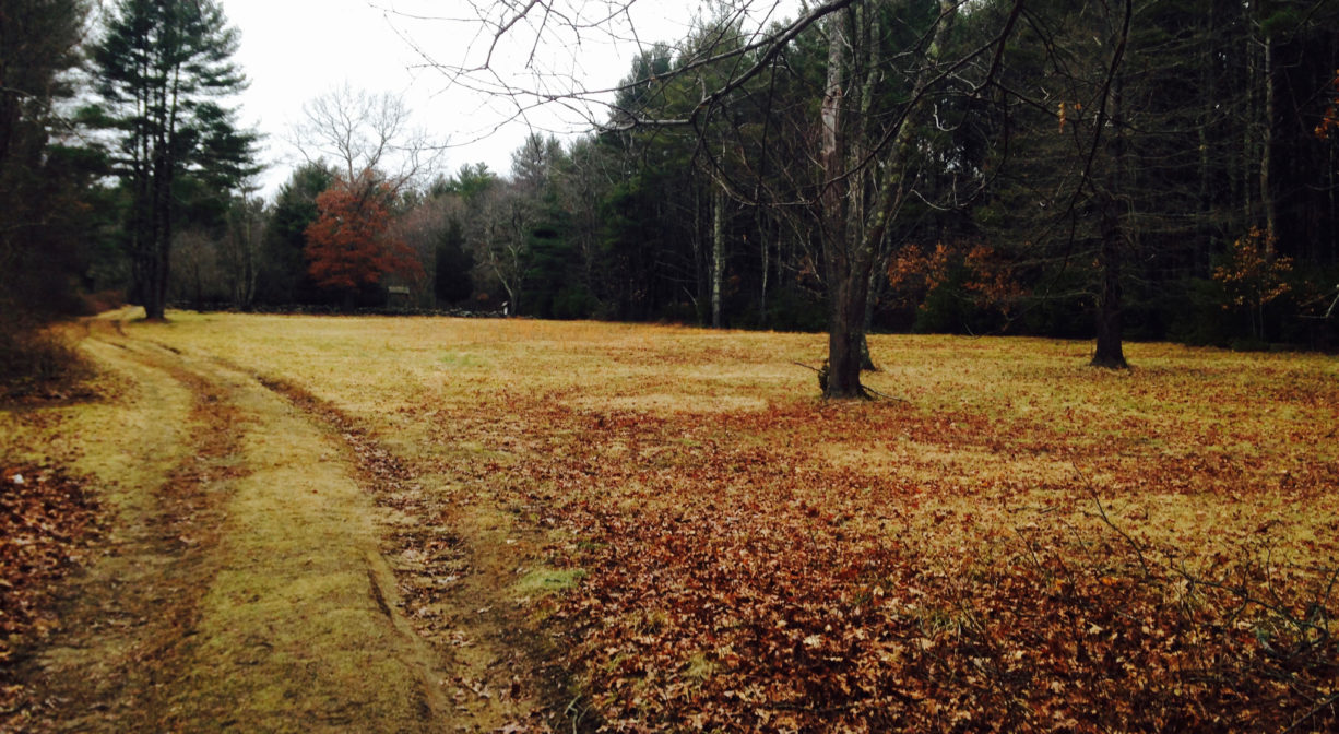
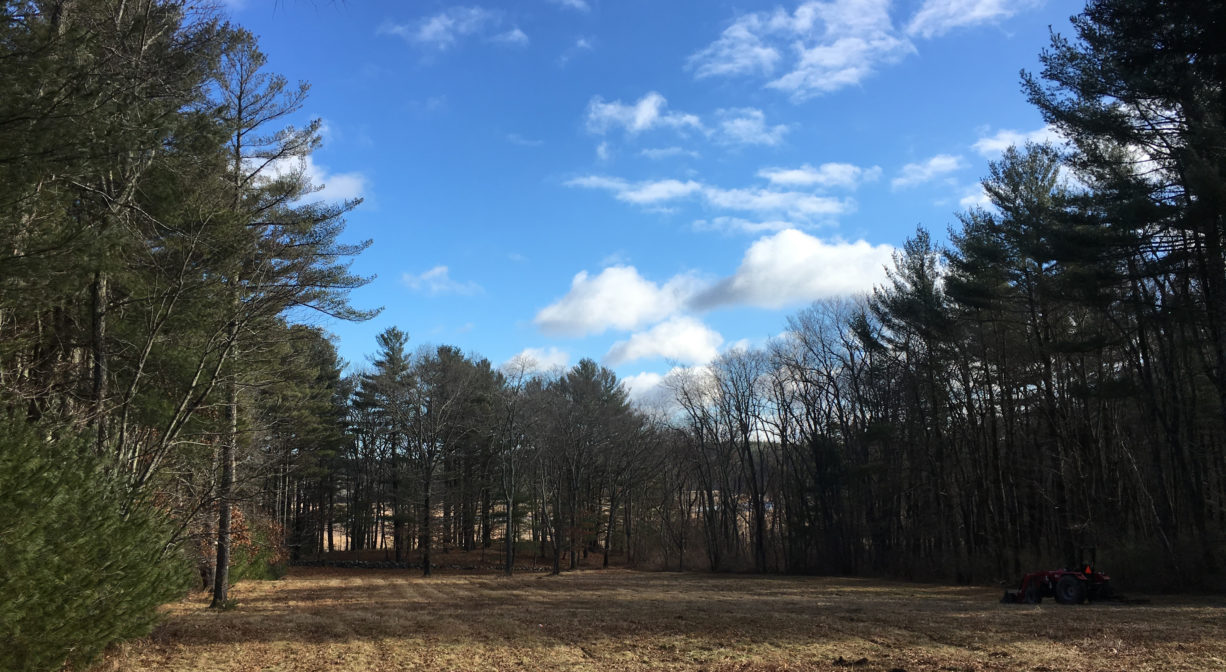
Stetson Meadows is remote — tucked away in the woods, in a corner of Norwell that is accessible only by a single dirt road. The Town of Norwell purchased the 184-acre property in 1972 with the intention of providing public access, as well as to curb further development along the North River. Since then, volunteers and the town have worked together to establish a network of trails. Now visitors can enjoy the property’s forests, meadows, wetlands, and woody swamps, along with impressive views of the salt marsh and the river.
Until it earned its own name in 1888, Norwell (also known as South Scituate) was part of the town of Scituate. Europeans began to settle there around 1628. While there were no formal roads back then, Native American tribes had created trails over the land. However it was often easier to travel by water, in small boats and canoes. The river was essentially the highway. The original farms established by European settlers in Norwell were along the North River.
The first European to lay claim to the area that is now Stetson Meadows was Robert Stetson, who received a 100-acre land grant in 1634, and settled on it by 1640. Stetson served the Crown of England for 14 years, attaining the rank of Cornet, a commissioned officer. He is remembered in posterity as a member of the contingent that established the boundary between the Plymouth and Massachusetts Bay Colonies, as well as for leading a troop of soldiers in King Philips War, and for negotiating the purchase of Abington and Hanover from the Narragansett.
Cornet Stetson and his wife, Honour Tucker, had 10 children. Four of their sons — Joseph, Benjamin, Thomas and Samuel – eventually inherited the 100-acre land grant. Thomas farmed there, while in 1660, Benjamin established a shipyard on site at Bald Hill, just upstream of the present-day Route 3 bridge. Three generations of Stetsons worked the shipyard, which was eventually taken over by Nathaniel Church. The farm also passed down through subsequent generations, and was eventually sold to Michael Ford, a shipbuilder farther upstream at Fox Hill. Three generations of the Ford Family inhabited the farm, and then the Morton family was the final owner before the town made its purchase.
Around 1875, a petition was raised to order the construction of a footbridge over the North River from the Stetson/Ford/Morton farm across to the Two Mile section of Marshfield, but it never came to fruition. Similar efforts (for a drawbridge) occurred slightly downstream, near Wanton Shipyard, both in 1785 and 1827, but they failed as well.
These days, there isn’t much evidence on site of the Stetsons or any of the families who came after them. Forest and swamp now cover the farmland, although the occasional stone wall reminds the visitor of days past. It’s a lovely place to spend an hour or two.
This land is within the region of the Massachusett (or Massachuseuk) Native American tribe. For thousands of years, the land that today is known as Norwell was inhabited by indigenous people who grew crops, foraged, hunted, and fished in the Assinippi and North River areas. Circa 1617, a major outbreak of disease decimated an estimated 90% of the native population in New England, including the Massachusett and Wampanoag tribes that inhabited the South Shore. There are still descendants of these original inhabitants living here today. They are known as the Mattakeesett Tribe of the Massachusett Indian Nation , the Massachusett Tribe at Ponkapoag, the Herring Pond Wampanoag and the Mashpee Wampanoag tribe.
Trail Description
To get to Stetson Meadows, from River Street in Norwell, turn onto Stetson Shrine Lane. The paved road ends in a cul-de-sac. Continue on Meadow Farm Way, which is unpaved, for a half mile or so to get to the conservation area’s parking lot.
Stetson Meadows features two loop trails. To reach the 1.25-mile River loop, begin at the parking area, cross the dirt road, and head downhill, along the meadow, toward the river. You’ll see a sign for the River Loop on the right. Follow the River Loop all the way around, and then continue downhill to the picnic area and the River Trail. Then follow the River Trail along the water and across Meadow Farm Way. This brings you to the Twin Pines Trail, which continues to the parking area, completing the loop.
The Twin Pines Trail also provides access to a second loop, which traverses the western side of the property for an additional 1.25 miles via the Stetson and Haskins Trails. The EMS Trail, a short (0.13 miles) spur off the Haskins Trail, was created by volunteers and Eastern Mountain Sports in the 1990’s, and connects with the private Meadow Farm Way.
Stetson Meadows borders private property in several places. It is important to be mindful of this, and remain on established trails. We recommend downloading the map/property guide.
Habitats and Wildlife
Stetson Meadows is a classic example of a white pine-oak forest. Among the pines and oaks is a considerable amount of low-lying shrubbery, including low-bush blueberry, huckleberry, mountain laurel and sheep laurel. There is also a lot of moss and some holly. Abundant wildlife make their home in Stetson Meadows because of the mix of habitats and the sizable acreage. Watch for northern harriers in the winter. Also of interest are a few intriguing glacial erratic boulders along the trail.
The property is located on the North River, which rises from marshes and springs in Weymouth, Rockland and Hanson. It is approximately 10 miles in length, with its source at the confluence of the Indian Head River (Hanover) and Herring Brook (Pembroke). From there it flows through the towns of Hanover, Pembroke, Marshfield, Norwell, and Scituate to the Atlantic Ocean between Third and Fourth Cliffs, draining approximately 59,000 acres along the way.


Historic Site: No
Park: No
Beach: No
Boat Launch: No
Lifeguards: No
Size: 184 acres
Hours: Dawn to Dusk
Parking: Limited on-site parking. Look for the parking area and kiosk after the sharp curve on Meadow Farm Way.
Cost: Free
Trail Difficulty: Easy
Facilities:
Picnic tables and benches. Geocache location.
Dogs: Dogs must remain on leash. Please clean up after your pet!
Boat Ramp: No
ADA Access: No
Scenic Views: Yes
Waterbody/Watershed: North River