
291 Union St, Marshfield, MA 02050, USA
http://www.thetrustees.org/places-to-visit/south-of-boston/two-mile-farm.html
Owned By: The Trustees
Two Mile Farm, owned by The Trustees, is 68 acres on the North River in Marshfield, with salt marsh, upland forest and more than a mile of trails, plus occasional old stone walls. Founded in 1640 by the Hatch family, Two Mile Farm derives its name from rights granted to the Town of Scituate (whose boundaries encompassed the farm until 1788) to harvest salt hay “two miles along the river and one mile inland on each side.” Contiguous with Jose Carreiro Woodland. Dog walkers are known to frequent this property.
Hunting is not permitted on this property.
Features
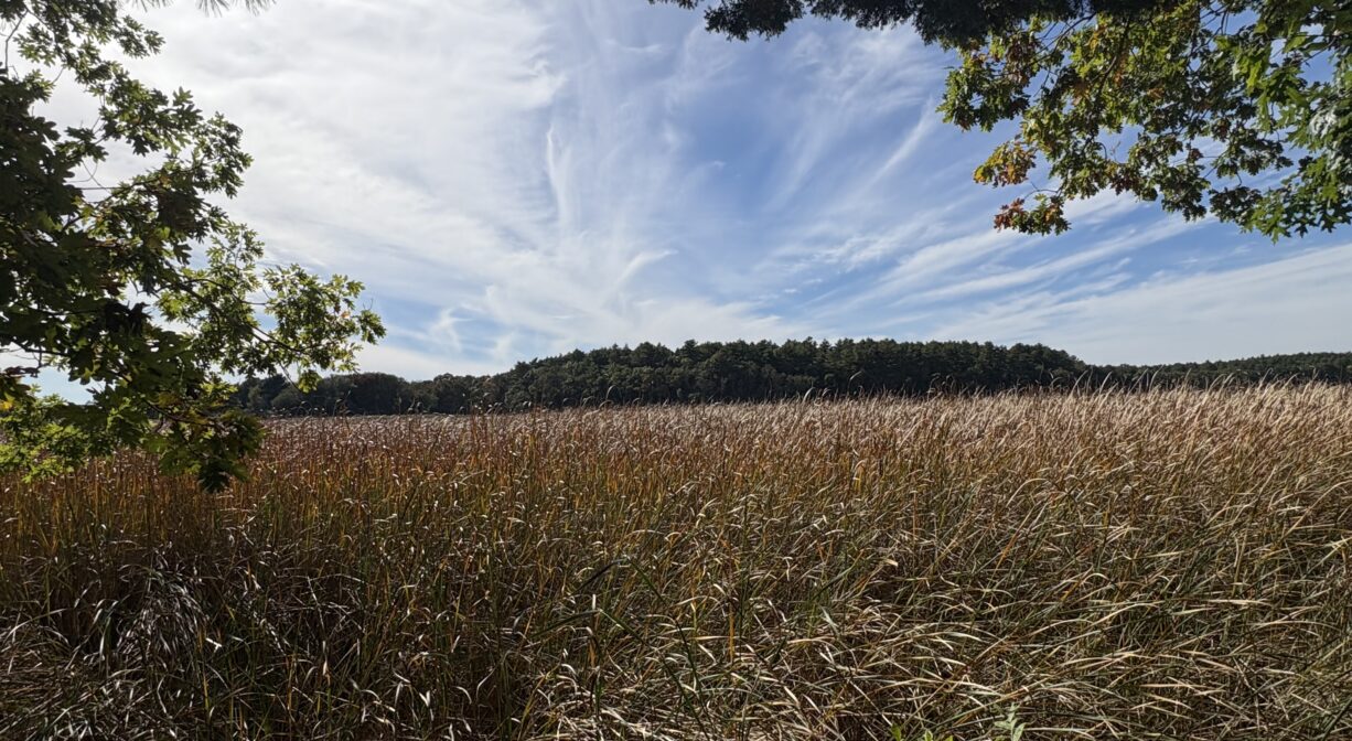
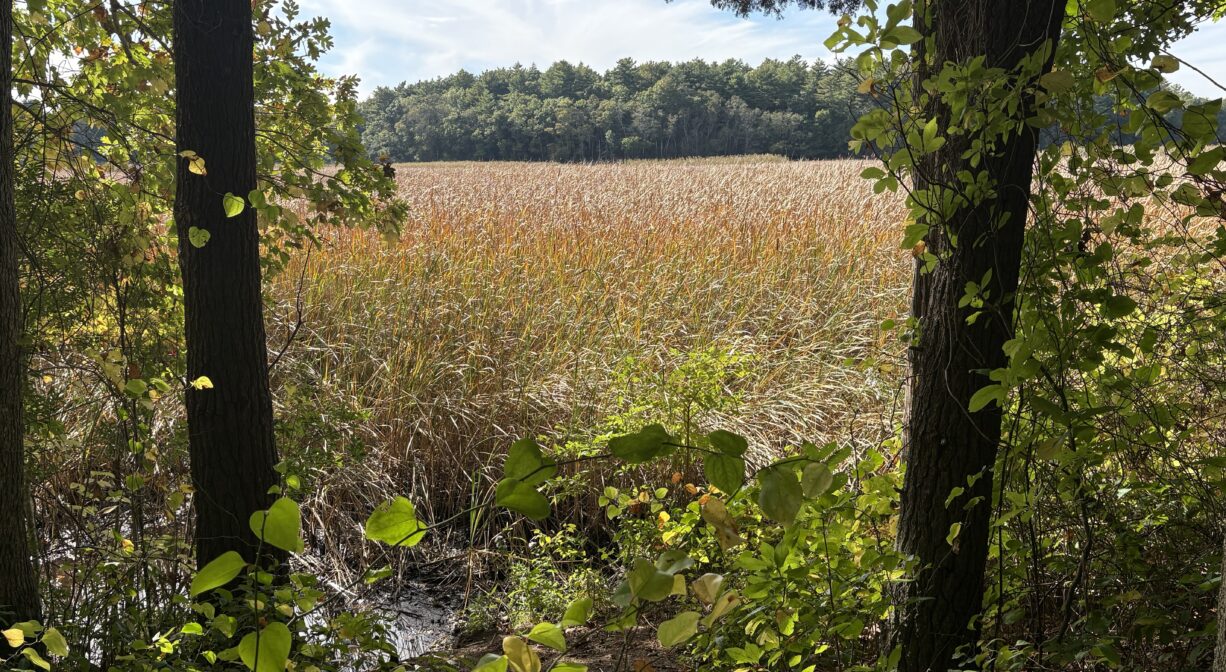
The Trustees (formerly Trustees of Reservations) acquired this 68-acre property in 1995. Narrow trails and wide cart paths pass through a white pine woodland, with occasional hemlock, oak and beech. Look for the remains of old stone walls. The trails slope down to the marsh’s edge, presenting broad views of the North River and Stetson Meadows.
If it weren’t for the salt hay along the rivers, the 17th century European settlers probably would not have survived here. There was very little unforested land, and what they managed to clear, they needed for growing crops for human consumption. Thus they fed their livestock salt marsh hay. (It was also used for roof thatch and wall insulation.) By the late 1600’s, land rights had been granted to all of the area’s salt marshes. Ditches were cut to serve as property boundaries. Thus, Two Mile, one of Marshfield’s many villages, earned its name. In 1640, a parcel in Marshfield and Pembroke — two miles long and one mile wide (measured from midstream in the river to the upland) — was deeded to South Scituate (Norwell), for salt haying rights. Pembroke successfully petitioned to annex the southern portion is 1738. Marshfield did the same with the northern portion in 1788.
Around 1875, a petition was raised to order the construction of a footbridge over the North River from the Two Mile section of Marshfield to the Stetson/Ford/Morton farm in today’s Norwell (then South Scituate), but it never came to fruition. Similar efforts, for a drawbridge, occurred slightly downstream, near Wanton Shipyard, both in 1785 and 1827, but they failed as well.
This land is within the region of the Massachusett (or Massachuseuk). To learn more about local Native American tribes, we encourage you to interact with their members. The Mattakeeset band of the Massachusett, and the Massachusett tribe at Ponkapoag, both share information on their websites.
Trail Description
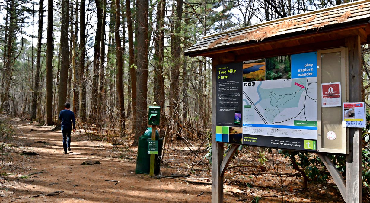
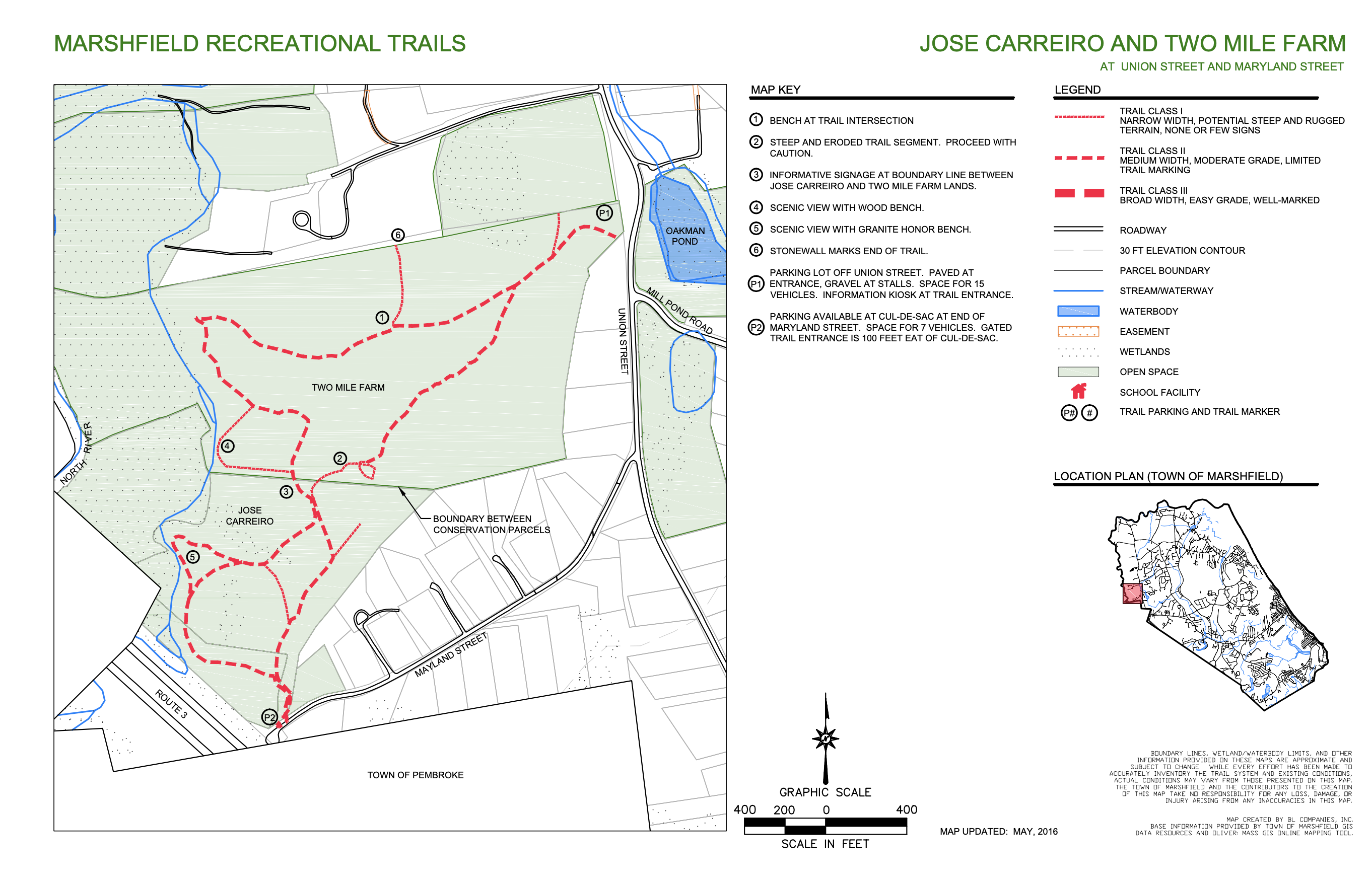
If you’re in the mood for a walk in the woods, the combined 79-acre Two Mile Farm and Jose Carreiro Woodland are worthy of your consideration. You can begin your walk on either property, however if you set off from Two Mile, you’ll finish your walk on a long uphill! Two trail maps are posted along the way.
From the parking area, follow the trail into the woods. For guidance, watch for the white trail markers posted on trees. Head downhill, bearing right at the first intersection, and continue until you get close to the river. There, the trail veers to the left (avoid the private property on your right). Look for a narrow trail along the edge of the upland, where you’ll be treated to occasional views of the marsh. (Another option is to remain on the wider, more direct trail.)
Both will eventually bring you to the entrance to the Jose Carreiro Woodland. You can continue to follow the trail along the edge of the upland through Carreiro — it will eventually loop back to this spot — or for a shorter walk, you can turn left here and head uphill on a different trail, and eventually back to the parking area. When you get finally to the top of the hill (it’s a long, slow climb) spend some time at the kiosk reading about the property’s history.
Habitats and Wildlife
The forest is primarily maple, elm and oak, with scatterings of pine and and spruce. You’ll also find fern, wild blueberry, and bittersweet. Many colorful wildflowers sprout here in the springtime. Watch for deer grazing in the salt marsh or in the forest. Numerous small mammals call this woodland home. Listen for the chattering of marsh wrens. They are commonly observed in this section of the marsh and all the way up to the freshwater marshes in Pembroke and Hanover. Other bird species observed here include: pine warbler, red-wing blackbird, common yellowthroat.
This property is located on the North River. As you travel upstream from the mouth of the river, first you enter the estuary — extensive salt marshes. The farther upriver you go, the more the salt water from the ocean mixes with the fresh water from upstream. As the water becomes less salty, the marsh plants slowly change as well. In the saltier parts of the marsh, closer to the mouth, the dominant plants are the Spartinas — the smooth cordgrass and salt marsh hay. At Two Mile Farm, you begin to see other, less salt-tolerant plants, including narrow-leaf cattail and phragmites.
The North River rises from marshes and springs in Weymouth, Rockland and Hanson. It is approximately 10 miles in length, with its source at the confluence of the Indian Head River (Hanover) and Herring Brook (Pembroke). From there it flows through the towns of Hanover, Pembroke, Marshfield, Norwell, and Scituate to the Atlantic Ocean between Third and Fourth Cliffs, draining approximately 59,000 acres along the way.


Historic Site: No
Park: No
Beach: No
Boat Launch: No
Lifeguards: No
Size: 68 acres
Hours: Dawn to Dusk
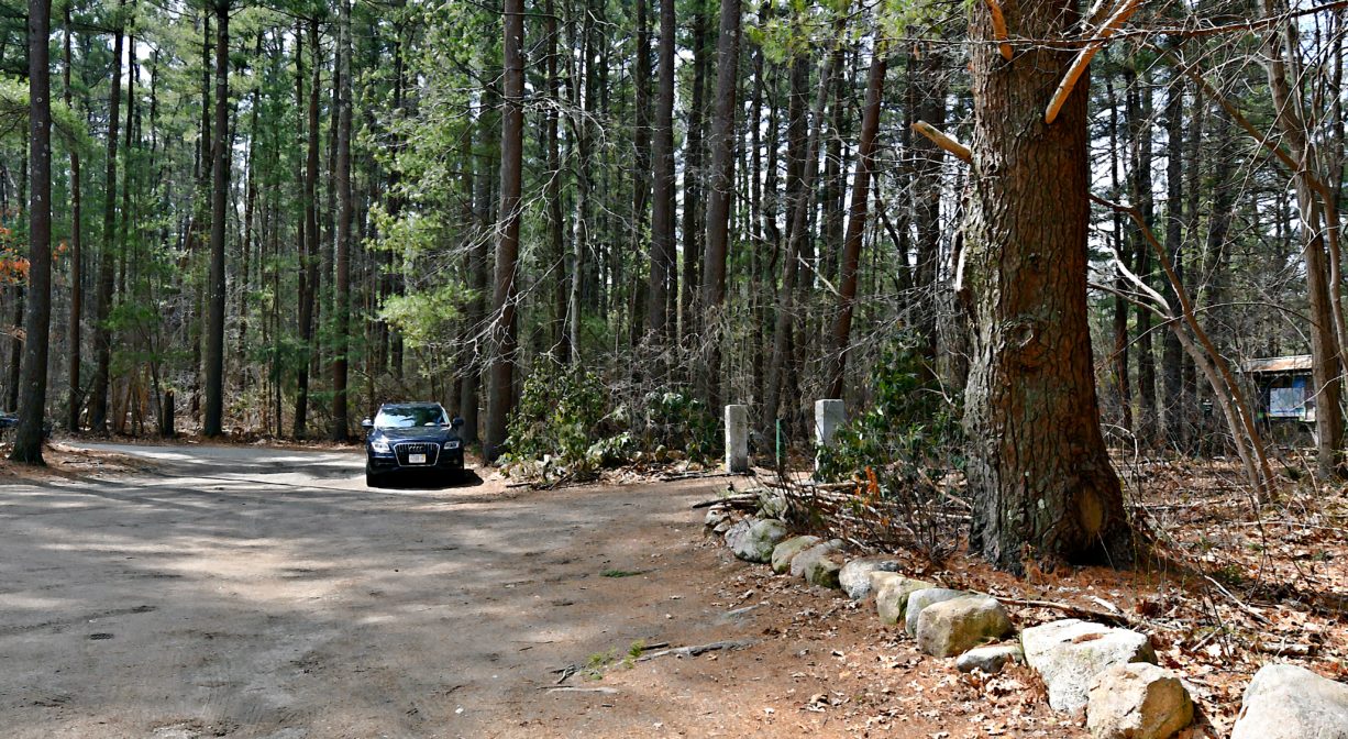
Parking: Limited on-site parking (8 vehicles). Look for the property sign at 291 Union Street. The driveway leads to a small gravel lot.
Cost: Free
Trail Difficulty: Easy, Medium
Facilities:
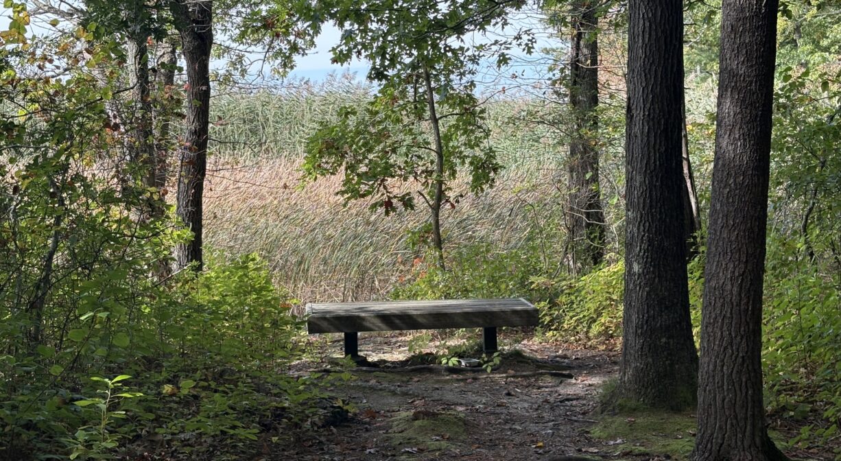
Benches are located in three locations in the trail system. Informational kiosk. Geocache location. Trash & pet waste receptacles.
Dogs: Dogs must remain on leash. Always clean up after your dog!
Boat Ramp: No
ADA Access: No
Scenic Views: Yes
Waterbody/Watershed: North River