
430 Cushing St, Hingham, MA 02043, USA
Hingham Conservation: 781-741-1445
https://hinghamlandtrust.org/whortleberry-hollow/
Owned By: Hingham Land Conservation Trust
The 13-acre Whortleberry Hollow in Hingham offers a short (0.4-mile) trail through the woods and around a wetland, with benches for quiet contemplation.
Features
This land was donated to the Hingham Land Conservation Trust in 1994 by Suvia P. Whittemore, in memory of her husband, the late Arthur E. Whittemore, who served as Hingham’s Town Moderator for many years. Evan Lamlein of Hingham built and installed the benches on this property as part of an Eagle Scout project.
This land is within the region of the Massachusett (or Massachuseuk). To learn more about local Native American tribes, we encourage you to interact with their members. The Massachusett tribe at Ponkapoag and the Mattakeeset band of the Massachusett share information on their websites.
Trail Description
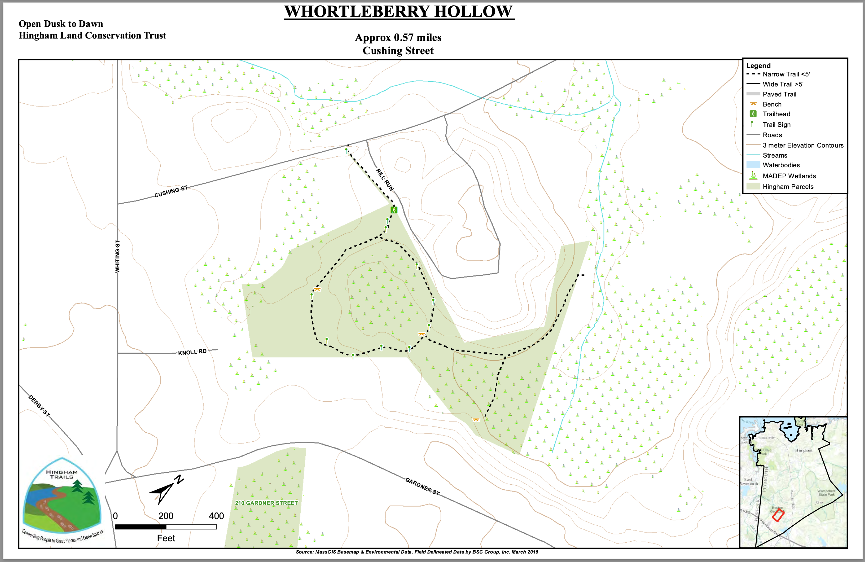
On Cushing Street, look for the property sign, and the granite steps that lead up to the entrance trail. Follow this fenced-in pathway until you arrive at the informational kiosk. Continue straight and you will soon arrive at the loop trail, which leads around a wetland. It begins in a white pine forest, and continues to a small grassy clearing with a large maple tree. Wooden signposts with arrows indicate where to go — to the left. Follow the trail back into the woods. Steps built into the trail make it easier to descend a small hill. The trail leads through an old stone wall, over a small stream and into a beautiful grove of beech trees, before rejoining the entrance path.
Habitats and Wildlife
There are several rhododendron shrubs along the entrance trail, along with pine, oak and beech. Inside the property, along the loop trail, look for a beautiful grove of beech trees.
The streams and wetlands on this property flow to the Plymouth River. The Plymouth River is a major tributary to Crooked Meadow River, which joins with Fulling Mill Brook to create the Weir River. The Weir River flows north through Hingham, with Tower Brook and Accord Brook joining it in its first mile. It gradually turns northeast and flows for another 1.4 miles, through Weir River Farm and eventually into Foundry Pond. The Weir River Estuary, designated by the Commonwealth of Massachusetts as an Area of Critical Concern, begins just below the manmade dam at the pond. The mile-wide estuary — with numerous acres of undisturbed salt marsh — forms the border between Hingham and Hull, and empties into Hingham Bay. For more information about the Weir River, follow the Weir River Watershed Association.


Historic Site: No
Park: No
Beach: No
Boat Launch: No
Lifeguards: No
Size: 13 acres
Hours: Dawn to Dusk
Parking: Limited roadside parking across from 430 Cushing Street. Please be mindful of private driveways!
Cost: Free
Trail Difficulty: Easy
Facilities:
Informational kiosk, benches.
Dogs: Dogs must remain on leash. Please clean up after your pet!
Boat Ramp: No
ADA Access: No
Scenic Views: Yes
Waterbody/Watershed: Plymouth River (Weir River watershed)