
842 Tremont St, Duxbury, MA 02332, USA
Owned By: Town of Duxbury
Green’s Harbor Path and Kettle Hole Loop are two miles of woodland trails that incorporate a pre-Colonial path. They are part of an expansive trail network in Duxbury, with links to Knapp Town Forest, Mass Audubon’s North Hill Marsh Wildlife Sanctuary, the Waiting Hill Preserve, and the Round Pond Conservation Area + Cherry Lane Bogs.
HUNTING: Hunting is not permitted on this trail. Please note that hunting is permitted nearby, in a remote section of Knapp Town Forest. Please be sure to understand state and local hunting guidelines before proceeding. Non-hunters, be mindful of hunting seasons, and wear bright orange if you’re entering the property during those times. Hunting is not permitted on Sundays.
Features
This land is within the region of the Patuxet Wampanoag tribe, who for centuries have inhabited the area around the Jones River now known as Duxbury, Kingston and Plymouth. To learn more about local Native American tribes, we encourage you to interact with their members. The Mashpee Wampanoag and the Herring Pond Wampanoag share information on their websites.
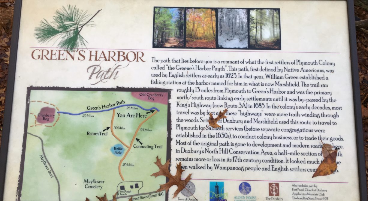
Green’s Harbor Path was an approx. 13-mile road that extended from Plymouth, through Kingston, Duxbury and Marshfield. Originally defined by Native Americans, it became the primary north-south thoroughfare for our region’s European settlers as early as 1623.
It is said that William Greene established a fishing station at the Green Harbor (now named for him) in what is now Marshfield. The road linked various settlements, and was in heavy use until the King’s Highway (present-day Route 3A) replaced it around 1685. In the 17th century, most travel was undertaken by foot. Before they established their own parishes in the 1630s, settlers in Marshfield and Duxbury would travel south to Plymouth for Sabbath services, as well as to trade goods or conduct business. A half-mile section of the original route has been preserved here. The rest has been lost to modern roads and residential development. Much of the trail restoration work here was done by Duxbury resident Jack Champagne, as part of an Eagle Scout project.
Trail Description
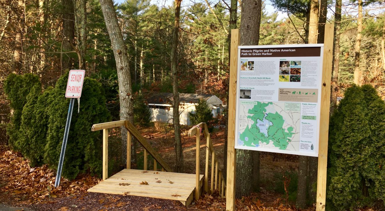
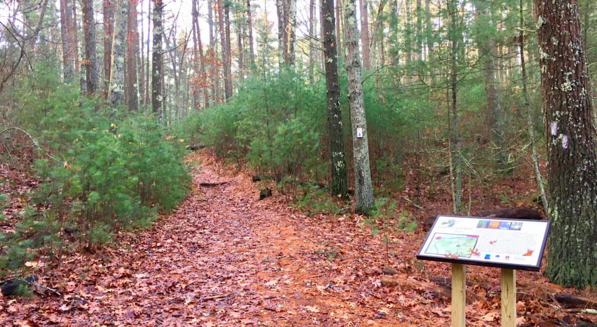
Look for the kiosk and trailhead behind First Parish Church in Duxbury (842 Tremont Street). Follow the stairs, or the trail nearby, to head downhill. Walk past the labyrinth/meditation garden, and continue to the fence that borders Mayflower Cemetery. The trail is clear from this point onward.
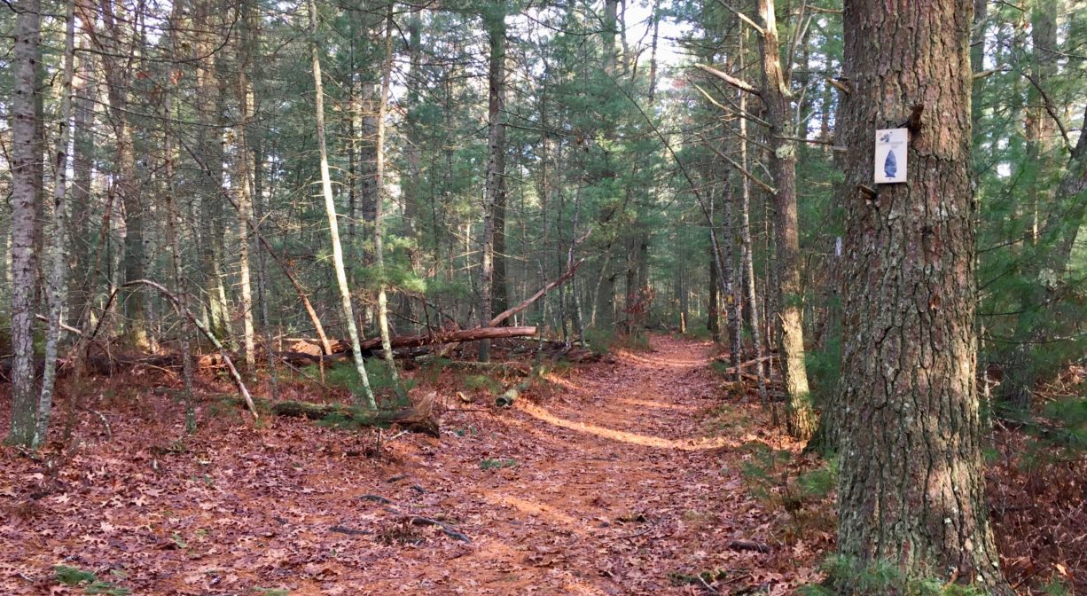
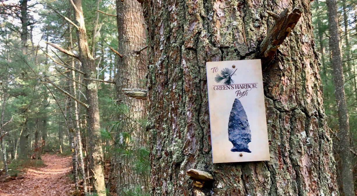
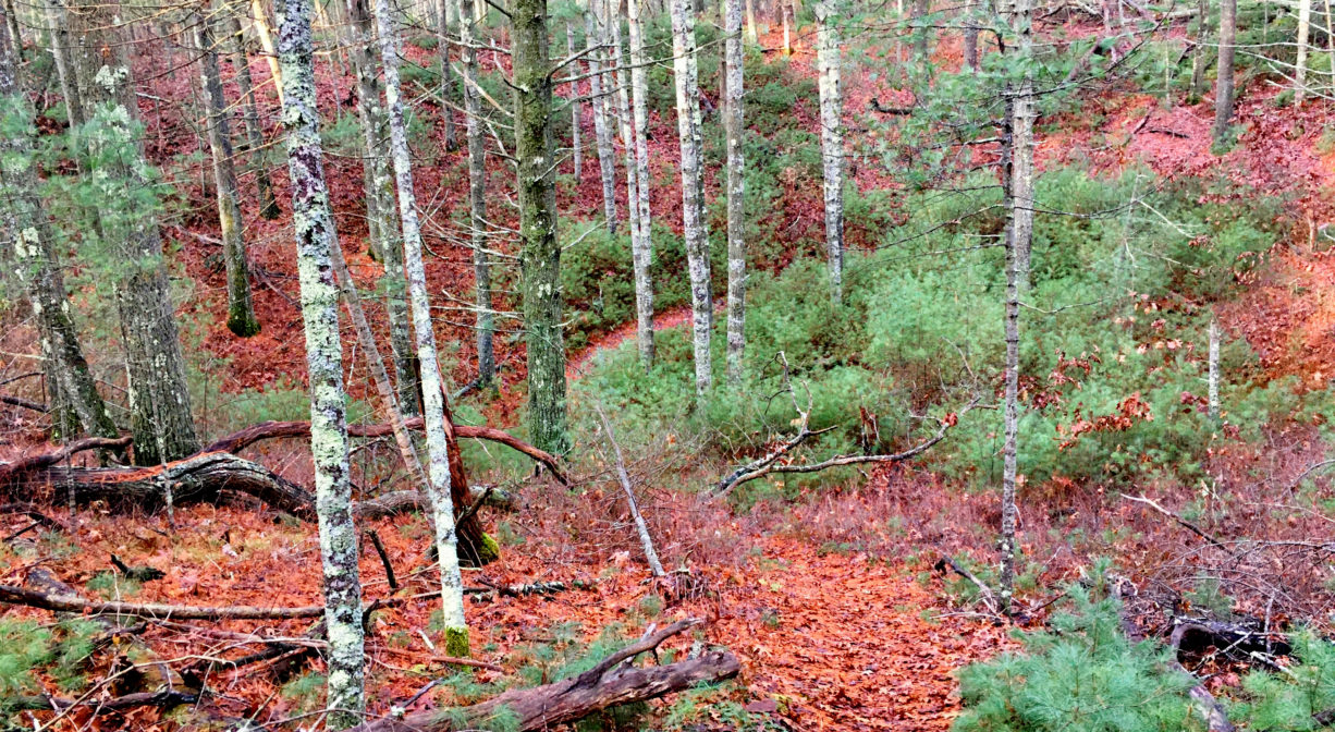
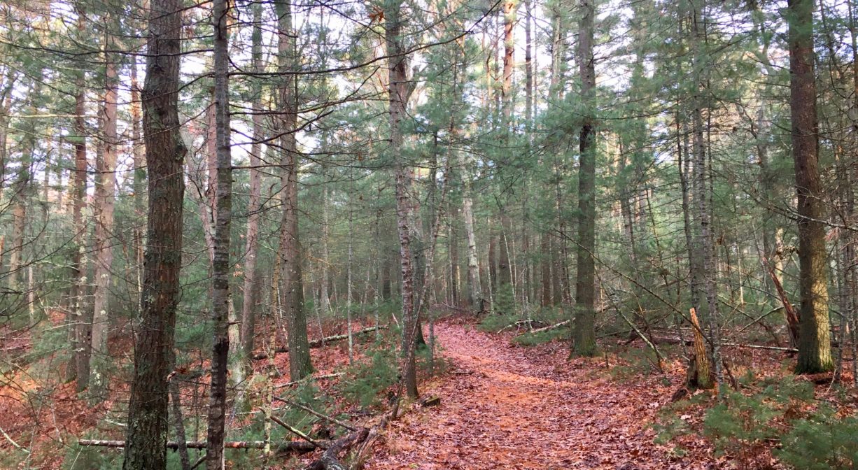
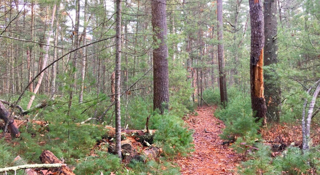
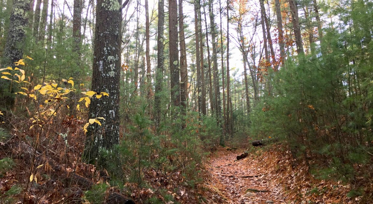
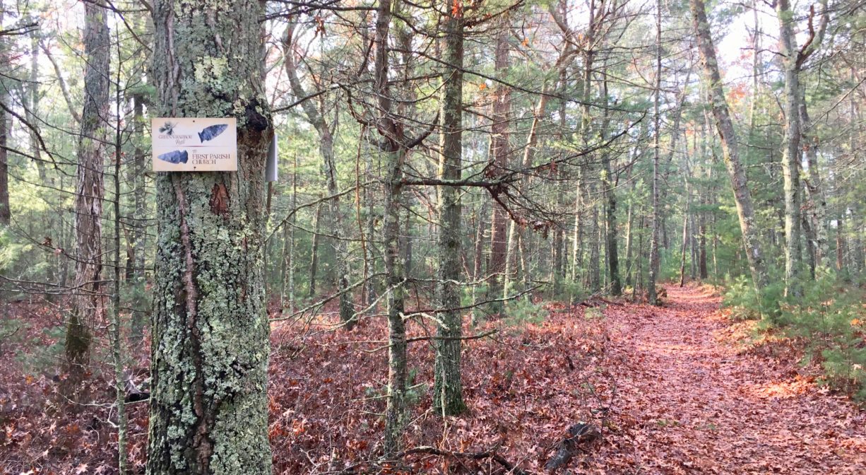
This trail system features a large loop. A portion of it runs along the top of a kettle hole — a hollow formed by a block of melting glacial ice. One third of the loop is the 1623 Green’s Harbor Path, which is marked with white signs bearing an arrowhead design. The other two thirds is the Kettle Hole Loop. It is marked with white blazes. Some additional, secondary trails, provide alternate routes within the larger loop. One of these runs down (and then up) a steep hill, through the center of a kettle hole.
Also nearby, the Knapp Trail, blazed in yellow, leads into the property from the intersection of Harrison and Tremont Streets, runs concurrent with much of the Kettle Hole Loop trail, and then continues through the O’Brien Bog and into the Knapp Town Forest. Another trail, blazed in red, extends from the northern intersection of Green’s Harbor Path and the Kettle Hole Loop, west to the North Hill Marsh trail network. Additional unblazed trails lead to the North Hill Country Club property and Merry Ave.
These trails are part of a much larger network that includes Knapp Town Forest, Mass Audubon’s North Hill Marsh Wildlife Sanctuary, the Waiting Hill Preserve, Round Pond Conservation Area + Cherry Lane Bogs.
Habitats and Wildlife
The woods are primarily pine and oak. Birds such as hawks, osprey, herons, ducks, geese and tree swallows are commonly found here. In the spring and summer you may see butterflies, dragonflies and damselflies. For mammals, watch for white-tailed deer, mink, muskrat, opossum, raccoon, chipmunk, squirrel and coyote. Reptile residents include black snakes and a variety of turtles (box, painted, spotted, snapping). Amphibians include frogs, toads and salamanders. Some of the flowers commonly viewed include mayflowers in April, ladyslippers in May, and sheep laurel in June.
This property is part of the Bluefish River watershed. The Bluefish River originates in ponds and springs between Duxbury’s Station & Washington Streets and Partridge Road, and flows north, parallel to the coast, to the Cushman Preserve. From there, it turns east, passing the Reynolds-Maxwell Garden and flowing under Washington Street, where it opens up into a broad estuary. The Bluefish River merges with the Duxbury Back River in Duxbury Bay.
Historic Site: Yes
Park: No
Beach: No
Boat Launch: No
Lifeguards: No
Size: The trail network is approx. 2 miles altogether, with links to a much larger network.
Hours: Dawn to Dusk
Parking: Limited on-site parking at Duxbury Town Offices, 842 Tremont Street.
Cost: Free
Trail Difficulty: Easy, Medium
Facilities:
Informational kiosk, dog waste bag receptacle, one interpretive sign on the trail.
Dogs: All dogs shall be effectively restrained and controlled by a chain or leash, or otherwise under the immediate and effective control of a handler, or confined to a motor vehicle. Each person who owns, possesses or controls a dog shall remove and properly dispose of any feces left by his/her dog. For current rules see: https://www.town.duxbury.ma.us/animal-control
Boat Ramp: No
ADA Access: No
Scenic Views: Yes
Waterbody/Watershed: Bluefish River (Duxbury Back River watershed)