
313 Water St, Hanover, MA 02339, USA
Owned By: Town of Hanover
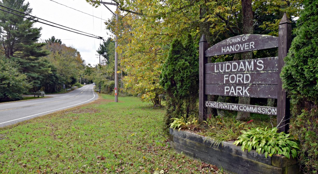
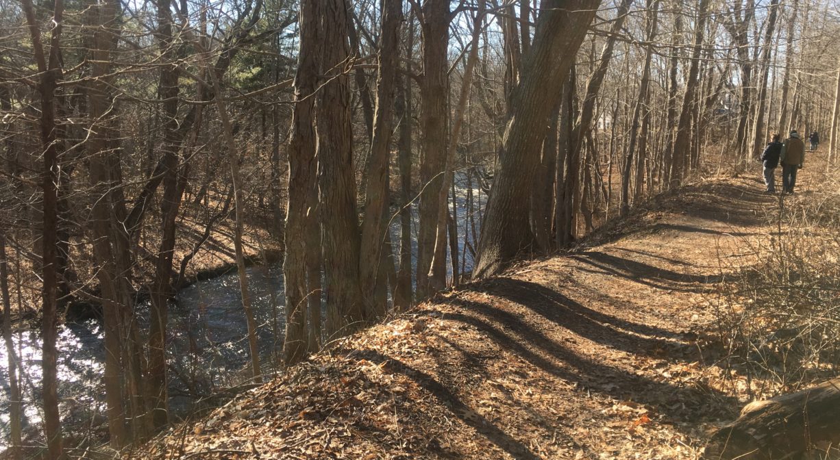
The Indian Head River Trails is a linear property owned by Hanover Conservation. The trails, which extend for 2 miles along the banks of the Indian Head River in South Hanover, follow the course of the river and offer stunning views. A former railroad bed provides the primary trail. Don’t miss the narrow footpaths that lead right up to the water’s edge … often on rocky outcroppings! There is a very pleasant bench at the end of the trail near Hanson, at a secluded spot at the river’s edge. Look for a walking trail from the parking area on Cross/State Street. There are trailheads at Ludden’s Ford Park in Hanover, as well as off Water Street and Broadway.
Hunting is not allowed on this property.
FISHING ADVISORY: It’s important to know that some of our freshwater fisheries are contaminated with mercury, PFAS and/or other concerning substances. The Massachusetts Department of Public Health maintains an online database with up-to-date advisories regarding fish consumption, sorted by location. We recommend you consult this valuable resource when planning a fishing excursion.
Features
HISTORY: A former railroad bed is the setting for the primary trail through this property. The Hanover Branch Railroad extended 7.8 miles from Hanover Four Corners, through South and West Hanover, across Rockland, to North Abington, where it connected with the Old Colony Railroad to Plymouth. Incorporated in 1846, and constructed over the better part of the next 20 years, it officially opened for service in 1868.
E. Y. Perry — a businessman, Justice of the Peace, and abolitionist — operated a large tack factory in South Hanover, and was largely responsible for the creation of the railway. He also owned a general store (now Myette’s) and constructed the building in South Hanover that for many years housed a series of a shoe factories – Goodrich, Cochran, and Shanley — and part of the Clapp Rubber Company. The railway facilitated the transport of materials and finished products to and from these and other businesses, but also offered passenger service. The Old Colony Railroad absorbed the Hanover Branch in 1887. In 1893, the New York, New Haven and Hartford Railroad took over the lease. Railroad service had dwindled significantly by the 1930s.
The Indian Head River Trail offers views of what used to be the Waterman Tack Factory. Remnants of its dam are visible on both sides of the river. You can also see some of the factory works (this is easier from the Pembroke side, within the Tucker Preserve). Beginning in the 1700’s, this site was home to a number of industries. The earliest was probably a carding mill, where wool fibers were prepared for spinning. Other incarnations included Joseph Smith’s c. 1726 fulling mill (where wool fiber was cleaned and thickened), and later a grist mill.
In 1830, a tack factory moved in, operated by Elihu Hobart and Charles Dyer. Hobart passed away and Dyer established a partnership with E.Y. Perry, who took ownership of the factory in 1850. By 1870, the factory passed to George Curtis, who then transferred the property to Lemuel C. Waterman, Rodolphus C. Waterman and George P. Clapp, who operated the R. C. Waterman Tack Factory.
Tack is another word for nail. Waterman tacks were used primarily in shoemaking and repair, but also in the furniture and upholstery trades, for equestrian equipment, and for laying carpet. Historians indicate that many shoe repair shops, even in New York and Philadelphia, would only use Waterman tacks. The business continued to expand and thrive, and by 1875 it employed 25 people and produced 250 tons of tacks per year.
Scan the course of the river, and consider how the power of the water behind the dam was harnessed to fuel the factory. You can probably guess where the water went in, and where it went out. But now, 150 years later, where has it all gone?
In February 1886, there was an unusually heavy rain. The water rose at such speed, and to such height, that it severely damaged not only the factory but the adjacent train tracks. The railroad was repaired, but for the most part ceased operations in the 1930’s. Subsequent storms in 1938 and 1954 did permanent damage to industries throughout the river valley. Since then, this spot has become a different world. It’s so quiet now – and so natural — it’s hard to imagine it was ever any other way.
The section of the river where the Waterman Tack Factory was located was known in the early 18th century as “Project Dale.” The name reflected both the setting (“dale” is another word for “valley”) and the varied industrial history of the area (the various “projects” undertaken here, as mentioned above). The remains of a different dam or bridge can be seen farther up the trail, upstream of Rocky Run Brook. Look for the stone abutments close to the water’s edge on both sides of the river.
At the Hanson end of the trail, look for a relatively new (2020) historic marker indicating the location of Barstow’s Forge. Joseph Grecco of Hanover has done extensive research into the true origins of the two anchors for the USS Constitution that were produced in Hanover. For over a century, it was assumed that they were forged in the Curtis Iron Works downstream. They may actually have been forged here, at Barstow’s.
Not far from this marker, there is a short trail that extends along the Indian Head River to its confluence with an unnamed tributary. The views here are quite captivating! Two benches provide vantage points. According to Hanover Conservation, the brook that flows into the Indian Head here was identified as Iron Mine Brook on an 1848 map and retained that name going forward … but then lost its name entirely in 1976! Meanwhile, a short distance east, there is another brook, known today as Iron Mine Brook. This brook was identified as Trout Brook on 1848 and 1849 maps, and retained that name until 1976, when it became Iron Mine Brook. This can be cause for confusion, especially when reading history books. Both brooks flow into the Indian Head River.
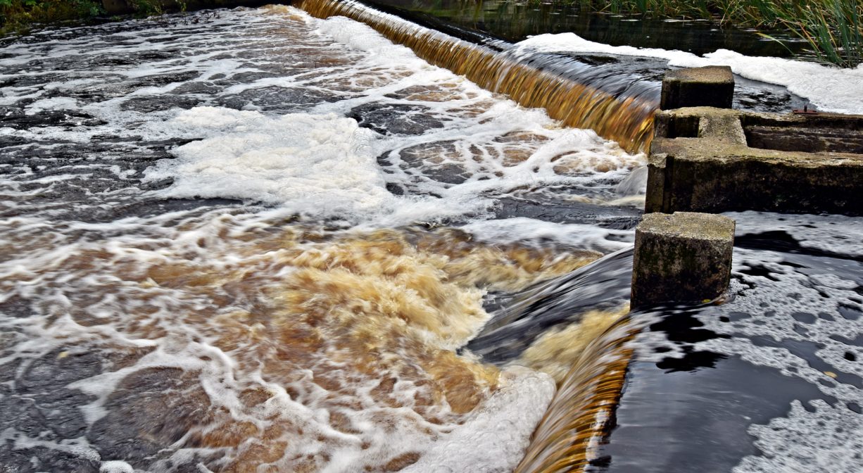
Also at the Hanson end of the trail is the State Street Dam, spanning the Indian Head River on State Street (Hanson) and Cross Street (Hanover). According to Hanover Historian Barbara Barker’s “Focus on History,” the river was dammed here as early as 1720, powering a series of industries including the aforementioned iron forge, as well as an anchor forge, a grist mill, and factories that produced bar iron and tacks. The E. Phillips and Sons tack factory (c. 1853), with at least 12 buildings and 2 furnace stacks, stretched into both towns. During World War I, the Atlas Tack Factory was located here. Most of the buildings were eventually torn down, and the dam was destroyed by the Hurricane of 1938, with some remnants still in place.
This land is within the region of the Massachusett (or Massachuseuk) Native American tribe. The Mattakeeset band of the Massachusett lived for thousands of years in the North River watershed. Their village included most of today’s Pembroke and Hanson. To learn more about local Native American tribes, we encourage you to interact with their members. The Massachusett tribe at Ponkapoag and the Mattakeeset band of the Massachusett share information on their websites.
Trail Description
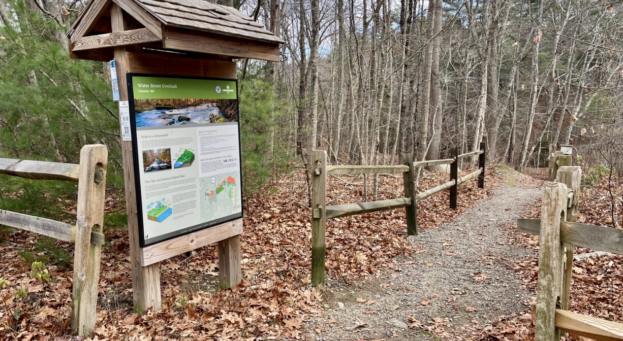
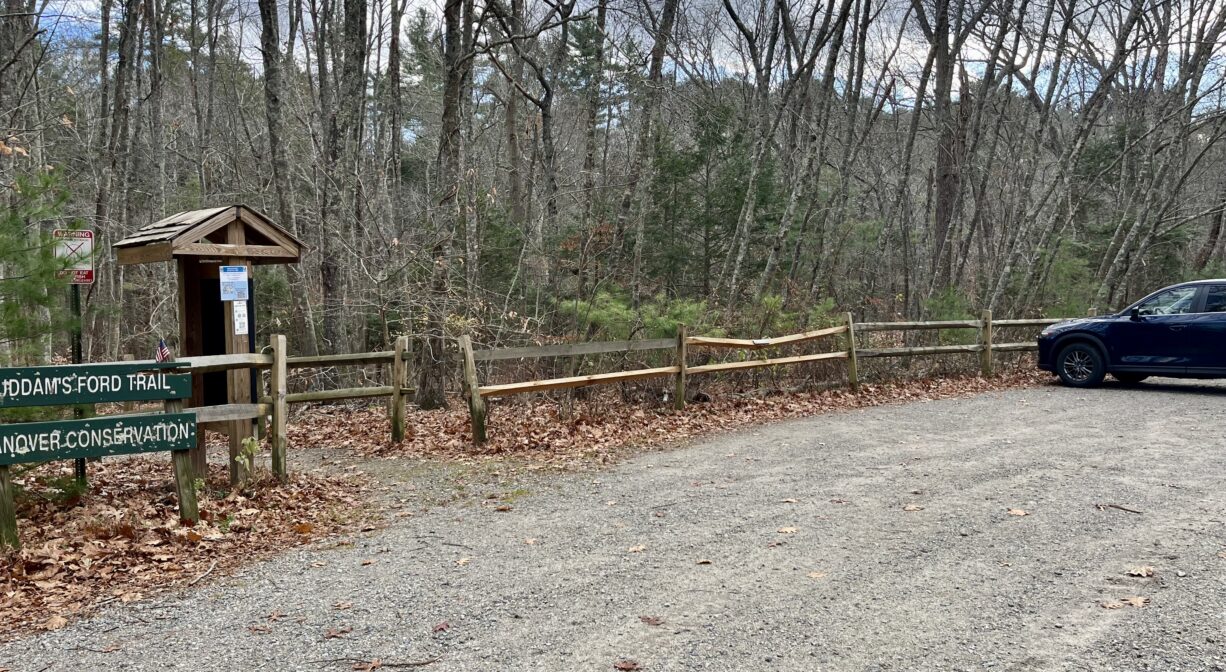
The primary trail at this property is a former railroad bed. There are secondary trails that lead to gorgeous views of the Indian Head River. The two types of trail intersect at numerous points along the two-mile stretch. The Indian Head River Trail makes a detour mid-route to skirt around the remains of the Waterman Tack Factory. The trail opens to Water Street, continues in front of the recently-renovated (and privately owned) factory building, and then ducks back into the woods immediately thereafter. Look for an informational kiosk. Access the trails at Ludden’s Ford Park in Hanover, at two locations on Water Street (near what used to be the Waterman Tack Factory), and at 1126 Broadway in South Hanover, across the intersection from Myette’s store.
Extend your walk by making a loop as follows: From Ludden’s Ford Park in Hanover, follow the Indian Head River Trail to Hanson. Cross the river at Cross/State Street (near Myette’s) and then enter Rocky Run Conservation Area on the Hanson side. Follow the trail through Rocky Run, then through the Tucker Preserve, and ultimately to Ludden’s Ford Park in Pembroke. Cross the river to return to your starting point. This route typically takes 2-3 hours.
Across the street from the Hanover section of Ludden’s Ford Park, look for the 0.26-mile Mattakeeset Trail, which extends parallel to Indian Head Drive, within view of the Indian Head River. It connects with the Hanover Public Launch, where you can continue your walk on the Chapman’s Landing and Iron Mine Brook Trails, immediately adjacent.
Habitats and Wildlife
The Indian Head River rises from French’s Stream in Rockland, Longwater Brook and the Drinkwater River in West Hanover, and Indian Head Brook in Hanson. It creates the boundary line between the towns of Hanover and Hanson, with several small brooks contributing to its flow. Just downstream of Cross Street (Hanover) / State Street (Hanson), Rocky Run Brook flows into the Indian Head from the Hanson side. One of Jesse Reed’s tack factories was on this brook, and before that a mill operated by Isaac Buck that produced wooden ware such as bowls, trays and skimmers.
Farther downstream is Ludden’s Ford, and beyond that is a spot called The Crotch, where the Indian Head joins Pembroke’s Herring Brook to create the North River. The North River flows 12 miles through Pembroke, Hanover, Norwell, Marshfield and Scituate, eventually making its way to Massachusetts Bay and the Atlantic Ocean.
FREE-FLOWING RIVERS are unaltered by human impact, and flow unobstructed, carrying and depositing nutrients and sediments along their corridors. They house essential native breeding grounds for migratory fish and provide for a biodiverse ecosystem. Prior to industrialized society, all rivers were free flowing, however, free-flowing rivers are now globally threatened, primarily by infrastructure. The section of the Indian Head River (IHR) immediately downstream of the Waterman Tack Factory site flows freely. Native fish in the IHR that need free-flowing rivers to complete their life cycle include brook trout, brown trout, rainbow trout and northern redbelly dace.
There are two dams leftover from the industrial use of the Indian Head River — the highly visible one at Ludden’s Ford, and the rock remnants of one just downstream of the State Street and Cross Street bridge in Hanson and Hanover. The dam at Ludden’s Ford Park is an obstruction for the thousands of river herring and shad that come each spring to spawn in the Indian Head River. There is a fish ladder on the dam, but it is difficult — if not impossible — to maintain, as it is in the middle of the spillway and impassable under certain conditions. The river is host to river herring, shad, eels, freshwater mussels, and native and stocked brown and Eastern brook trout.
ROCKY OUTCROPPINGS: Rock outcroppings and enormous glacial erratic boulders border the trail at various points. You can walk or climb right up onto many of them! This also provides an excellent view of the river. There are a few sections of rapids along this section of the Indian Head too.
The outcrop of rock near the western end of the trail, on both sides of the river, is the top of a 12,000-foot-thick sedimentary rock unit that was formed during the Pennsylvanian Era (300 million years ago [MYA]). Known as the Rhode Island Formation, it stretches across Southeastern Massachusetts and Rhode Island, from northeast to southwest. These sedimentary rocks are collectively included in what geologists call the Narragansett Basin. The Basin is approximately three miles wide at the mouth of the North River and fans out to about 22 miles wide in Bristol, Rhode Island.
Alternating layers of rock types can be seen of shale, sandstone and pebble conglomerate. The sedimentary environment for this deposit was a large, shallow, warm freshwater river system and associated lakes and swamps that filled with sediment and organic material.
During the Pennsylvanian Era, extensive shallow, freshwater wetlands across the globe were formed while global temperatures were several degrees warmer, resulting in the coal and oil deposits we use today. While difficult to find, several thin coal seams can be found on the other side of the river that contain fossilized ferns from the Pennsylvanian Era. During the 1970s energy crisis, several local universities studied the Basin for its potential coal reserves.
Originally deposited on top of older granitic rocks of the Precambrian Era (600 MYA), the Basin is now in contact with these granites at almost the same elevation; older granite can be found immediately to the north. This ancient border fault is now the North River/Indian Head River Valley Corridor. Remnants of this are seen here with what is called a “fault splay” off the main fault system. Looking at the outcrop, the original horizontal layers can be seen to be almost rolled and are cracked as a result of the faulting process. The steep drop in the rock to the south and the rapid rise in the rock on the other side of the river is the actual fault splay that the river now flows through.
LIFE AMONG LICHEN: Look for lichen on the rocks and stone walls along the Indian Head River Trails. Lichen is a pioneer species, and among the first to colonize a new environment in a process called “primary succession.” During primary succession, generations of pioneer species decay, enriching the soil and allowing more substantial and energy intensive plants to move in.
Lichen is a result of a symbiotic relationship between algae and fungi. Algae can photosynthesize and produce its own food, while fungi cannot. But fungi can break down organic matter and increase available nutrients in the soil. Algae and fungi work together to sustain their mutual existence; they flourish in nearly every ecosystem. In lichen, the algae produce sugars through photosynthesis, from which the fungi feed. In return, the fungi shelter the algae and prevent it from drying out, allowing the organism to live for hundreds, if not thousands, of years.
Lichen, like other photosynthesizing organisms, sequesters carbon and mitigates greenhouse gas emissions. It is, however, particularly sensitive to air pollution and in some cases, may die off or be replaced by a more pollution-tolerant species. Upon this discovery in the 1970s, the US Forest Service began using lichen to monitor air quality and pollution levels. Some types of lichen commonly found along the Indian Head River Trails include: Hypotrachyna sinus, Xanthoria polycarpa, and Chaenotheca furfuracea.


Historic Site: No
Park: No
Beach: No
Boat Launch: No
Lifeguards: No
Size: 2 miles
Hours: Dawn to Dusk
Parking: On-site parking and trail access at Ludden's Ford Park, 243 Elm Street, Hanover. Trail access and very limited parking also available on Water Street and at the State/Cross Street Bridge.
Cost: Free
Trail Difficulty: Easy, Medium
Facilities:
Historic markers, interpretive signage, benches.
Dogs: Dogs must remain on leash. Always clean up after your dog!
Boat Ramp: No
ADA Access: No
Scenic Views: Yes
Waterbody/Watershed: Indian Head River (North River watershed)