
2 Indian Head Dr, Hanover, MA 02339, USA
Owned By: Town of Hanover
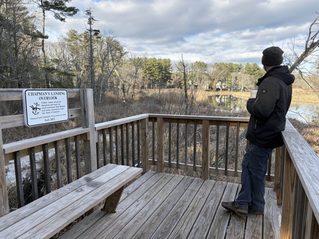
Totaling about 2 miles, Hanover’s Chapman’s Landing and Iron Mine Brook Trails traverse 50 acres of state and locally-owned conservation land on the Indian Head and North Rivers. In 2023, a tall observation platform was installed at the river’s edge, offering a spectacular view. Right next door at the Hanover Public Launch, look for the start of the Mattakeeset Trail, which connects to Ludden’s Ford Park in Hanover, and a network of trails along the Indian Head River.
Adjacent to this site is the Hanover Public Launch, an ideal place to launch your canoe or kayak to access the Indian Head River, the North River, Herring Brook, and freshwater tidal marsh that surrounds The Crotch. The Indian Head River between Chapman’s Landing and Ludden’s Ford is a popular spot for shad fishing.
Hunting is not permitted on this property.
FISHING ADVISORY: It’s important to know that some of our freshwater fisheries are contaminated with mercury, PFAS and/or other concerning substances. The Massachusetts Department of Public Health maintains an online database with up-to-date advisories regarding fish consumption, sorted by location. We recommend you consult this valuable resource when planning a fishing excursion.
Features
Long ago, the North River-built steamship Mattakeesett delivered iron ingots to the Hanover forges. It would travel upstream all the way to Chapman’s Landing, the westernmost shipping point on the river. Chapman’s Landing was also a popular spot for swimming, until the industrial refuse from the Clapp Rubber Mill upstream (1873+) made wading in the water extremely unappealing.
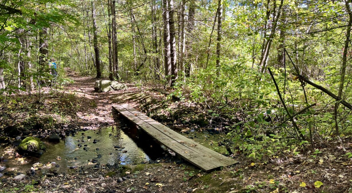
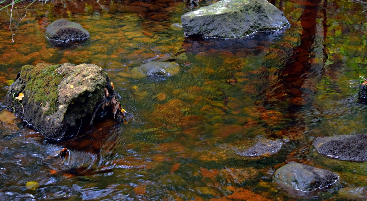
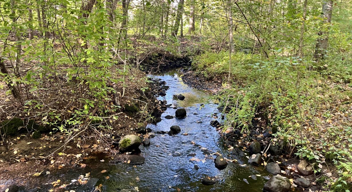
Iron Mine Brook flows into the Indian Head River at this spot. It rises in Randall’s Swamp in Hanover, and flows through the town conservation lands off Broadway (Folly Hill/Bog Iron Trails). There are several opportunities to view, and cross, the brook within this property. There are also several striking views of the lower reaches of the Indian Head River.
According to Hanover Conservation, the brook that flows into the Indian Head here was identified as Trout Brook on 1848 and 1849 maps, and retained that name until 1976, when it became Iron Mine Brook. Meanwhile, a short distance to the west, there is a different brook which was identified as Iron Mine Brook on an 1848 map. It retained that name going forward … but then lost its name entirely in 1976! This can be cause for confusion, especially when reading history books. Both brooks flow into the Indian Head River.
This land is within the region of the Massachusett (or Massachuseuk) Native American tribe. The Mattakeeset band of the Massachusett lived for thousands of years in the North River watershed. Their village included most of today’s Pembroke and Hanson. To learn more about local Native American tribes, we encourage you to interact with their members. The Massachusett tribe at Ponkapoag and the Mattakeeset band of the Massachusett share information on their websites.
Trail Description
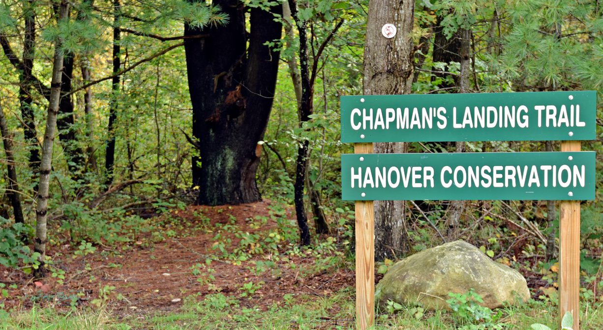
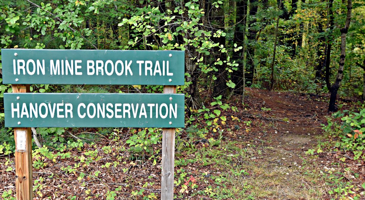
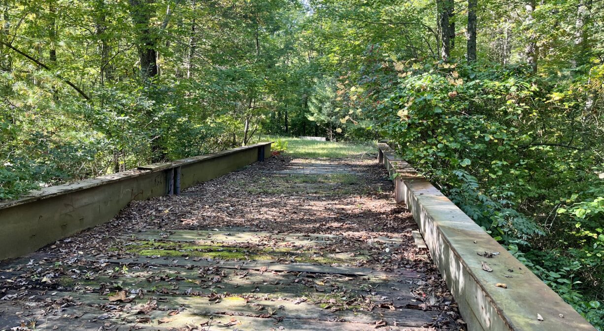
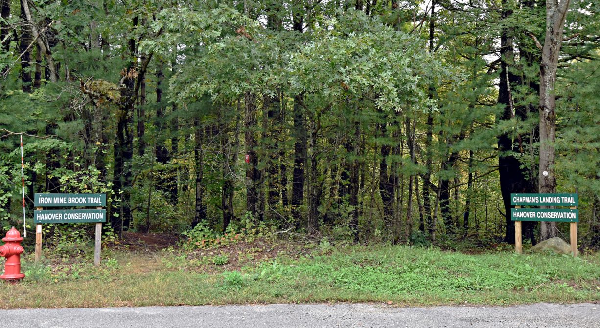
From the trailhead near the parking area, the Iron Mine Brook Trail extends through the woods, crossing the brook twice, and also crossing Riverside Drive. At the edge of the property, it intersects with an old railroad bed and eventually loops back around. You can return the way you came, or veer off to the left, to access the Chapman’s Landing Trails. Note: The railroad bed also provides a trail connection to River Road in Hanover.
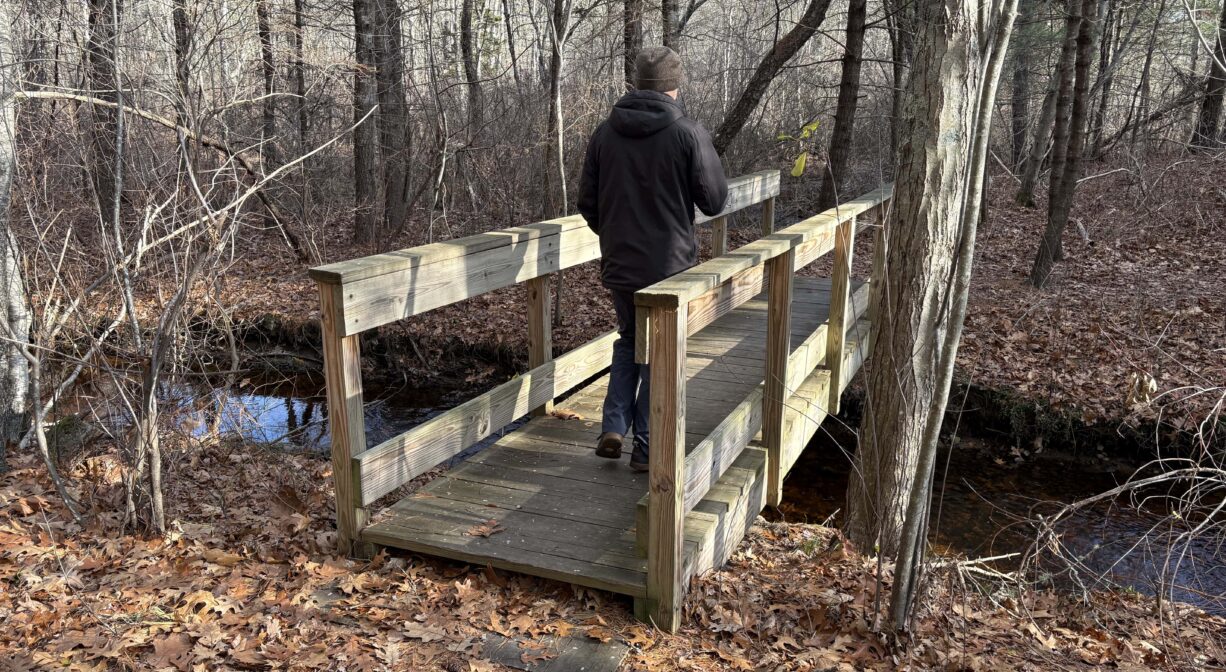
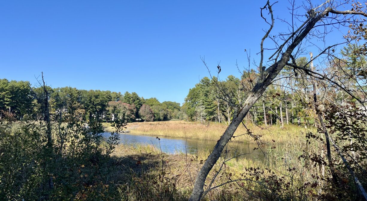
Chapman’s Landing also has a trailhead near the parking area. There are several intersecting paths that loop through woods and wetlands, with views of the Indian Head River, the North River, and the freshwater tidal marsh that surrounds them. Along the way, you’ll find numerous footbridges and plank boardwalks, plus a tall observation platform at the edge of the river. Climb to the top and enjoy the spectacular view! This property borders Hanover Water Protection land. Please respect the signage and fencing that demarcates it.
The trails are blazed in green and red. Some are wide and clear; others are narrow and rooty.
In addition, the Mattakeeset Trail begins here and extends parallel to Indian Head Drive, within view of the river, and connects with the 4-mile Indian Head River Trails system at Ludden’s Ford Park in Hanover.
Habitats and Wildlife
The forest here is primarily pine, with some oak, beech, holly, and the occasional cedar. Look for high bush blueberry in season. There are some old stone walls, where you might see critters. There’s also an enormous, and intriguing, pile of stones, in the section of the property near the North River. And a surprising amount of quartz.
Iron Mine Brook is a cold, groundwater fed, freshwater tributary to the Indian Head River. This type of stream habitat supports eastern brook trout (Salvelinus fontinalis), which is part of the salmon family. These fish depend on cold, clean, oxygen-rich water, and cannot live in water temperatures above 68°F. Once abundant and highly valued by fishermen, eastern brook trout populations are now diminished in eastern Massachusetts due to habitat loss and are considered a species in need of conservation.
In 2017, the NSRWA, the town of Hanover, the Sheehan Family Foundation and the Southeastern Mass. Trout Unlimited Chapter 241 removed a culvert that fragmented the brook’s habitat, opening the stream to allow summer refuge for fish from the warmer waters of the Indian Head River, plus access to the brackish waters downstream in the North River. (Check out this link to a restoration project.)
Other habitat issues still remain, due to the groundwater wells for the town of Hanover’s drinking water (upstream). In the summertime, flows are diminished by increased water consumption, in particular for irrigation of lawns. Conserving water will help ensure this iconic species remains a part of our natural heritage.
To fully experience the “cold water brook,” and feel the difference in temperatures, get in the water at the Hanover Public Launch. Wade straight in, and notice the temperature of the water, which has been heated by the damming of the river upstream. Now wade over to the left, where Iron Mine Brook enters the Indian Head. It’s much cooler! You can immediately detect about a 10 degree difference in temperature. This cooler, oxygen-rich water affords brook trout some respite during the warmer months.
This property is located on the Indian Head River. The Indian Head River rises from the Drinkwater River and Factory Pond in West Hanover. It forms the boundary between Hanover and Hanson, and merges with Pembroke’s Herring Brook, a short distance downstream of Ludden’s Ford Park, to form the North River at a spot called The Crotch. The North River flows 12 miles through Pembroke, Hanover, Norwell, Marshfield and Scituate, eventually making its way to Massachusetts Bay and the Atlantic Ocean.


Historic Site: No
Park: No
Beach: No
Boat Launch: Yes
Lifeguards: No
Size: 28 acres
Hours: Dawn to Dusk
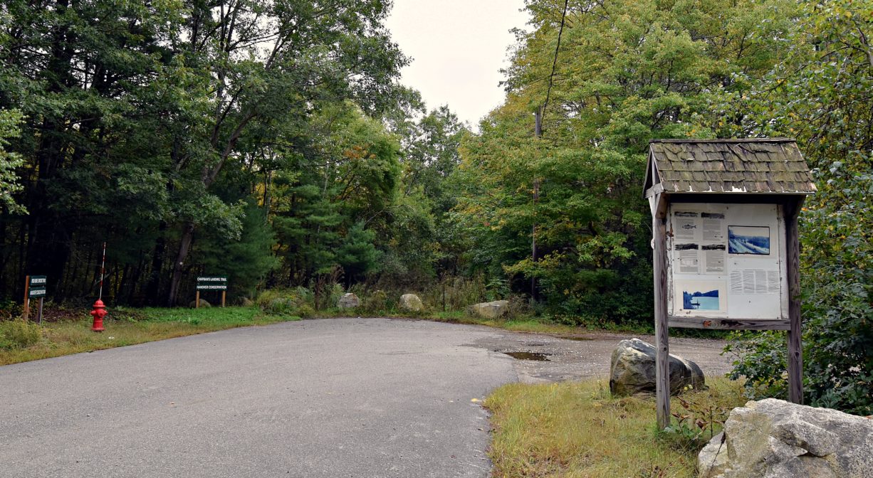
Parking: Ample on-site parking at the end of Indian Head Drive.
Cost: Free
Trail Difficulty: Easy
Facilities:
Interpretive signage, footbridge, observation platform.
Dogs: Dogs must remain on leash. Always clean up after your dog!
Boat Ramp: No
ADA Access: No
Scenic Views: Yes
Waterbody/Watershed: Iron Mine Brook and Indian Head River (North River watershed)