
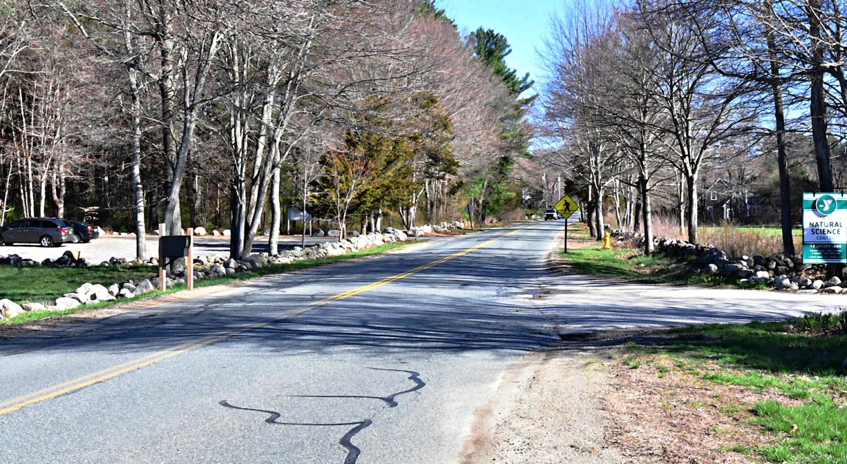
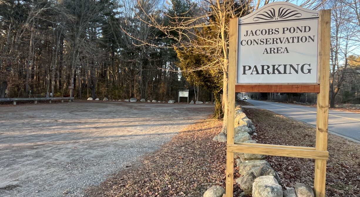
81 Jacobs Ln, Norwell, MA 02061, USA
Norwell Conservation: (781) 659-8022
Owned By: Town of Norwell
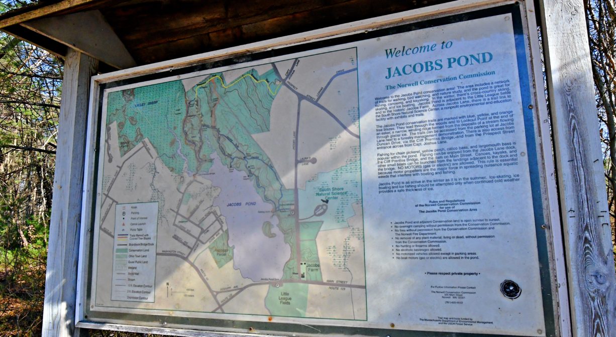
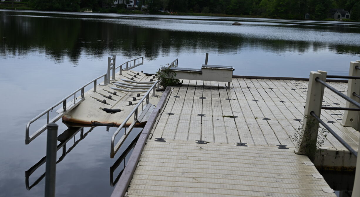
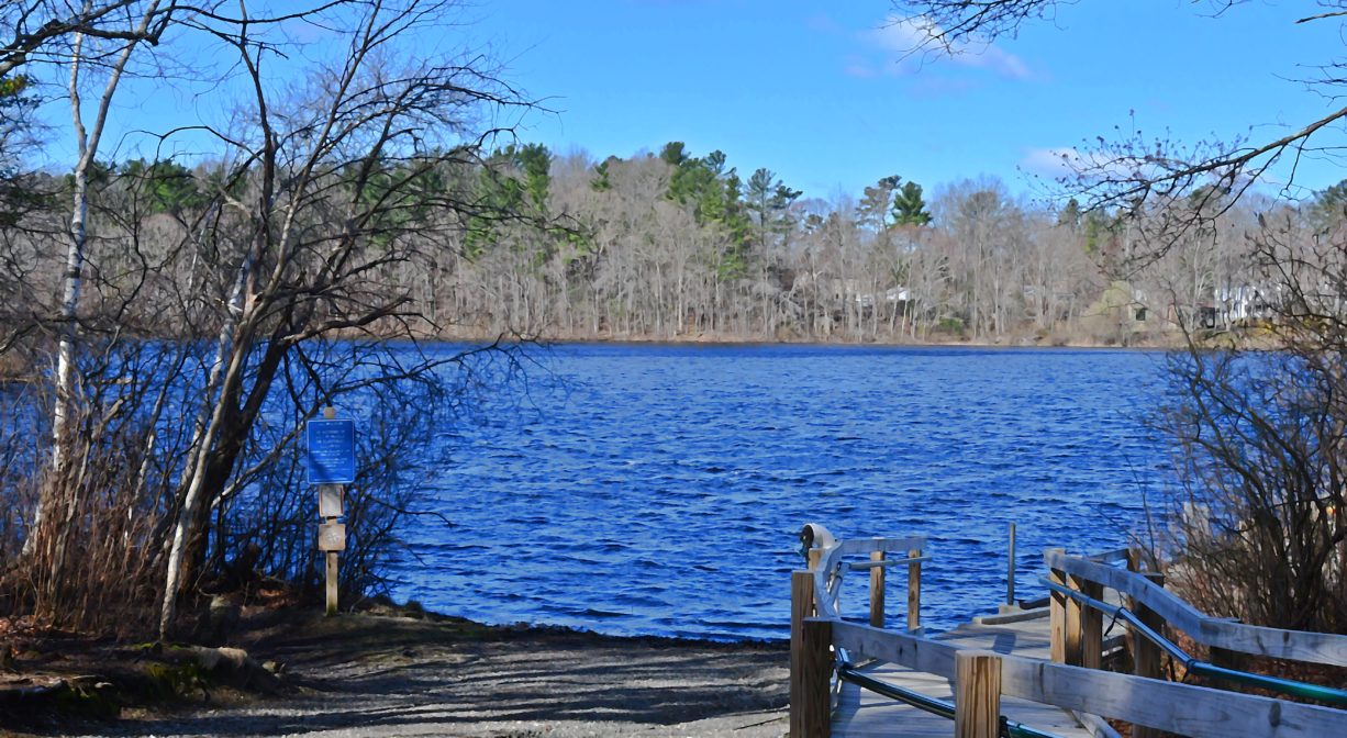
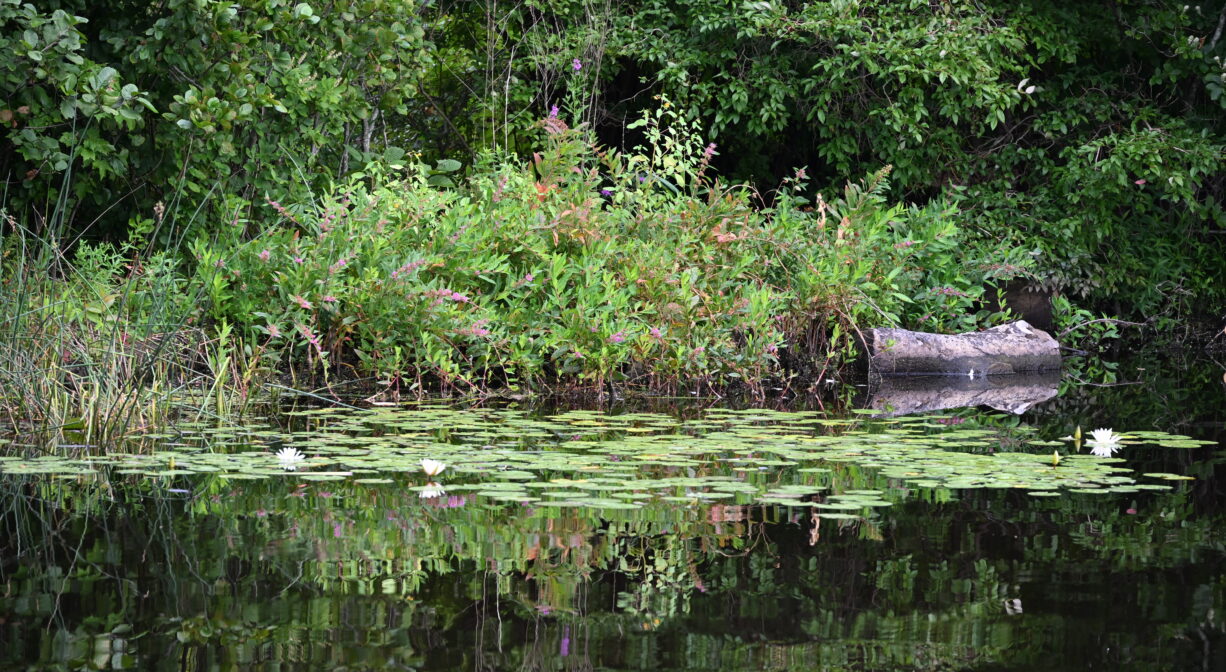
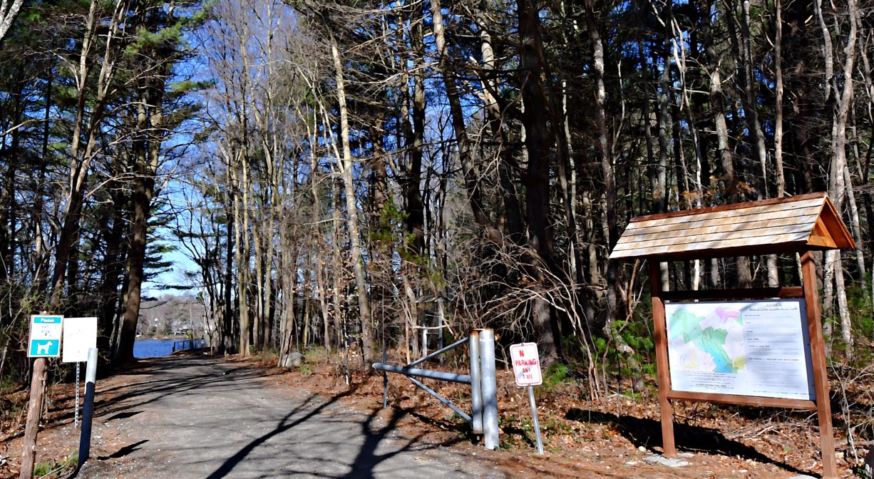
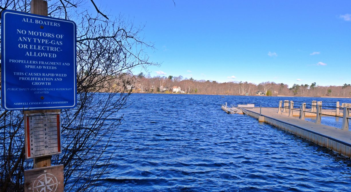
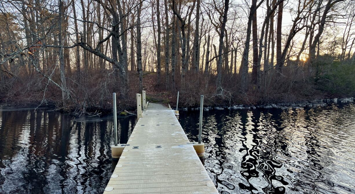
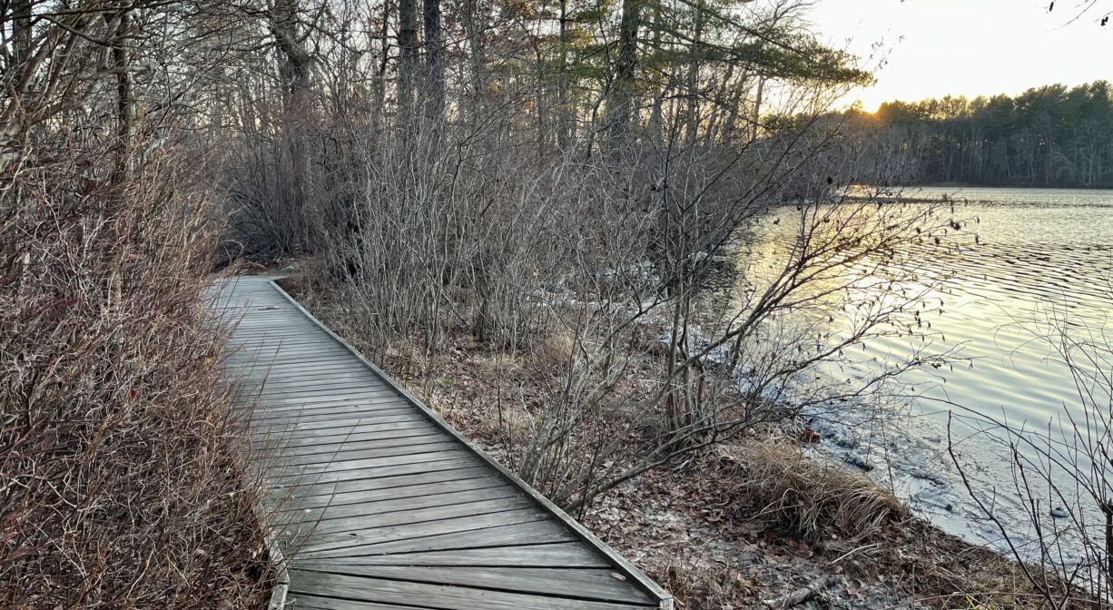
The Jacobs Pond Conservation Area features 189 acres of Norwell Conservation land with a 3-mile trail system around the north and east sides of the 60-acre pond, and occasional boardwalks.There are canoe/kayak launches at both the Jacobs Lane and Duncan Drive entrances. The former features an ADA-accessible kayak launch along with a fishing area. Other fishing locations on the property include the Cliff Prentiss Bridge near Duncan Drive, the island within the pond, and the water’s edge along Main Street. No motors (gas or electric) are permitted on the pond. Winter activities here include cross country skiing, ice skiing, ice boating, and ice fishing.
Extend your visit with a walk on the Jacobs Homestead Trail, which shares the parking lot on Jacobs Lane.
Note: Norwell Conservation posted the following alert in April 2026: “Jacobs Island will be closed to public access for the foreseeable future. The Beech trees on the island have succumb to both Beech Bark and Leaf disease and pose a significant hazard as they drop limbs, snap, and fall over. Due to this, it is unsafe to use the island for any reason. The bridge to the island is currently closed and signage is posted around the parking and dock areas. Portions of the bridge will be removed in the near future. The island will remain closed until we are able to eliminate the hazards.”
HUNTING: Those who hold town-issued permits may use only the western portion of this property (west of trails JP10 and JP13) for seasonal hunting and trapping. Hunting is not allowed on, or across, any trail. Visit the hunting page on Norwell’s website for details. Non-hunters, be mindful of hunting seasons, and wear bright orange if you’re entering the property during those times. Hunting is not permitted on Sundays.
FISHING ADVISORY: It’s important to know that some of our freshwater fisheries are contaminated with mercury, PFAS and/or other concerning substances. The Massachusetts Department of Public Health maintains an online database with up-to-date advisories regarding fish consumption, sorted by location. We recommend you consult this valuable resource when planning a fishing excursion.
Features
Jacobs Pond was created in 1723 when Third Herring Brook was dammed, at Main Street, to create power for a grist mill and later a sawmill. The sawmill burned down in 1920. There was also a brick manufacturing facility at this site (1680-1830).
The area itself is known as Assinippi. The name, given by early native inhabitants, means “rocky water.” There was a Native American settlement here prior to European contact, and there is a Native American burial ground across the street at the Union Cemetery. The pond was originally called Snapper (or Snappet) Pond. “Snapper/Snappet” was a play on the word “Assinippi.” Later it was named for the Jacobs family, whose farmhouse, barn, and hay fields are located on Jacobs Lane (now overseen by Norwell’s Conservation and Historic Commissions).
This land is within the region of the Massachusett (or Massachuseuk) Native American tribe. For thousands of years, the land today known as Norwell was inhabited by indigenous people who grew crops, foraged, hunted, and fished in the Assinippi and North River areas. Circa 1617, a major outbreak of disease decimated an estimated 90% of the native population in New England. Descendants of these original inhabitants are living here today. They are known as the Mattakeesett Tribe of the Massachusett Indian Nation, the Massachusett Tribe at Ponkapoag, the Herring Pond Wampanoag, and the Mashpee Wampanoag tribe.
Trail Description
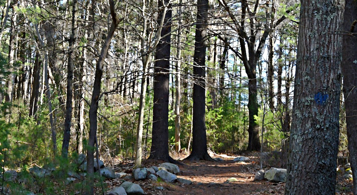
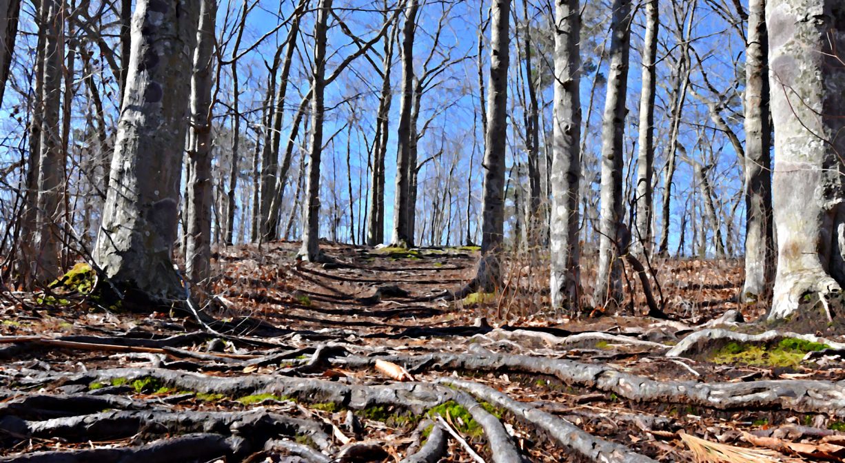
Trail access is provided in 3 areas: at Jacobs Lane, at Prospect Street, and via the Cliff Prentiss Bridge off Duncan Drive. From the Jacobs Lane parking area, a dirt road leads to the pond and the 3-mile trail network. (Note: the boardwalk to the island was closed in April 2026. See note at top for details.) The trails are mostly dirt, but there are additional boardwalks that traverse wetlands. While generally flat, some of the terrain is uneven due to tree roots. Along the western side of the pond, the trail follows an esker ridge. Also nearby, the Jacobs Homestead Trail extends along the edge of the pond, through a light woodland and beside the agricultural fields of the historic Joshua Jacobs Homestead.
Habitats and Wildlife
The headwaters for Third Herring Brook are located north of Jacobs Pond, in the southern portion of Valley Swamp. Third Herring Brook exits the pond from the southern side, at the dam. The brook forms the border between Norwell and Hanover, and flows into the North River downstream of the old stone bridge on Washington Street.
The North River rises from marshes and springs in Weymouth, Rockland and Hanson. It is approximately 10 miles in length, with its source at the confluence of the Indian Head River (Hanover) and Herring Brook (Pembroke). From there it flows through the towns of Hanover, Pembroke, Marshfield, Norwell, and Scituate to the Atlantic Ocean between Third and Fourth Cliffs, draining approximately 59,000 acres along the way.
Between Jacobs Pond and Historic Sylvester Field in Hanover, there aren’t many public places to view Third Herring Brook, but it’s exciting to consider everything that has been happening there lately! Since 2014, NSRWA has worked with federal, state, and local officials to remove three obsolete dams from the brook. (The dams were originally constructed to provide water power to sawmills and grist mills.) As a result, water quality has improved and wildlife habitat has been restored. We are watching closely with the hope of seeing brook trout and river herring return to their now-restored habitat.
Locations of the dam removals:
• The Mill Pond Dam, located behind today’s Hanover YMCA, dates back to about 1690, and was originally built by the Curtis family. Later owners were T. J. Gardner and Samuel Church, who operated both a sawmill and a grist mill on site. The last mill building burned down in 1937. After a partial collapse of the dam in 2001 and a breach of the dam in 2010, the NSRWA and the Hanover YMCA worked together to raise funds for removal of the dam. It was removed in 2014 — the first dam removal in our watershed!
• The Tack Factory Pond (or Tiffany Pond) Dam, located on Cardinal Cushing School property, was established in the 1670s by Charles Stockbridge for a grist mill. Later Recompense Tiffany took over operations, and the mill pond was named for him. In 1834, Zephaniah Talbot and Samuel Salmond established a tack factory on site. The factory building remained in use into the 20th century. According to Joseph Merritt’s History of South Scituate-Norwell, Samuel Salmond Sylvester owned it in 1938. The factory burned down in 1983, and the dam was removed in 2016.
• The Peterson Pond Dam, located behind the former (1976-2016) site of the Hanover Mall Cinema, was established on a mill privilege originally associated with John Clapp, who operated a sawmill there in 1653. The last mill was torn down around 1918. The current property owner, Hanover Crossing, opted to remove the dam in 2020, as part of the Hanover Mall redevelopment project.
• There was also a sawmill at Jacobs Pond, operated by the Jacobs family. The dam is still in place, and unlikely to be removed, but we are working with federal, state and local officials to install a fish ladder there.
At Jacobs Pond, the pond and conservation area provide habitat for small mammals, fish, turtles, frogs and birds. Common fish found here include chain pickerel, yellow perch, calico bass, and largemouth bass. Listen and watch for toads, turtles, and a variety of frogs (bullfrogs, green frogs, pickerel frogs). You may see snapping turtles and northern water snakes too.
The forest surrounding the pond is made up primarily of pine and oak, but you’ll also find beech, hemlock, maple, and a few clusters of mountain laurel. In the wetlands, look for ferns and skunk cabbage. Also present, a small pocket of Inland Atlantic White Cedar Swamp, and some Acidic Shrub Fen.
Sources: L. Vernon Briggs – History of Shipbuilding on North River, Plymouth County, Massachusetts (1889); Joseph Foster Merritt – A Narrative History of South Scituate-Norwell, Massachusetts (1938), and John Stetson Barry – A Historical Sketch of the Town of Hanover, Mass., with Family Genealogies (1853).


Historic Site: No
Park: No
Beach: No
Boat Launch: Yes
Lifeguards: No
Size: 189 acres
Hours: Dawn to Dusk
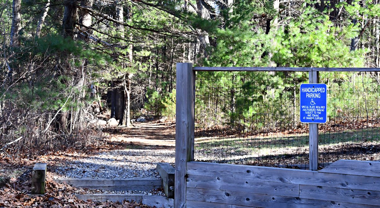
Parking: Limited on-site parking at 81 Jacobs Lane and at Duncan Drive.
Cost: Free
Trail Difficulty: Easy
Facilities:
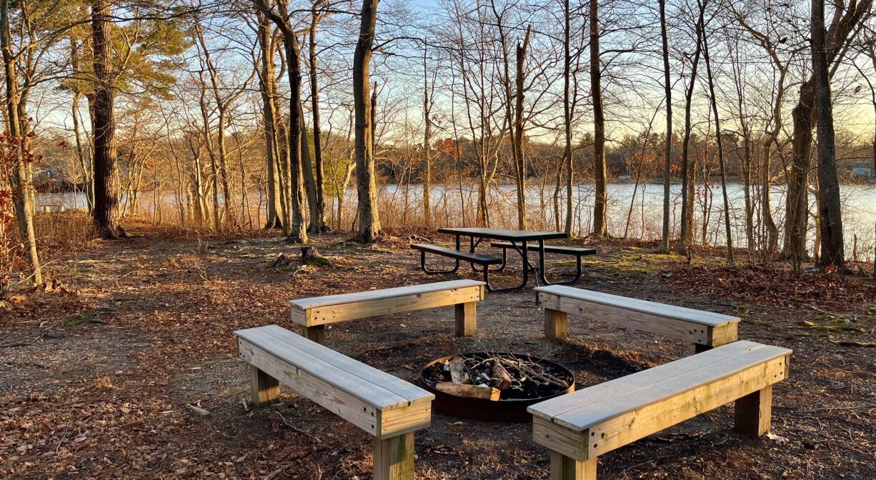
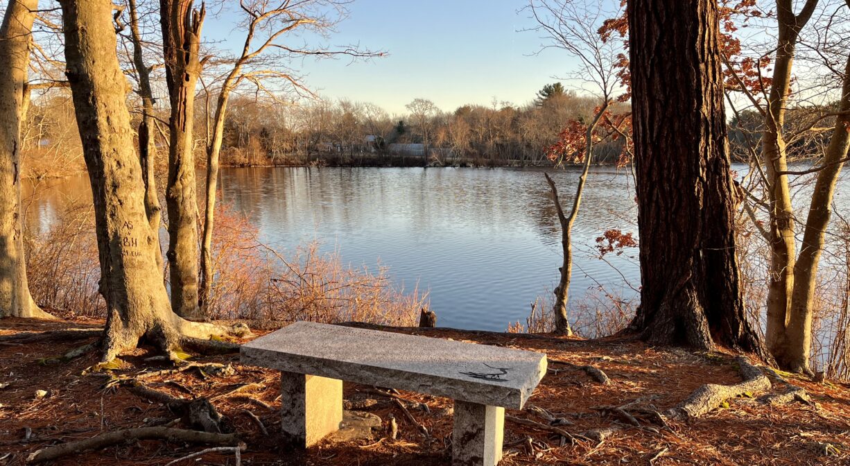
Benches, picnic tables, fishing area, ADA-accessible kayak launch, geocache.
Dogs: Dogs must remain on leash. Always clean up after your dog!
Boat Ramp: No
ADA Access: Fishing area and picnic tables near the fishing area are ADA-Accessible.
Scenic Views: Yes
Waterbody/Watershed: Third Herring Brook (North River watershed)