
21 Triphammer Rd, Hingham, MA 02043, USA
Hingham Conservation: 781-741-1445
Owned By: Town of Hingham
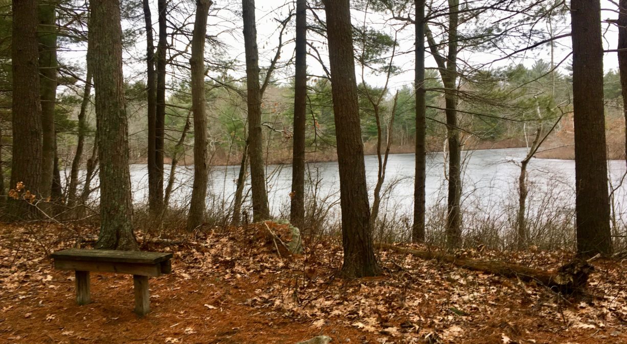
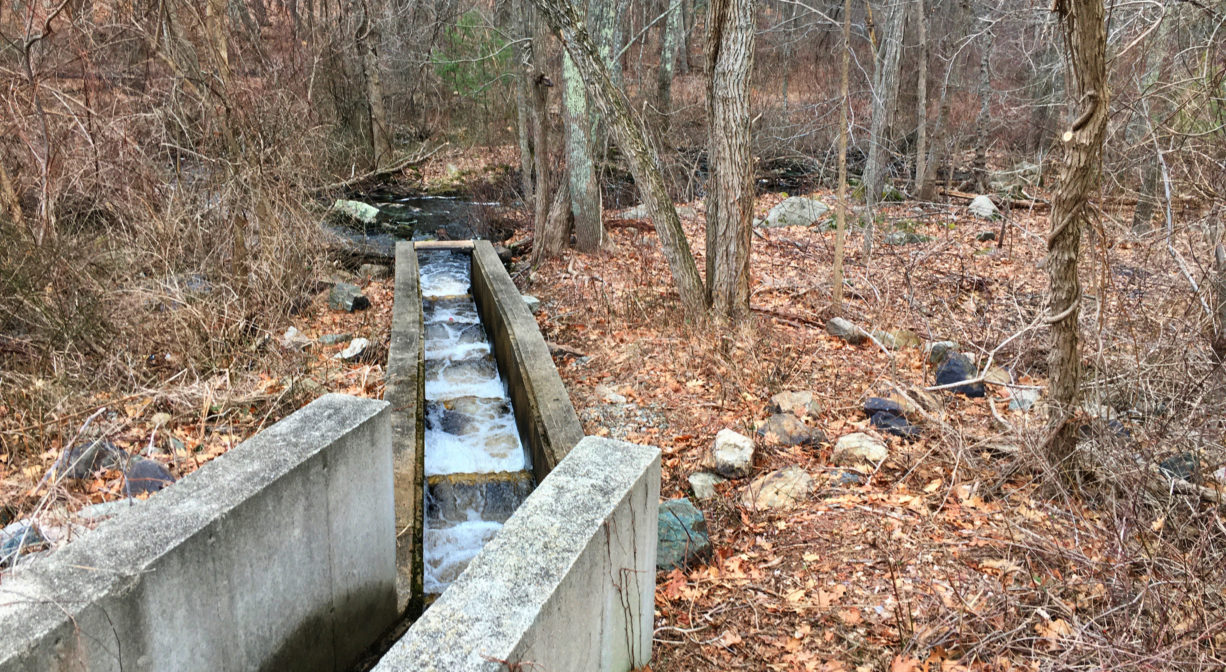
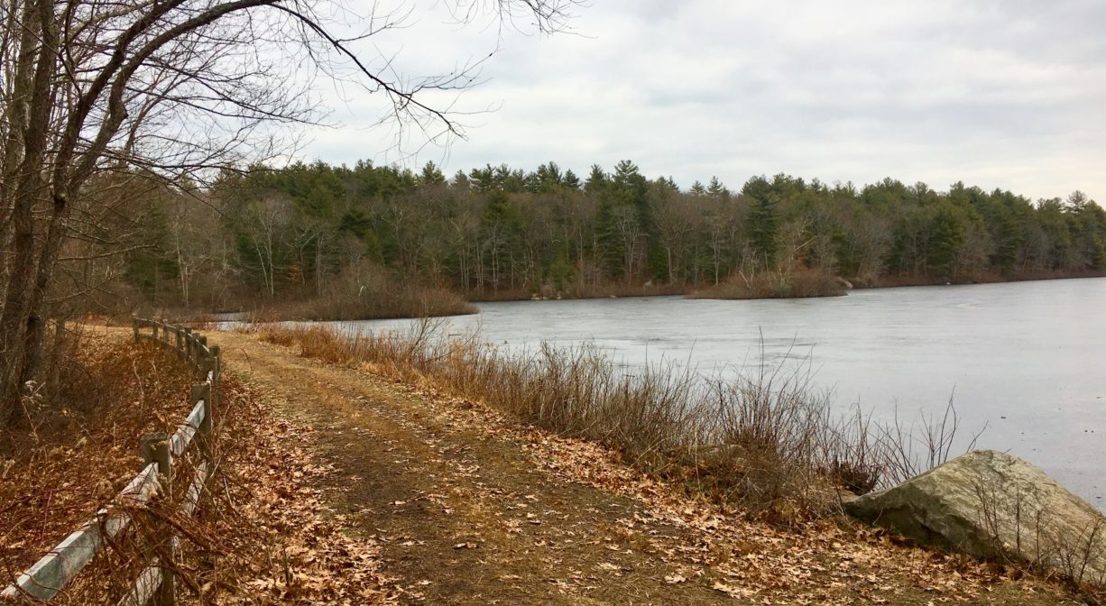
Hingham’s Triphammer Pond Conservation Area is a 19-acre pond surrounded by woods. Features include a 1-mile walking trail around the perimeter, occasional stone walls, and numerous glacial erratics. Some of the shoreline is suitable for launching canoes and kayaks. Try ice skating here in the winter. Watch for migrating fish (in the fish ladder) in the spring. The trails link directly to Wompatuck State Park.
HUNTING: Limited bow hunting is allowed, by Special Permit only, through the Hingham Conservation Commission. For more information, go to Hingham Conservation Land/Hunting. Non-hunters, be mindful of hunting seasons, wear bright orange if you’re entering the property during those times, and leash your dogs. Hunting is not permitted on Sundays.
FISHING ADVISORY: It’s important to know that some of our freshwater fisheries are contaminated with mercury, PFAS and/or other concerning substances. The Massachusetts Department of Public Health maintains an online database with up-to-date advisories regarding fish consumption, sorted by location. We recommend you consult this valuable resource when planning a fishing excursion.
Features
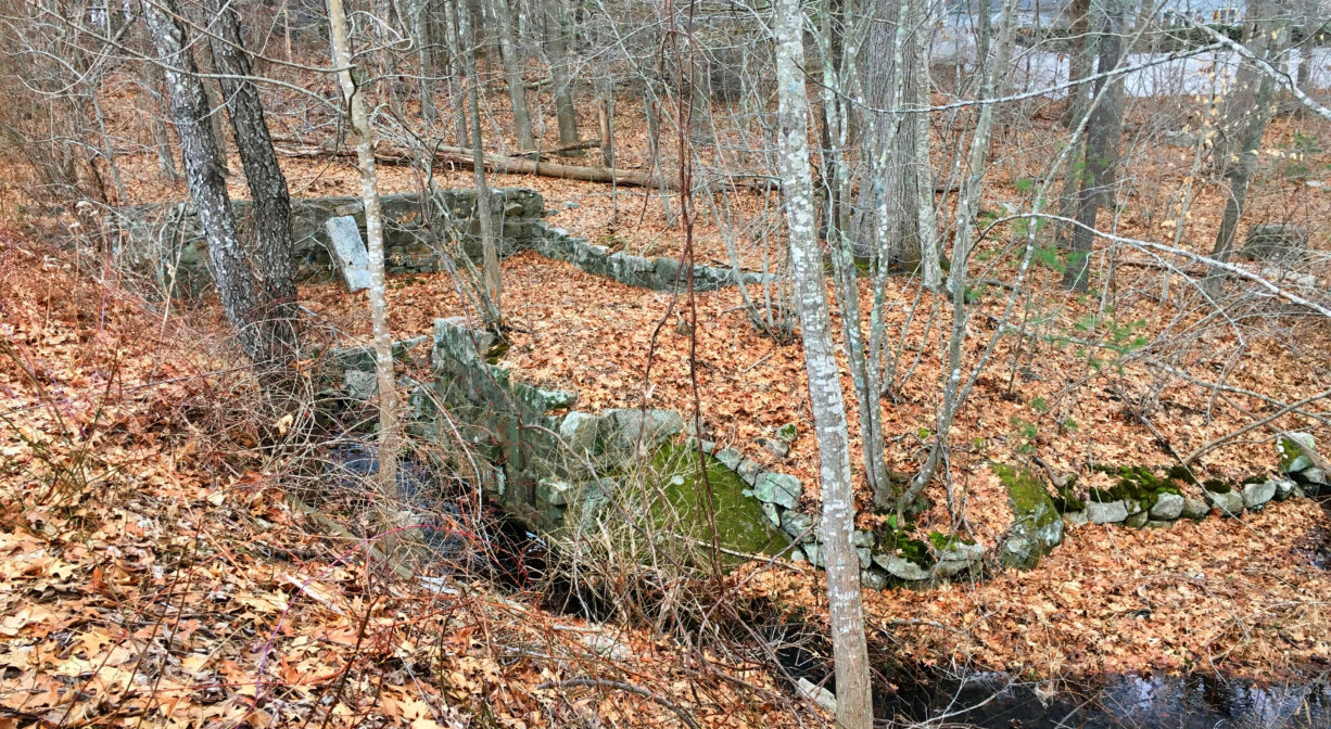
According to interpretive signage on site, the Matthew Curtis family built the first mill at this location c. 1700. A sawmill, it was used by the family for over a century, producing various lumber products. It burned down in 1823. Later a new mill was constructed on site. It made products for the maritime industry. Originally the pond was known as Saw-Mill Pond. Later, due to the presence of a triphammer at the mill, it became known by its present name.
Triphammer Pond was acquired by the Town of Hingham in 1945. Triphammer Woods, an adjacent woodland, was acquired in 1995, protecting the entire shoreline of the pond. Walk across the dam and look for the remains of an old mill below. Non-motorized boating is permitted on the pond.
This land is within the region of the Massachusett (or Massachuseuk). To learn more about local Native American tribes, we encourage you to interact with their members. The Mattakeeset band of the Massachusett and the Massachusett tribe at Ponkapoag share information on their websites.
Trail Description
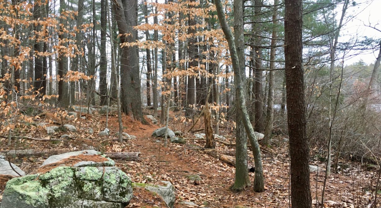
A rugged, unmarked trail extends for just over a mile around the pond. It is mostly on Hingham Conservation land, but passes briefly through Wompatuck State Park (between markers N16 and N11). The trail is sometimes rocky and rooty. There are two short boardwalks and several spots where the trail extends close to the water, where you can pause to enjoy the view … often while standing atop a large rock.
Habitats and Wildlife
The forest here is primarily pine and oak, with some beech, holly and hickory, plus sweet pepper bush, green brier, and ferns. Red maple dominates the swampy areas. The terrain is rocky in places, with a number of glacial erratic boulders and the occasional rocky outcropping. Deer hunting is permitted here between October 19 and November 28, with a special permit from the Town of Hingham.
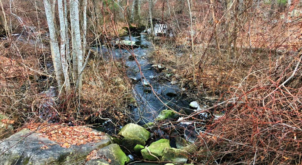
Triphammer Pond was created when Accord Brook was dammed in the 1600s to provide power for a sawmill. Accord Brook flows from Wompatuck State Park, through Triphammer Pond, and eventually into the Weir River.
Formed at the confluence of Crooked Meadow River and Fulling Mill Brook, the Weir River flows for a mile or so north through Hingham. Farther downstream, it turns northeast and flows for another 1.4 miles, through Weir River Farm and eventually into Foundry Pond. The Weir River Estuary, designated by the Commonwealth of Massachusetts as an Area of Critical Concern, begins just below the manmade dam at the pond. The mile-wide estuary forms the border between Hingham and Hull, and empties into Hingham Bay. For more information about the Weir River, follow the Weir River Watershed Association.


Historic Site: No
Park: No
Beach: No
Boat Launch: Yes
Lifeguards: No
Size: 98 acres
Hours: Dawn to Dusk
Parking: Limited on-site parking. Look for the unpaved driveway between #75 and #128 Popes Lane. Continue driving about 1/4 mile beyond the conservation area sign.
Cost: Free
Trail Difficulty: Easy, Medium
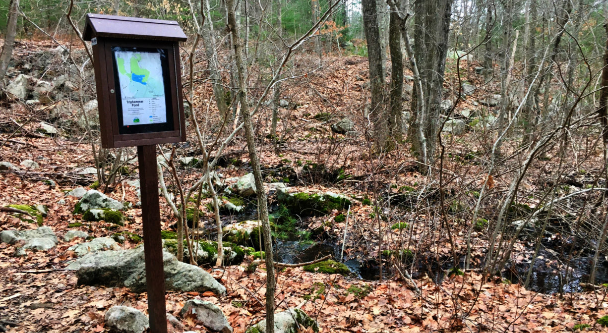
Facilities:
Informational kiosk, boardwalks, trailside picnic table, and two benches overlooking the pond. Simple launch area for canoes, kayaks and other small boats.
Dogs: Dogs must remain on leash. Always clean up after your dog!
Boat Ramp: No
ADA Access: No
Scenic Views: Yes
Waterbody/Watershed: Accord Brook (Weir River watershed)