
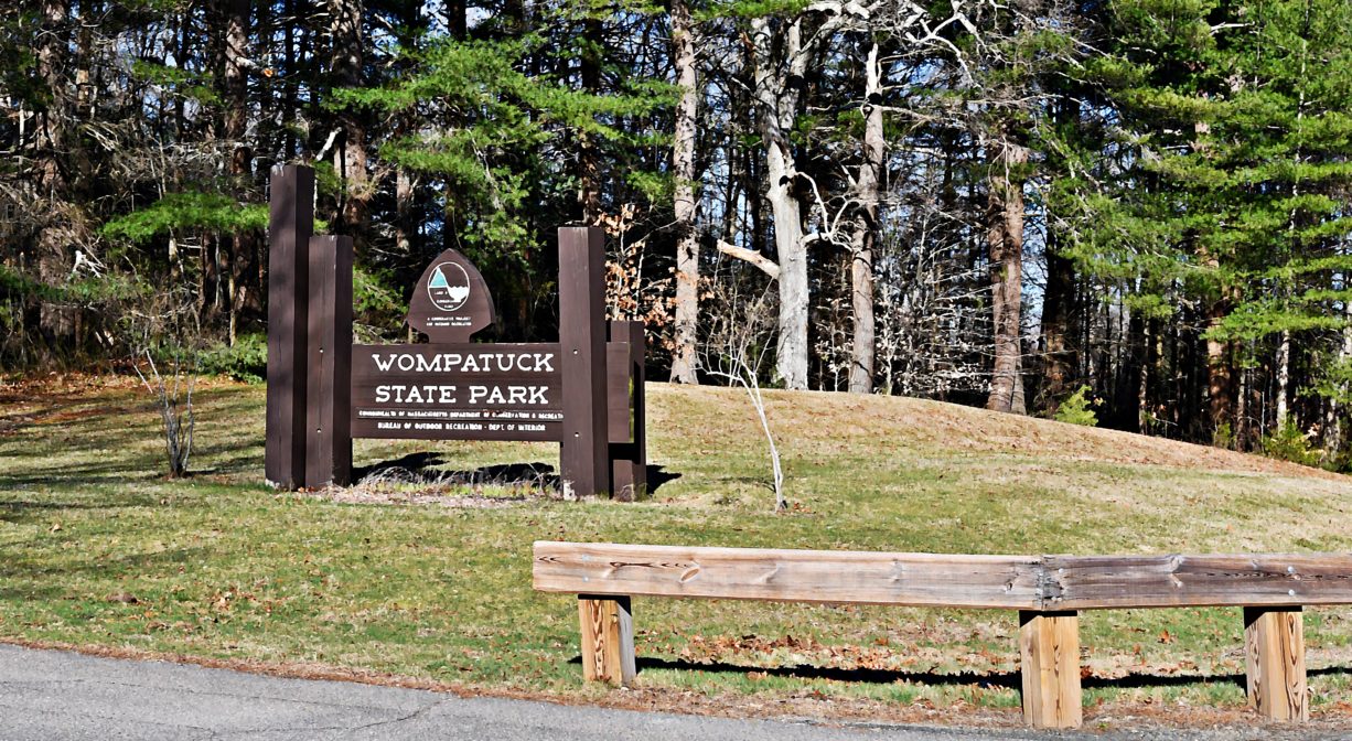
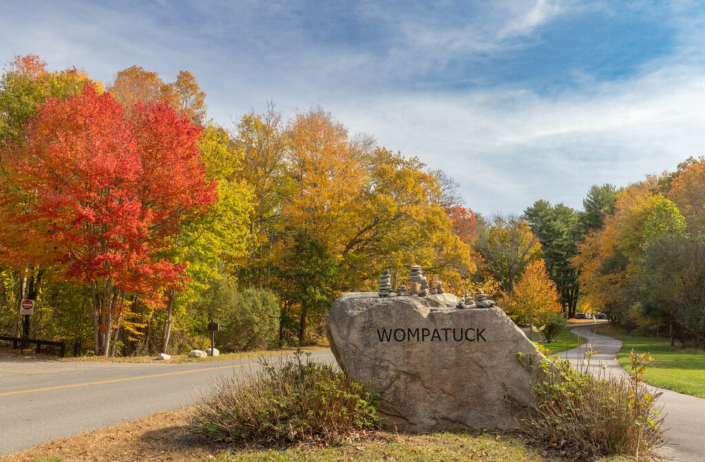
204 Union St, Hingham, MA 02043, USA
Wompatuck State Park: (617) 895-8245
https://www.mass.gov/locations/wompatuck-state-park
Owned By: Commonwealth of Massachusetts
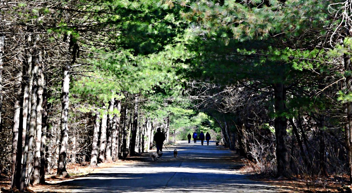
The 3,500-acre Wompatuck State Park stretches into four towns – Hingham, Cohasset, Scituate and Norwell. There are 12 miles of paved bike paths, plus off-road trails for hiking, mountain biking, horseback riding and cross-country skiing. The park features numerous seasonal campsites, plus fishing and non-motorized boating on the Aaron River Reservoir. There are many rocky outcroppings and glacial erratic boulders throughout the property. Some trails are stroller- and wheelchair-friendly.
Other access points include: Leavitt Street Entrance, Hingham • Triphammer Pond Conservation Area, Hingham • Whitney Spur Rail Trail, Cohasset • Whitney & Thayer Woods, Cohasset • Doane Street Entrance, Cohasset • Aaron River Reservoir and Dam, Cohasset • Brass Kettle Conservation Area, Cohasset • Grove Street, Norwell • Mt. Blue Street, Norwell
FISHING ADVISORY: It’s important to know that some of our freshwater fisheries are contaminated with mercury, PFAS and/or other concerning substances. The Massachusetts Department of Public Health maintains an online database with up-to-date advisories regarding fish consumption, sorted by location. We recommend you consult this valuable resource when planning a fishing excursion.
HUNTING: Hunting is not permitted in this section of the park. Deer hunting is not permitted on this property. Limited game hunting is permitted in season, by licensed persons in compliance with Massachusetts law, but only in the section of the park west of Union Street/Mt. Blue Street, and south of the Aaron River, including the area known as “Prospect Hill.” Please be sure to understand state and local hunting guidelines before proceeding. Non-hunters, be mindful of hunting seasons, and wear bright orange if you’re entering the property during those times. Hunting is not permitted on Sundays.
Features
The land at Wompatuck State Park was commonly used by the Massachusett tribe, led by Chief Josiah Wompatuck. Local history books indicate that in 1655, he conveyed the rights to a large tract of land on the South Shore to European settlers. Please bear in mind that Native American cultures often favor oral histories to written ones. Much of what’s recorded about the history of the South Shore is from the perspective of European settlers. It’s not the whole story.
For thousands of years, the land that today is known as Norwell was inhabited by indigenous people who grew crops, foraged, hunted, and fished in the Assinippi and North River areas. Circa 1617, a major outbreak of disease decimated an estimated 90% of the native population in New England, including the Massachusett and Wampanoag tribes that inhabited the South Shore. There are still descendants of these original inhabitants living here today. To learn more about our local tribes, we encourage you to interact with their members. The Mattakeeset band of the Massachusett, the Massachusett tribe at Ponkapoag, the Herring Pond Wampanoag, and the Mashpee Wampanoag also share information on their websites.
In the 1700s, early settlers and ship captains held title to the Wompatuck State Park area, but the land was never extensively developed. During the 1800s, families maintained woodlots and grazing lands there, and the streams powered the Stockbridge Shingle Mill. Water from Mt. Blue Spring was commercially bottled.
The property served as military site from 1941 to 1965. In 1941, the United States government established the Hingham Naval Ammunition Depot Annex (known by locals as the “Cohasset Annex”). Land was acquired from private homeowners for the purpose of expanding the Hingham Naval Ammunition Depot nearby. It remained in use until 1965, and served both World War II and the Korean Conflict.
Scattered throughout the property are over 100 decommissioned military bunkers, which were used to store ammunition. Explosives such as TNT-loaded depth charges, bombs, fuses, projectiles, and cartridges were produced and stored here. Many of these bunkers have been backfilled, but some remain exposed. There are several old military buildings on the property, as well as an abandoned railroad. Most buildings have had their roofs and windows removed, and are open to the elements.
The U.S. Navy deactivated the Cohasset Annex in 1963 and declared the land “surplus.” The Commonwealth of Massachusetts took possession of the land in 1966, and began developing it as a public park the following year. The park itself opened in 1969. Since then, 725 acres have been added.
A railroad spur, the Whitney Spur, once connected the Ammunition Depot to the Old Colony Railroad’s Greenbush Line. In 2003, the DCR sold the land for the Cohasset commuter rail station and parking lot to the MBTA, in exchange for the construction of a rail trail on the former rail spur. The 1.5-mile Whitney Spur Rail Trail now connects the Cohasset MBTA station to Wompatuck State Park.
Trail Description
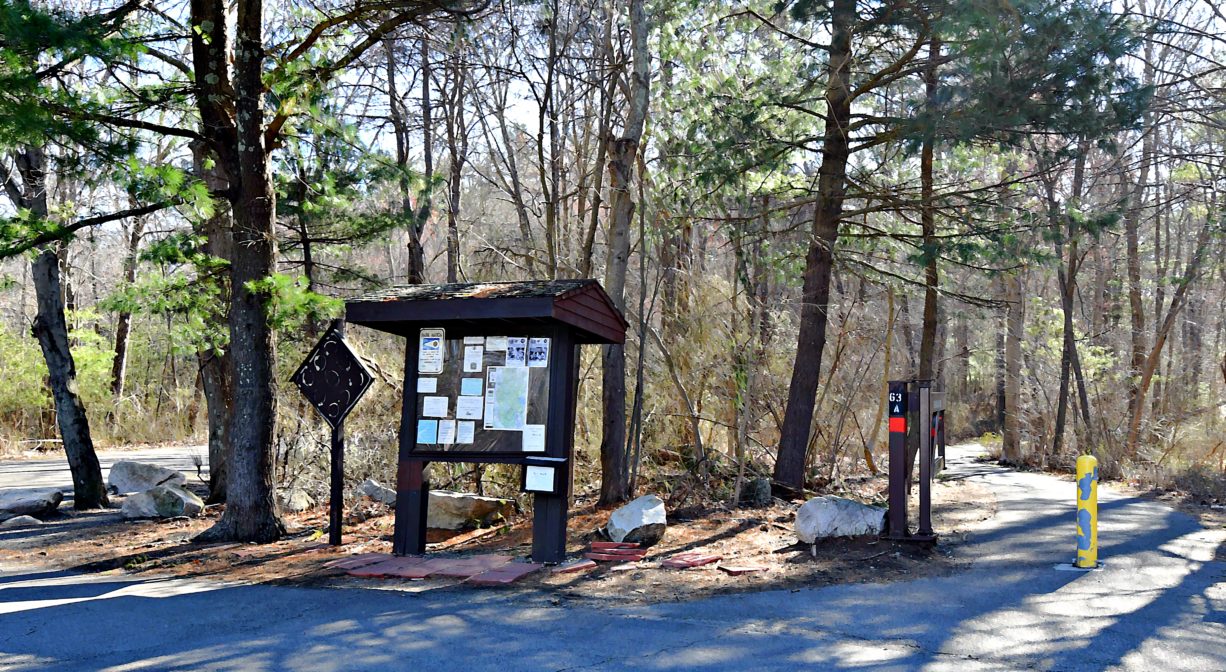
There are numerous woodland trails for hiking, dog-walking, horseback riding, cycling, and cross-country skiing. For mountain bikers, the park is home to one of the longest section of switchbacked singletrack in the state. The Wompatuck Trail is ADA accessible.
Suggested Hike 1 (paved): (Healthy Heart Loop) From the Visitor Center Parking Lot off Union Street, take the bike path to N12, then turn left on the Landing Strip to N1, and return to the Visitor Center. Distance = 1 mile.
Suggested Hike 2: Park at the Transfer Station, on Union Street, within the park. Follow the Beechwood Street paved trail from E13, past E16 to the boat/kayak launch area for a view of the Aaron River Reservoir. Backtrack a little, then follow the paved trail to E17 and then R9. Follow the woodland trail along the edge of Heron Pond to E18 an E15, then follow the paved trail back to the starting point. Distance = about 2 miles.
Suggested Hike 3: From the Visitors Center parking area, proceed to N2 then follow an unpaved trail to N11 and N16. The take the unpaved trail to N17, N20, N23, N24, and N25. Cross the paved trail, then continue on the unpaved trail to N31. From there, follow another unpaved trail to C8, then the paved trail to C7. From there, look for the unpaved trail beside Wildcat Pond, and follow it to N33 and N32. Then return to the Visitor’s Center via the paved trail past N14, N12, N3, and N2. Distance = about 4 miles. It’s a great introduction to the park!
Habitats and Wildlife
Much of the park is undeveloped and is heavily wooded. Trees include Atlantic white cedar, American holly, chestnut oak, shagbark hickory, mountain laurel, pink dogwood, white pine, American beech, and hemlock — some estimated to be 175 years old. Wildflowers and flowering shrubs also grow in abundance. Among the most common are swamp azalea, solomon’s seal, white geranium, ladyslipper, and sheep laurel.
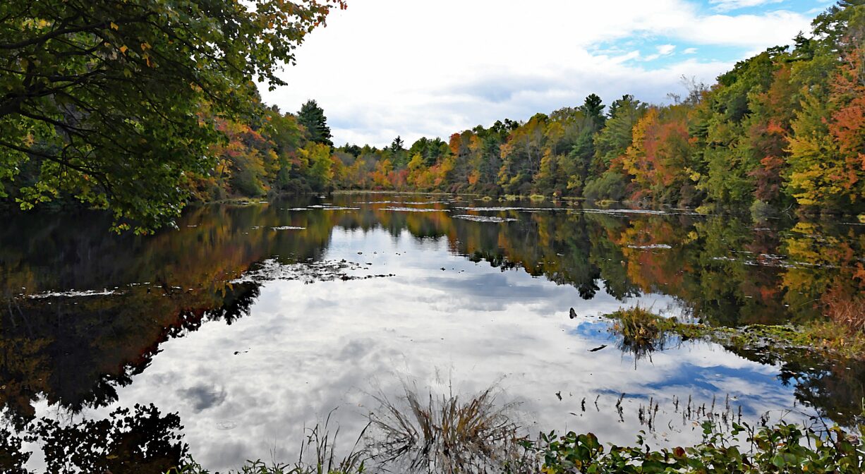
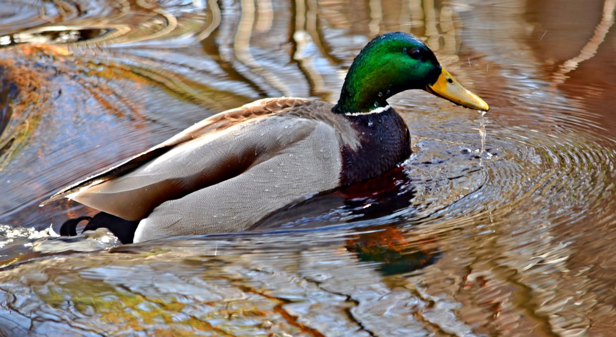
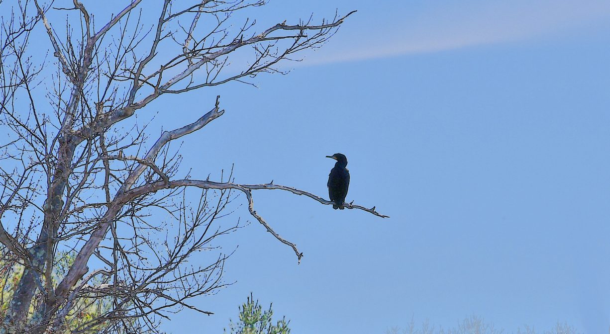
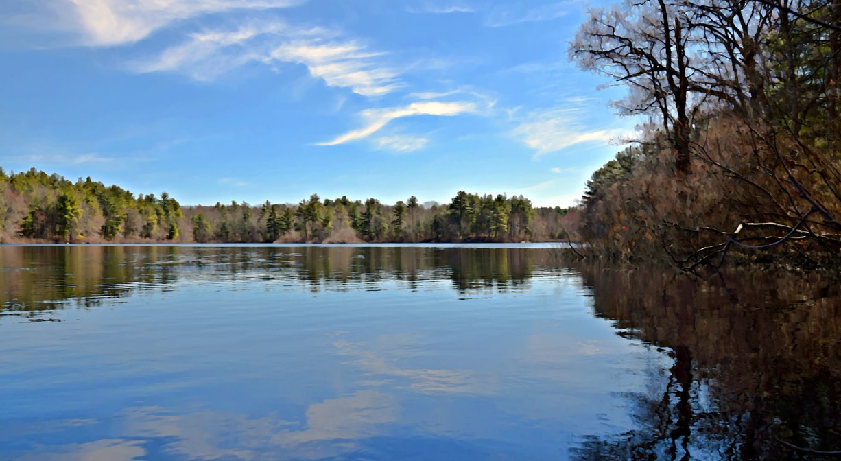
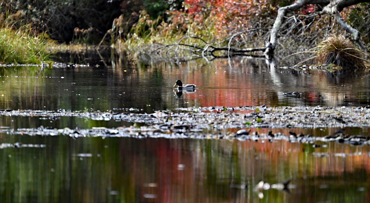
Land and water creatures abound in the park. Common species include: muskrat, raccoon, cottontail rabbit, skunk, painted turtle, bullfrog, coyote, deer, bobcat, fisher cat, red & grey fox, yellow spotted salamander, yellow spotted turtle, and box turtle. There are over 250 bird species including: blue jay, great blue heron, goshawk, red tail hawk, yellow warbler, ruffed grouse, woodcock, and quail. Fish commonly found in the 136-acre Aaron River Reservoir include bass, pickerel, sunfish, and perch.
This park is the site of the Burbank Boulder. This rock, a remnant of the glacial period, balances itself at three points equally distant from each other. Also, the park contains the highest point in Hingham: Prospect Hill.
Accord Brook flows through this side of Wompatuck, through Triphammer Pond, and into the Weir River. Formed at the confluence of Crooked Meadow River and Fulling Mill Brook, the Weir River flows north through Hingham, with Tower Brook and Accord Brook joining it in its first mile. It gradually turns northeast and flows for another 1.4 miles, through Weir River Farm and eventually into Foundry Pond. The Weir River Estuary, designated by the Commonwealth of Massachusetts as an Area of Critical Concern, begins just below the manmade dam at the pond. The mile-wide estuary — with numerous acres of undisturbed salt marsh — forms the border between Hingham and Hull, and empties into Hingham Bay. For more information about the Weir River, follow the Weir River Watershed Association.
Many of the waterways within the park drain to the Aaron River, which flows northeast to the Aaron River Reservoir. The dam that holds the reservoir in place was constructed from 1976-1978. Below the dam, the river continues to flow through Cohasset. It joins with Brass Kettle Brook and eventually empties into the Gulf River in North Scituate. The Gulf River flows into the ocean at Cohasset Harbor.


Historic Site: No
Park: Yes
Beach: No
Boat Launch: Yes
Lifeguards: No
Size: 3526 acres
Hours: Sunrise to sunset, plus overnight camping with reservation.
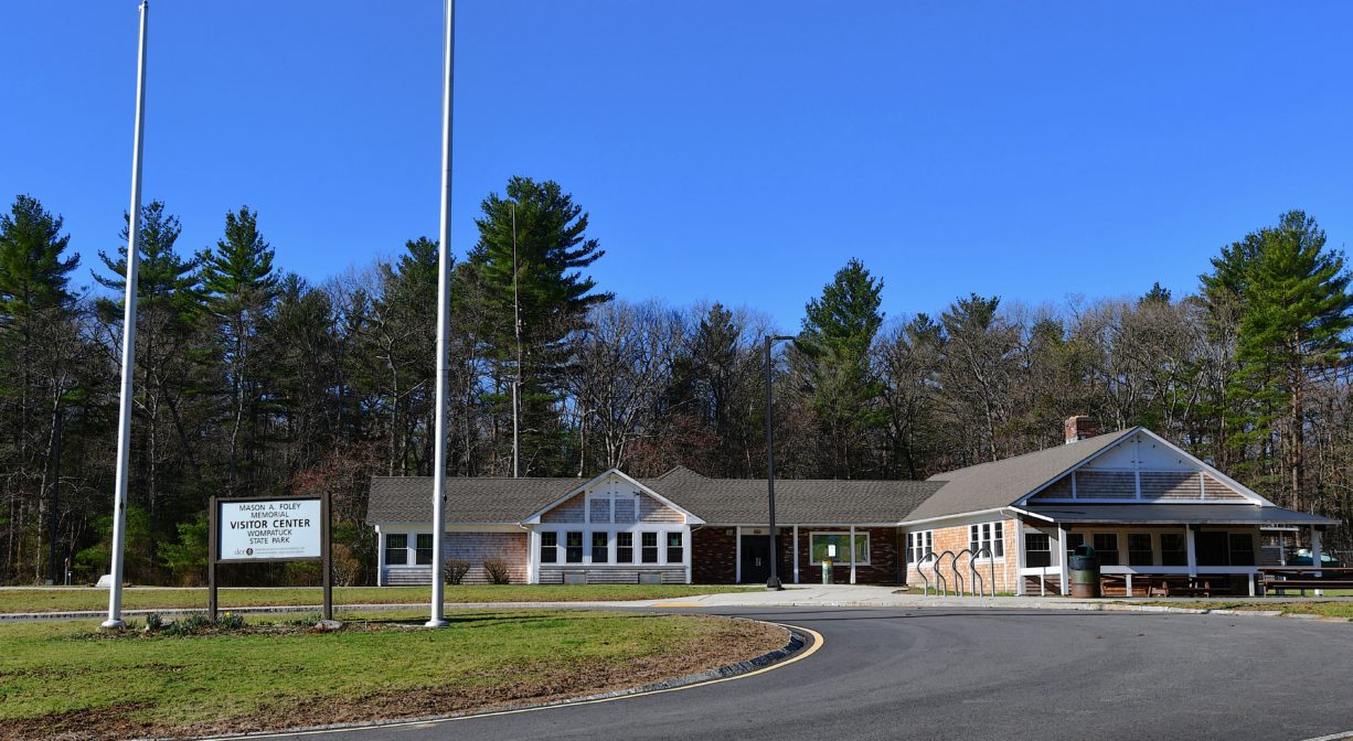
Parking: On-site parking at the Visitor Center at 204 Union Street, with additional parking at the Transfer Station, much farther into the park. Additional entrances with parking at Leavitt Street in Hingham, Doane Street in Cohasset, and Grove Street in Norwell. Pedestrian access from Mount Blue Street in Norwell, the Aaron River Reservoir in Cohasset, Whitney-Thayer Woods in Cohasset, Brass Kettle Conservation Area in Cohasset, and Prospect Street in Norwell, and South Pleasant Street in Hingham.
Cost: There is a fee for camping.
Trail Difficulty: Easy, Medium
Facilities:
Visitors Center, 400 campsites, non-motorized car-top boat ramp, paved bike paths, picnic areas, restrooms & showers, Trailer/RV hookup & dumping. Several geocaches on site.
The Mt. Blue Spring offers water drawn directly from a natural aquifer. You can find it in a shed with an adjacent parking area, on Union Street in the park, between markers E14 and E1, not far from the Transfer Station area. The water is tested frequently for safety. When planning a visit, we recommend contacting the park to verify that the spring is open.
Dogs: Dogs must be leashed at all times. Always clean up after your dog!
Boat Ramp: No
ADA Access: Yes
Scenic Views: Yes
Waterbody/Watershed: Accord Brook (Weir River watershed) and Aaron River (Gulf River watershed)