
510 Grove St, Norwell, MA 02061, USA
Norwell Conservation: (781) 659-8022
Owned By: Town of Norwell
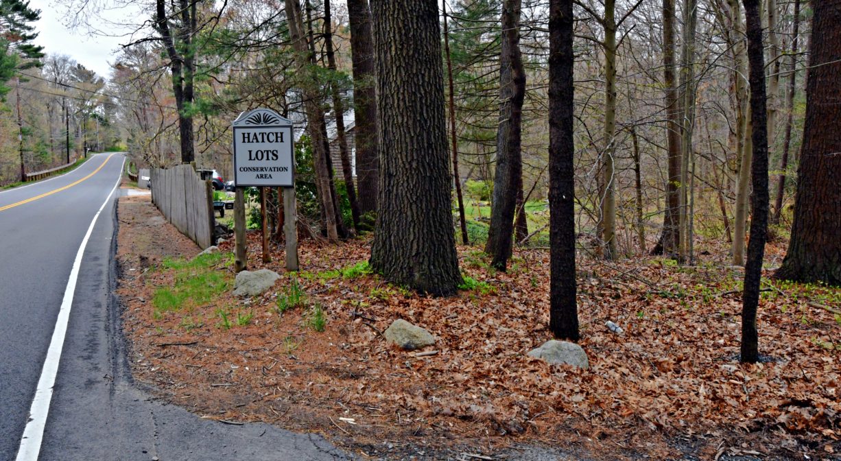
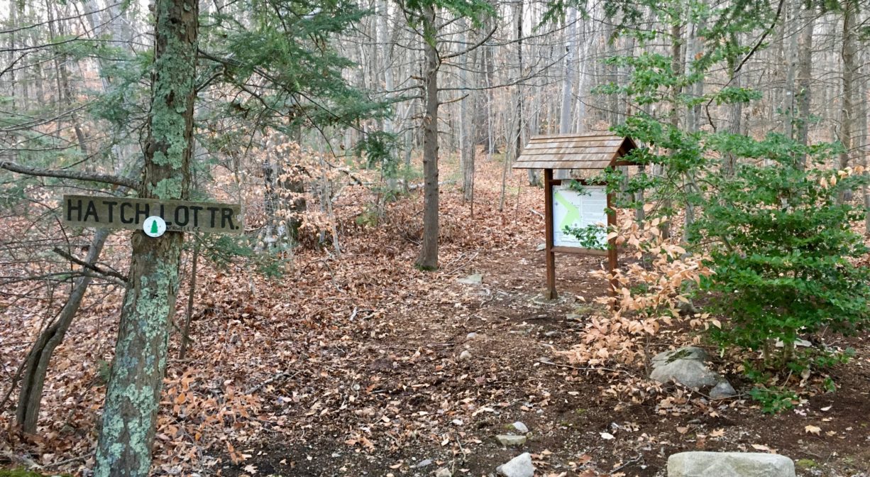
The Hatch Lots Conservation Area in Norwell features 44 acres of historic woodlots with 2 miles of walking trails and footbridges through forest and wetlands. Contiguous with Simon Hill and Bowker Street Conservation Area.
HUNTING: Those who hold town-issued permits may use this property for seasonal hunting and trapping. Hunting is not allowed on, or across, any trail. Visit the hunting page on Norwell’s website for details. Non-hunters, be mindful of hunting seasons, and wear bright orange if you’re entering the property during those times. Hunting is not permitted on Sundays.
Features
The Hatch Lots are named for a local farmer, Samuel Hatch. He and his sons owned the property until 1844, and used it as a woodlot where they would harvest trees for firewood and construction materials. The Hatch Lots Conservation Area was established in 1977, with 30 acres of town-owned wood lots, plus 14 acres purchased from the Loring Farm Trust. Hornstra Farm is immediately adjacent (southwest).
In 2020 a connector trail was constructed between Hatch Lots and the adjacent Simon Hill/Bowker Conservation Area.
Burnt Plain Swamp, to the east, was valued in earlier times for the cedar trees that grew there, which could be used for making shingles. Swamp pine trees were harvested and used in construction.
This land is within the region of the Massachusett (or Massachuseuk) Native American tribe. For thousands of years, the land today known as Norwell was inhabited by indigenous people who grew crops, foraged, hunted, and fished in the Assinippi and North River areas. Circa 1617, a major outbreak of disease decimated an estimated 90% of the native population in New England. Descendants of these original inhabitants are living here today. They are known as the Mattakeesett Tribe of the Massachusett Indian Nation, the Massachusett Tribe at Ponkapoag, the Herring Pond Wampanoag, and the Mashpee Wampanoag tribe.
Trail Description
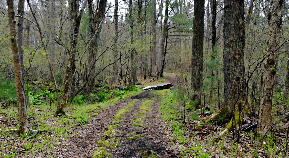
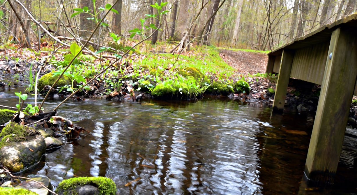
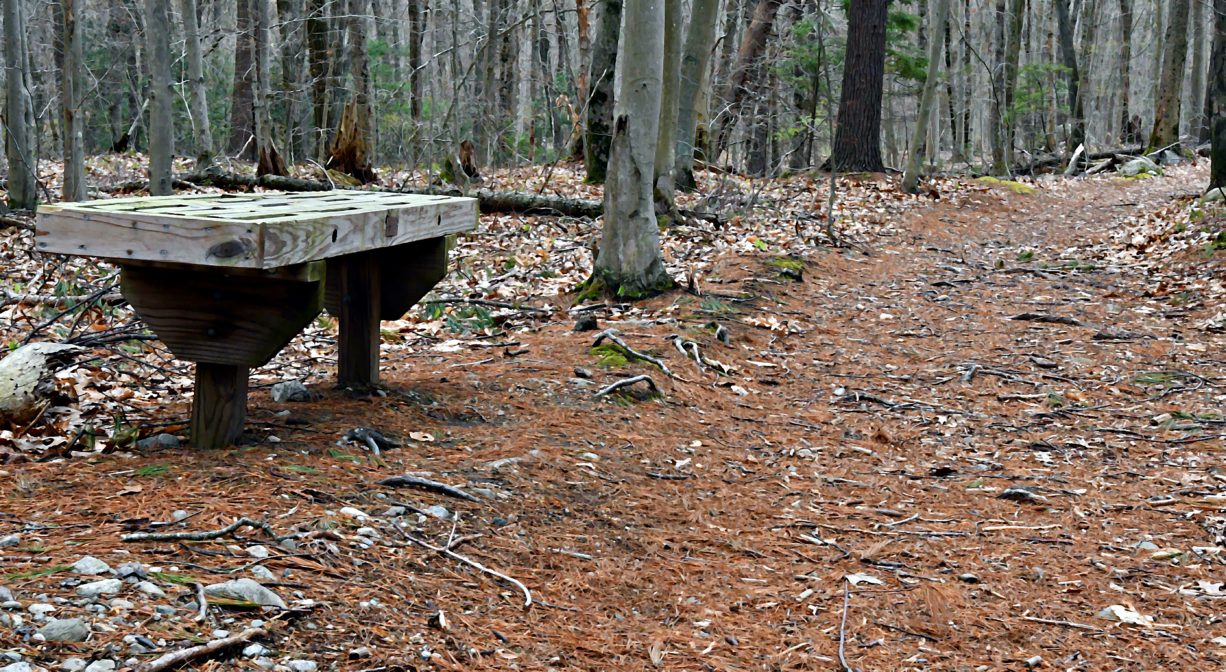
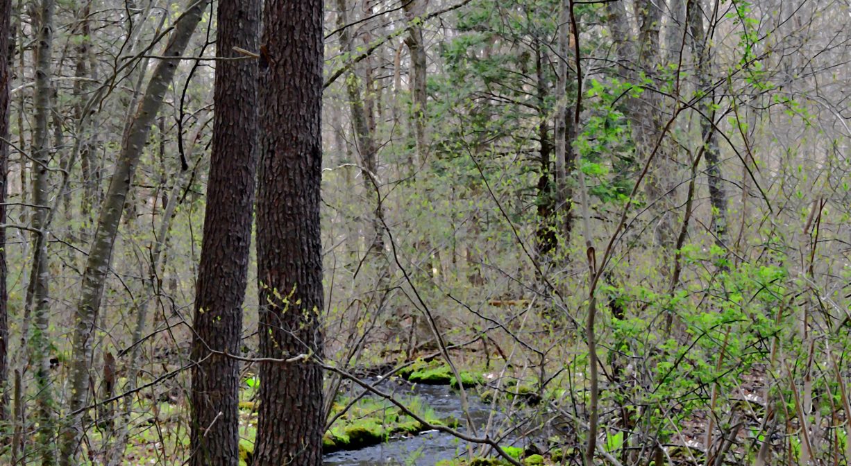
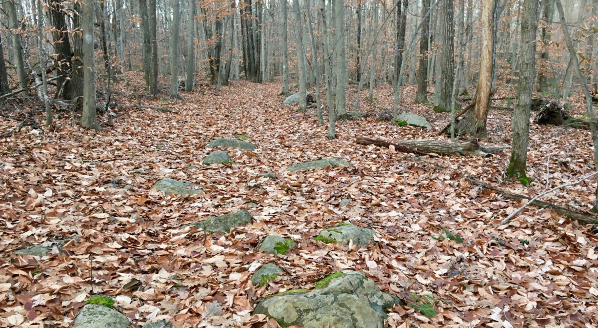
From the parking area on Grove Street, an approx. 1-mile trail extends through woods and wetlands, crossing over a small stream. This trail (blazed in white) is mostly wide, very likely an old cart path. A second bridge provides an additional stream crossing. Farther in, you’ll find a bench for sitting.
At the first major intersection, you can continue straight/right to explore additional uplands. This trail, which forks at the end, leads to a second property entrance from the Edgewood Park neighborhood. The other fork leads to private property on Captain Joshua Lane. Just before the aforementioned fork, there is a new (2020) trail that connects to Norwell’s Simon Hill/Bowker Street Conservation Area. This new trail provides a connector loop with the section of the property mentioned below.
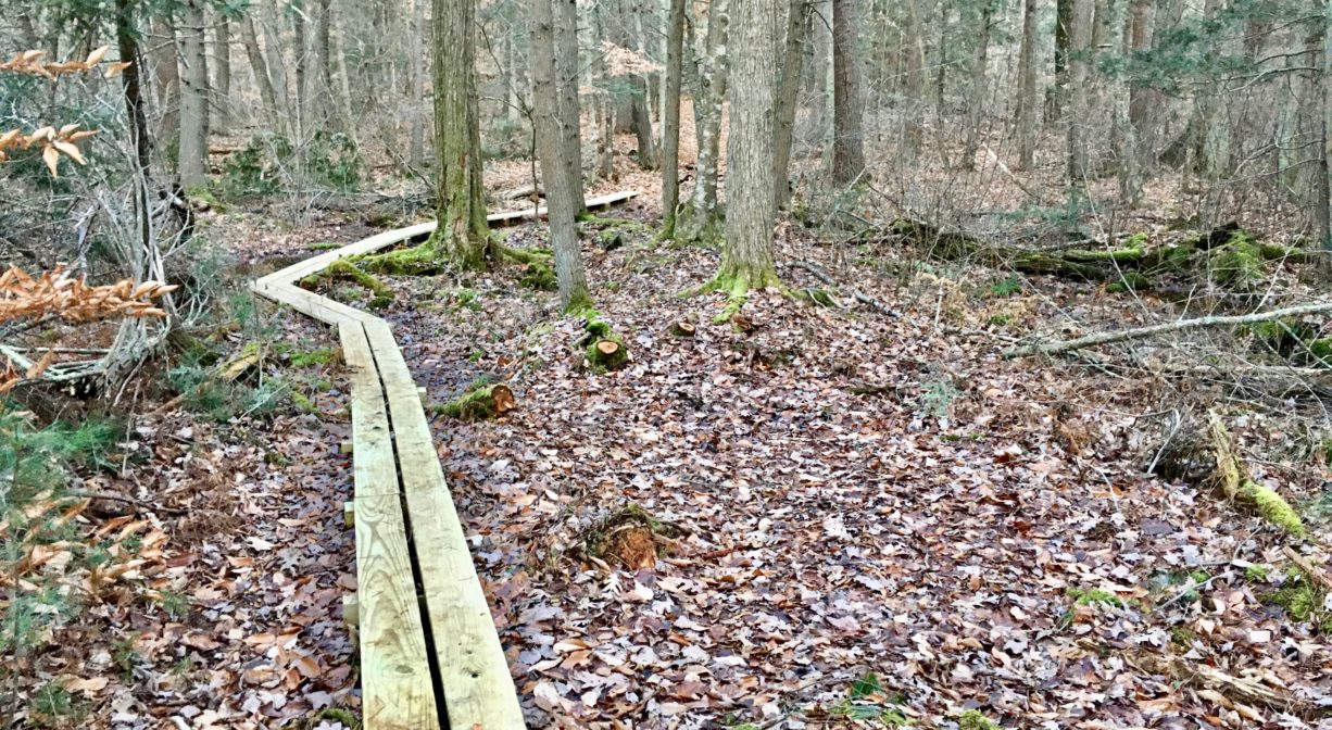
An alternative route is to turn left at the first major intersection. This will lead you closer to Burnt Plain Swamp, which is bordered on one side by well-preserved stone walls. There is a approx. half-mile loop trail (blazed with yellow tape) that traverses both upland and wetland. It includes small sections of boardwalks in the wettest areas. This trail loop is not always easy to follow, so carrying a map is strongly advised! A spur at the far end of the loop trail leads back toward Grove Street but does not actually connect with it.
Please note that some sections of the trails in Hatch Lots are wide and relatively flat, but others contain many roots and rocks.
Habitats and Wildlife
Hatch Lots features a large number a beech trees, as well as oak and pine, plus hemlock, birch and holly. There are numerous mossy, damp areas too. The beech-covered drumlin hill toward the center of the property is especially inviting.
Burnt Plain Swamp, a large (hundreds of acres) wetland complex, is immediately adjacent to Hatch Lots. It is known as a watershed divide, meaning that the water in one portion of it flows to one watershed, while the water in another portion flows to a different watershed. The waters in Burnt Plain Swamp flow north across Grove Street toward the Aaron River Reservoir (Gulf River watershed) in Wompatuck State Park and also south into Hoop Pole Swamp, which eventually drains to Third Herring Brook (North & South Rivers watershed).


Historic Site: No
Park: No
Beach: No
Boat Launch: No
Lifeguards: No
Size: 44 acres
Hours: Dawn to Dusk
Parking: Limited on-site parking at 510 Grove Street.
Cost: Free
Trail Difficulty: Easy
Facilities:
Footbridges and plank boardwalks, one bench, geocache location.
Dogs: Dogs must remain on leash. Please clean up after your pet!
Boat Ramp: No
ADA Access: No
Scenic Views: Yes
Waterbody/Watershed: Burnt Plain Swamp (Gulf River watershed) and Hoop Pole Swamp (North River watershed)