
72 Simon Hill Rd, Norwell, MA 02061, USA
Norwell Conservation: (781) 659-8022
Owned By: Town of Norwell
Norwell’s Simon Hill and Bowker Street Conservation Area offers 2 miles of trails across 200 acres, with views of Burnt Plain Swamp. Simon Hill is a 27-acre property managed by Norwell’s Conservation Commission and Water Department. Bowker Street Conservation Area is a 173-acre property managed by Norwell’s Water Department.
In addition, there is a trail connection to Norwell’s Hatch Lots Conservation Area.
HUNTING: Those who hold town-issued permits may use this property for seasonal hunting and trapping. Hunting is not allowed on, or across, any trail. Visit the hunting page on Norwell’s website for details. Non-hunters, be mindful of hunting seasons, and wear bright orange if you’re entering the property during those times. Hunting is not permitted on Sundays.
Features
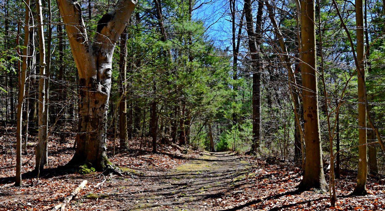
Simon Hill was originally targeted for development. It is now preserved for water protection and passive recreation. As its name suggests, the terrain is hilly, and also rocky in some places, with an interesting footbridge bridge constructed of one very large split log. Bowker Street Conservation Area is maintained by the Town of Norwell for reserve drinking water wells and groundwater protection, as well as passive recreation. It too offers some hills and rocky terrain.
According to the Massachusetts Historical Commission, native tribes occupied the Simon Hill area through the Woodland, First Period and Colonial Period, and likely continued to occupy the site into the late 1700’s. According to Deane’s 1831 History of Scituate, the hill was named for Simon, a member of the Mattakeeset tribe who lived there in the late 1700’s.
In 2020, a connector trail was constructed between the Simon Hill & Bowker Street Conservation Area and the adjacent Hatch Lots Conservation Area, comprised largely of bog boards through wetlands at the edge of Burnt Plain Swamp. It is marked with one small sign, with additional signage to come.
This land is within the region of the Massachusett (or Massachuseuk) Native American tribe. For thousands of years, the land today known as Norwell was inhabited by indigenous people who grew crops, foraged, hunted, and fished in the Assinippi and North River areas. Circa 1617, a major outbreak of disease decimated an estimated 90% of the native population in New England. Descendants of these original inhabitants are living here today. They are known as the Mattakeesett Tribe of the Massachusett Indian Nation, the Massachusett Tribe at Ponkapoag, the Herring Pond Wampanoag, and the Mashpee Wampanoag tribe.
Trail Description
The main trail leads into the woods at the end of Simon Hill Road, to the top of Simon Hill, and down the other side. After traversing some wetlands at Burnt Plain Swamp, it continues into the Bowker Street portion of the property, where there are some trail loops. The main trail continues to Bowker Street. In the Bowker Street area, look for a small sign pointing the way to Hatch Lots. This connector trail will extend your walk considerably.
The terrain here might not be suitable for everyone. It is very rocky in places, and often steeper than what one would expect to find in the area. Those seeking a little elevation are likely to enjoy the hills. Step carefully, especially when fallen leaves cover the trails in the autumn.
Habitats and Wildlife
The forest here is primarily beech. It can be absolutely stunning in the mid-to-late fall. There are also numerous rocky outcroppings. A stream runs through the property, plus there is a vernal pool and some red maple swamp on the Bowker Street portion of the property. The connector trail to Hatch Lots Conservation Area passes along the edge of Burnt Plain Swamp.
Burnt Plain Swamp is a large (hundreds of acres) wetland complex. It is known as a watershed divide, meaning that the water in one portion of it flows to one watershed, while the water in another portion flows to a different watershed. The waters in Burnt Plain Swamp flow north across Grove Street toward the Aaron River Reservoir in Wompatuck State Park and also south into Hoop Pole Swamp, which eventually drains to Third Herring Brook.
Third Herring Brook is a major tributary to the North River. Its headwaters are located north of Jacobs Pond in Norwell, in the southern portion of Valley Swamp. Third Herring Brook exits the pond from the southern side, at the dam. (Watch for a fish ladder here in the future!) The brook forms the border between Norwell and Hanover, and flows past Sylvester Field Conservation Area, and into the North River downstream of the old stone bridge on Washington Street.
The Aaron River finds its source within Wompatuck State Park and flows northeast to the Aaron River Reservoir. The dam that holds the reservoir in place was constructed from 1976-1978. Below the dam, the river continues to flow through Cohasset. It joins with Brass Kettle Brook and eventually empties into the Gulf River in North Scituate. The Gulf River flows into the ocean at Cohasset Harbor.


Historic Site: No
Park: No
Beach: No
Boat Launch: No
Lifeguards: No
Size: 200 acres
Hours: Dawn to Dusk
Parking: Off-street parking along the cul de sac at the end of Simon Hill Road, and at the entry gate across from #190 Bowker Street.
Cost: Free
Trail Difficulty: Easy
Facilities:
Geocache locations.
Dogs: Dogs must remain on leash. Always clean up after your dog!
Boat Ramp: No
ADA Access: No
Scenic Views: Yes
Waterbody/Watershed: Burnt Plain Swamp: Aaron River (Gulf River watershed) and Third Herring Brook (North River watershed) Aaron River (Gulf River watershed/Cohasset Harbor) and Third Herring Brook (North River watershed)