
31 Holly Crest Rd, Scituate, MA 02066, USA
Scituate Conservation: 781-545-8721
Owned By: Town of Scituate
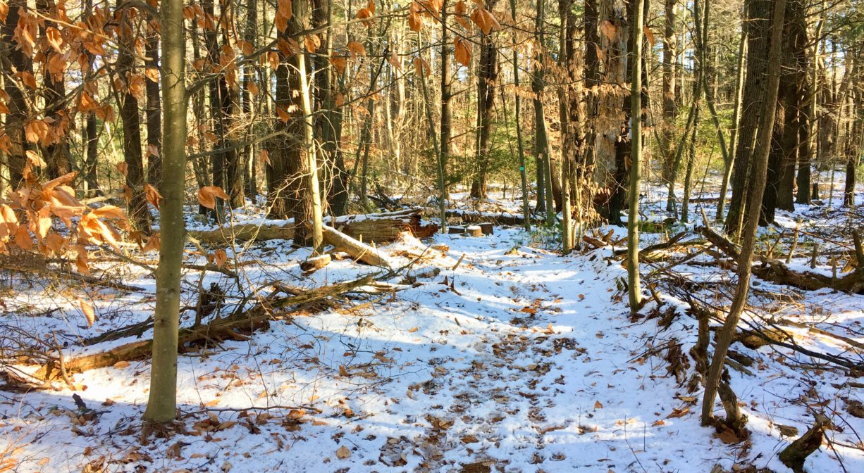
The Higgins-MacAllister Preserve in Scituate features a 1.2-mile loop trail. Follow the large wooden bridge to the trail, which extends through woods and wetlands, offering views of Merritt Brook, a tributary to Bound Brook.
HUNTING: Hunting is allowed, in season, by licensed persons in compliance with Massachusetts law. Please be sure to understand state and local hunting guidelines before proceeding. Non-hunters, be mindful of hunting seasons, and wear bright orange if you’re entering the property during those times. Hunting is not permitted on Sundays.
Directly adjacent to the Bates Lane Conservation Area. While you’re in Scituate’s West End neighborhood, also consider the Damon Preserve and the Crosbie Family Preserve / Appleton Field.
Features
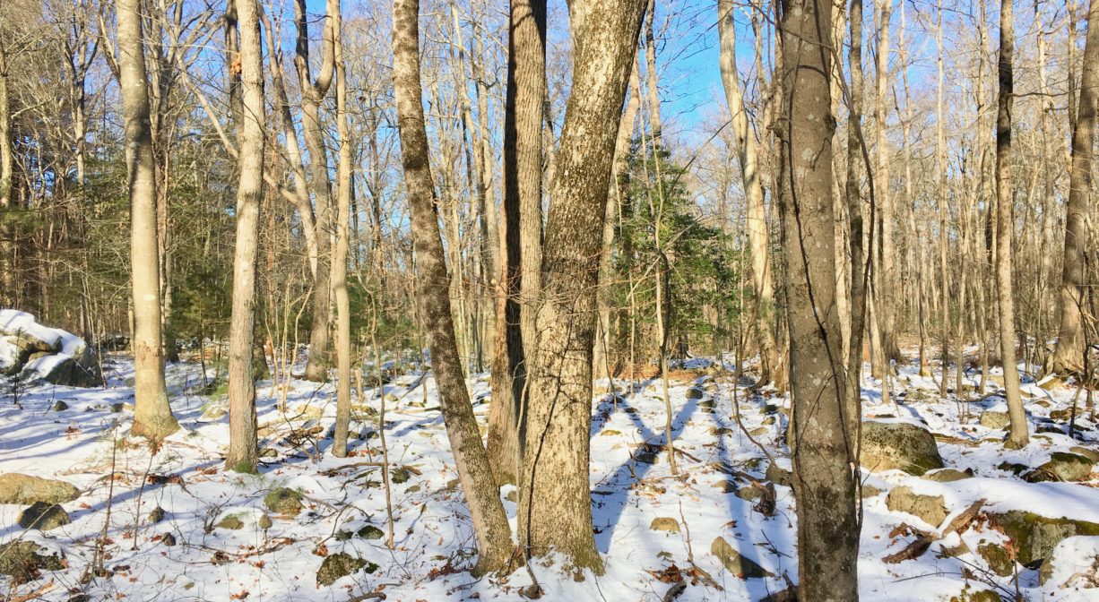
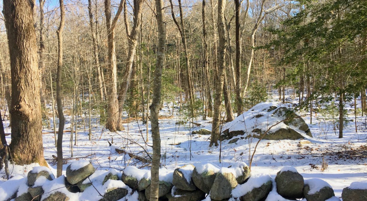
There are a lot of rocks in the Higgins-MacAllister Preserve — glacial erratic boulders, as well as smaller, often moss-covered, rocks, plus numerous stone walls. Another landmark is a very large Eastern White Pine tree, with a 17-foot circumference! Small signs direct hikers to its exact location. The property was purchased by the Town of Scituate in 2012.
This land is within the region of the Massachusett (or Massachuseuk). To learn more about local Native American tribes, we encourage you to interact with their members. The Mattakeeset band of the Massachusett, and the Massachusett tribe at Ponkapoag, both share information on their websites.
Trail Description
The terrain through much of the property is rocky. While rarely steep, the trail requires a careful eye and even more careful steps. If you’re up for it, it is well worth the adventure!
The parking area at the end of Holly Crest Road, and the wooden bridge over Merritt Brook offer direct access to the property. There are two short downhill trails to the bridge, both marked with white squares. After the bridge, you’ll quickly encounter a 1.2-mile loop trail, marked with teal-colored squares. To the right, the trail traces the edge of the brook, offering numerous captivating views.
At marker #16, you have the option of continuing on the main trail or taking a short detour on the Boulder Loop Trail, marked in cornflower blue. The loop is well worth your time! You’ll also see a short spur to a big pine tree. Continue following the teal trail around the perimeter of the property, through an area called Boulder Valley. At #14, you have the option of turning right, to access the much-larger Bates Conservation Area. Or continue on the loop, through a grove of holly, along some very old stone walls, and eventually back around to the bridge intersection (#17).
Additional access is available from the Bates Lane Conservation Area. From Bates Lane itself, follow the (blue) Carl Pipes Trail to intersection #10. From there, follow the trail blazed with teal markers, which leads into the Higgins-MacAllister Preserve. The loop trail begins at marker #14.
Habitats and Wildlife
The upland forest here contains mostly pine and beech trees, plus oak, holly, fern, and princess pine. In general there is very little shrubbery, due to a large population of deer. Closer to the wetlands are yellow birch, cedar, and red maple. Here the shrubs are more prolific. Also look for winterberry and cinnamon fern. Moss is abundant!
Merritt Brook, which rises in South Swamp and flows through the Higgins-MacAllister Preserve, is a headwater stream for the watershed of Bound Brook and the Aaron River Reservoir. It eventually flows into the Gulf River, which empties into Cohasset Harbor.


Historic Site: No
Park: No
Beach: No
Boat Launch: No
Lifeguards: No
Size: 37 acres
Hours: Dawn to Dusk
Parking: Parking area at the end of Holly Crest Road. Additional access through the Bates Lane Conservation Area (see listing for details).
Cost: Free
Trail Difficulty: Medium
Facilities:
Geocache locations.
Dogs: Dogs must remain on leash and waste must be picked up.
Boat Ramp: No
ADA Access: No
Scenic Views: Yes
Waterbody/Watershed: Merritt Brook (Gulf River watershed)