
29 Marshall Ave #1, Marshfield, MA 02050, USA
Town of Marshfield - Cemetery, Trees & Greens: (781) 834-5575
Owned By: Town of Marshfield
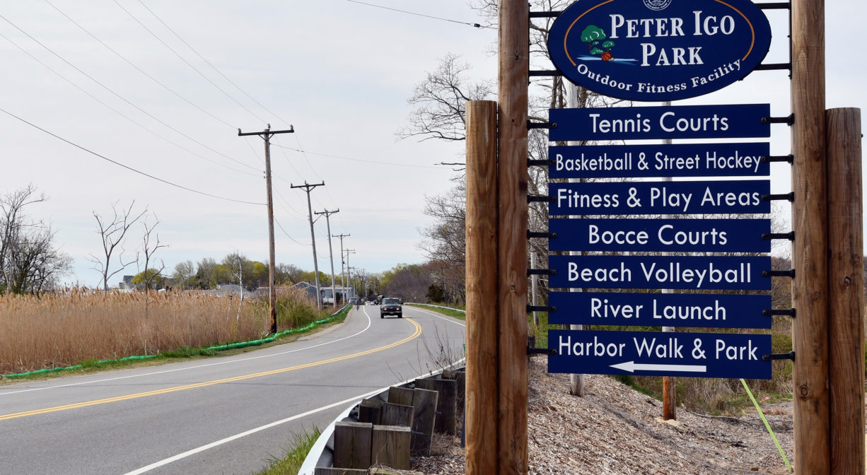
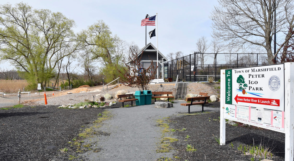
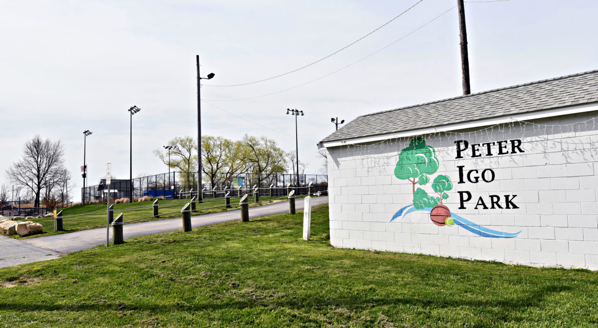
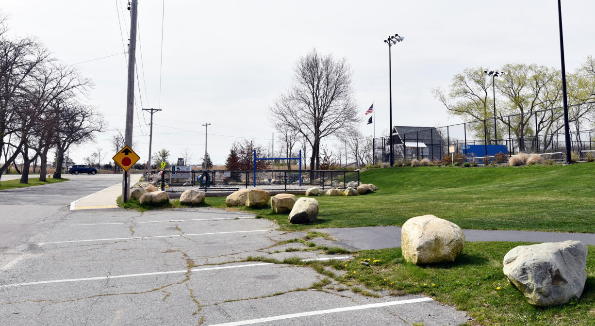
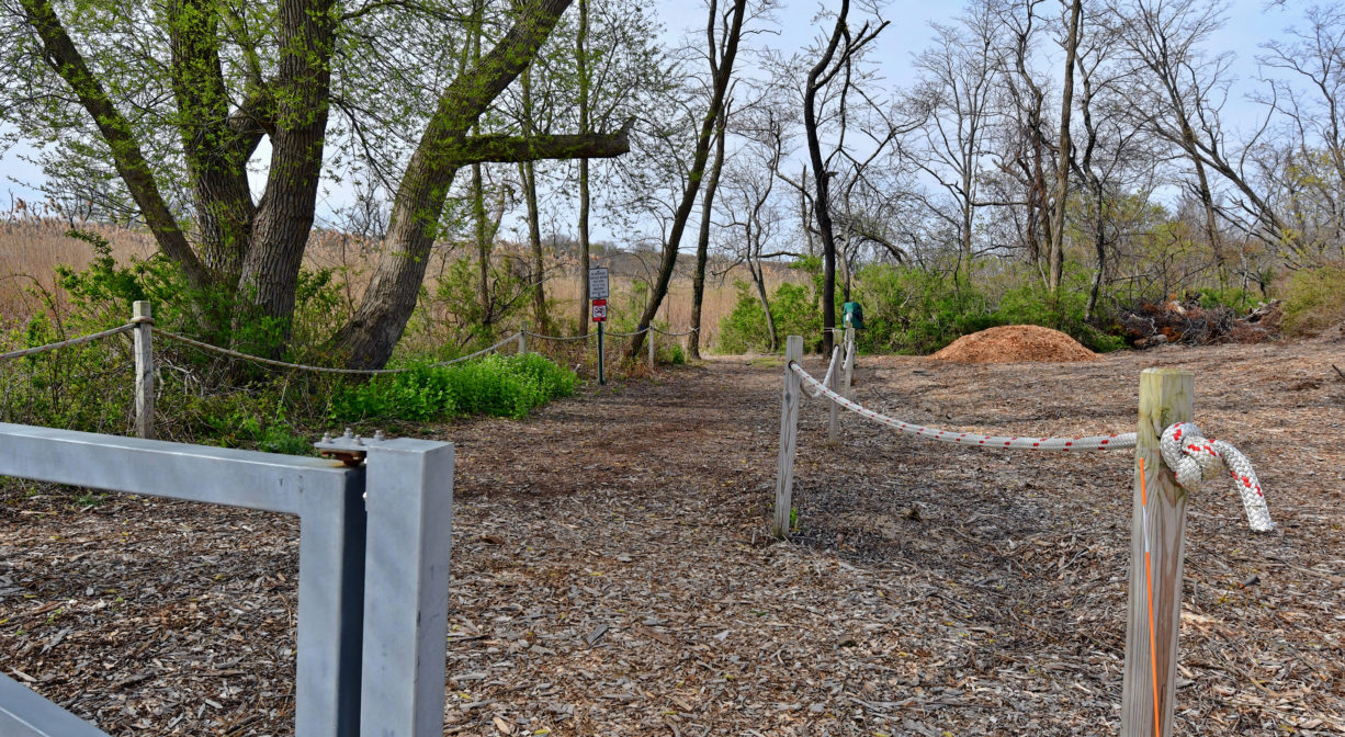
Peter Igo Park is located in the Brant Rock village of Marshfield. It features basketball, tennis/pickleball, beach volleyball, and bocce courts, a small playground, and access to the Green Harbor River for non-motorized boats and rowing shells. In season, there is a small pier with floats directly on the river and an all-access launching ramp. The park is also accessible via the Harbor Walk.
FISHING ADVISORY: It’s important to know that some of our freshwater fisheries are contaminated with mercury, PFAS and/or other concerning substances. The Massachusetts Department of Public Health maintains an online database with up-to-date advisories regarding fish consumption, sorted by location. We recommend you consult this valuable resource when planning a fishing excursion.
Hunting is not allowed at Peter Igo Park.
Features
Named for Marshfield’s first Director of Recreation and dedicated on July 3, 1976, this park was renovated and updated in 2014. It is maintained by the Friends of Peter Igo Park, a registered 501(c)3 non-profit. Before its transformation to parkland, it was a landfill, sometimes known as the Brant Rock Dump. Also of note: for part of the 20th century, a Horton Sphere, storing compressed gas, stood on the site of the park.
Home of the Marshfield Tennis Club, the park also features 3 regulation tennis courts, 4 “10 and under” tennis / pickle ball courts, plus 2 regulation bocce courts, a basketball court, beach volleyball, horseshoes, and street hockey. Borrow a bocce ball or a volleyball at the DAV across the street from the park. The park is also the headquarters of Green Harbor Rowing, which offers rowing shell lessons for juniors and adults. Click here for details.
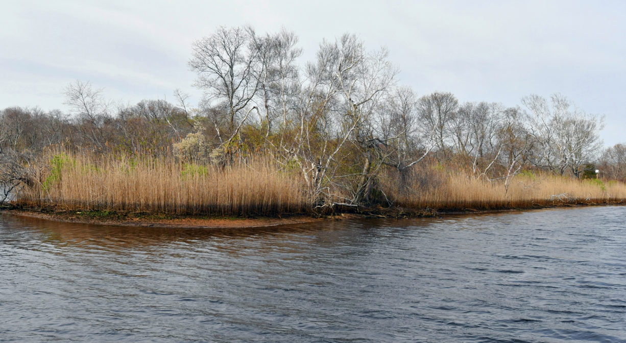
Peter Igo Park is located on the Green Harbor River, a short distance upstream from Green Harbor itself. The original mouth of the river was located on the Marshfield/Duxbury line, more than a half mile south of the present mouth. It was closed by a storm in 1806. The present mouth opened in 1810. By eliminating the narrow last leg of the river, the 1810 opening dramatically increased the incoming tidal flow to the river. This was a boon to local fishermen, as it improved the harbor’s navigability. However the owners of farms bordering the river saw things differently. The increase in both the volume and the frequency of saltwater flooding to their agricultural lands was problematic.
So in 1871, a group of farmers petitioned the court to construct a dike, or tide gate, that would block the flow of saltwater upstream, and create more arable land. The dike was constructed in 1872, with the condition that “Should shoaling take place above the level of mean low water in the channel in consequence of dike construction, it was to be removed by the Marsh proprietors.” Shoaling did occur, and thus began the “Brant Rock Dike Feud.” Read all about it on our blog. The dike is located where Rout 139 crosses the river, just downstream of this park.
According to information posted at the park, Everson Island did not appear on the 1795 local map, but it was present on the 1872 map. Local lore indicates that the island is composed of Saco soil, found only around Saco, Maine. The prevailing theory is that schooners transporting lumber from Maine to T.B. Blackman’s lumber yard on the Green Harbor River used the Saco soil as ballast. The island received its name from Erastus Everson, a writer who built a small house there c. 1894.
This land is within the region of the Massachusett (or Massachuseuk) and Wampanoag Native American tribes. To learn more about local tribes, we encourage you to interact with their members. The Mattakeeset band of the Massachusett, the Massachusett tribe at Ponkapoag, the Mashpee Wampanoag, and the Herring Pond Wampanoag also share information on their websites.
Trail Description
No trails within the park, however just a few steps away is the Harbor Walk, a concrete walkway that extends from the Marshfield Town Pier to the Brant Rock Esplanade, as well as past Peter Igo Park to Careswell Street (just over 1 mile total).
Padding Tips: Paddlers can really only head upstream here, as the Brant Rock Dike (under Route 139/Dyke Road) prevents boats from traveling downstream. In the middle of the river, close to the launch area, is the 1.9-acre Everson Island. It is privately owned, but respectful visitors are welcome to explore. It’s easiest to land your boat on the far side (south) of the island.
Heading upstream, when you arrive at the first fork, Wharf Creek is to the left, and the Green Harbor River is to the right. You can paddle up Wharf Creek for a bit before it gets too narrow and shallow. Continuing up the Green Harbor River, at the next fork, Bass Creek is to the right, and the main channel of the Green Harbor River is to the left. (For the average paddler, this junction is about an hour from Peter Igo Park.)
You can continue paddling quite a way up Bass Creek before it becomes difficult to navigate. If you continue on the Green Harbor River, you will reach the two bridges of Mass Audubon’s Daniel Webster Wildlife Sanctuary. The river channel narrows, but you can continue for another hour or so, almost to Webster Street. Just remember, you will have to paddle all the way back. There are no upstream launch spots on the Green Harbor River.
Habitats and Wildlife
The Green Harbor River, and one of its major tributaries, Wharf Creek, flow through this property. The Green Harbor River finds its source in springs and ponds in Duxbury. It twists and turns through Marshfield, flowing through Red Gold Farm, the Green Harbor Golf Club, the Daniel Webster Wildlife Sanctuary, property owned by the Marshfield Municipal Airport, and Peter Igo Park. Just downstream of the Dyke Road bridge (and dike) it flows into the Atlantic Ocean at Green Harbor.
There are usually at least two osprey nests visible from the portion of the Green Harbor River below Bass Creek. Osprey activity can be quite captivating. Be especially respectful during (spring) nesting season, and do not approach closely. Other birds commonly observed here include snowy egrets, red winged blackbirds, Baltimore orioles, bald eagles, cooper hawks, and bobolinks. Upstream, it is common to see great blue herons. Some of the fish commonly found in the river include striped bass, white perch, American eel, alewife herring, as well as blue crab.


Historic Site: No
Park: Yes
Beach: No
Boat Launch: Yes
Lifeguards: No
Size: 17 acres
Hours: Dawn to Dusk
Parking: Ample on-site parking at 29 Marshall Ave., off Route 139.
Cost: Free
Trail Difficulty: Easy
Facilities:
Dock and float on river for launching non-motorized boats and rowing shells, with accessibility features. Bocce, horseshoes, basketball, street hockey, beach volleyball, tennis and pickle ball courts. Small playground, benches, trash and pet waste receptacles, informational kiosk.
Dogs: Dogs must remain on leash. Always clean up after your dog!
Boat Ramp: No
ADA Access: Yes
Scenic Views: Yes
Waterbody/Watershed: Green Harbor River