
100 Central St, Marshfield, MA 02050, USA
Marshfield Harbormaster: 781-834-8298
https://www.marshfieldpolice.org/harbormaster
Owned By: Town of Marshfield
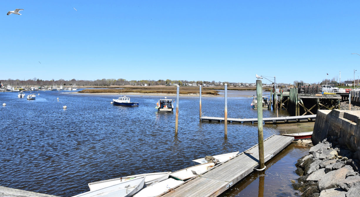
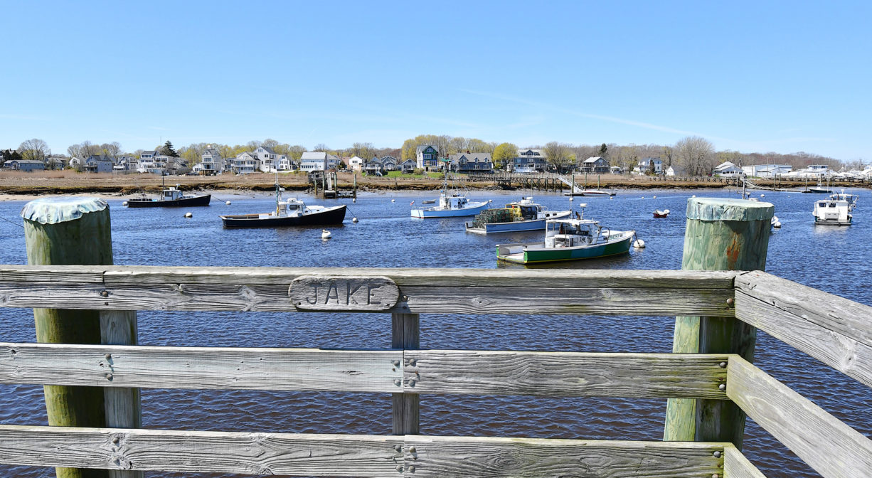
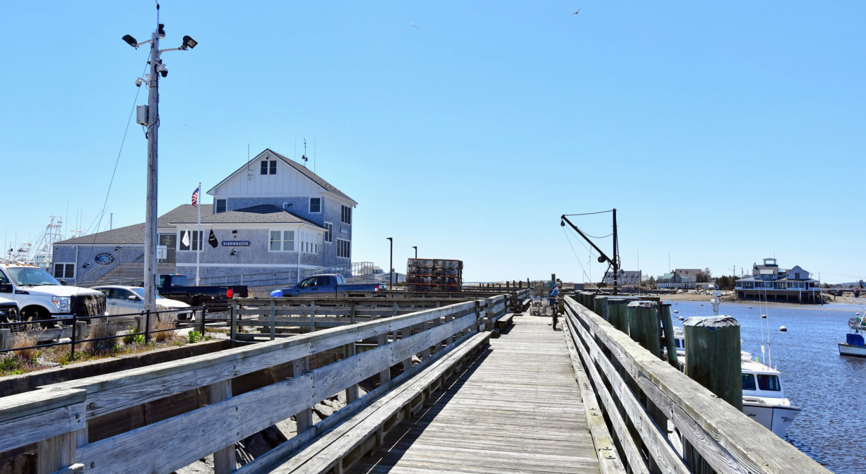
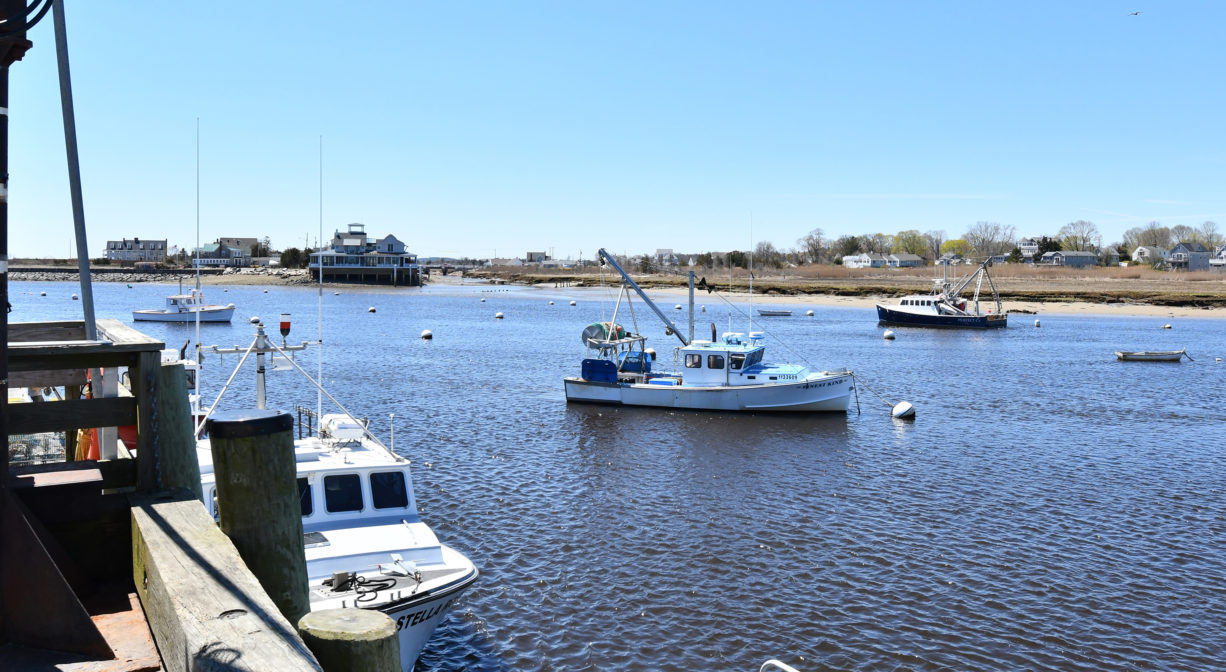
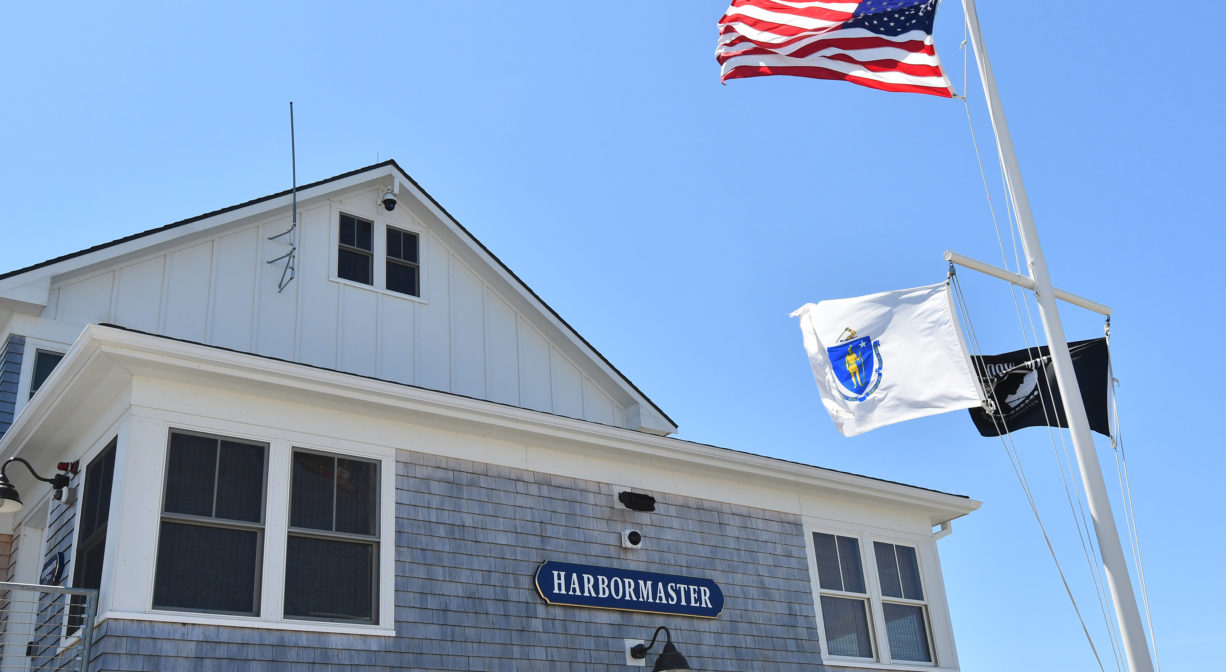
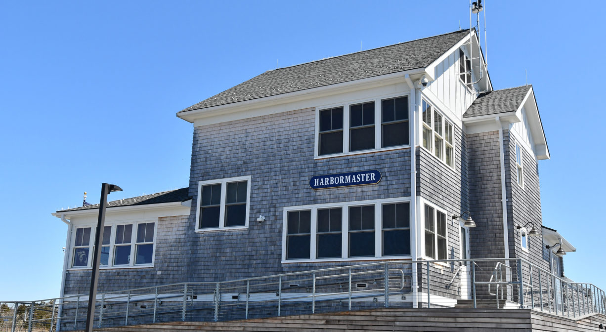
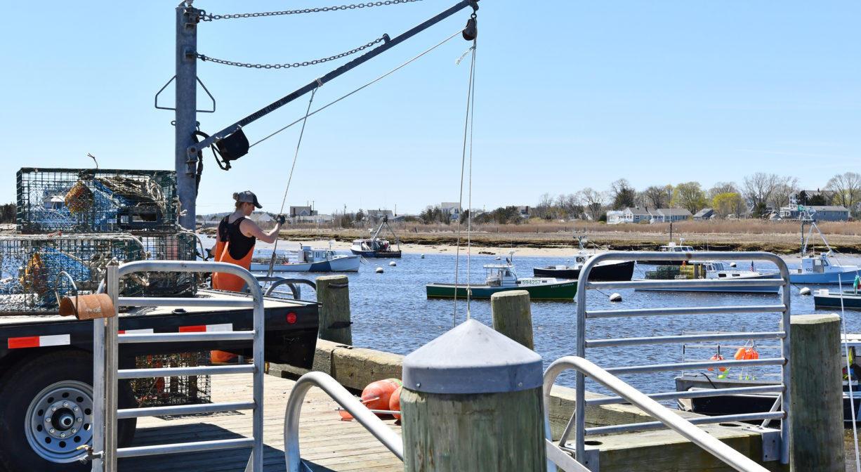
The Marshfield Town Pier is situated on a busy commercial harbor on the Green Harbor River. Launch your boat from the public ramp, fish from the pier, or just sit and watch the fishing boats. The property is also home to the Marshfield Harbormaster.
FISHING ADVISORY: It’s important to know that some of our freshwater fisheries are contaminated with mercury, PFAS and/or other concerning substances. The Massachusetts Department of Public Health maintains an online database with up-to-date advisories regarding fish consumption, sorted by location. We recommend you consult this valuable resource when planning a fishing excursion.
Features
The Marshfield Town Pier is located on the Green Harbor River, not far from the river mouth. Most of Marshfield’s commercial fishing fleet is based here. These are primarily in-shore lobster boats, some of which fish for tuna during the season.
The original mouth of the river was located on the Marshfield/Duxbury line, more than a half mile south of the present mouth. It was closed by a storm in 1806. The present mouth opened in 1810. By eliminating the narrow last leg of the river, the 1810 opening dramatically increased the incoming tidal flow to the Green Harbor River. This was a boon to local fishermen, as it improved the harbor’s navigability. However the owners of farms bordering the river saw things differently. The increase in both the volume and the frequency of saltwater flooding to their agricultural lands was problematic.
So in 1871, a group of farmers petitioned the court to construct a dike, or tide gate, that would block the flow of saltwater upstream, and create more arable land. The dike was constructed in 1872, with the condition that “Should shoaling take place above the level of mean low water in the channel in consequence of dike construction, it was to be removed by the Marsh proprietors.” Shoaling did occur, and thus began the “Brant Rock Dike Feud.” Read all about it on our blog.
This land is within the region of the Wampanoag. To learn more about local Native American tribes, we encourage you to interact with their members. The Mashpee Wampanoag and the Herring Pond Wampanoag share information on their websites.
Trail Description
The Harbor Walk, a concrete walkway (much like a sidewalk) extends for 0.8 miles from the Town Pier along the edge of the marsh to Harbor Park, the parking area for Brant Rock Beach, Peter Igo Park, and the Green Harbor Marina. A spur connects to the Brant Rock Esplanade.
Habitats and Wildlife
The Marshfield Town Pier is located on Green Harbor, at the mouth of the Green Harbor River. A short channel connects it to the open ocean.
The Green Harbor River finds its source in springs and ponds in Duxbury. It twists and turns through Marshfield via large cranberry bog complex, the Green Harbor Golf Club, the Daniel Webster Wildlife Sanctuary, property owned by the Marshfield Municipal Airport and Peter Igo Park. Just downstream of the Dyke Road bridge (and dike) it flows into Green Harbor.


Historic Site: No
Park: No
Beach: No
Boat Launch: Yes
Lifeguards: No
Size: 4.24 acres
Hours: Dawn to Dusk
Parking: Large public parking area at Central Ave. and Joseph Driebeek Way.
Cost: Daily boat launch rate. Annual passes available from Harbormaster.
Trail Difficulty: Easy
Facilities:
Public launch ramp, pumpout, restrooms, kayak storage rack.
Dogs: Dogs must remain on leash. Please clean up after your pet!
Boat Ramp: Yes
ADA Access: Yes
Scenic Views: Yes
Waterbody/Watershed: Green Harbor River/Atlantic Ocean