
12 Chief Justice Cushing Hwy, Scituate, MA 02066, USA
Owned By: Town of Scituate
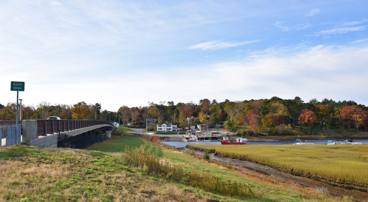
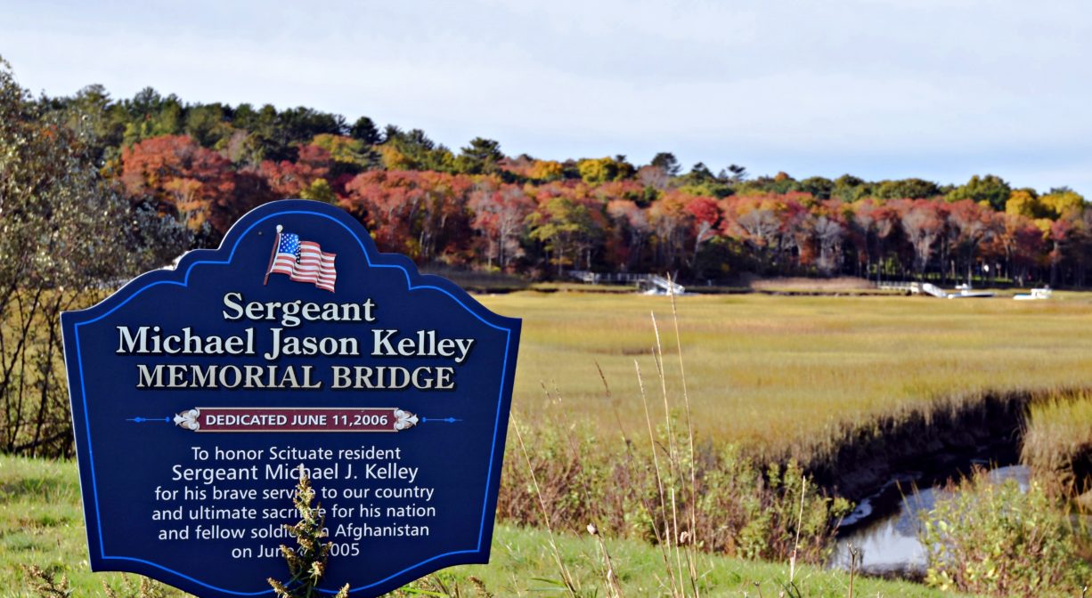
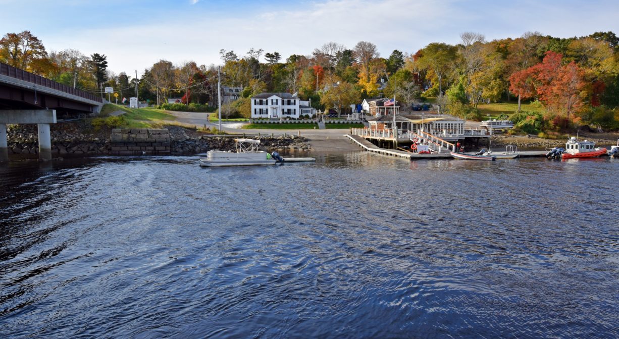
The Route 3A state highway bridge in Scituate features a scenic pull-off area with gorgeous views of the North River estuary. Originally constructed in 1825 as Little’s Bridge, and now known as the Sergeant Michael Jason Kelley Memorial Bridge, it was dedicated in 2006, to honor a Scituate resident. It offers 1-hour public parking for up to 12 vehicles.
Features
Beginning in 1637, William Vassall of Belle House Neck in Scituate operated Vassall’s Ferry near this site. It was also known as the New Harbor Ferry. The cost was one penny for a man, and four pence “for a beast.” It is likely that the ferry boat was at first a canoe or a skiff. The ferry service itself carried passengers from the upland east of the present-day bridge to Vassall’s property at today’s 20 Neal Gate Street in Scituate. The original route was established by aboriginal tribes. A square-ended scow eventually replaced the canoe/skiff, to accommodate teams of horses and stagecoaches. By 1730, it was known as Doggett’s Ferry, and was operated by Thomas Doggett of Marshfield, and later his son John (age 15).
A charter member of the Massachusetts Bay Company, William Vassall left Scituate in 1646, and established a enslaved-labor sugar plantation in Barbados. His son John established slave plantations in Jamaica. Maintaining their connections in Scituate, the family was prominent in the 17th-century slave trade between the West Indies and Massachusetts. Click here to learn more about this and other stories on the North River Early Black Heritage Trail.
The first bridge at this site — Little’s Bridge — was a drawbridge and a toll bridge. It was constructed in 1825 by a stock company made up of local men, including members of the Little family. The keeper lived in a small adjacent house, and collected a toll from anyone crossing, whether on foot or by horse/cart. Charles Lewis was the first keeper, followed by Freeman Damon and Edwin Curtis. Later the toll was waived for pedestrians. For a single team of horses the toll was 8 cents, and for a double team it was 10 cents. Luther Tilden was the last toll keeper. In 1865, the towns of Marshfield and Scituate took control of the bridge, and removed the toll requirement. The draw bridge was opened to enable packet ships to pass through. This was also required when large ships constructed upstream were hauled downriver, on their way to White’s Ferry and the ocean.
You can view the old stone abutments of former bridges at this site if you look up/under the bridge from the parking area at Roht Marine‘s Marshfield location.
The North River forms the border between the towns of Marshfield and Scituate. Local lore tells the story of two ministers, Reverend Leonard from the Second Church of East Marshfield and Revered Edmund Q. Sewall from the First Church of Scituate. The two ministers exchanged pulpits with some regularity. On those occasions, they would meet early in the morning at the bridge, where they would swap horses to avoid paying the toll.
In the 1800s, Luther Rogers operated a packet ship at or near this location. He also owned a store (1823-1848) at the corner of Highland and Old Main Streets in Marshfield, which was on the stagecoach route to Boston. His packet ship supplied the store, but also bought and sold goods at packet landings farther upriver. Rogers was one of many North River packet ship pilots.
Packet ship lines were established prior to 1670, and thrived until railroads came to the South Shore in the mid-to-late 1800s. Over time, White’s Ferry, Little’s Bridge, Union Bridge, Hobart’s Landing, Foster’s Landing, Job’s Landing, Brick-Kiln Yard, and the North River (Washington Street) Bridge in Hanover became regular stops. Farmers would meet the packet ship and barter for items from China and Mediterranean, such as coffee, sugar, rum, and spices. In addition to home-grown goods, packet pilots also bought wood, fish, pot iron, and charcoal from locals, and sold them lumber and ship supplies.
The William Taylor yard, an early shipyard, was located downstream of the bridge, on the Marshfield side. Very likely it specialized in boat and ship repair, as opposed to construction.
This land is within the region of the Massachusett (or Massachuseuk). To learn more about local Native American tribes, we encourage you to interact with their members. The Mattakeeset band of the Massachusett, and the Massachusett tribe at Ponkapoag, both share information on their websites.
Trail Description
A paved pull-off area provides parking for up to 12 vehicles, plus sidewalk access to the bridge.
Habitats and Wildlife
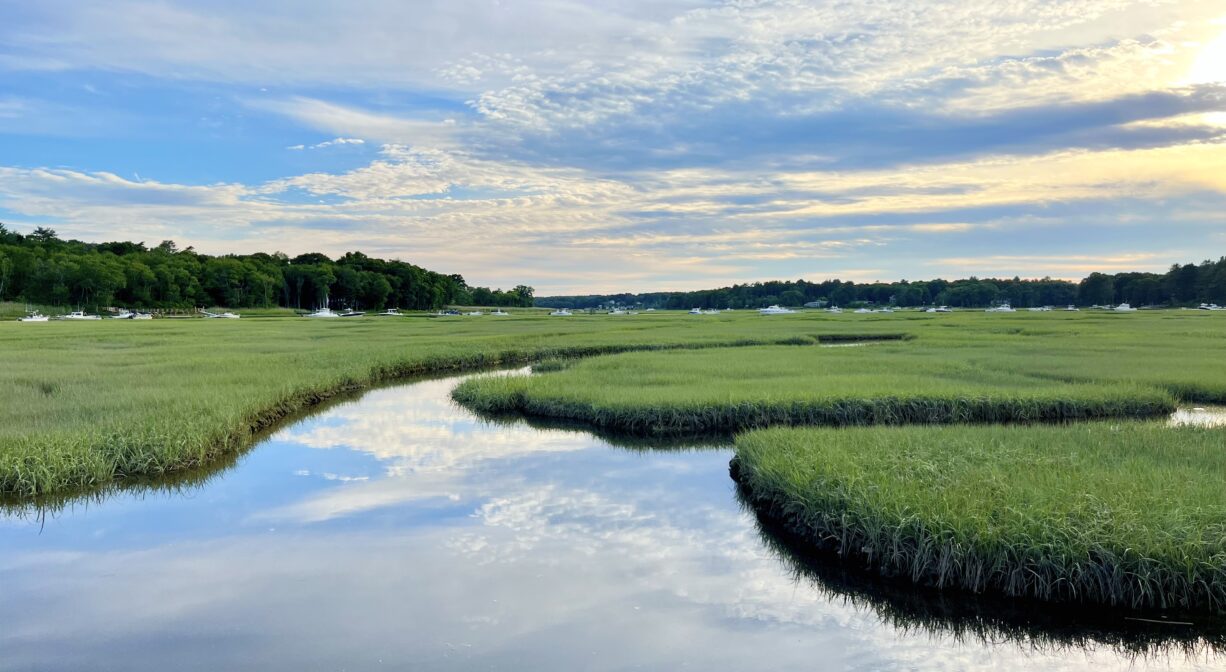
The bridge crosses the North River. Watch for the occasional harbor seal in the water. Bald eagles nest nearby, so you may see adult or juvenile eagles. Also watch for the peregrine falcons, which sometimes chase terns, and red-tailed hawks. In the summer, look for snowy egrets in the marsh.
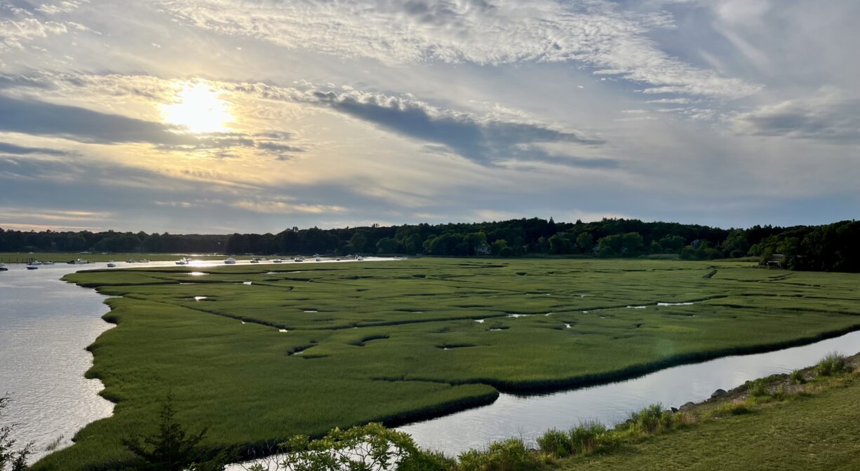
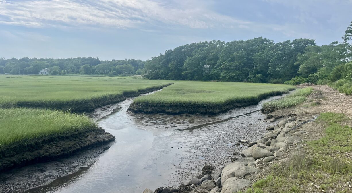
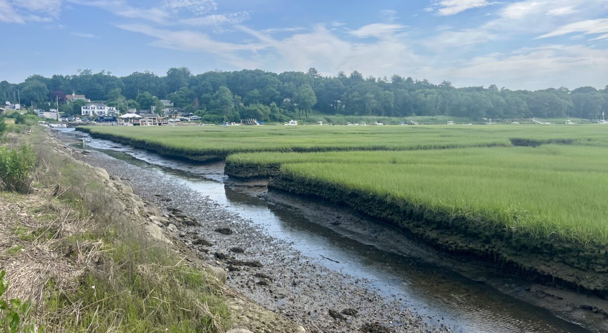
The North River, approximately 10 miles in length, begins at the confluence of the Indian Head River (Hanover) and Herring Brook (Pembroke). From there it flows through the towns of Hanover, Pembroke, Marshfield, Norwell, and Scituate. It empties into the Atlantic Ocean between Third and Fourth Cliffs, draining approximately 59,000 acres along the way.


Historic Site: Yes
Park: Yes
Beach: No
Boat Launch: No
Lifeguards: No
Hours: Dawn to Dusk
Parking: On-site parking for up to 12 vehicles is available in the scenic pull-off area just north of the bridge, at 12 Chief Justice Cushing Highway. Parking is limited to 1 hour.
Cost: Free
Trail Difficulty: Easy
Facilities:
Picnic tables, informational kiosk, interpretive signage, trash receptacles.
Dogs: Dogs must remain on leash. Always clean up after your dog!
Boat Ramp: No
ADA Access: Yes
Scenic Views: Yes
Waterbody/Watershed: North River