348 Central Ave, Humarock, MA 02047, USA
https://www.hanscomfss.com/fourth-cliff
Owned By: United States Air Force
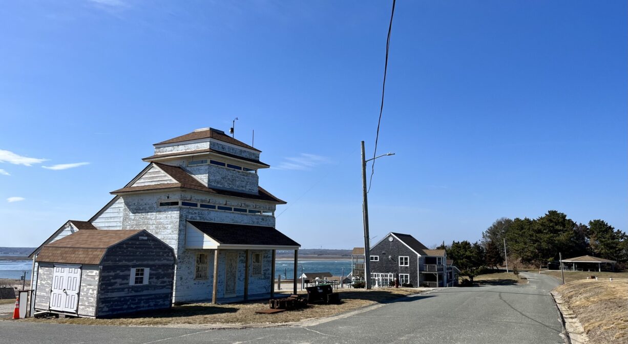
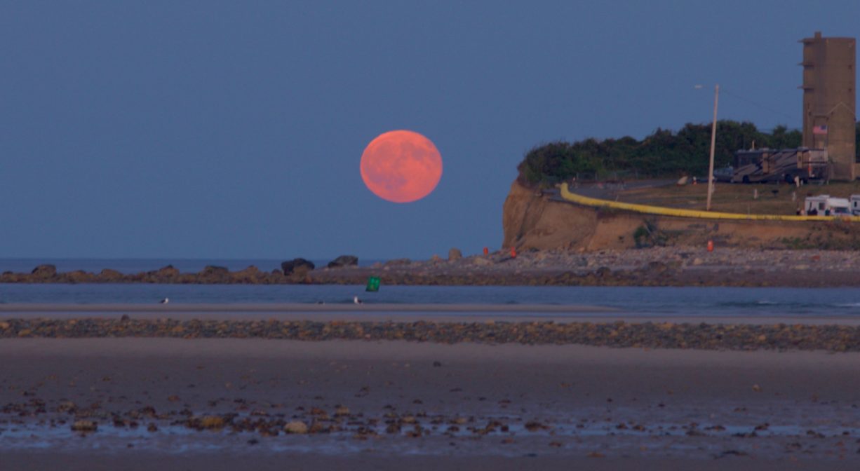
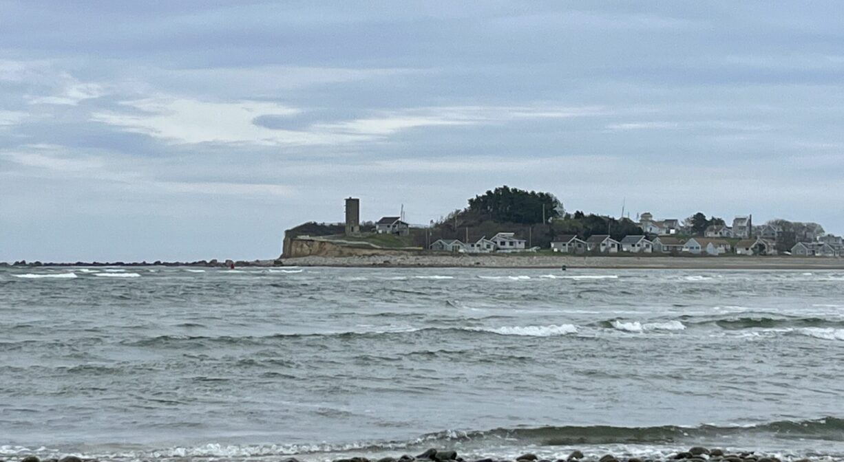
The US Air Force Recreation Area, at the tip of Fourth Cliff in Humarock, is a historic site is owned and operated by the United States Air Force for its own private use. The concrete submarine watch tower still remains and serves as a landmark to those seeking entrance to the North River.
Through the years, the site has served as a US Navy Radio Compass Station, an Army Coastal Artillery Gun Site, an Air Force antenna tower site, and an Air Force Family Recreation Area. There is no public access.
Features
According to Fred Freitas’s book Humarock: Hummocks, Humming Rocks, and Silver Sands, the US military began its tenure at Humarock in 1910, when the Army Corps of Engineers conducted a partial survey of the area. Just after World War I, the government built a Navy Radio Compass Station on the northernmost section on Fourth Cliff. The station coordinated with additional stations at Deer Island and Gloucester to triangulate signals, helping ships in and out of harbors in fog or other murky conditions. The barracks were constructed 1924.
The US Army bought all 57 acres of Fourth Cliff in 1941. In 1942, it built a Coastal Artillery Gun Site here, considered “one of the most unique and deadly coastal fortifications in New England.” It was known as battery 206 (or 208), and was part of the World War II Boston Harbor coastal defense system. There were two 6-inch Model T2 guns mounted about 60 feet above sea level, concealed with shrubbery and with a small wooden shed-like structure built over them for camouflage.
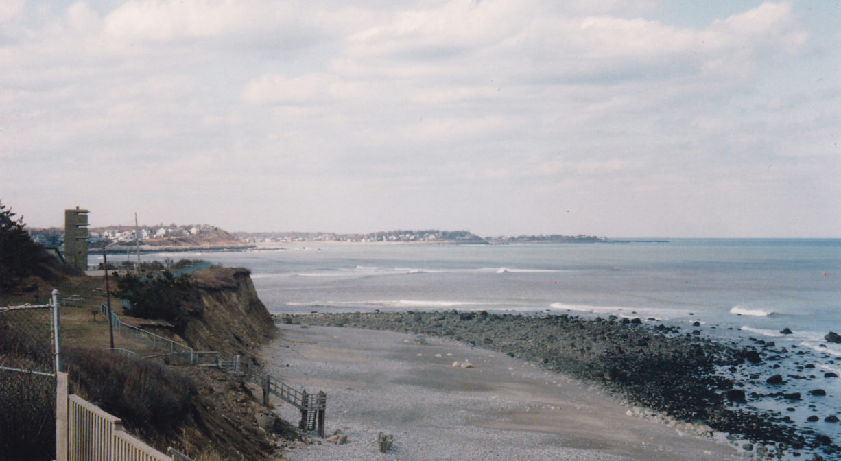
From the ocean, the area was made to look like cottages on a cliff, but it was really a military base in disguise. There was also a radar unit to guide the guns on Holly Hill, across the South River. The bunker and concrete observation tower are still there, but not open to visitors. There is concern about erosion of the cliff, which is beginning to undercut them.
After World War II, and the advent of the jet engine, coastal defense became more of an air-based effort, not sea-based. The US Air Force, then a new branch of the military, took control of Fourth Cliff in 1948. In 1955 it was called the Fourth Cliff Research Annex. Antenna towers were added during the Cold War.
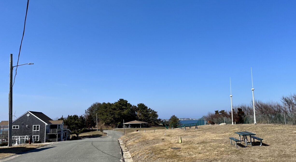
The guns platforms have now been covered up. One has a wooden picnic pavilion over it, and the other has been converted into a RV camping site. The area itself became an Air Force Family Recreation Area in 1964. The antennae were taken down, some of the buildings were restored, new cottages were built and RV pads constructed. There is no public access.
Have you ever wondered why Humarock is part of Scituate, not Marshfield? It’s not attached by land to Scituate. It’s actually contiguous with Marshfield – by land, via the Rexhame Dunes. (It’s also attached to Marshfield by bridge, on Sea Street/Marshfield Avenue.) Before 1898, the mouth of the North River sat at the southern end of Humarock, near present-day Rexhame Beach in Marshfield. The site of the current mouth between Third and Fourth Cliffs was then a narrow barrier beach.
On November 26 and 27, 1898, a nor’easter known as the Portland Gale struck the New England coastline. It is remembered particularly for wreaking havoc on the South Shore and Cape Cod. Named after one of over 100 ships that were wrecked during the course of the storm, the Portland Gale claimed more than 400 lives in under 24 hours. It is considered to be New England’s worst maritime disaster ever, with widespread destruction of homes, railroad tracks, sea walls and bridges.
At the height of storm, a surge on the river washed right over the beach between Humarock’s Third and Fourth Cliffs, and out to sea. It was powerful enough to make a permanent cut in the beach. So the outgoing river tides continued to flow through what became known as New Inlet to the sea, and the incoming ocean tide, flowed through there to the river. Thus, the North River, with its mouth now three miles farther north, became 3 miles shorter! And the South River – which originally flowed into the North River at Rexhame – became 3 miles longer. After a couple years, the old mouth at Rexhame filled in with sand and became part of the beach. It’s now the northern portion of the Rexhame Dunes.
This wasn’t entirely an unwelcome change – at least for some. For years there had been a movement to make a cut in the beach between Third and Fourth Cliffs. Earlier in the century North River shipbuilders had lobbied for a “new inlet” that would make it easier to sail a newly-constructed ship downstream to the ocean. Because of the shallow and winding nature of the waterway, it often took an entire week to get a North River ship out to sea. The final few miles of river along Humarock were particularly difficult to navigate, and since this stretch could only accommodate a certain size vessel, it set a limit on the size of the ships that could be built. An inlet between Third and Fourth Cliffs might alleviate this problem, but when the shipbuilders petitioned the state legislature to fund such a cut their request was denied. After a hearing with residents from all of the riverfront towns it was determined that relocating the mouth of the North River would have far too much impact on the other river industries, namely agriculture and salt marsh haying.
However . . . in 1843, a group of set out under cover of night and with shovels, picks, and teams of oxen and made a clear cut across the beach. They were unable to complete the task, as they discovered a rock-hard meadow bank beneath the sand. Water flowed through their cut temporarily, but the beach soon filled back in. A similar effort, for which a dredging machine was hired, was made in 1858. There is some speculation that these attempts to relocate the river mouth weakened the resolve of this stretch of beach so that when the Portland Gale arrived in 1898, it was all the more susceptible to the force of the water.
In the years since the Portland Gale cut a new inlet for the North River, the size of the mouth has increased fifteen times over. What was once only 200 feet wide and ten feet deep is now 1/2 to 1 mile wide and up to 60 feet deep. The Rexhame Dunes now stand at the site of the old mouth. The dunes rise at least 20 feet above the mean high tide level, helping to enclose one of the more unique landscapes on the South Shore.
The opening of the New Mouth affected agriculture, because of increased flooding. Fields near the river couldn’t be farmed in the same way, or at all. Salinity levels of the marshes increased, salt haying business ceased as more coarse grasses took over, white cedar trees as far as Job’s Landing in Pembroke died. You can still see the dead cedars. Before the coming of the new mouth, the ocean’s high tides flowed to the North River’s 5,000 acres of salt marsh with the spring tides, only twice each month. With the opening of the inlet at Fourth Cliff, the frequency of these high tides increased to twice each day.
Prior to all of this, the Tilden family of Scituate had extensive land holdings on Fourth Cliff, including an expanse of salt marsh in “New Harbour,” what was then a protected area inside the cliff, as well as at least one homestead (constructed in 1828). The Humane Society of the Commonwealth of Massachusetts established a small “hut” safety station on Fourth Cliff in 1857. It was replaced by a larger station in 1879, the Fourth Cliff Lifesaving Station. There was also a boarding house, the Fourth Cliff House, for vacationers and shorebird hunters.
This land is within the region of the Massachusett (or Massachuseuk). To learn more about local Native American tribes, we encourage you to interact with their members. The Mattakeeset band of the Massachusett, and the Massachusett tribe at Ponkapoag, both share information on their websites.
Habitats and Wildlife
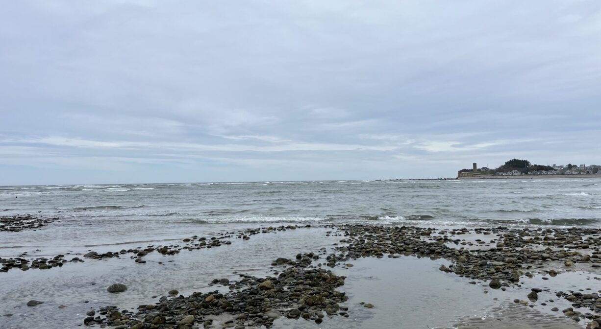
Located at the mouth of the North River, also known as New Inlet. The currents here are very dangerous and should not be navigated by canoes, kayaks, or other paddling boats. It is the third most dangerous inlet in Massachusetts.
Erosion has been an issue on Fourth Cliff for as long as it’s been inhabited. In 1893, the Fourth Cliff Life Saving Station had to be moved because, “the sea was making dangerous inroads upon the station.” In the 1948, three Air Force barracks at the tip of Fourth Cliff were removed and sold to private entities because the land beneath them was eroding quickly. A 2001 study by the Air Force concluded that the combined effects of wave action at the base of Fourth Cliff, as well as storm water runoff, continued to erode it. It’s plain to see, with the naked eye, that the erosion continues today.
Historic Site: Yes
Park: No
Beach: No
Boat Launch: No
Lifeguards: No
Size: 56 acres
Hours: Not open to the public.
Parking: No public parking.
Facilities:
No public facilities.
Dogs: No
Boat Ramp: No
ADA Access: Yes
Scenic Views: No
Waterbody/Watershed: North River, South River