
280 Driftway, Scituate, MA 02066, USA
Owned By: James Landing
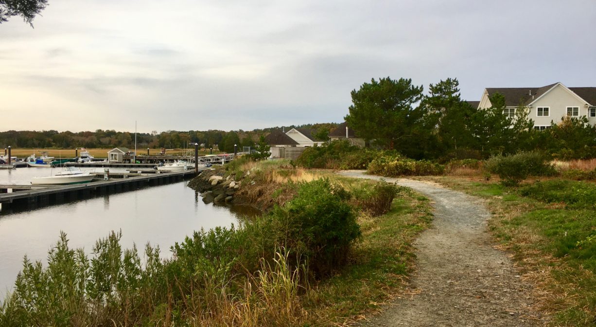
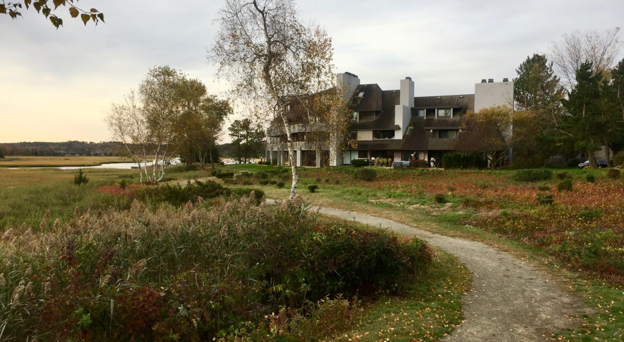
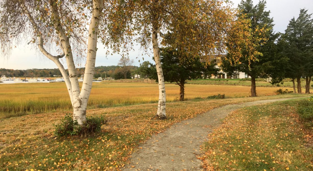
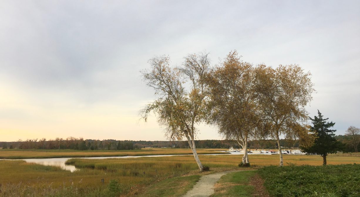
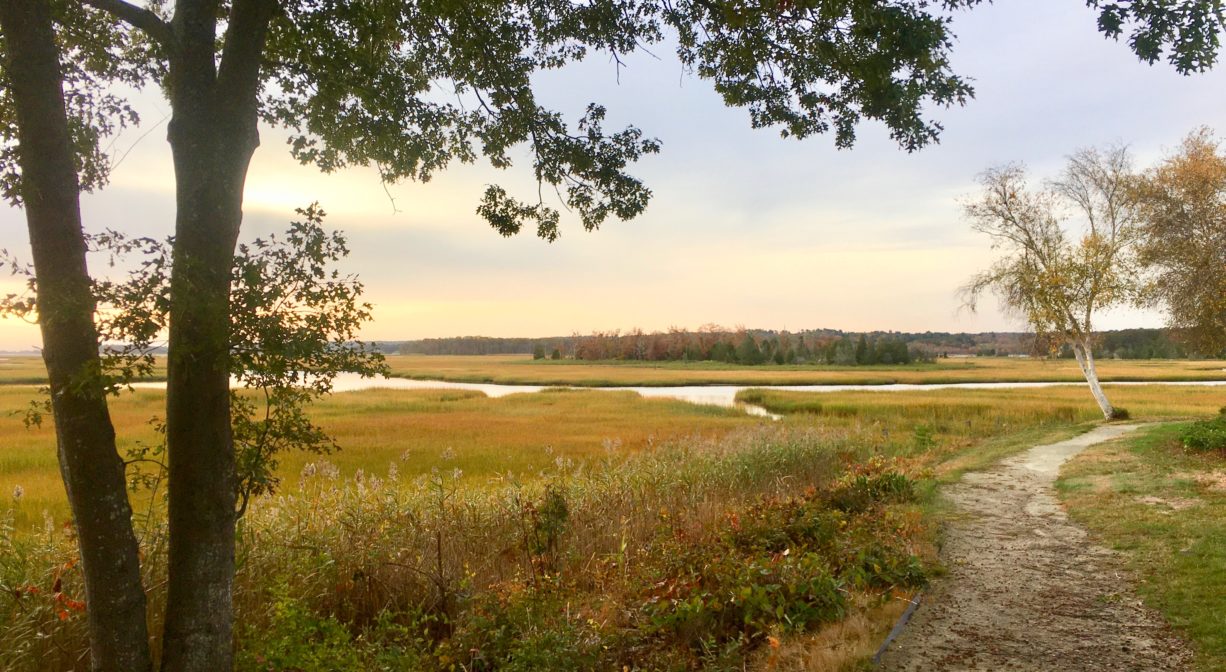
The James Landing Walkway is a scenic, 0.3-mile gravel trail for public use that connects to Scituate’s Driftway. It extends along the edge of the Herring River marsh, through the James Landing condominium complex, with views of the Herring River.
Hunting is not permitted on this property.
Continue your walk on the Driftway Multi-Purpose Path, which continues in one direction to Herring River Trail, and in the other direction to Driftway Conservation Park, Widow’s Walk Golf Course, the Scituate Dog Park, and beyond.
Features
This land is within the region of the Massachusett (or Massachuseuk). To learn more about local Native American tribes, we encourage you to interact with their members. The Mattakeeset band of the Massachusett, and the Massachusett tribe at Ponkapoag, both share information on their websites.
Trail Description
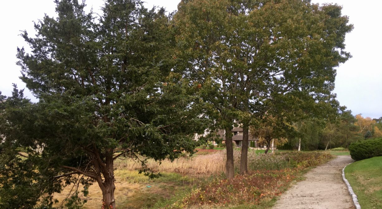
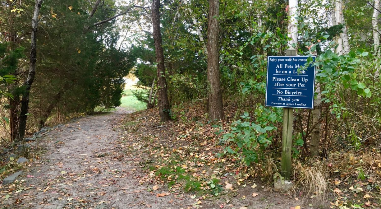
If you start at the Driftway Conservation Park, the best way to find the James Landing Walkway is to head out of the driveway and turn left on the Driftway Multi-Purpose Path. Follow this paved path (sidewalk) about 0.3 miles, then look for a dirt trail to the left, heading up a moderate incline into the back of the James Landing condominium complex. At the top of a small hill, you will see a blue sign with trail rules. Head to the left, and follow the scenic gravel walkway along the edge of the marsh, where you can enjoy views of the Herring River and the mouth of the North River. Please be mindful of private property boundaries.
Habitats and Wildlife
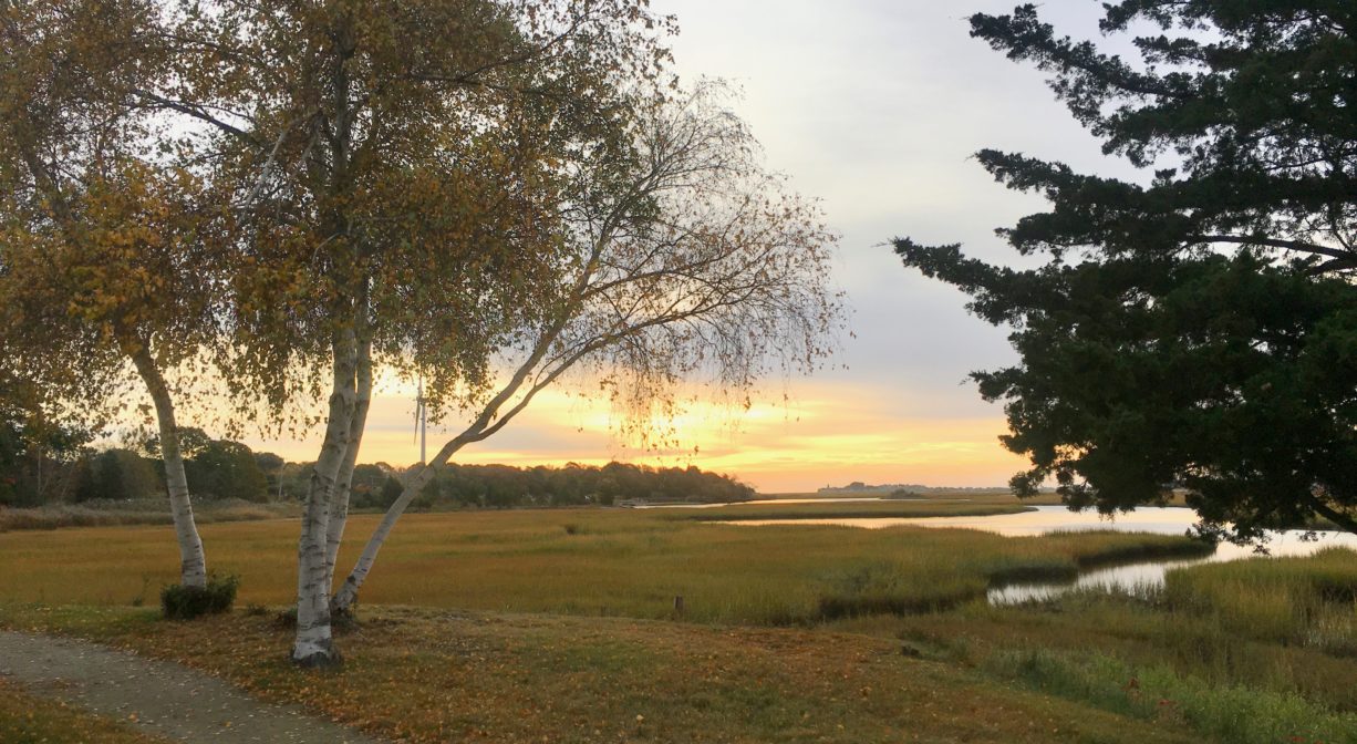
Because of its location on the Herring River, this property is an excellent spot to observe numerous species of native birds and fish. Watch for snowy egrets in the adjacent salt marsh. The walkway features open views of the marsh, but also several birch and cedar trees, as well as a few oaks and pines.
First Herring Brook finds its source in Scituate in the area west of Route 3A, between First Parish Road and Old Oaken Bucket Road. It flows through the First Herring Brook Reservoir, and downstream to Old Oaken Bucket Pond, passing through two dams. Below the historic Stockbridge Grist Mill, at the Driftway, it flows into Herring River, a major tributary to the North River. Herring River flows into the North River near The Spit.
Historic Site: No
Park: No
Beach: No
Boat Launch: No
Lifeguards: No
Size: 0.3 miles
Hours: Dawn to Dusk
Parking: The best parking spot for public use of the James Landing Walkway is the Driftway Conservation Park at 250 Driftway in Scituate.
Cost: Walkway usage is free.
Trail Difficulty: Easy
Dogs: Dogs must remain on leash. Always clean up after your pet!
Boat Ramp: No
ADA Access: No
Scenic Views: Yes
Waterbody/Watershed: Herring River (North River watershed)