
Conservation Park, Driftway, Scituate, MA, USA
Scituate Conservation: 781-545-8721
Owned By: Town of Scituate
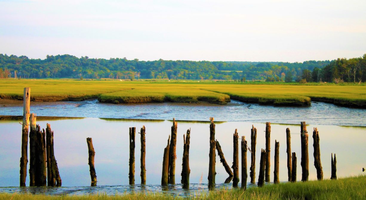
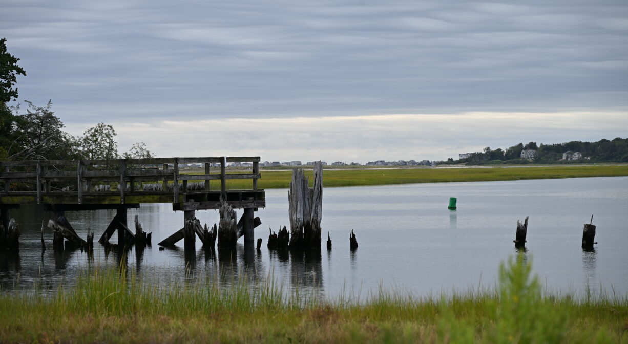
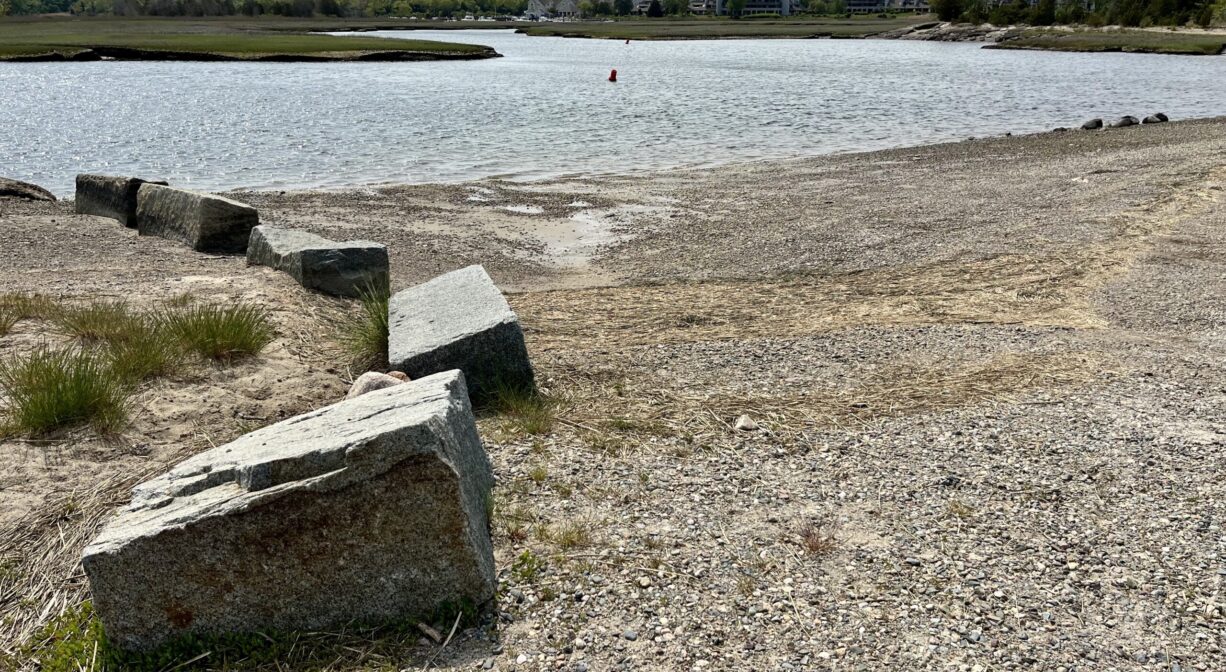
Driftway Conservation Park is 334 acres in Scituate with a panoramic view of the Herring River and its salt marshes. In the 1930’s, Boston Sand and Gravel owned the property and mined it for projects such as the construction of Logan International Airport. You can still see vestiges of the wharf that was built to aid in the transport of sand, via barge, to Boston.
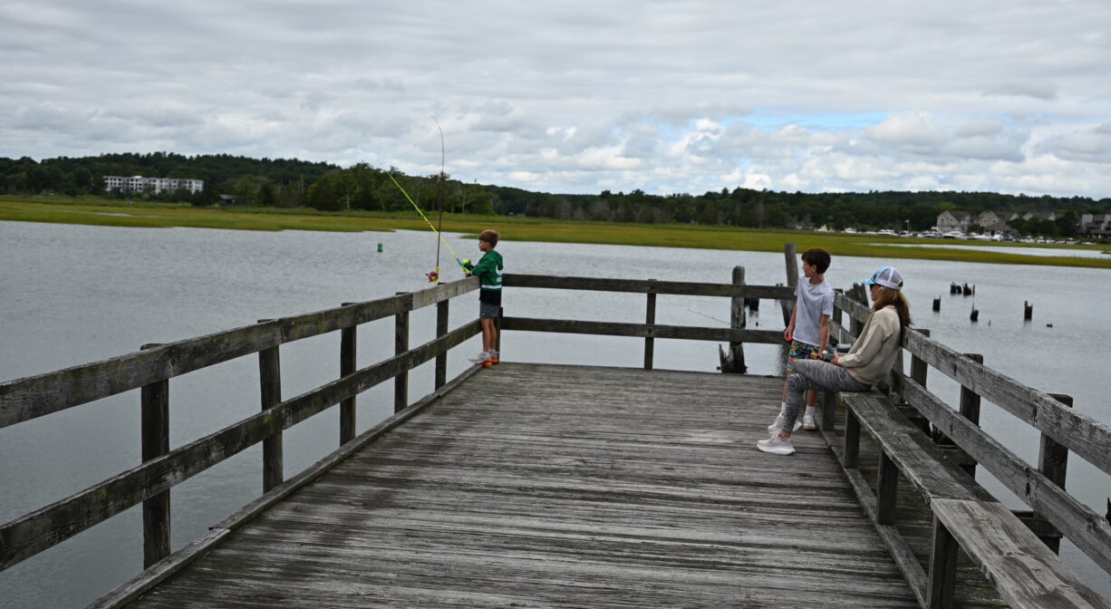
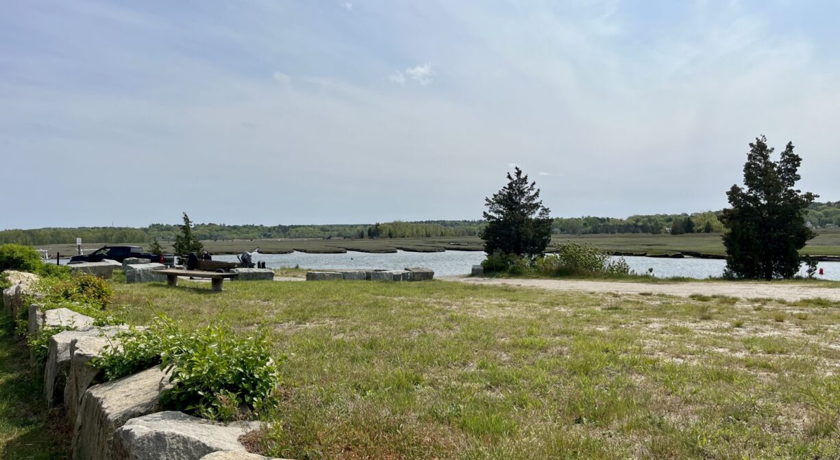
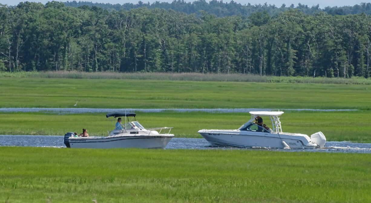
Walking trails, a fishing pier, a small trailered boat launching ramp, an open field, and picnic benches allow for public use of this popular site. Convenient access to the Driftway Multi-Purpose Path, which continues in one direction to Herring River Trail, the James Landing Walkway, and Widow’s Walk Golf Course, and in the other direction to the Scituate Dog Park and beyond. Launch your kayak, canoe, or paddleboard here and explore the Herring River and its marshes, but avoid the river mouth beyond The Spit.
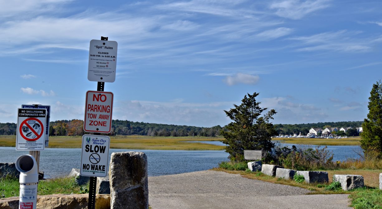
Tide Math: High tide at the Driftway Conservation Park is about 45-60 minutes after the Boston high tide. Set off from here to go clamming
SHELLFISHING: The shellfish beds in both the North and South Rivers are now closed for the season. They are typically open from November 1 to May 31st. Please visit our Shellfishing page for maps and permit info.
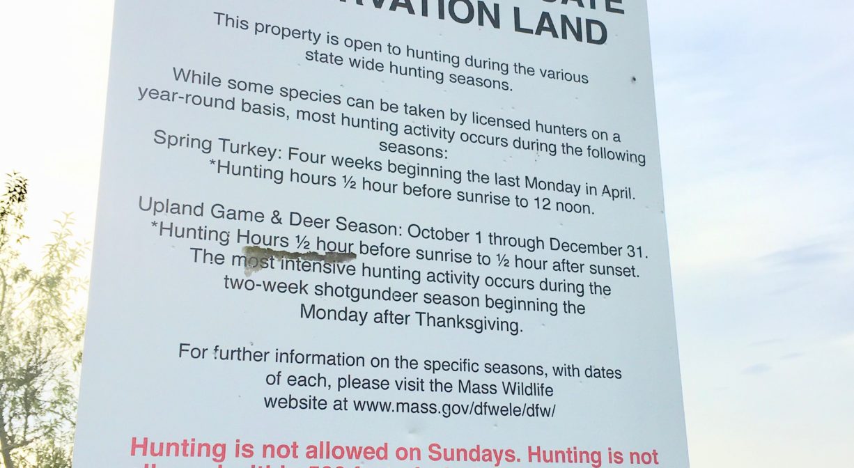
HUNTING: Hunting is allowed, in season, by licensed persons in compliance with Massachusetts law. Please be sure to understand state and local hunting guidelines before proceeding. Non-hunters, be mindful of hunting seasons, and wear bright orange if you’re entering the property during those times. Hunting is not permitted on Sundays.
FISHING ADVISORY: It’s important to know that some of our freshwater fisheries are contaminated with mercury, PFAS and/or other concerning substances. The Massachusetts Department of Public Health maintains an online database with up-to-date advisories regarding fish consumption, sorted by location. We recommend you consult this valuable resource when planning a fishing excursion.
Features
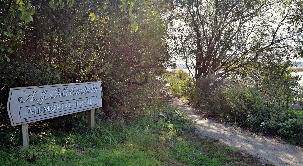
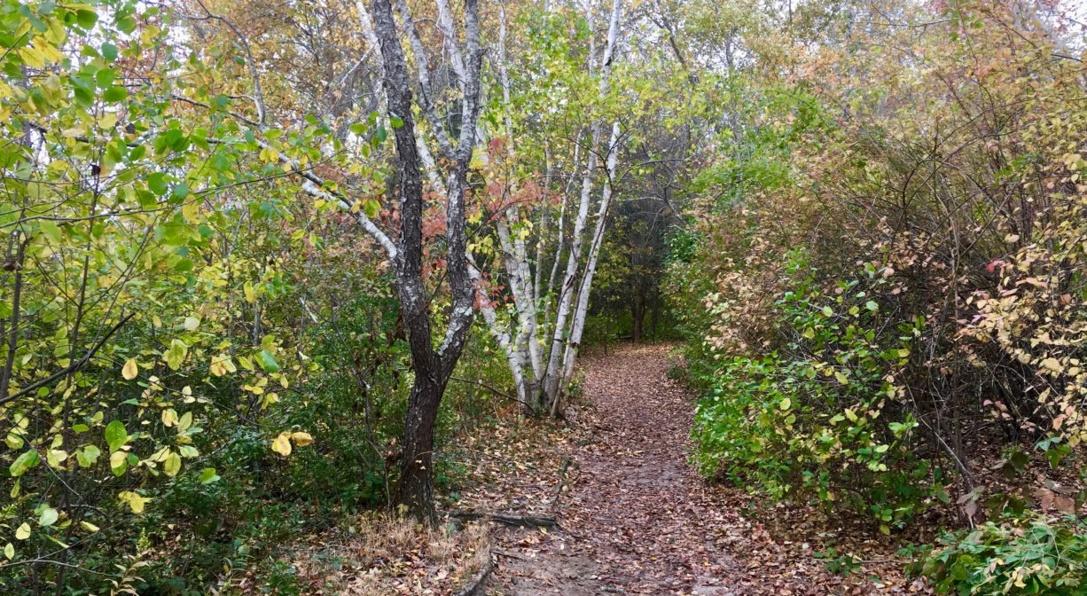
Don’t miss the 1.65 mile A. J. McEachern Memorial Trail network — a variety of paved, gravel, and sand paths — a fantastic place for dog walkers and bird watchers … or just to get away for a while. Bear in mind that hunting is permitted on this property during the various statewide hunting seasons. A sign in the parking lot spells out many of the details. Please proceed with caution, especially in the marshes, during these times.
The public parking lot can be busy in the summer due to the property’s popular boat launch. Lookout Hill, close to the parking lot, is the highest point in the park. It offers a panoramic view of Third and Fourth Cliffs, Wood and Bear Islands, and the mouth of the North River (New Inlet). This property is also a great place to view Scituate’s wind turbine.
Beginning in 1914, the Boston Sand and Gravel Company undertook an extensive earth removal project on this site and beyond. Colman’s Hill once stood on the inland side of today’s Driftway, from the Greenbush railroad station north to Kent Street, offering a broad view of the entire estuary. Little by little, Boston Sand and Gravel carted away the material that made up the hill — first by steam-driven sand scows, then by tugboats and barges, and later by trucks and trains. By 1963, over 14 million tons of sand and gravel had been removed and the hill was gone. That year, a dramatic fire destroyed the sand & gravel company. Later, the Town of Scituate purchased the land.
This land is within the region of the Massachusett (or Massachuseuk). To learn more about local Native American tribes, we encourage you to interact with their members. The Mattakeeset band of the Massachusett, and the Massachusett tribe at Ponkapoag, both share information on their websites.
Trail Description
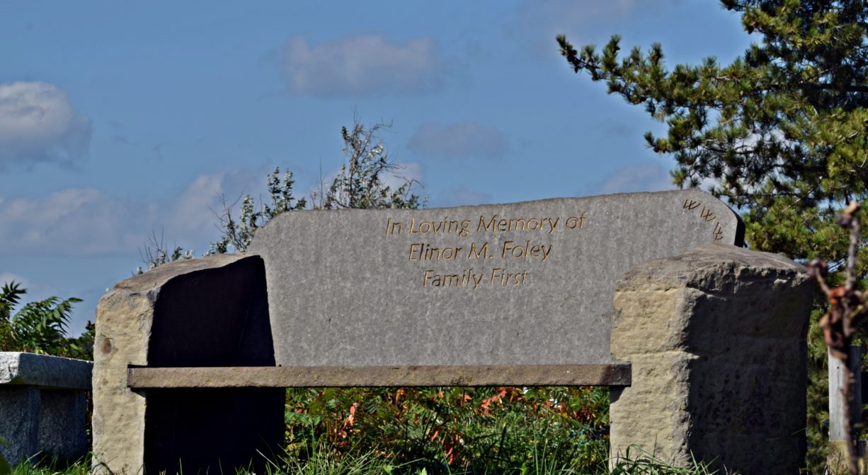
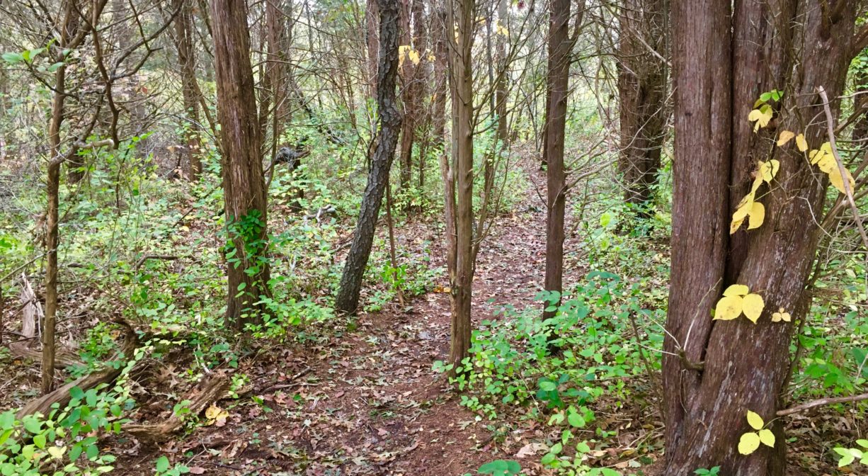
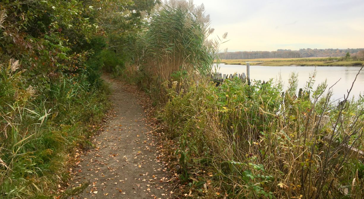
To find the trailhead for the A. J. McEachern Trail, follow the paved walkway along the water for about 0.1 mile. After you pass the wooden fishing pier, you will see a sign for the trail. In general, the trail is well-maintained, flat, easy terrain. Some sections are stroller-friendly, and there are occasional benches. The trail leads into the woods to a memorial stone, which serves as a useful landmark.
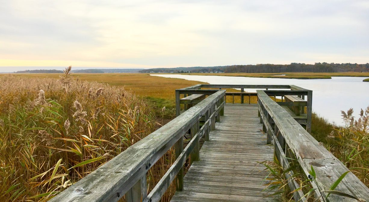
• If you turn right at the memorial, and then go straight ahead, you will soon find yourself on a wooden pier with ample bench seating and views of the Herring River and its marshes. Truly a lovely spot.
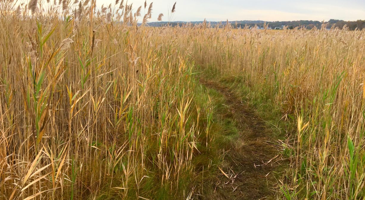
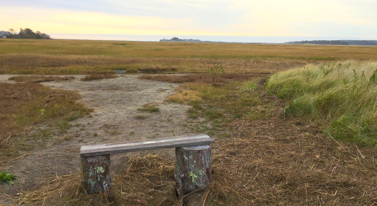
• If you turn right at the memorial and then take a quick left onto the blue trail, you will pass through a forest comprised primarily of maple, cedar, oak, cherry, pine and birch, with plenty of ferns and sweet pepper bush. The trail is mostly narrow and flat, but occasionally there are steep and/or uneven sections. This trail eventually offers the option to loop back around, heading back to the memorial, as well as to the red trail. Another option is not to loop back yet, but to continue out into the marsh, where there is a small island, as well as “Carol’s Perch,” a bench that looks out across the marsh. This is the yellow trail; it may be flooded during higher tides. There are several side trails in this section, most of which eventually reconnect with the main trails of the McEachern network. Some offer up-close views of Scituate’s windmill.
• If you turn left at the memorial, you can follow the red, yellow, and green trails through woodlands and sandy clearings, generally with wider paths. Not all trails are clearly marked, and they all seem to circle back onto each other eventually.
Suggested paddling excursions from this location (timing is approximate and depends quite a bit on wind, tide, and your own strength and stamina):
• Put your boat in the water 1-2 hours before ocean low tide. Paddle upstream to The Spit, and take some time to explore while the tide is out. Return to Driftway Conservation Park as the tide comes back in. (1 hour on the water, plus time to explore)
• Stage a second vehicle at the Marshfield Public Launch on Union Street. Bring your boat to Driftway Conservation Park, and put in the water 2-4 hours before ocean high tide. Paddle up Herring River toward The Spit. This will be against the rising tide, but it’s a relatively short distance. When you reach the North River, continue upstream, Damon’s Point and the Route 3A Bridge, and perhaps exploring a bit of Cove Creek. The Marshfield Public Launch will be on your left, just after the Union Street Bridge. (2+ hours on the water)
• Stage a second vehicle at Pembroke Town Forest. Bring your boat to Driftway Conservation Park, and put it in the water 2-3 hours before ocean high tide. Paddle up Herring River toward The Spit. This will be against the rising tide, but it’s a relatively short distance. When you reach the North River, continue upstream, past Damon’s Point and the Route 3A Bridge, riding the rising tide to your endpoint, and perhaps stopping at Couch Beach along the way. The Pembroke Town Forest will be on your left a short distance after the spot where Robinson’s Creek flows into the North River. (4-5 hours on the water)
Habitats and Wildlife
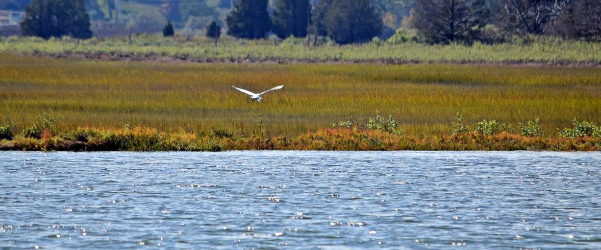
The woodland here is relatively new. It began growing after a 1963 fire resulted in the cessation of sand & gravel mining operations. In the sandy areas, look for beach heather, little bluestem grass, and bayberry. The forest itself is home to high bush blueberry, pussy willow, and arrowwood. Trees include red cedar, American holly, black cherry, crabapple, oak, pine, red maple, and quaking aspen. Watch out for poison ivy! The salt marsh is made up primarily of black grass and spike grass, with some sea lavender, goldenrod, and glasswort.
Numerous bird species favor this marshy conservation land, due to its proximity to the river. Look for egrets, yellowlegs, willets, and sandpipers at low tides. Just downstream of the pier, look for bank swallows nesting in holes in the riverbanks. Bald eagles have been spotted here. Kingfishers sometimes nest here. Also, you may see fox and deer along the trails.
The Herring River, a continuation of First Herring Brook, flows through this property. First Herring Brook finds its source in Scituate in the area west of Route 3A, between First Parish Road and Old Oaken Bucket Road. It flows through the First Herring Brook Reservoir, and downstream to Old Oaken Bucket Pond, passing through two dams. Below the historic Stockbridge Grist Mill, at the Driftway, it flows into Herring River, a major tributary to the North River. Herring River flows into the North River near The Spit.


Historic Site: No
Park: Yes
Beach: No
Boat Launch: Yes
Lifeguards: No
Size: 334 acres
Hours: Dawn to Dusk
Parking: On site parking lot at 251 Driftway.
Cost: Free
Trail Difficulty: Easy
Facilities:
Portable toilet at park entrance. Numerous benches plus 12 picnic tables. Trash and dog waste receptacles. Two wooden piers for fishing and wildlife observation. Kayak storage racks. Geocache location.
Dogs: Dogs must remain on leash. Always clean up after your dog!
Boat Ramp: Yes
ADA Access: Yes
Scenic Views: Yes
Waterbody/Watershed: Herring River (North River watershed)