
1361 Union St, Marshfield, MA 02050, USA
Marshfield Conservation: 781-834-5573
Owned By: Town of Marshfield
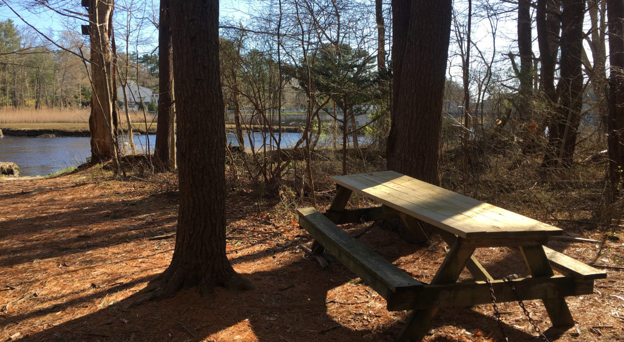
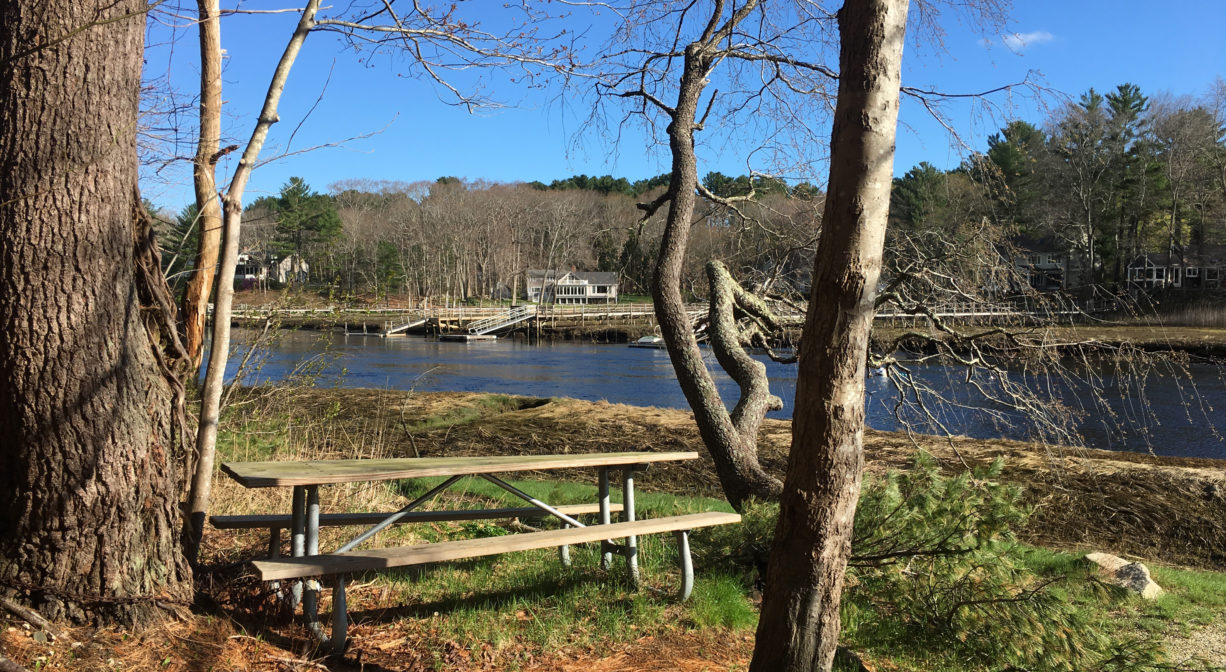
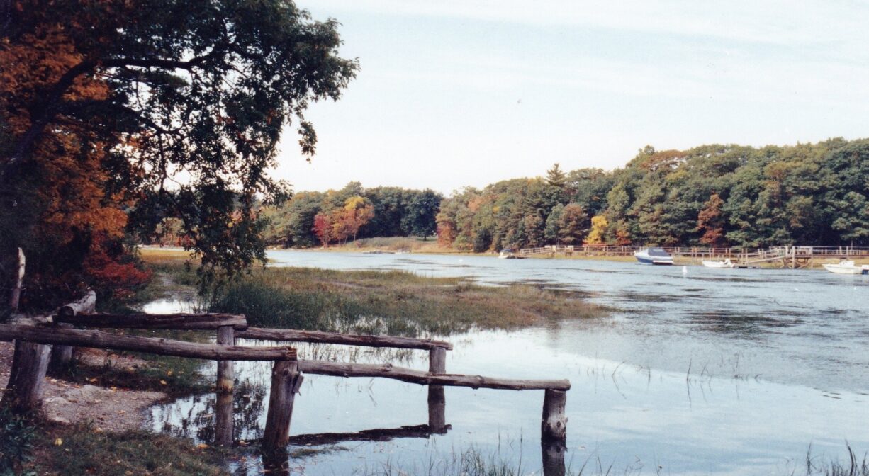
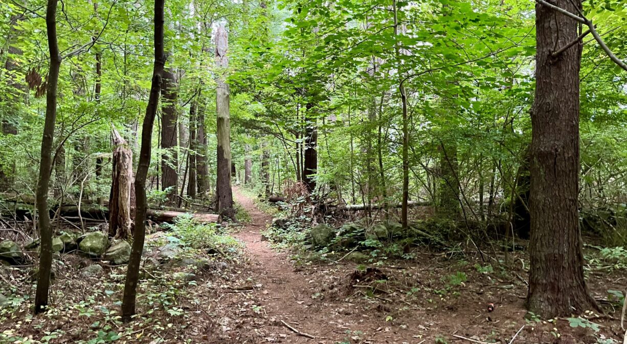
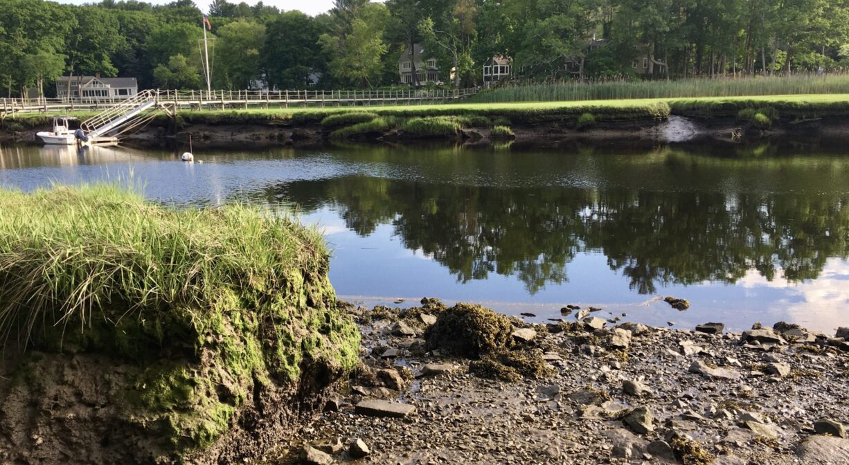
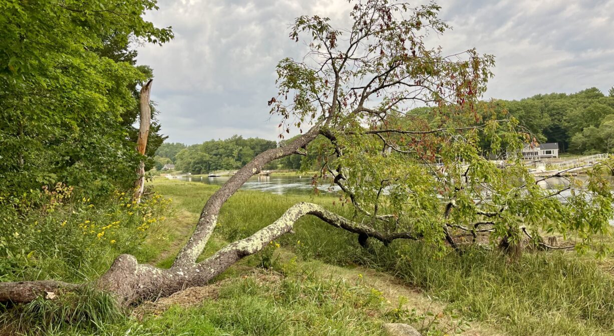
The Marshfield Launch and Brooks-Tilden Shipyard is a 15-acre conservation parcel, located directly on the North River, just upstream of the Union Street Bridge. The property features a public canoe/kayak launch, plus 2 picnic tables. It is also the site of the Brooks-Tilden Shipyard (1701-1848). A 0.1-mile trail extends through the woods from the parking area, past several old stone walls, to a scenic overlook with a memorial bench.
Tides at the Marshfield Launch are delayed ~1 -1.5 hours after the Boston high tide. Set off from here to go clamming!
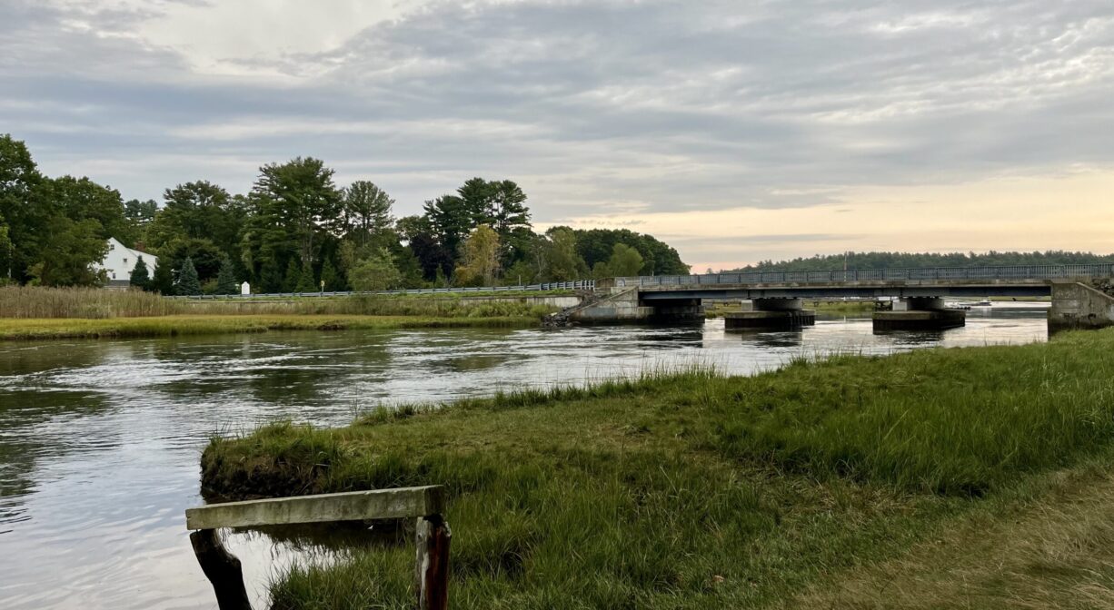
The Union Street Bridge spans the North River from Union Street in Marshfield to Bridge Street in Norwell. On the Norwell side, there is a ramp for boats (residents only). On the water in this area, be aware of swift currents and low bridge clearance. For related information, please see the listing for Union Street Bridge and Norwell Town Landing. The bridge is also the starting line for the NSRWA’s annual Great River Race.
SHELLFISHING: The shellfish beds in both the North and South Rivers are now closed for the season. They are typically open from November 1 to May 31st. Please visit our Shellfishing page for maps and permit info.
Hunting is not allowed at the Marshfield Launch/Brooks-Tilden Shipyard, nor at any of Marshfield’s other conservation properties.
FISHING ADVISORY: It’s important to know that some of our freshwater fisheries are contaminated with mercury, PFAS and/or other concerning substances. The Massachusetts Department of Public Health maintains an online database with up-to-date advisories regarding fish consumption, sorted by location. We recommend you consult this valuable resource when planning a fishing excursion.
Features
In 1977, the Town of Marshfield purchased this 15-acre parcel for conservation land, establishing a public canoe launch on site 3 years later. The landings on both sides of the Union Street Bridge are ideal places to launch your canoe or kayak. Be aware that there is a tide delay — 1 to 1.5 hours after the Boston high tide.
No records exist of ships built at this site prior to 1837, but it is likely that it was a shipyard for many years leading up to that point. In 1837, Elijah Brooks and George Tilden built the 106-ton schooner “Huron” here, as well as the 113-ton hermaphrodite brig “Lewis Bruce.” In the years that followed, they built the schooner “Erie” (113 tons), the brig “Michigan,” the schooner “Roanoke,” and the brig “Joseph Balch” (153 tons). Then in 1843, Elijah Brooks built the brig “Allen King,” which was probably the last ship constructed here.
Dating back even farther, the remains of a North River ferry boat are visible from the northern bank of the river, just upstream from here on the Norwell side, at dead low tide. Look in the third tidal ditch upstream of the bridge. (Water access only.) It’s likely that ferry traffic decreased dramatically after the Union Street Bridge was constructed in 1801, and certainly when the toll bridge became a free bridge in 1850.
This land is within the region of the Massachusett (or Massachuseuk) and Wampanoag Native American tribes. To learn more about local tribes, we encourage you to interact with their members. The Mattakeeset band of the Massachusett, the Massachusett tribe at Ponkapoag, the Mashpee Wampanoag, and the Herring Pond Wampanoag also share information on their websites.
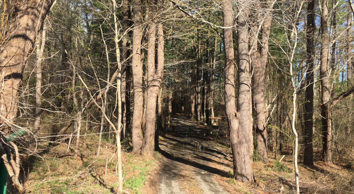
Trail Description
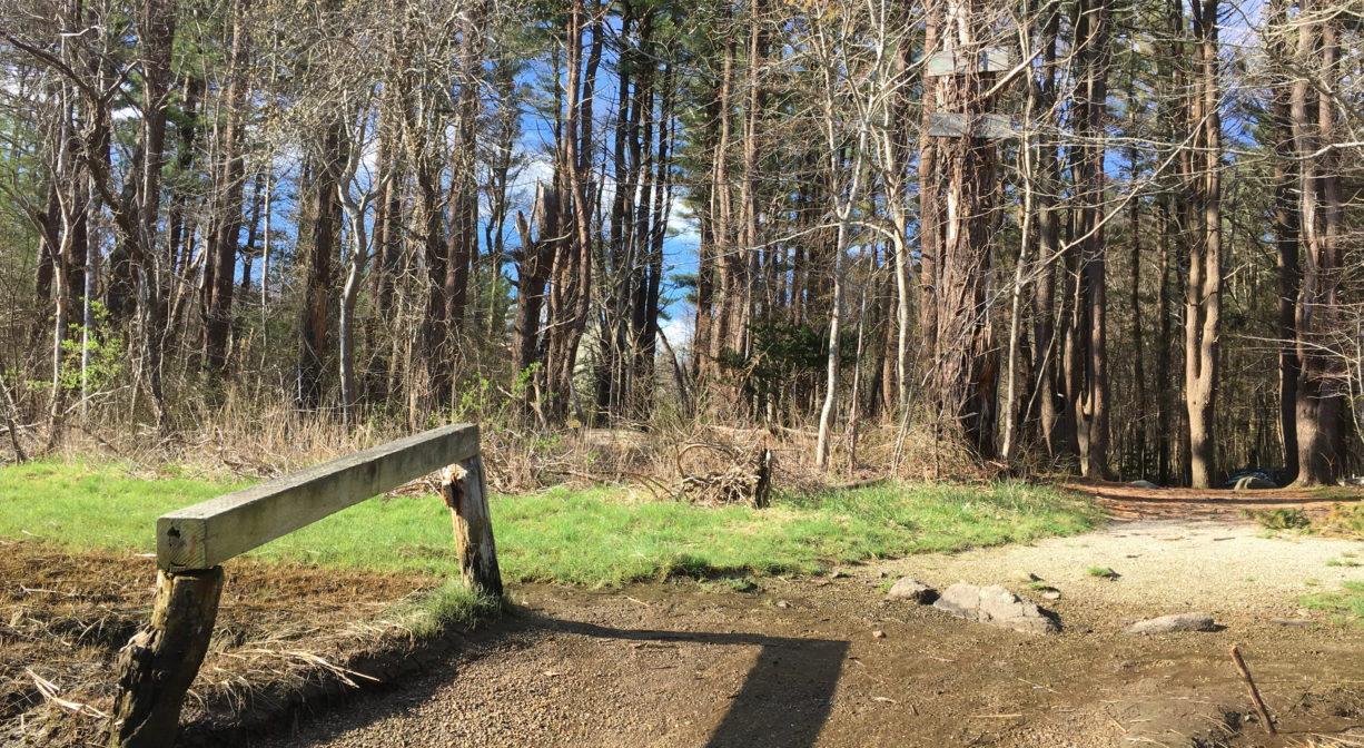
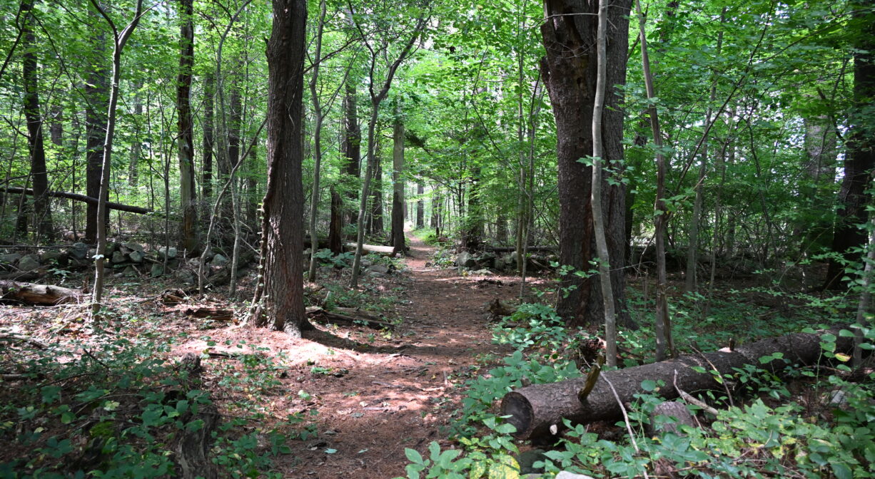
There is a gate across the entrance, open from dawn to dusk. Proceed slowly, as the vehicle entrance is a steep downhill. The launch area is surrounded by woodland. After rain, large puddles can form in the unpaved parking area, so be careful of the mud.
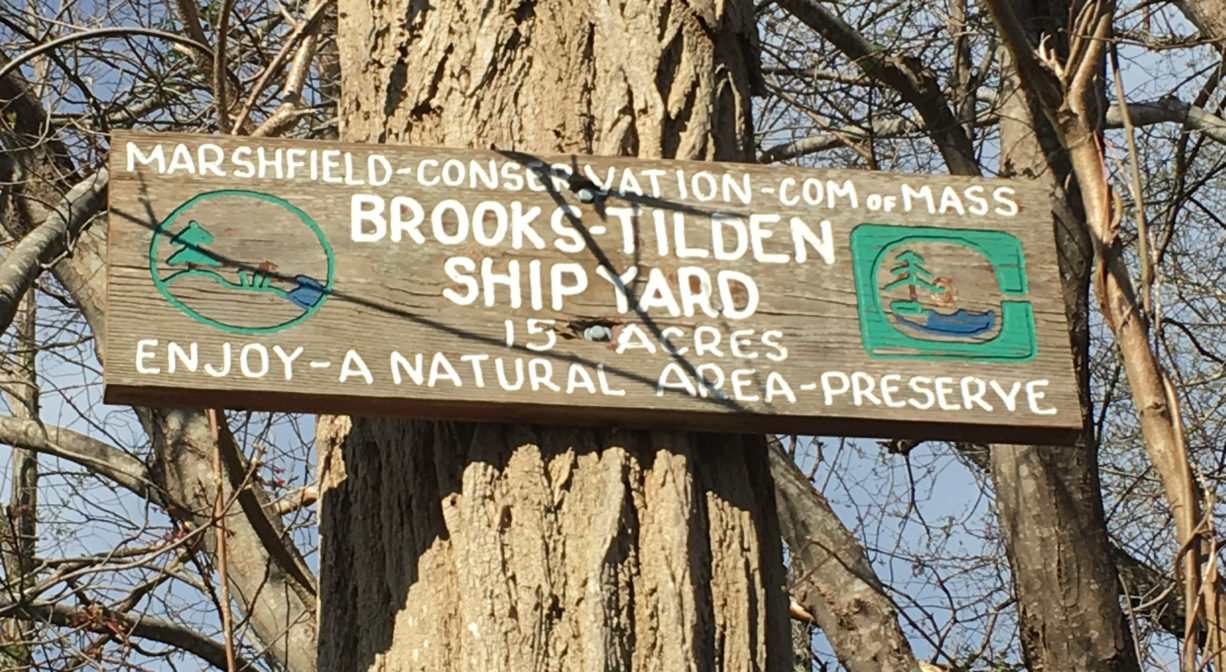
A 0.1-mile trail extends through the woods from the parking area, past several old stone walls, to a scenic overlook with a memorial bench. The trail is marked with red blazes. Along the way, look for a wooden “Brooks Tilden Shipyard” sign, placed unusually high in a tree. Just below it is a stone structure that resembles a well — likely a relic from the property’s shipyard days. Local amateur archaeologist Paul F. McCarthy theorizes that this is the remains of a fire pit, which might have been used to power a steamer (to make timber more pliable). The shipyard’s former saw pit is nearby. Also likely related to shipbuilding, a wooden structure protrudes from the marsh on the Marshfield side of the river. It can only be viewed at low tide.
Suggested paddling excursions from this location (timing is approximate and depends quite a bit on wind, tide, and your own strength and stamina):
• Put your boat in the water around the time of ocean low tide and paddle downstream to Cove Creek. Explore the creek and then return with the rising tide upstream to your starting place. (2+ hours)
• Put your boat in the water about 2 hours before ocean low tide and paddle downstream to Damon’s Point and the North River estuary. Then ride the rising tide back upstream to your starting place. (2.5+ hours)
• Put your boat in the water 1-2 hours before ocean high tide and head upstream to Couch Beach. Stretch your legs at Couch Beach and then return with the slack/receding tide. (3+ hours)
• Stage a second vehicle at Damon’s Point or Driftway Conservation Park. Return to Marshfield Launch and put your boat in the water 2-3 hours after ocean high tide, then take a one-way trip with the outgoing tide to your second vehicle. (1-2 hours)
• Stage a second vehicle at Pembroke Town Forest. Return to Marshfield Launch and put your boat in the water 2-4 hours before ocean high tide, then take a one-way trip with the incoming tide to your second vehicle. (3-4 hours)
Habitats and Wildlife
This property is located directly on the North River. The forest is primarily pine, with some oak, maple, hemlock, holly, and sassafras trees, along with greenbrier.
The North River rises from marshes and springs in Weymouth, Rockland and Hanson. It is approximately 10 miles in length, with its source at the confluence of the Indian Head River (Hanover) and Herring Brook (Pembroke). From there it flows through the towns of Hanover, Pembroke, Marshfield, Norwell, and Scituate to the Atlantic Ocean between Third and Fourth Cliffs, draining approximately 59,000 acres along the way.


Historic Site: Yes
Park: No
Beach: No
Boat Launch: Yes
Lifeguards: No
Size: 15 acres
Hours: Dawn to Dusk
Parking: Limited on-site parking at 1361 Union Street.
Cost: Free
Trail Difficulty: Easy
Facilities:
Picnic tables, launch area for non-motorized boats, trash receptacles, memorial bench overlooking the river.
Dogs: Dogs must remain on leash. Always clean up after your dog!
Boat Ramp: No
ADA Access: No
Scenic Views: Yes
Waterbody/Watershed: North River