
299 Damons Point Rd, Marshfield, MA 02050, USA
Marshfield Harbormaster: (781) 834-6655 x. 175
Owned By: Town of Marshfield
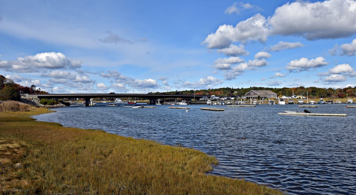
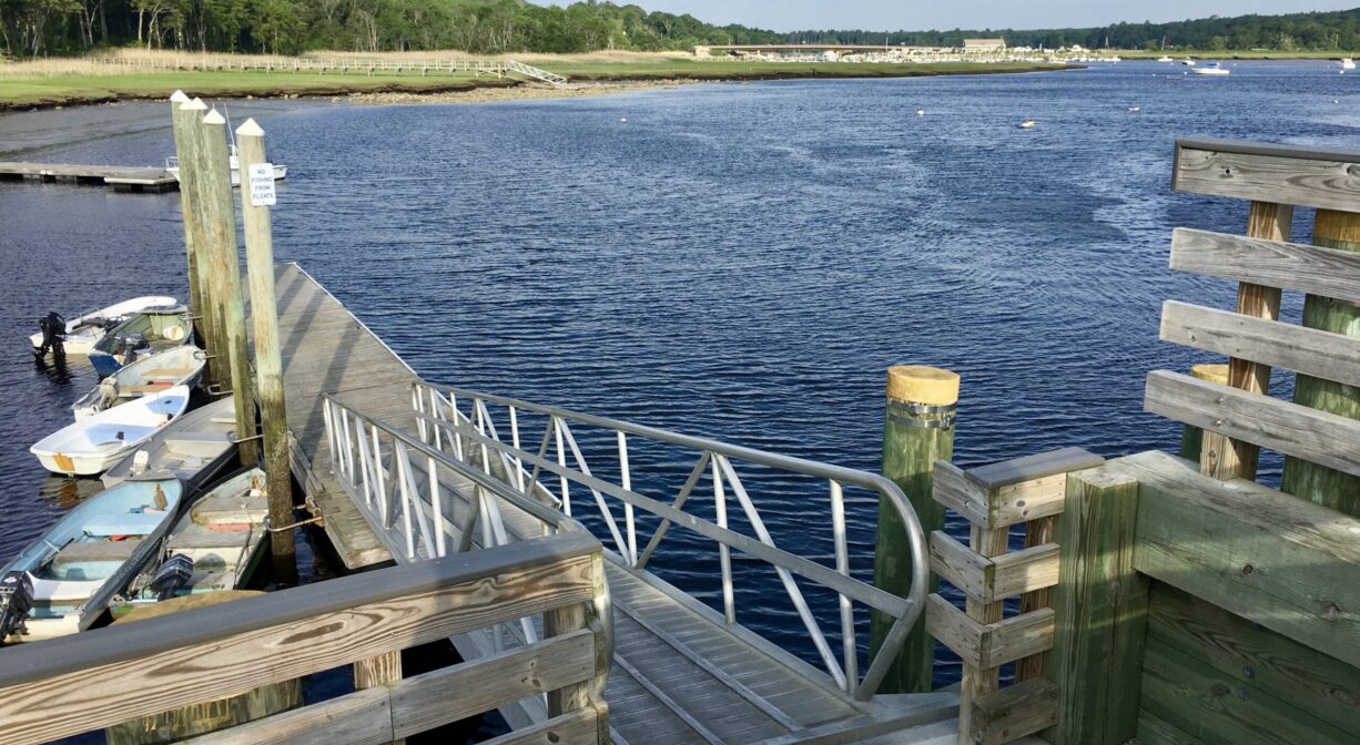
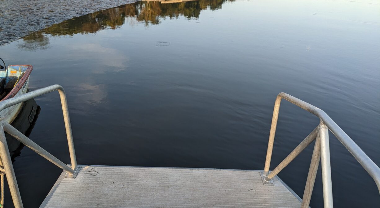
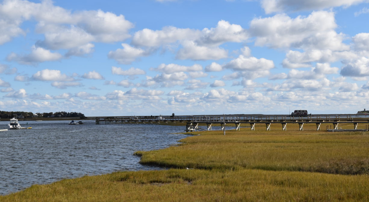
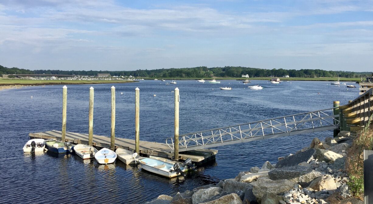
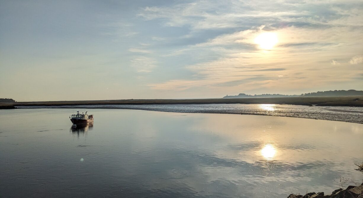
Damon’s Point in Marshfield is a beautiful spot on the North River. A small town pier is located here, offering a fine scenic vista with wooden benches. On the western side, there is a small launch for kayaks, canoes, and paddleboards. A step-down launching platform was added in 2025. Use extreme caution if paddling through, and past, Damon’s Point toward The Spit, because of dangerous currents. Do no paddle in, or through, the mouth of the North River.
Tide Math: High tide at Damon’s Point is about 20 minutes after the Boston high tide. Set off from here to go clamming!
ALERT FROM HARBORMASTER (June 2025): Attention boaters transiting the South River. This recent survey shows significant shoaling at the entrance into the South River, the shoaling as depicted on the survey starts at the entrance into the South River; near Green buoy #9. The shoaling continues towards South River buoy Red #2. This area was last dredged in 2019. However, significant shoaling has returned. The Towns of Marshfield and Scituate are working with federal agencies and state delegations to seek the needed funding to assist with this hazard to navigation. Mariners should use extreme caution when transiting this area and avoid transiting within 2 hours either side of the low tide. Larger drafted vessels may need additional tide to safely pass.
SHELLFISHING: The shellfish beds in both the North and South Rivers are now closed for the season. They are typically open from November 1 to May 31st. Please visit our Shellfishing page for maps and permit info.
Hunting is not allowed on this property.
FISHING ADVISORY: It’s important to know that some of our freshwater fisheries are contaminated with mercury, PFAS and/or other concerning substances. The Massachusetts Department of Public Health maintains an online database with up-to-date advisories regarding fish consumption, sorted by location. We recommend you consult this valuable resource when planning a fishing excursion.
Features
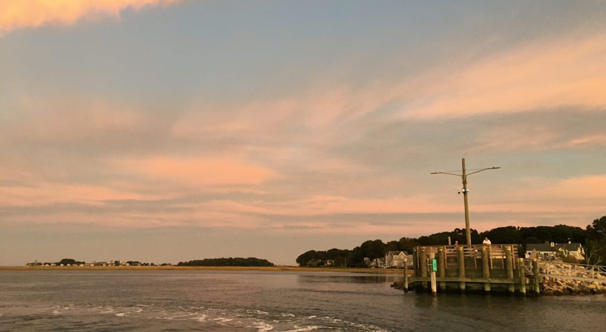
Located at a beautiful spot within the North River estuary, this pier is a popular destination for photography and a nice place to watch the sunset. A step-down launching platform was added to the dock system in 2025 with funding provided by the Marshfield Community Preservation Act.
From 1871 to the late 1930’s the Duxbury and Cohasset Railroad (later the Old Colony Railroad) traveled through Scituate and Marshfield. A portion of the railroad bed ran along the course of today’s Damon’s Point Road. The pier was constructed atop the remains of the railroad trestle. Look across the river to see the route the railroad traveled through the salt marsh, from Scituate. You can visit another portion of this old railroad bed at Herring River Trail in Scituate.
Building the railroad bridge at Damon’s Point was a major challenge. The river seemed bottomless, making it difficult to place the wooden support pilings. The first bridge was too low, and prevented a number of vessels from passing beneath it, especially at high tide. After the 1898 Portland Gale washed the bridge away and destroyed much of the railroad bed in the adjacent marsh, the bridge was rebuilt at a higher elevation. It contained a removable section that allowed larger crafts to pass. However removing this section often involved several days’ work by rail crews, interrupting regular train service. The bridge was replaced again in 1910/1911 with a man-powered drawbridge. This remained in place until rail service ended in 1939. It was removed in the early 1940s, but some of the pilings remain.
The Marshfield Hills railroad station was located at the inland end of today’s Damon’s Point Road, near the intersection with Summer Street. Adjacent to it was Herbert Macomber’s livery barn. Railroad commuters would leave their horses and/or carriages at Macomber’s for the day, while they traveled to and from Boston. After train service was terminated, a portion of the railroad bed became Damon’s Point Road. Much of the original railroad bed has been preserved for public access as Marshfield’s Bridle Trail and Rail Trail. The section between the Marshfield Hills station (off Summer Street) and the Seaview station (Station Street) does not currently offer public access.
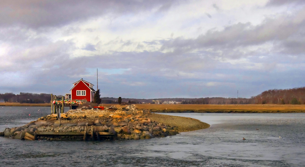
Looking across the river toward Scituate, you’ll notice a small wooden structure sitting atop the former railroad bed. Known these days as Dauphtucket, it was owned for decades by Dick and Barbara Pearson, South Weymouth residents who spent their summers on the North River. It’s actually a houseboat, moored on the old railroad trestle. According to a 1990 Yankee Magazine article, it arrived on the North River in 1868, towed as a barge from Tea Wharf in Boston. It has remained in place through innumerable storms, with the exception of the Hurricane of 1938 and the Blizzard of 1978, both of which washed it from its perch (to be towed back later).
This land is within the region of the Massachusett (or Massachuseuk). To learn more about local Native American tribes, we encourage you to interact with their members. The Mattakeeset band of the Massachusett, and the Massachusett tribe at Ponkapoag, both share information on their websites.
Trail Description
A small pier extends into the North River with a spectacular view.
Suggested paddling excursions from this location (timing is approximate and depends quite a bit on wind, tide, and your own strength and stamina):
• Put your boat in the water a little before ocean high tide and paddle upstream to Cove Creek. Explore the creek and then return downstream to your starting place. (2+ hours)
• Put your boat in the water an hour before ocean high tide and paddle upstream to the Marshfield Public Launch at the Union Street Bridge, then return downstream to your starting place. (2+ hours) Or stage a second vehicle at the Marshfield Public Launch and make it a one-way excursion.
• Put your boat in the water an hour before ocean high tide and paddle downstream to Driftway Conservation Park on the Herring River. Then return with the rising tide to your starting place. (1-2+ hours)
• Stage a second vehicle at Driftway Conservation Park. Return to Damon’s Point and put your boat in the water around the time of ocean high tide, then take a one-way trip to your second vehicle. (1+ hour)
Habitats and Wildlife
Many species of mammals, fish, and birds can be spotted wandering the river and the river’s edge. Look for raccoons, fox, and squirrels in the nearby woodlands and marshes. This is a popular spot to observe migrating shorebirds from June to September. Watch for harbor seals in the water. Bald eagles nest nearby, so you may see adults or juveniles. Also watch for peregrine falcons, which sometimes chase terns.
This property is located directly on the North River. Macombers Creek and Macombers Island are just east of Damon’s Point Road. The creek drains to the mouth of the North and South Rivers.
The North River rises from marshes and springs in Weymouth, Rockland and Hanson. It is approximately 10 miles in length, with its source at the confluence of the Indian Head River (Hanover) and Herring Brook (Pembroke). From there it flows through the towns of Hanover, Pembroke, Marshfield, Norwell, and Scituate to the Atlantic Ocean between Third and Fourth Cliffs, draining approximately 59,000 acres along the way.


Historic Site: No
Park: No
Beach: No
Boat Launch: Yes
Lifeguards: No
Hours: Dawn to Dusk
Parking: Limited public on-site parking at the end of Damon's Point Road. Marshfield beach sticker required for most spots.
Cost: Free
Trail Difficulty: Easy
Facilities:
Benches. Geocache location. Seasonal dock and float with step-down platform to facilitate the launching of small watercraft.
Dogs: Dogs must remain on leash. Always clean up after your dog!
Boat Ramp: No
ADA Access: Yes
Scenic Views: Yes
Waterbody/Watershed: North River