
259 Dyke Rd, Marshfield, MA 02050, USA
Marshfield Conservation: 781-834-5573
Owned By: Town of Marshfield
Marshfield’s 122-acre Wharf Creek Conservation Area offers two trails through an open woodland with a footbridge, old stone walls, and views of Wharf Creek and the Green Harbor River. This is an excellent spot for birding! Extend your visit by exploring the Harbor Walk and Peter Igo Park.
This 2026 video from the Marshfield Trails Committee offers a quick glimpse of the property.
Hunting is not allowed at Wharf Creek Conservation Area, nor at any of Marshfield’s other conservation properties.
FISHING ADVISORY: It’s important to know that some of our freshwater fisheries are contaminated with mercury, PFAS and/or other concerning substances. The Massachusetts Department of Public Health maintains an online database with up-to-date advisories regarding fish consumption, sorted by location. We recommend you consult this valuable resource when planning a fishing excursion.
Features
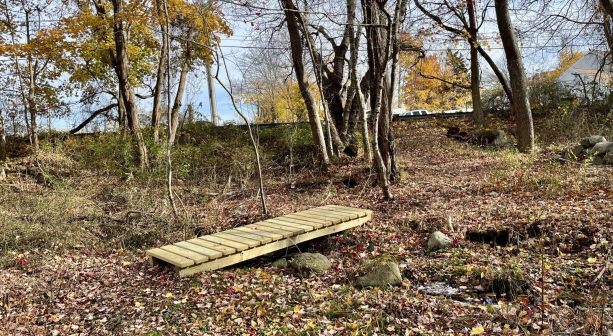
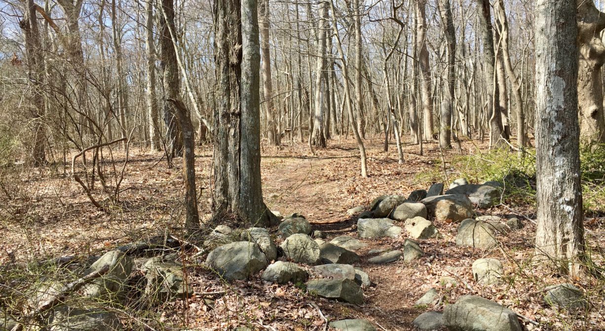
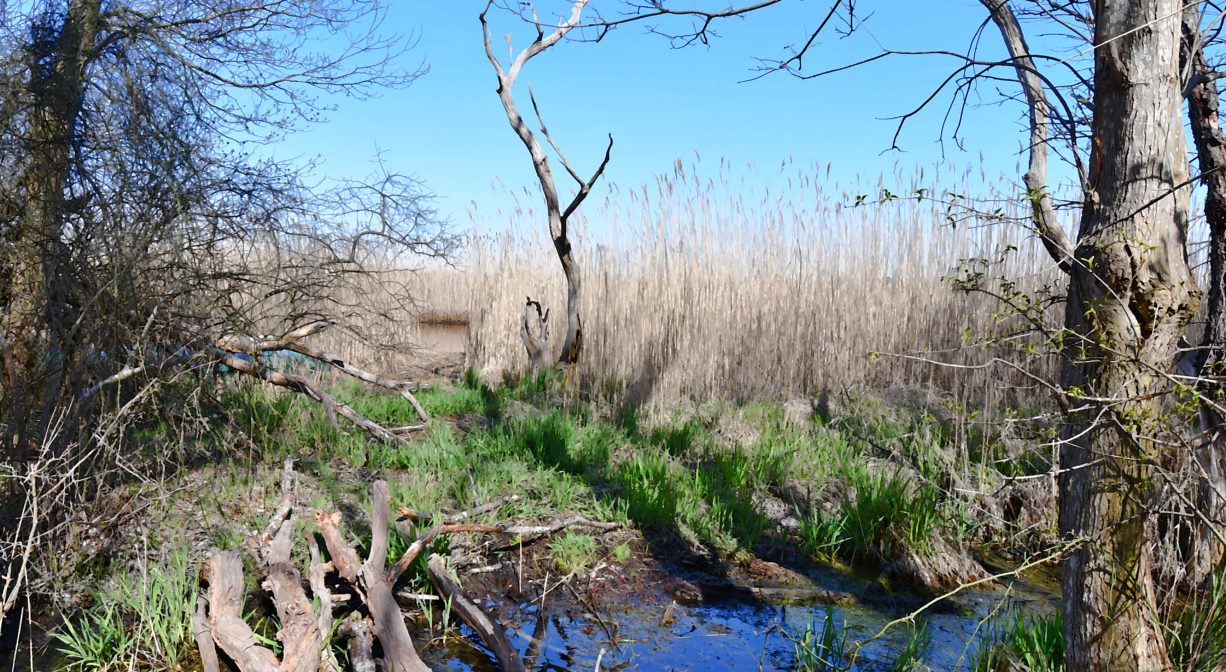
Also known as Estes Woods, this property features a number of old stone walls within a relatively open woodland. The views Wharf Creek and the Green Harbor River are quite nice! A portion of this property was acquired by the town in 1978, with more to follow. The footbridge and memorial bench were installed in 2025.
The original mouth of the Green Harbor River, which was located on the Marshfield/Duxbury line, more than a half mile south of the present mouth, was closed by a storm in 1806. The present mouth opened in 1810. The opening of the new mouth dramatically increased the incoming tidal flow to the Green Harbor River. This was a boon to local fishermen, as it improved the harbor’s navigability. However the owners of farms bordering the river saw things differently. The increase in both the volume and the frequency of saltwater flooding to their lands was a big problem, as most crops don’t tolerate salt water.
So in 1871, a group of farmers petitioned the court to construct a dike, or tide gate, that would control the flow of saltwater upstream, and create more arable land. The dike was constructed in 1872, with the condition that “Should shoaling take place above the level of mean low water in the channel in consequence of dike construction, it was to be removed by the Marsh proprietors.” Shoaling did occur, and thus began the “Brant Rock Dike Feud.” Read all about it on our blog. The dike still stands, and you can view it from this property, looking downstream. (It’s the structure beneath the Route 139 bridge.)
This land is within the region of the Wampanoag. To learn more about local Native American tribes, we encourage you to interact with their members. The Mashpee Wampanoag and the Herring Pond Wampanoag share information on their websites.
Trail Description
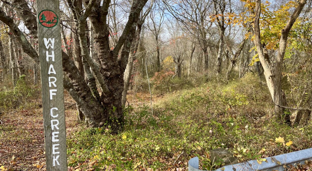
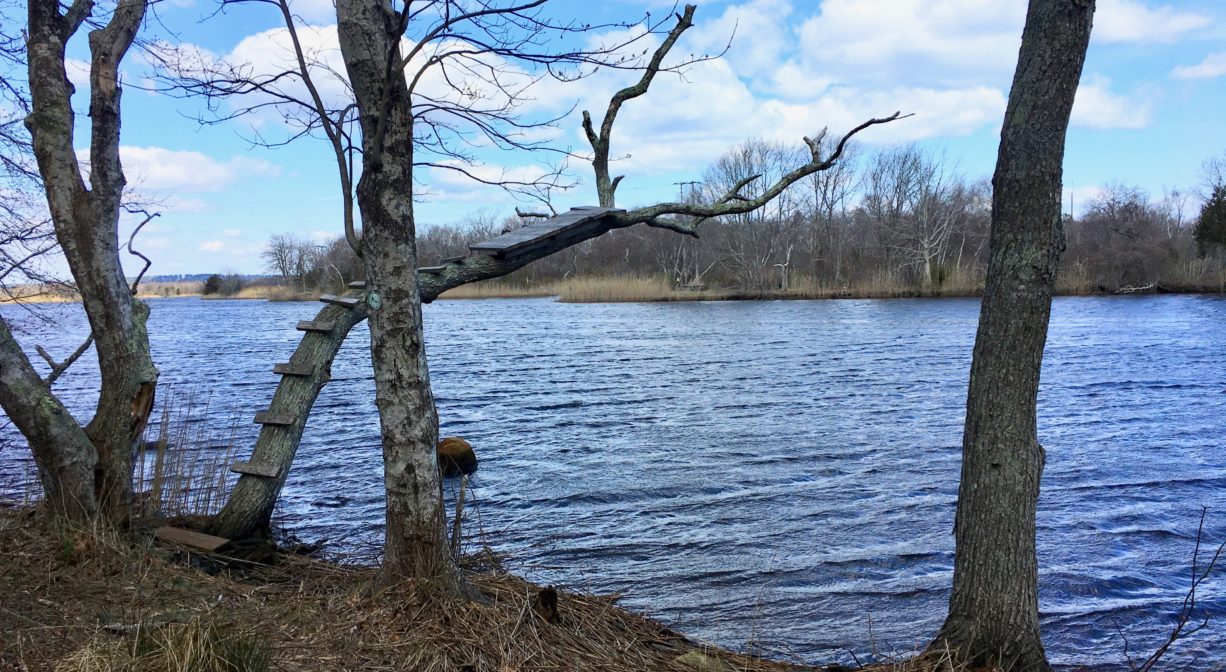
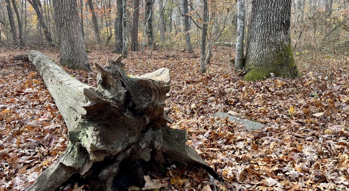
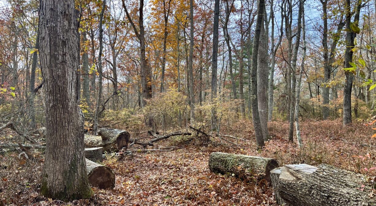
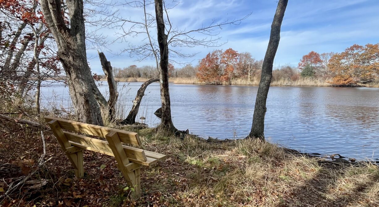
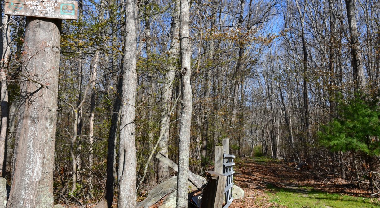
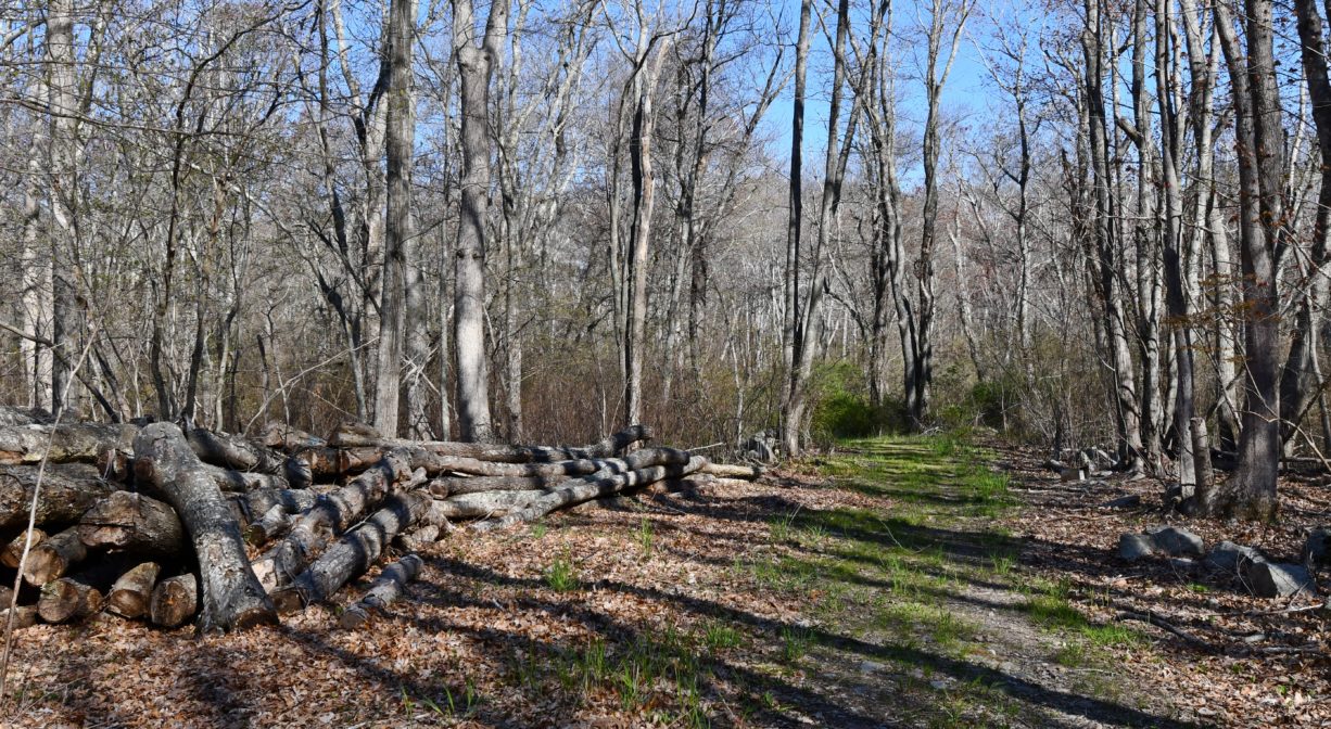
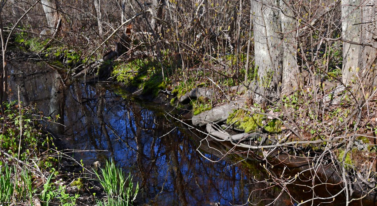
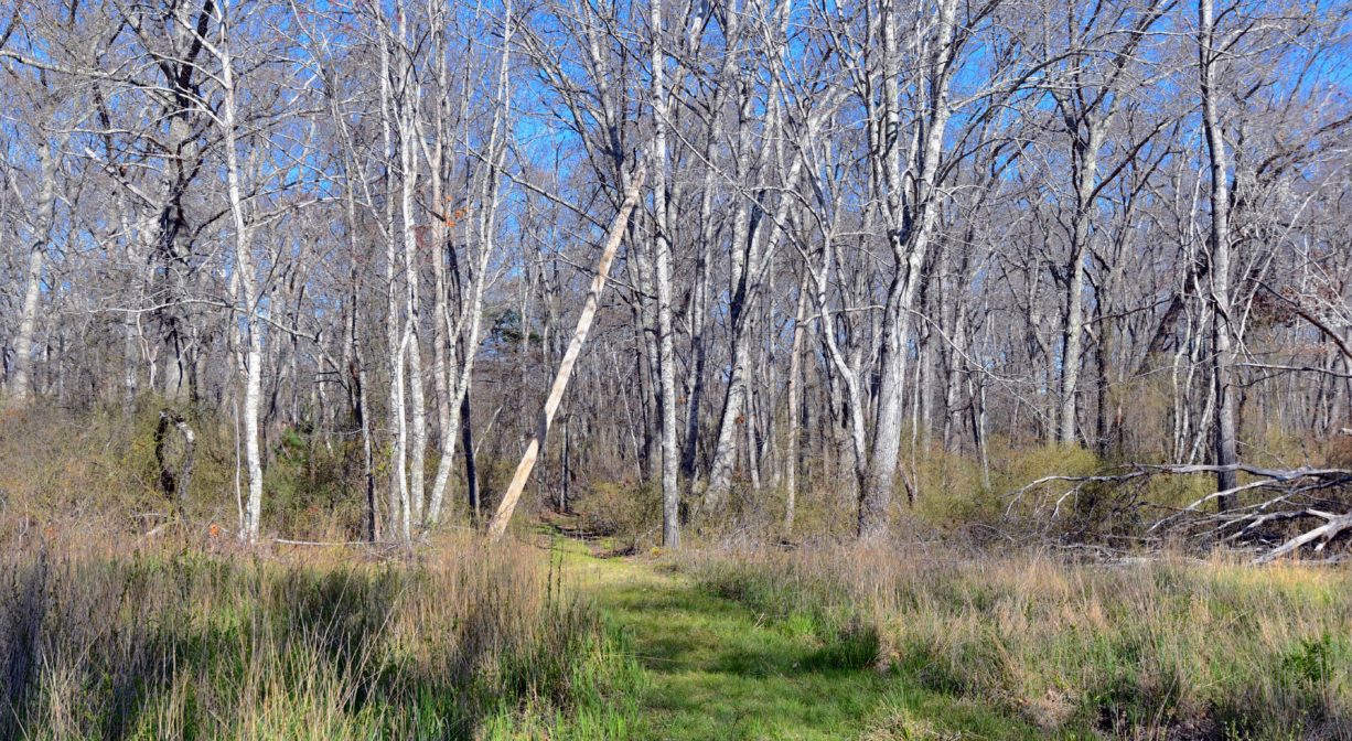
There are two out-and-back trails on this property. One begins at Dyke Road, across the street from Green Harbor Marina, and extends about 1/3 mile through the woods to the Green Harbor River. At the beginning of the trail, which is blazed in red, a footbridge provides passage over a stream. The trail continues through a maple-oak woodland, veers right after a split-rail fence, and continues in a straight line through dense stands of sweet pepperbush before emerging at the edge of the river. Take a seat on the memorial bench at this spot and enjoy the view of the water, along with the privately-owned Everson Island. Along the way, the trail passes through two old stone walls. In some spots, the terrain is rocky, rooty and otherwise uneven.
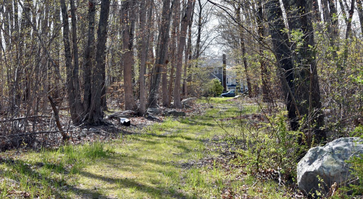
A second trail extends for about 0.4 mile from Calypso Lane to Wharf Creek. The trailhead is located between #57 and #63 Calypso Lane. Follow the row of trees to the trailhead, where there is a gate and a trail sign. Please be mindful of private property! A wide cart path enters the woods, crosses a small stream, and leads past a power easement, before narrowing and continuing to the edge of the marsh and Wharf Creek.
Note: While the two trails used to connect, they currently do not. The Dyke Road trail is narrow and relatively flat. The Calypso Lane trail is also flat, and somewhat wider. Some sections of the trails are wet and/or overgrown.
Extend your visit by exploring the Harbor Walk, which can be accessed from the Dyke Road trailhead. Cross the street and follow the sidewalk toward the Green Harbor River. The Harbor Walk continues as an ADA-compliant pathway across the Brant Rock Dike, along Route 139 and the edge of the marsh, past Peter Igo Park and a parking lot for Brant Rock Beach, to Harbor Park and the Marshfield Town Pier. Next to the Water Treatment Plant, there is a spur trail to the Brant Rock Esplanade. The total length is about 1 mile.
Habitats and Wildlife
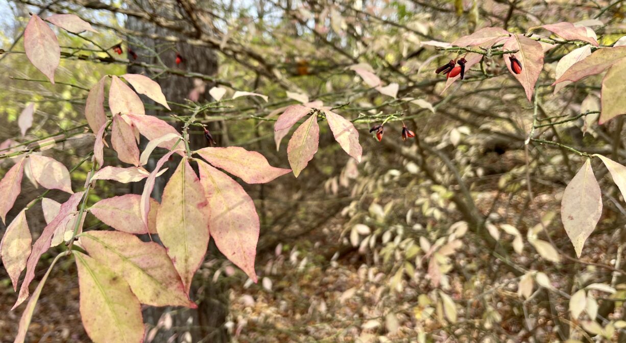
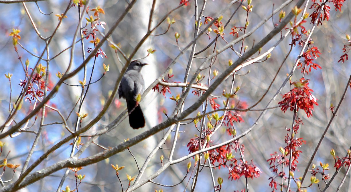
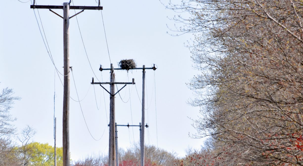
Open woodland with such trees as oak, elm, maple, hickory, sassafras and silver birch, with fern, greenbrier, sweet pepperbush, native chokeberry, and invasive bittersweet. Watch out for poison ivy! The thicket along the Dyke Road trail is an ideal place to observe birds. In the spring, it tends to be very popular among warblers. There are also some wetlands on this property. Once you arrive at Wharf Creek and/or the Green Harbor River, watch for the osprey that nest up above (look for the nests on top of the utility poles). You may also spot a tern.
This property is located where Wharf Creek flows into the Green Harbor River. The Green Harbor River finds its source in springs and ponds in Duxbury. It twists and turns through Marshfield via Red Gold Farm, the Green Harbor Golf Club, the Daniel Webster Wildlife Sanctuary, property owned by the Marshfield Municipal Airport, and Peter Igo Park. Just downstream of the Dyke Road bridge (and dike) it flows into the Atlantic Ocean at Green Harbor.
Historic Site: No
Park: No
Beach: No
Boat Launch: No
Lifeguards: No
Size: 122 acres
Hours: Dawn to Dusk
Parking: Pedestrian access from Dyke Road, across the street from Green Harbor Marina. Additional pedestrian access from Calypso Lane, between #57 and #63. For the Dyke Road entrance, we recommend parking at Peter Igo Park and following the Harbor Walk (sidewalk) across the Green Harbor River to the trailhead.
Cost: Free
Trail Difficulty: Easy
Facilities:
Geocache location. Bench, footbridge.
Dogs: Dogs must remain on leash. Always clean up after your dog!
Boat Ramp: No
ADA Access: No
Scenic Views: Yes
Waterbody/Watershed: Wharf Creek (Green Harbor River watershed)