
85 Willow St, Marshfield, MA 02050, USA
Marshfield Conservation: 781-834-5573
Owned By: Town of Marshfield
Marshfield’s Pratt Farm offers 34 acres of conservation land along both the South River and Zenas Brook. A half-mile of trails extend through woods and wetlands, with bridges and small sections of boardwalk. Two trails at Pratt Farm connect to Marshfield’s Bridle Path and Rail Trail.
Hunting is not allowed at Pratt Farm, nor at any of Marshfield’s other conservation properties.
Features
Pratt Farm was originally owned by one of Marshfield’s early settlers, Timothy Williamson, who operated the town “ordinary.” In 1663 he gave the town the land for the Training Green and First Congregational Church in exchange for additional property on the northern banks of the South River. These lands (now Pratt Farm) remained in his family until the mid-1800’s. Williamson’s descendants eventually sold the land to the Pratts, who kept it for another 120 years. The town purchased the land in 2012 with Community Preservation funds.
Pratt Farm is part of the South River Greenway, interconnected green spaces along the South River in downtown Marshfield, including Veterans Memorial Park, South River Park, Pratt Farm, the Keville Footbridge, Dandelion Park and Marshfield’s Rail Trail/Bridle Path.
This land is within the region of the Massachusett (or Massachuseuk) and Wampanoag Native American tribes. To learn more about local tribes, we encourage you to interact with their members. The Mattakeeset band of the Massachusett, the Massachusett tribe at Ponkapoag, the Mashpee Wampanoag, and the Herring Pond Wampanoag also share information on their websites.
Trail Description
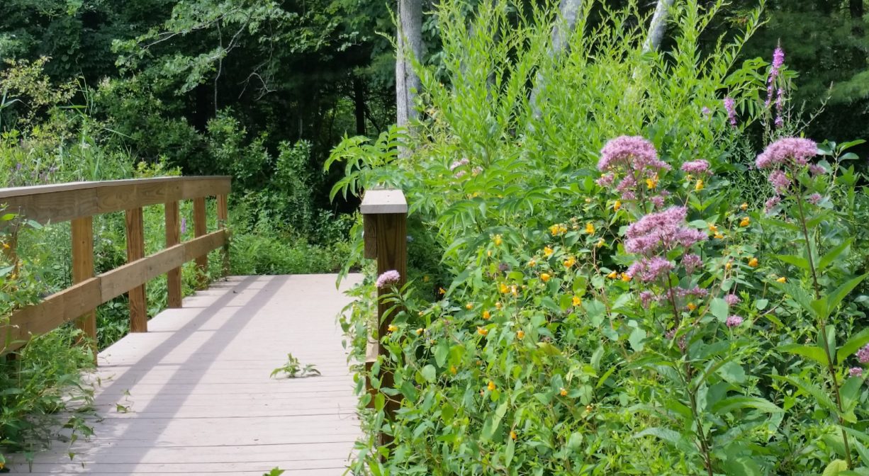
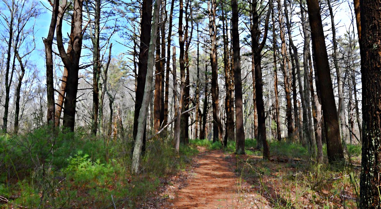
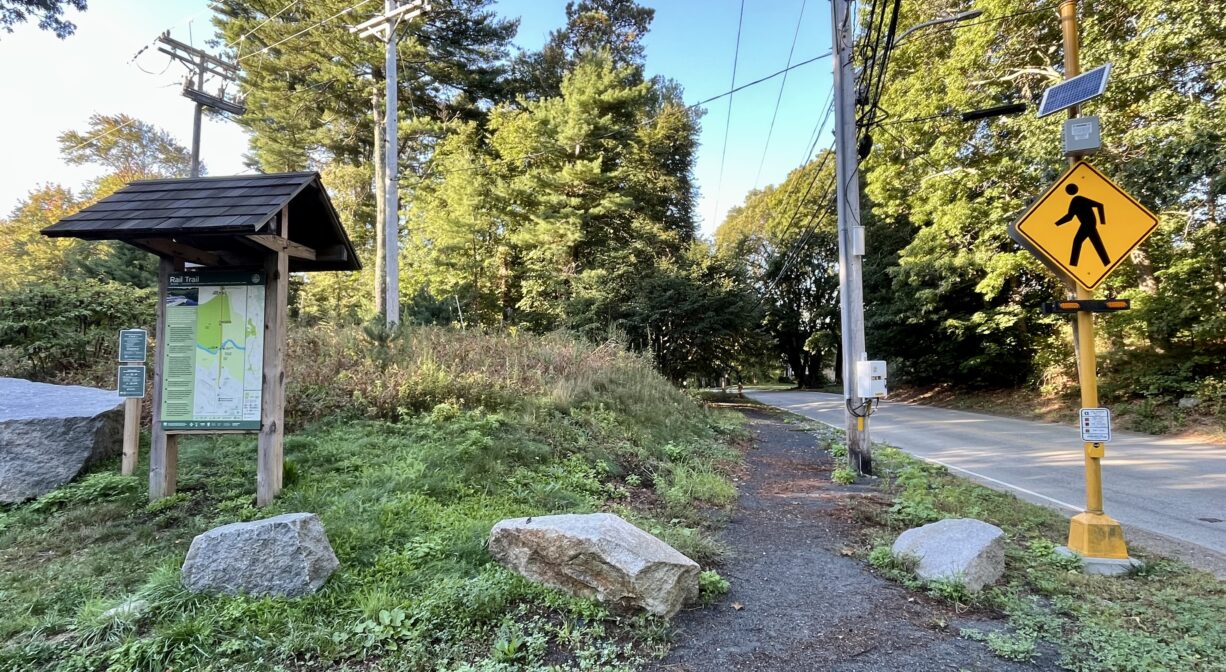
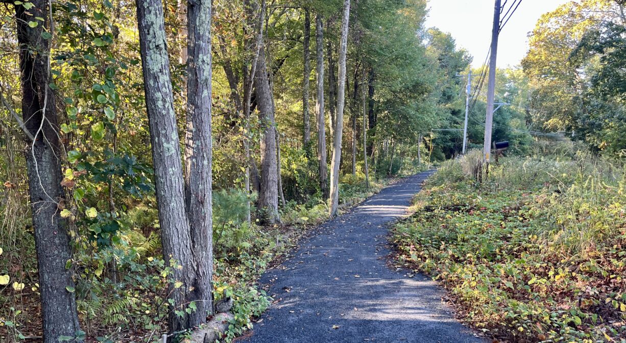
The trails are well-marked and easy to follow. From the entrance on Willow Street, the 0.35-mile main trail heads into the woods, then traverses two small bridges on Zenas Brook. It continues along the edge of the marsh and into the woods, with another bridge that crosses some wetlands. At the eastern end of the property, a tall set of stairs leads up to Marshfield’s Bridle Path & Rail Trail.
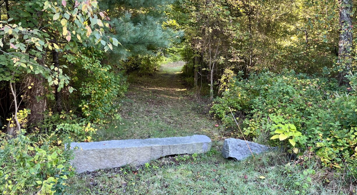
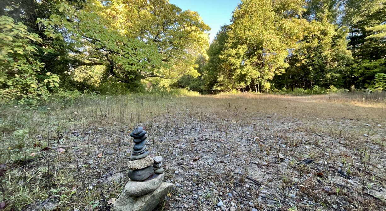
An additional 0.35-mile loop trail arcs away from the marsh to a clearing, before re-joining the main trail. The clearing also provides access to an additional stone dust trail that extends for 0.13 miles along South River Street to the Bridle Path & Rail Trail.
Suggested hike: Begin at the parking area on Willow Street. Follow the red-blazed trail across Zenas Brook and continue through the property, all the way to the tall staircase that leads to the Bridle Path & Rail Trail. At the top of the staircase, turn left and follow the Rail Trail to South River Street. Look for the informational kiosk. Just beyond it is a stone dust trail that extends along South River Street. Turn left onto the stone dust trail and follow it for 0.13 miles back to Pratt Farm. At this point, you will have reached a small clearing. Take either of the blue-blazed trails into the property, and then turn right on the red trail to return to Willow Street. Total distance: just under a mile.
Habitats and Wildlife
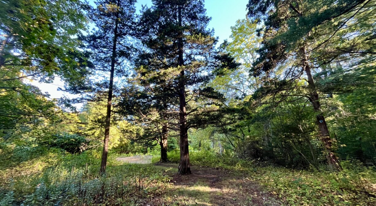
The forest at Pratt Farm is relatively young and very flat. It’s easy to imagine how not so long ago, it was farmland. The woods are primarily pine and oak, with some birch, maple, fern and sweet pepper bush, plus greenbrier and the occasional cedar and sassafras. Some sections of the trails feature bright green moss. Some sections are quite uneven, due to tree roots.
Zenas Brook flows into the South River. It is one of the few cold water streams in Marshfield, a key habitat for eastern brook trout. The brook is thought to be named for Zenas Thomas, who was born in 1742. by 1765, he owned the farm across the street from where Pratt Farm is today (the old Arthur Howland family farm). For many years Zenas Brook was impounded, creating a small pond within Pratt Farm.
The South River originates deep in Duxbury. Its source is in the Round Pond area, and from there it winds unobtrusively through the woods for several miles. Although one can view it from Route 3, and also from both South River Bog and the Camp Wing Conservation Area, it remains a narrow and mostly un-navigable stream until just below Veterans Memorial Park in Marshfield. From there it flows through South River Park, behind the playground of South River School, and under the Willow Street and Francis Keville Bridges. Wider at that point, and navigable at most tides, its course continues through the marshes as it runs parallel to Route 139, all the way to Rexhame. From there the river turns northward. It flows for 3 miles between Humarock and the mainland to Fourth Cliff, where it joins the North River at its outlet to the sea.


Historic Site: No
Park: No
Beach: No
Boat Launch: No
Lifeguards: No
Size: 34 acres
Hours: Dawn to Dusk
Parking: On-site parking at 85 Willow Street.
Cost: Free
Trail Difficulty: Easy
Facilities:
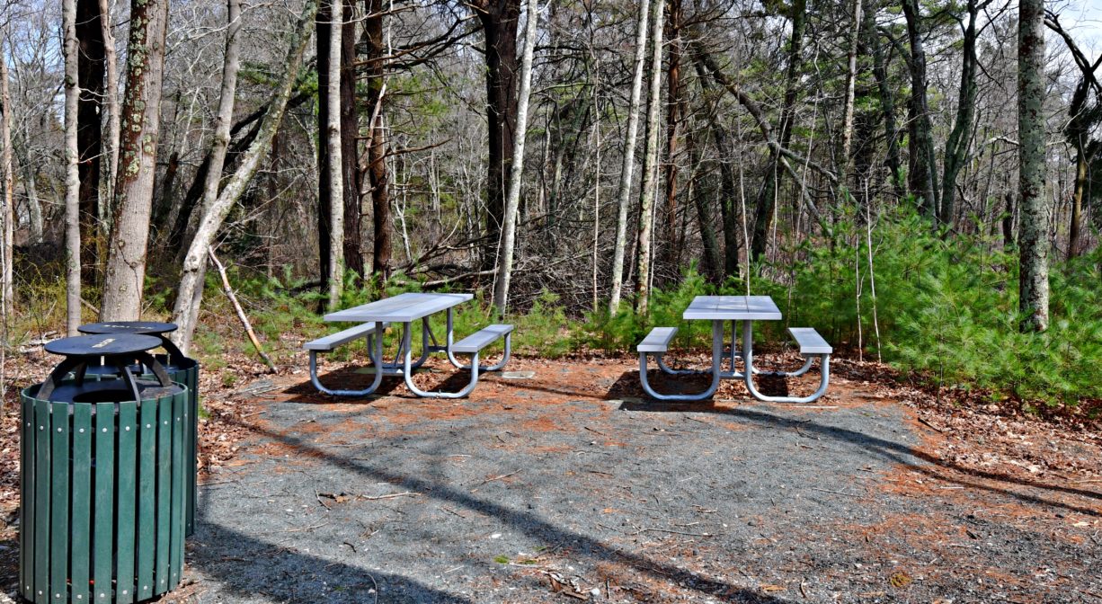
Picnic area, informational kiosks. Geocache location.
Dogs: Dogs must remain on leash. Always clean up after your dog!
Boat Ramp: No
ADA Access: No
Scenic Views: Yes
Waterbody/Watershed: Zenas Brook (South River watershed)