
2200 Ocean St, Marshfield, MA 02050, USA
Town of Marshfield: (781) 536-2500
https://www.marshfield-ma.gov/marshfield-veterans-services/pages/veterans-memorial-park
Owned By: Town of Marshfield
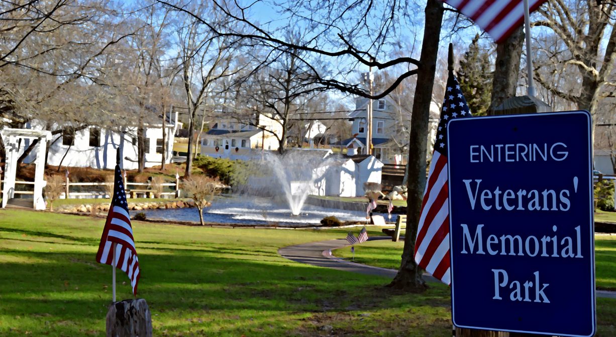
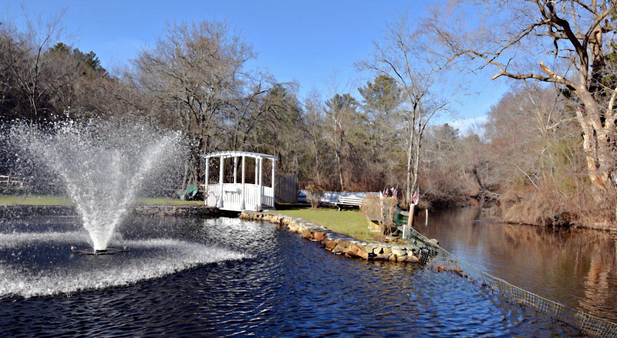
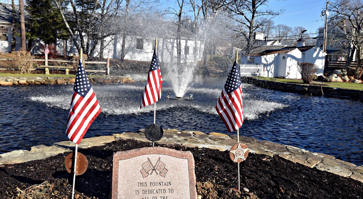
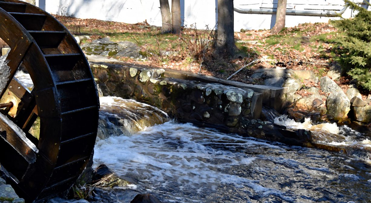
Veterans Memorial Park in Marshfield is a grassy property with numerous benches and memorials. The South River flows through it. Under renovation since November 2024, the park is likely to reopen soon. Features include a footbridge, a water wheel, concrete and paved walking paths, and small heart-shaped lagoon with a fountain.
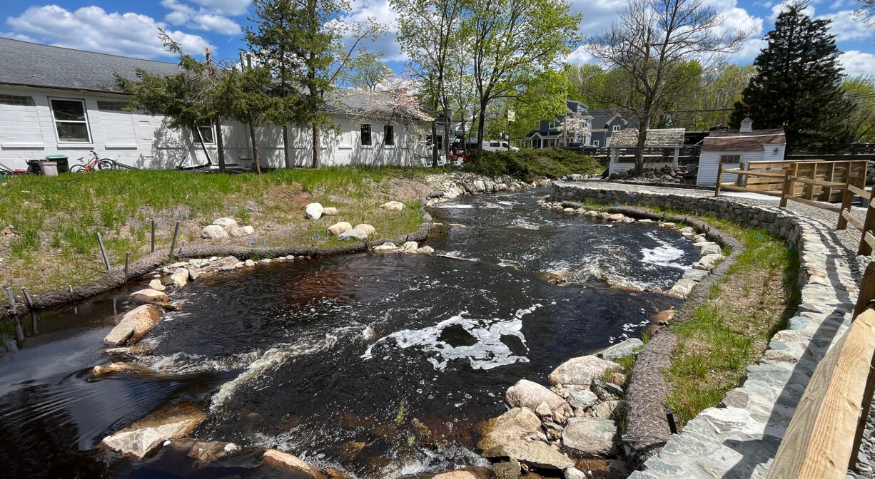
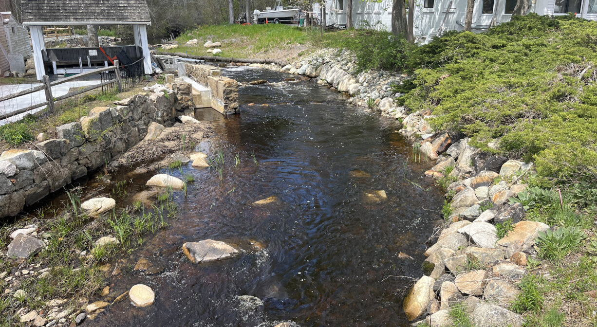
This historic milling and manufacturing site dates back to 1656, when William Ford and Josiah Winslow erected Marshfield’s first grist mill. In January 2025, after 10 years of planning, the obsolete mill dam was removed and the river channel was restored, reopening upstream portions of the river to migratory herring for the first time in almost 400 years. Historically, we’ve observed significant numbers of herring below the dam, but relatively few making it farther upstream. In 2026, we were delighted to see them in every section of the restored channel, and onward upstream! Read all about it in this blog post.
Please note that park access is currently restricted, due to the renovation project. Most of the photos included here are pre-renovation. We plan to update them when the park reopens.
Click here to view a time-lapse video of the dam removal.
Features
The town of Marshfield was founded in 1640. Its first mill, a grist mill, was established by 1656, on the South River at the site of today’s Veterans Memorial Park. In Colonial times, churches and mills were the social centers of a community. William Ford and Josiah Winslow were the first to operate a mill at this site. Winslow sold Ford his interest in 1657, and the Ford family carried on the business of both grist mills and sawmills at this location for several generations.
In 1810 or 1814, the Duxbury & South River Manufacturing Company opened Marshfield’s first major factory where the park stands now, producing cotton and woolen goods. The company owned three mills — the other two were at Chandler’s Pond and at Mill Brook in Duxbury. The mills employed both men and women for such tasks as weaving, spooling and cording. Some workers lived in a boarding house nearby. Later the operation was taken over by the Duxbury Manufacturing Company.
In the 1850’s, Henry C. Dunham operated a sawmill at the site. After 1900, the location was also used as a boxboard mill, an ice house, a paint shop, and for storage. In the 1930’s Stanley Baker ran a laundry on site, often referred to as “the wet wash.” The mill building was torn down in the 1940’s, and Veterans Memorial Park itself was created in 1948, to honor military servicemen and women.
Veterans Memorial Park is part of the South River Greenway, interconnected green spaces in Marshfield’s downtown, including South River Park, Pratt Farm, the Keville Footbridge, Dandelion Park and the Rail Trail/Bridle Trail.
This land is within the region of the Massachusett (or Massachuseuk). To learn more about local Native American tribes, we encourage you to interact with their members. The Massachusett tribe at Ponkapoag and the Mattakeeset band of the Massachusett share information on their websites.
Trail Description
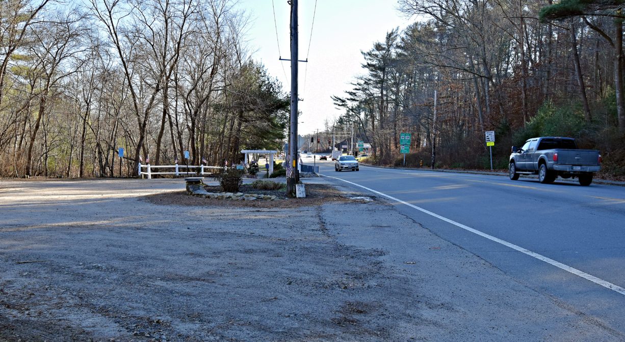
This is an open, grassy park with paved and concrete walkways, located at the corner of Routes 3A and 139. Follow the trail down a gentle slope from the parking to the park itself. In addition, on the other side of the parking area, a short trail leads to a gazebo with views of the South River.
The park itself is dedicated to American Veterans everywhere and hosts town events on Memorial Day and Veterans Day. Visitors are welcome, but a permit is required for use of the park by groups.
Below Veterans’ Memorial Park, the South River is navigable by canoe or kayak, however the stretch of river between the park and Willow Street may not be accessible at all tides due to bridge reconstruction, bridge clearance and/or low water. Launching a boat at Willow Street is not recommended, as poison ivy is abundant! Instead, launch at the Francis Keville Footbridge.
Habitats and Wildlife
The South River flows through this property. In January 2025, the first dam on the South River was removed at this site, reopening fish passage to the river upstream. NSRWA is currently working to restore the South River fishway in its entirety, with support from MassBays, the state’s Division of Ecological Restoration, the towns of Marshfield and Duxbury, Marshfield Veterans, and private dam owners. Removal of the second dam, at Chandler’s Pond in Marshfield, is in the planning phase, and removal of the third dam, at Temple Street in Duxbury, is now underway.
Currently the best time to see fish at Veterans Memorial Park is in May, and even into June. The run is predominantly blueback herring. Below Veterans Memorial Park, the South River is tidal. Twice per day, the fresh water flowing downstream is pushed back by the incoming salt water tide.
The South River originates deep in Duxbury. Its source is in the Round Pond area, and from there it winds unobtrusively through the woods for several miles. Although one can view it from Route 3, and also from both the South River Bogs and the Camp Wing Conservation Area, it remains a narrow and mostly un-navigable stream until just below Veterans Memorial Park. From there it flows through South River Park, behind the playground of South River School, and under the Willow Street and Francis Keville Bridges. Wider at that point, and navigable at most tides, its course winds through the marshes as it runs parallel to Route 139, all the way to Rexhame. From there the river turns northward. It flows for 3 miles between Humarock and the mainland to Fourth Cliff, where it joins the North River at its outlet to the sea.


Historic Site: No
Park: Yes
Beach: No
Boat Launch: No
Lifeguards: No
Size: 0.8 acres
Hours: Dawn to Dusk
Parking: Park at unpaved pull-off adjacent to the park on Plain Street (Route 139).
Cost: Free
Trail Difficulty: Easy
Facilities:
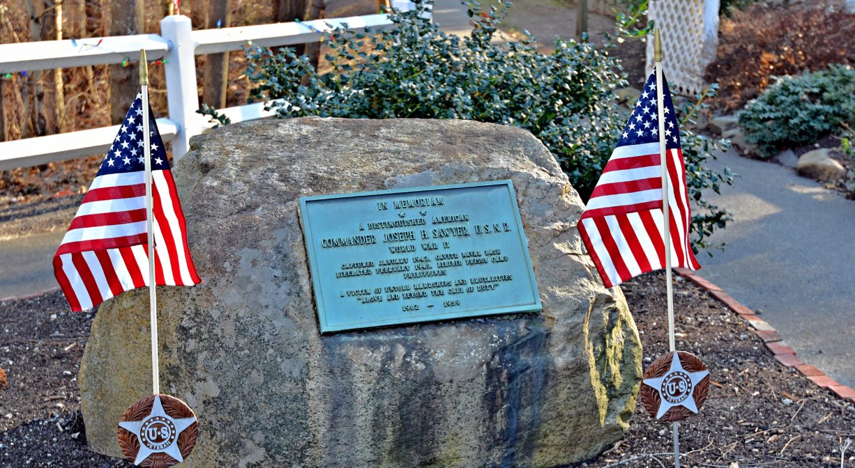
Benches, memorials, flagpole, footbridge, gazebo, water wheel, fountain, fish ladder. Geocache location.
Dogs: No
Boat Ramp: No
ADA Access: Yes
Scenic Views: Yes
Waterbody/Watershed: South River