
53 North St, Duxbury, MA 02332, USA
Town of Duxbury: (781) 934-1100
Owned By: Town of Duxbury
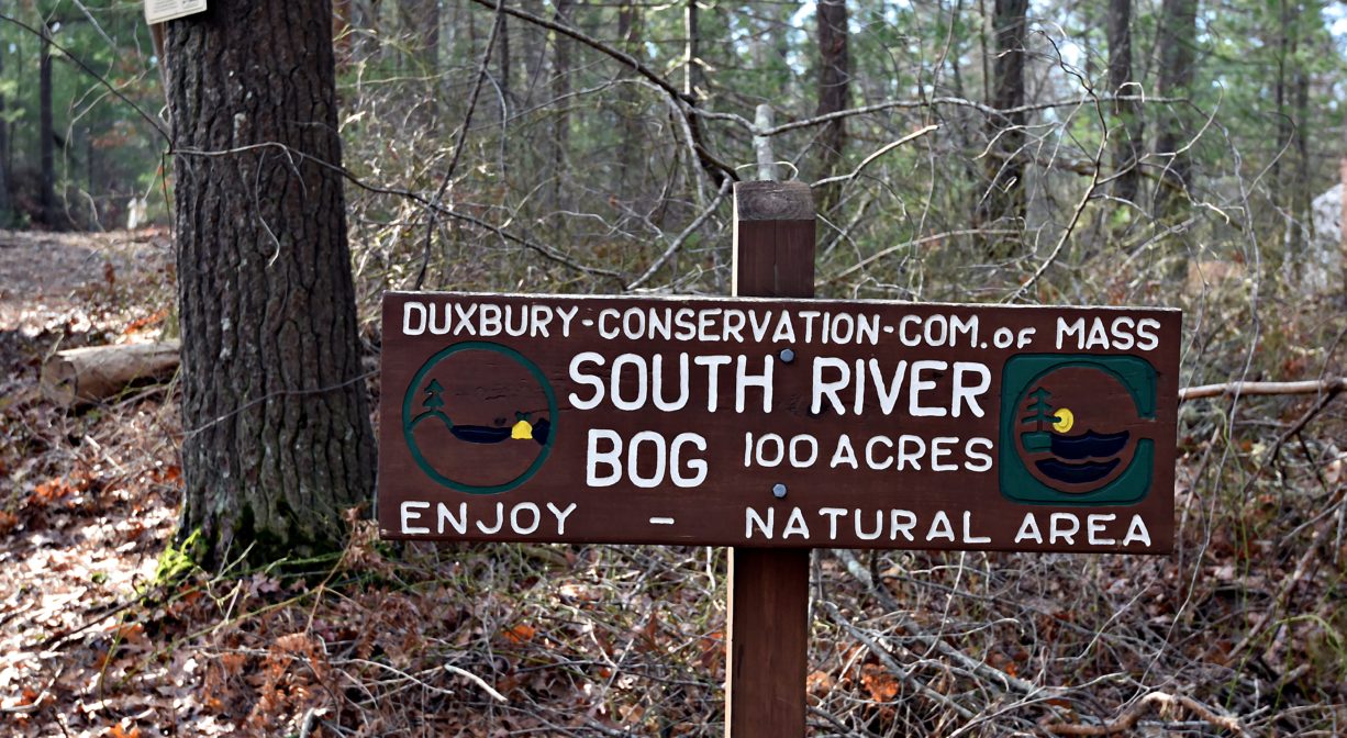
South River Bog is a 100-acre Duxbury Conservation property that offers about a mile of trails plus captivating views of the South River. In the past, the property was known as Feinberg Bog. It is comprised primarily of former cranberry bogs, and is adjacent to Route 3.
HUNTING: Archery hunting for deer is allowed on part of this property, in season, by licensed persons in compliance with Massachusetts law. Please be sure to understand state and local hunting guidelines before proceeding. Non-hunters, be mindful of hunting seasons, and wear bright orange if you’re entering the property during those times. Hunting is not permitted on Sundays.
Features
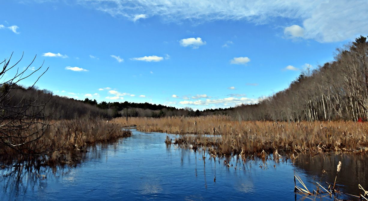
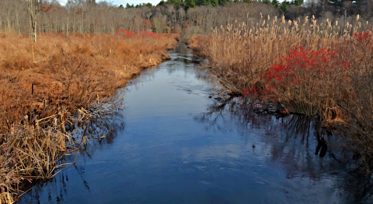
This 100-acre property was once cranberry bogs, but its agricultural days have passed. Dormant since the early 1900s, it has slowly converted to forest and marsh. The South River runs through it, plus some of the bog’s old irrigation channels are still in place. The parcel was once called Feinberg Bogs, and in addition to cranberry farming, charcoal was made in the forested uplands. Looking out over the river and its marshes, you may wonder what you’re seeing: the not-so-distant traffic of Route 3 is surprisingly close-by. The property was acquired by the Town of Duxbury in 1971.
Prior to European contact, the Mattakeeset band of the Massachuseuk (or Massachusett) Native American tribe lived for thousands of years in the North River watershed. Their village included most of today’s Pembroke and Hanson. Meanwhile the Patuxet band of the Wampanoag tribe inhabited the Jones River watershed, and the area now known as Kingston, Plymouth and Duxbury. This property lies within the upper portion of the South River watershed — right between those two territories. It’s possible that both tribes utilized the area. To learn more about local tribes, we encourage you to interact with their members. The Mattakeeset band of the Massachusett, the Massachusett tribe at Ponkapoag, the Mashpee Wampanoag, and the Herring Pond Wampanoag also share information on their websites.
Trail Description
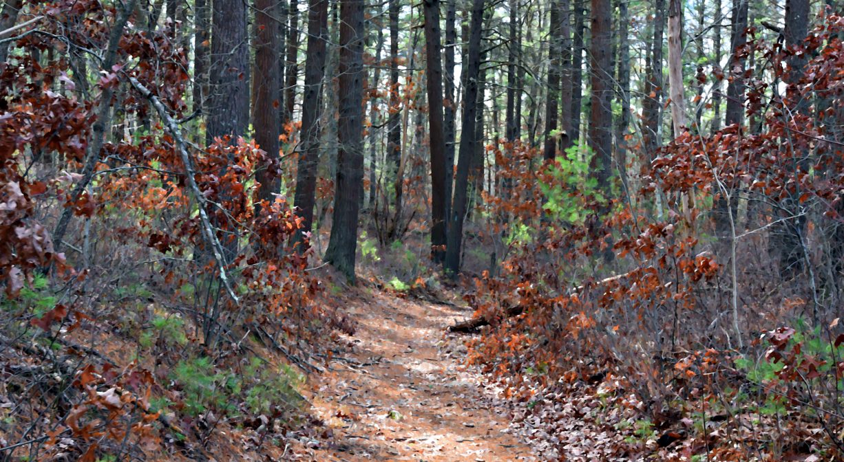
The property includes a network of trails, blazed in red, blue and green.
The entrance trail begins as a wide cart path and leads down a sizable hill. It soon narrows, and after about 0.2 miles, there is a fork. If you go right, after another 0.2 miles, you will arrive at another intersection. Continue straight for a beautiful view of the South River. A concrete structure serves as a bridge, and you can continue through the woods for 0.2 miles to the Highland Trail neighborhood.
If you turn left at the first intersection, the trail continues in an arc and eventually crosses an old cranberry bog channel, arriving at another intersection (0.3 miles). Turn right to complete a loop that leads back to the first intersection mentioned above. Turn left for a longer walk. The trail extends around the border of a former cranberry bog, now well on its way to returning to a more natural state. After another 0.1 mile or so, a concrete structure provides passage over the South River. You can stop here to admire the view in both directions, or continue along the trail for a short way to the Tanglewood Trail neighborhood.
Habitats and Wildlife
The South River flows through this property. The woods here are composed of pine, oak, maple, sassafras, grey birch, and beech. There are lots of ferns, and also sweet pepperbush, blueberry, and greenbrier. Look for beaver dams across the smaller streams. River otters have been spotted here (2021). Use caution: they are known to behave aggressively toward humans.
The South River originates deep in Duxbury. Its source is in the Round Pond area, and from there it winds unobtrusively through the woods for several miles. Although one can view it from Route 3, and also from both the South River Bog and the Camp Wing Conservation Area, it remains a narrow and mostly un-navigable stream until just below Veterans Memorial Park. From there it flows through South River Park, behind the playground of South River School, and under the Willow Street and Francis Keville Bridges. Wider at that point, and navigable at most tides, its course winds through the marshes as it runs parallel to Route 139, all the way to Rexhame. From there the river turns northward. It flows for 3 miles between Humarock and the mainland to Fourth Cliff, where it joins the North River at its outlet to the sea.


Historic Site: No
Park: No
Beach: No
Boat Launch: No
Lifeguards: No
Size: 100 acres
Hours: Dawn to Dusk
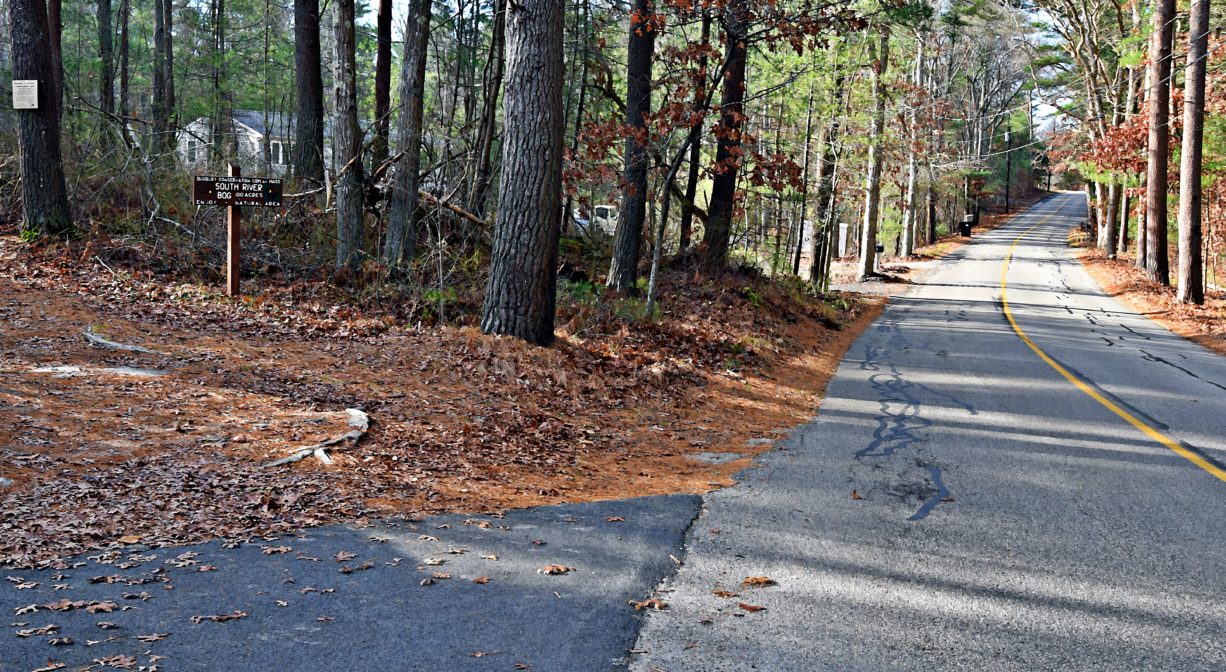
Parking: Limited parking (1-2 vehicles) is available on North Street. Look for a small wooden sign, up the road and diagonally across from Hillside Lane. No formal parking area. There is also pedestrian access from Tanglewood Trail and Highland Trail, with potential roadside parking.
Cost: Free
Trail Difficulty: Easy
Dogs: All dogs shall be effectively restrained and controlled by a chain or leash, or otherwise under the immediate and effective control of a handler, or confined to a motor vehicle. Each person who owns, possesses or controls a dog shall remove and properly dispose of any feces left by his/her dog. For current rules see: https://www.town.duxbury.ma.us/animal-control
Boat Ramp: No
ADA Access: No
Scenic Views: Yes
Waterbody/Watershed: South River