
Duxbury Conservation: (781) 934-1100 ext. 5471
Owned By: Town of Duxbury
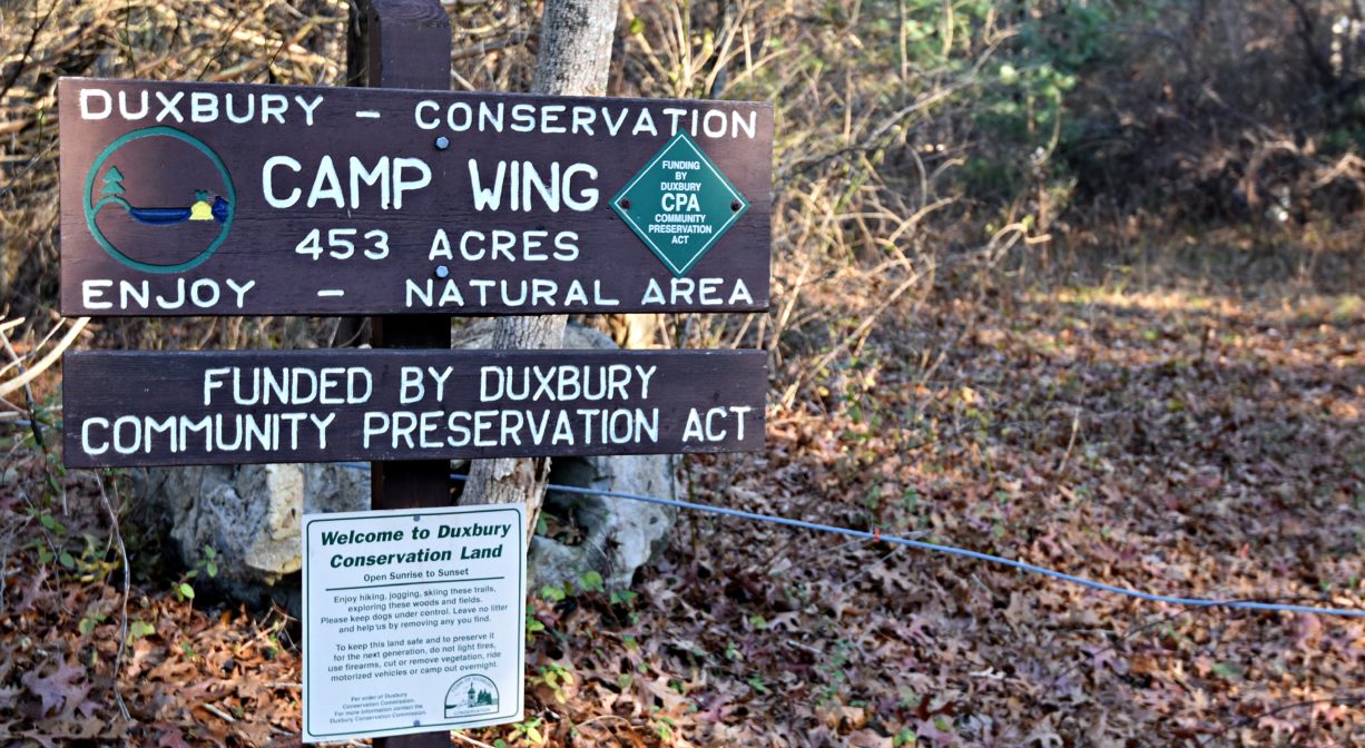
The 450-acre Camp Wing Conservation Area offers 2.7 miles of trails in two sections. Much of this Duxbury Conservation property is maintained as wilderness for water protection and wildlife habitat. Several rare or uncommon species of plants and animals can be found here. Both the South River and its tributary, Phillips Brook, flow through.
HUNTING: Waterfowl hunting and archery hunting for deer are allowed on portions of this property, in season, by licensed persons in compliance with Massachusetts law. Please be sure to understand state and local hunting guidelines before proceeding. Non-hunters, be mindful of hunting seasons, and wear bright orange if you’re entering the property during those times. Hunting is not permitted on Sundays.
Features
The Town of Duxbury acquired the Camp Wing Conservation Area in 1998. It is named for the Crossroads for Kids Camp (formerly Camp Wing), from whom the town purchased the land. It is bordered primarily by Route 3, Franklin Street, and Keene Street.
Prior to European contact, the Mattakeeset band of the Massachusett (or Massachuseuk) Native American tribe lived for thousands of years in the North River watershed. Their village included most of today’s Pembroke and Hanson. Meanwhile the Patuxet band of the Wampanoag tribe inhabited the Jones River watershed, and the area now known as Kingston, Plymouth and Duxbury. This property lies within the upper portion of the South River watershed — right between those two territories. It’s possible that both tribes utilized the area.
To learn more about local tribes, we encourage you to interact with their members. The Mattakeeset band of the Massachusett, the Massachusett tribe at Ponkapoag, the Mashpee Wampanoag, and the Herring Pond Wampanoag share information on their websites.
In the early 1600s, as European colonists began to settle along the shores of Duxbury, this area was designated as common land. It was open to the community as a place to fish, hunt and cut wood. Josiah Keene settled in Duxbury around 1700 and established a sawmill on the South River. Keene’s Mill Pond, at the northern boundary of this property, very likely was created by the construction of the mill dam. The presence of cedar stumps here, as well as the occasional standing cedar tree, indicates that before the pond was built, there was a cedar swamp. Isaac Keene constructed another mill here in the 1800s, but ultimately there wasn’t enough water to sustain it. There was also an ice house on the pond, known as Simon’s Tomb.
Within the upland portions of the Camp Wing property, old stone walls reveal an agricultural past. Some of the wetlands near Route 3 were once cranberry bogs — established in the early 1900s by the Consolidated Cape Cod Cranberry Company, and continuing until the highway was constructed in the 1960s. More recently, logging took place the woodland portions of Camp Wing. The trees have since begun to grow back. You can also see test holes in the part of the property near Franklin Street. These were created by a potential developer, and in time they will disappear.
Trail Description
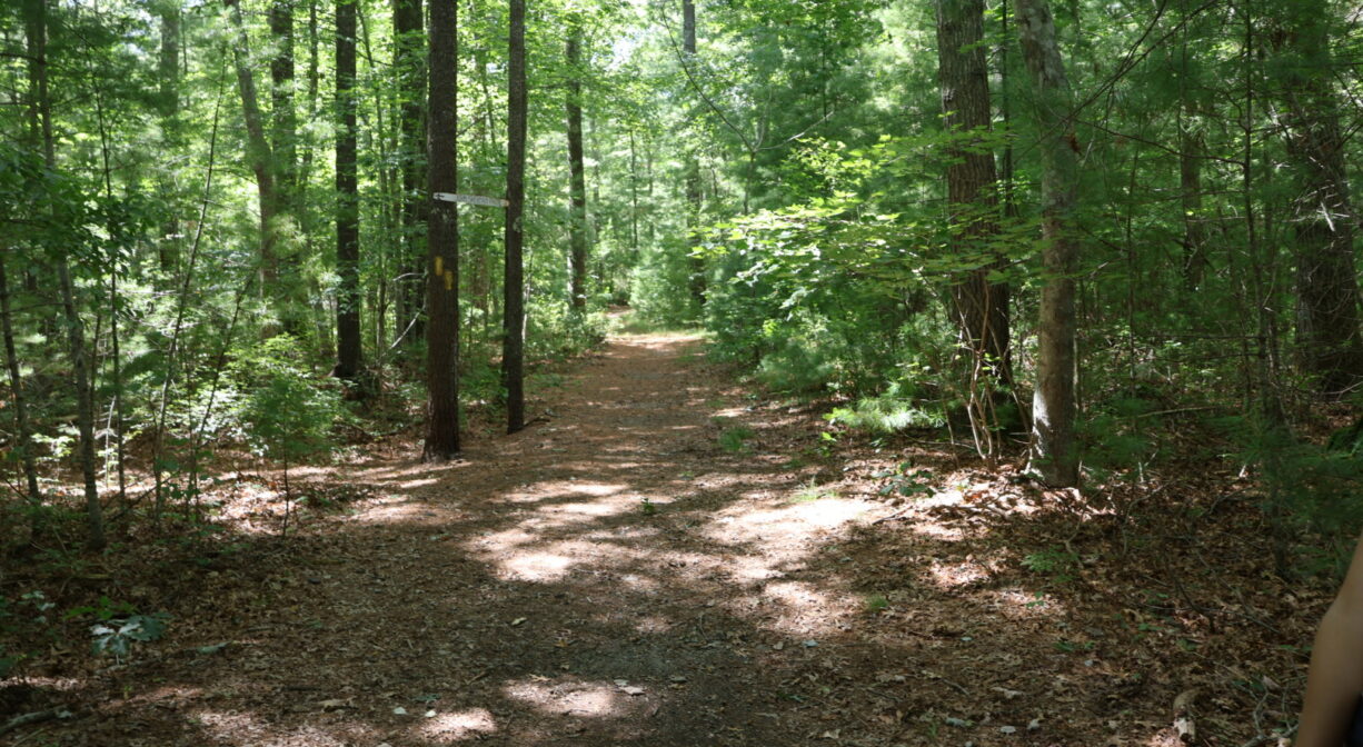
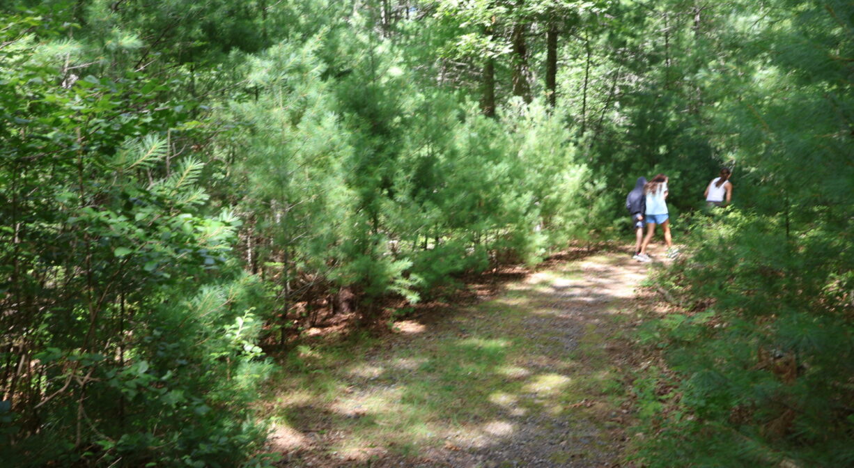
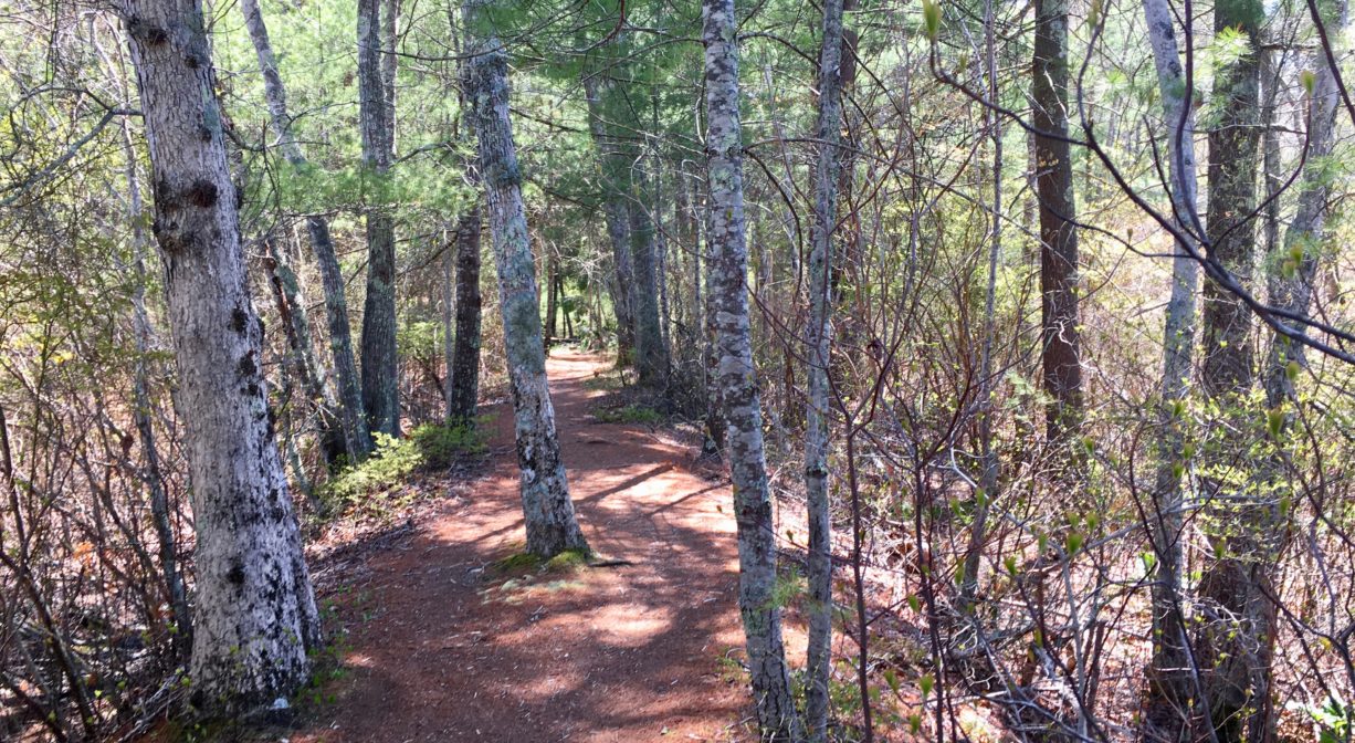
There are two distinct trail networks within Camp Wing. Some are narrow footpaths, and others trace the routes of old logging roads.
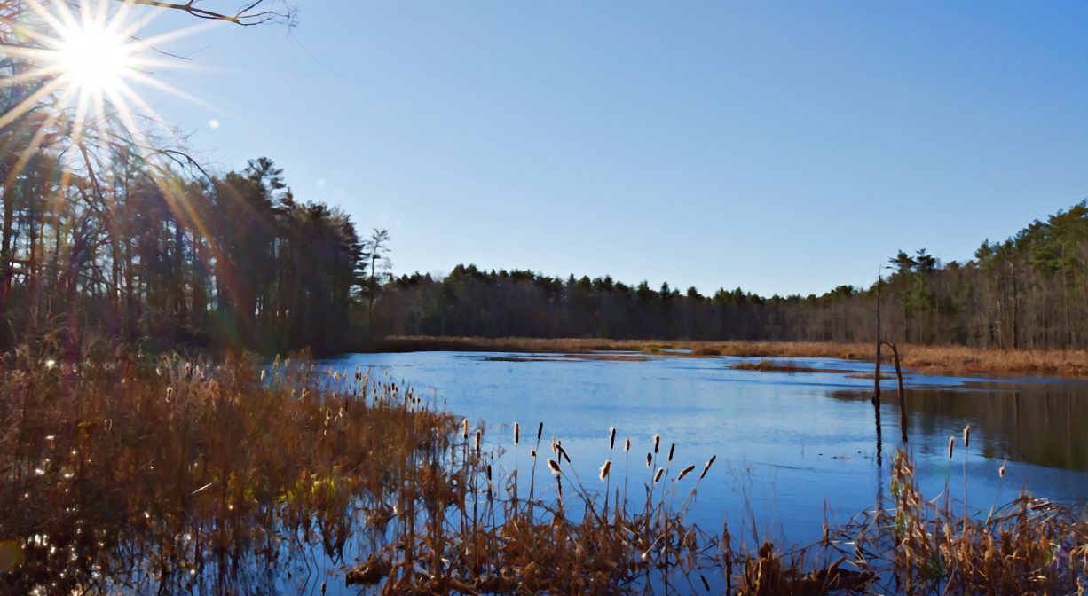
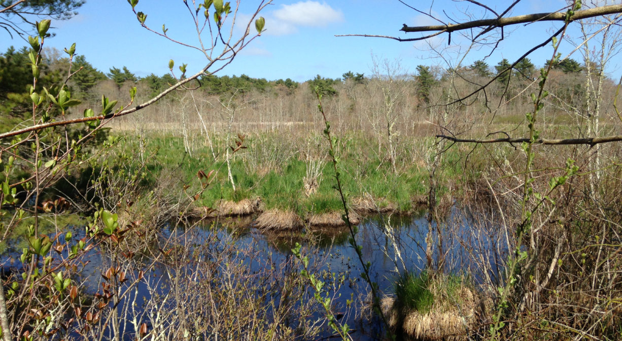
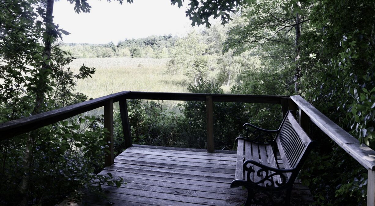
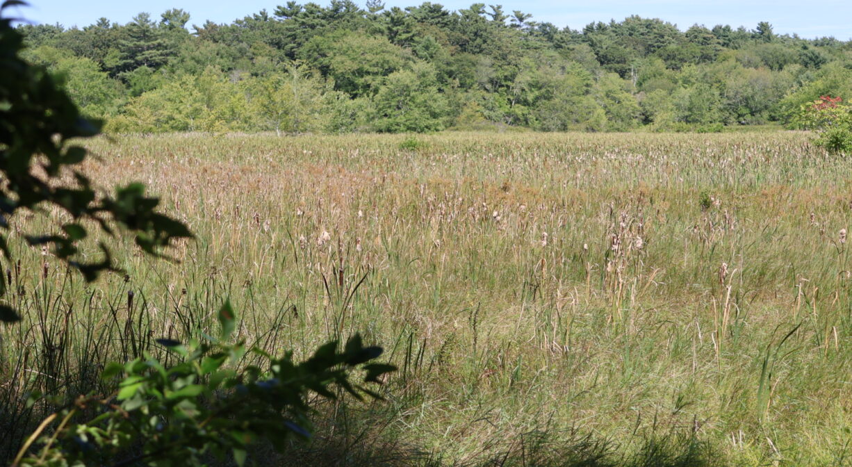
The larger trail system begins in the parking area on Franklin Street. The color-coded trails create a large loop, within which there are three smaller loops. The West Loop (orange, 0.2 miles) leads through the forest at the southern corner of the property. The adjacent blue/green loop (0.6 miles) extends through both upland and red maple swamp. The East Loop (red, 0.2 miles) is mostly upland as well, but at the end of a spur trail to the north, there is an observation deck that overlooks fen and marsh areas along the South River.
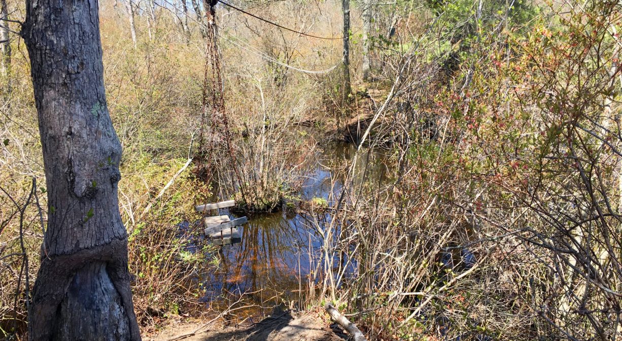
There is a “trolley” of sorts (a swing seat with a rope) across the South River a few hundred yards beyond the observation deck. On the other side, the trail follows a narrow stretch of upland through more wetlands, and ends in a pine forest abutting Route 3.
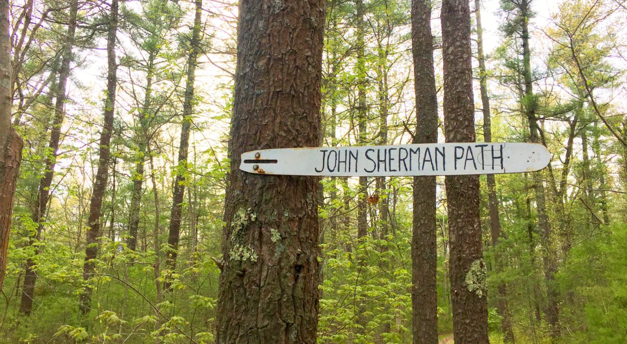
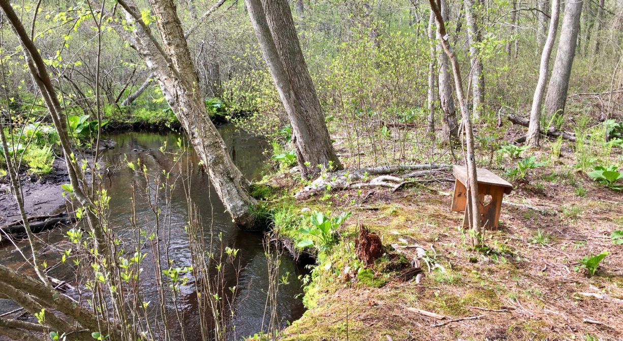
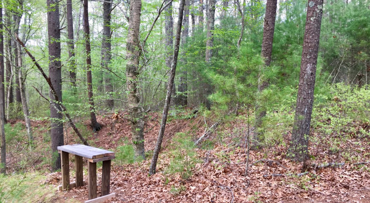
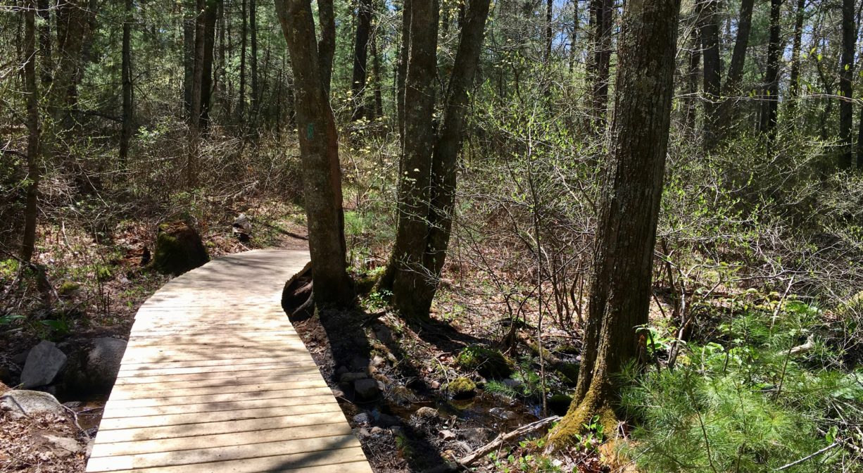
Yet another trail, blazed yellow, extends for 1.3 miles. Entering from the Franklin Street parking area, look for a sign on the left for the John Sherman Path. The path leads through woods and wetlands for more than a mile, eventually intersecting with the green-blazed trail. Along the John Sherman Path there are two marked spur trails that lead to Phillips Brook. There are a few benches along the way, at scenic points, as well as some bog boards traversing wet areas. Portions of this trail are wet and overgrown, and probably not the best option during tick season.
A smaller trail system — far away, on the opposite side of the property — is known as the John Rubin Path. This 1-mile trail is located off Myrtle (or Temple) Street. If you park near Keene’s Sawmill, the old mill dam and ice house, just downstream of Keene’s Mill Pond, or at the roadside pull-off a little farther down Temple Street, you’ll find the trailhead across the road. It will lead you through the woods and around a loop that offers views of the South River and its surrounding wetlands. This particular section of Camp Wing is just around the corner (and actually backs up to) the South River Bog property, with Route 3 in the middle.
Habitats and Wildlife
Camp Wing offers an unusually diverse array of habitats: two types of marsh, two types of swamp, upland and bottomland forest, and fens. Much of this is ideal habitat for migratory and wintering birds. Rails and bitterns nest in the streamside marshes. The black ducks that winter here feast on cattails in the marsh. Wood ducks and green herons build their nests in the red maple swamp, while songbirds such as warblers take up residence in the shrub swamp. Looking out at the wetlands from the observation deck on the East Loop, you might spy an egret fishing for small fish or frogs. In the upland forest listen for scarlet tanager, oven bird, ruffed grouse, and great horned owl.
Trees and shrubs are diverse here as well. White pine dominates the upland forest, but there is also huckleberry, and red, white, and black oak. In the bottomland forests, hemlock and American holly can be found, along with sweet pepper bush, witch hazel, blueberry, and inkberry. In the shrub swamp, some of the trees appear stunted. Alders, swamp azaleas, swamp sweet bells, and blueberries grow well there. Green ash trees join the red cedars in the red cedar swamp. Bog orchids and sphagnum moss can be spotted in the fens.
Amphibians, reptiles, and mammals are abundant here. Rare four-toed salamanders can be found in the red maple swamp and shrub swamp, along with spotted turtles. Vernal pools provide habitat for a variety of frogs. Look for white tailed deer, fox and coyote, as well as small creatures such as field mice, red and grey squirrels, mink, and opossum. You might even see an otter. Camp Wing is also excellent habitat for the rare dragonfly known as the banded bog haunter.
The South River originates deep in Duxbury. Its source is in the Round Pond area, and from there it winds unobtrusively through the woods for several miles. Although one can view it from Route 3, and also from both South River Bog and the Camp Wing Conservation Area, it remains a narrow and mostly un-navigable stream until just below Veterans Memorial Park. From there it flows through South River Park, behind the playground of South River School, and under the Willow Street and Francis Keville Bridges. Wider at that point, and navigable at most tides, it winds through the marshes as it runs parallel to Route 139, all the way to Rexhame. From there the river turns northward. It flows for 3 miles between Humarock and the mainland to Fourth Cliff, where it joins the North River at its outlet to the sea.

Historic Site: No
Park: No
Beach: No
Boat Launch: No
Lifeguards: No
Size: 450 acres
Hours: Dawn to Dusk
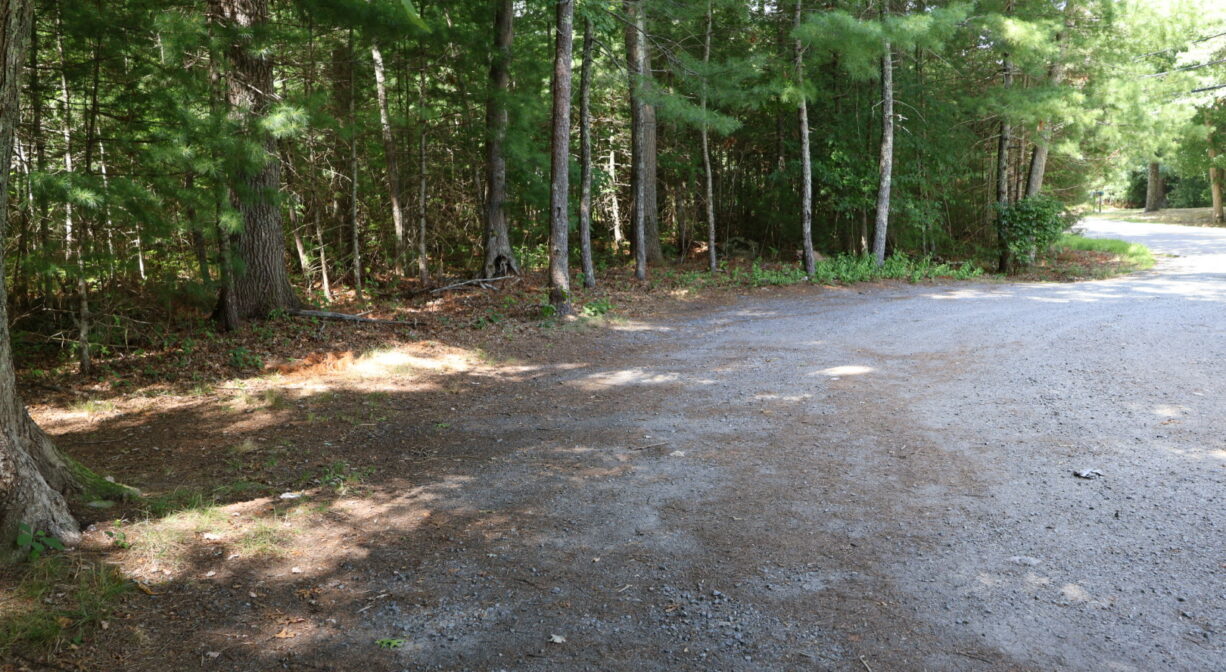
Parking: Small parking area at 654 Franklin Street. Parking also available on Temple Street.
Cost: Free
Trail Difficulty: Easy
Facilities:
Boardwalk and wetlands observation deck, occasional benches. Geocache location.
Dogs: All dogs shall be effectively restrained and controlled by a chain or leash, or otherwise under the immediate and effective control of a handler, or confined to a motor vehicle. Each person who owns, possesses or controls a dog shall remove and properly dispose of any feces left by his/her dog. For current rules see: https://www.town.duxbury.ma.us/animal-control
Boat Ramp: No
ADA Access: No
Scenic Views: Yes
Waterbody/Watershed: Phillips Brook (South River watershed)