
505 Ferry St, Marshfield, MA 02050, USA
Town of Marshfield: (781) 536-2500
Owned By: Town of Marshfield
The Marshfield Bridle Path and Rail Trail extends from just south of Summer Street, along one side of Carolina Hill Reservation, and behind the Marshfield Fairgrounds. It continues through Pratt Farm and over the Francis Keville Footbridge to Dandelion Park on Ocean Street. In total, it runs about 3.5 miles, with 5 informational kiosks and occasional, well-marked road crossings. A former railroad right-of-way, it is owned by the town of Marshfield. Stroller-friendly.
In addition, Rail Trail South (currently unmarked) extends as a sidewalk from Dandelion Park, along Webster Street, to Red Gold Farm, tracing and occasionally overlapping the original path of the railroad. Within Red Gold Farm, a 500-foot boardwalk leads to the southernmost section of the railroad bed, which extends to Careswell Street, and connects with both the Hoyt-Hall Preserve and the historic Pilgrim Trail.
Hunting is not allowed along the Marshfield Bridle Path and Rail Trail, nor at any of Marshfield’s conservation properties.
FISHING ADVISORY: It’s important to know that some of our freshwater fisheries are contaminated with mercury, PFAS and/or other concerning substances. The Massachusetts Department of Public Health maintains an online database with up-to-date advisories regarding fish consumption, sorted by location. We recommend you consult this valuable resource when planning a fishing excursion.
Features
Beginning in 1871, a branch of what became the Old Colony Railroad extended from Quincy to Kingston, passing through the towns of Hingham, Cohasset, Scituate, Marshfield, and Duxbury. The railroad entered Marshfield at Damon’s Point, traveled down today’s Damon’s Point Road (Marshfield Hills Station), and then along today’s Summer Street and Station Street (Seaview Station). It continued along the eastern base of Carolina Hill, across Ferry Street (Center Marshfield Station), and eventually across the South River near today’s downtown area (Marshfield Station). Continuing south, it crossed the Green Harbor River on Webster Street and passed into Duxbury just after the Webster Place Station. In 1938, a hurricane severely damaged the tracks at the North River, which were subsequently removed, putting an end to rail service from that point south. Much, but not all, of the railroad bed has been converted to trail.
The Bridle Path & Rail Trail is part of Marshfield’s South River Greenway which interconnects Veterans Memorial Park, South River Park, Pratt Farm, the Keville Footbridge, Dandelion Park and the Bridle Path & Rail Trail.
This land is within the region of the Massachusett (or Massachuseuk). To learn more about local Native American tribes, we encourage you to interact with their members. The Massachusett tribe at Ponkapoag and the Mattakeeset band of the Massachusett share information on their websites.
Trail Description
The trail begins at Station Street, just south of Summer Street in Marshfield Hills, and continues for a relatively short distance to Pinehurst Road.
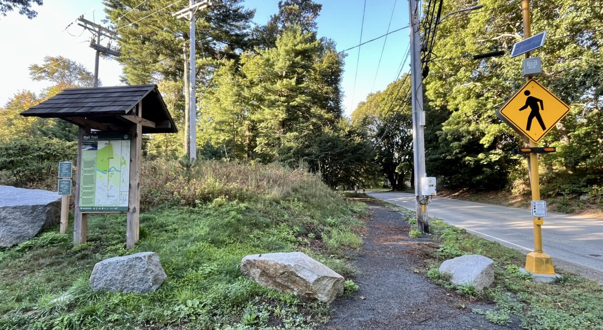
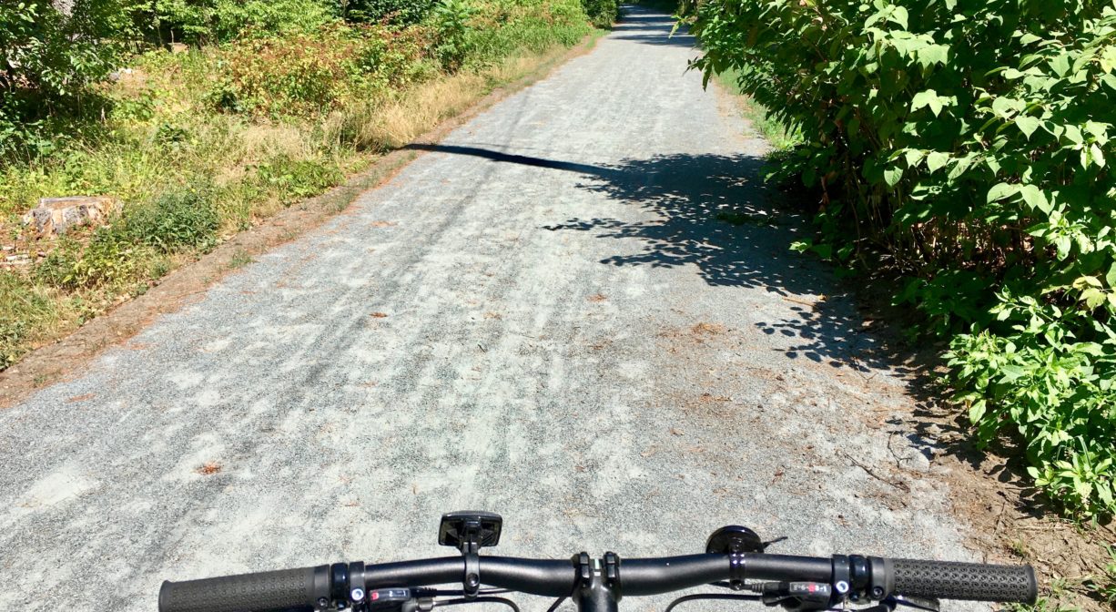
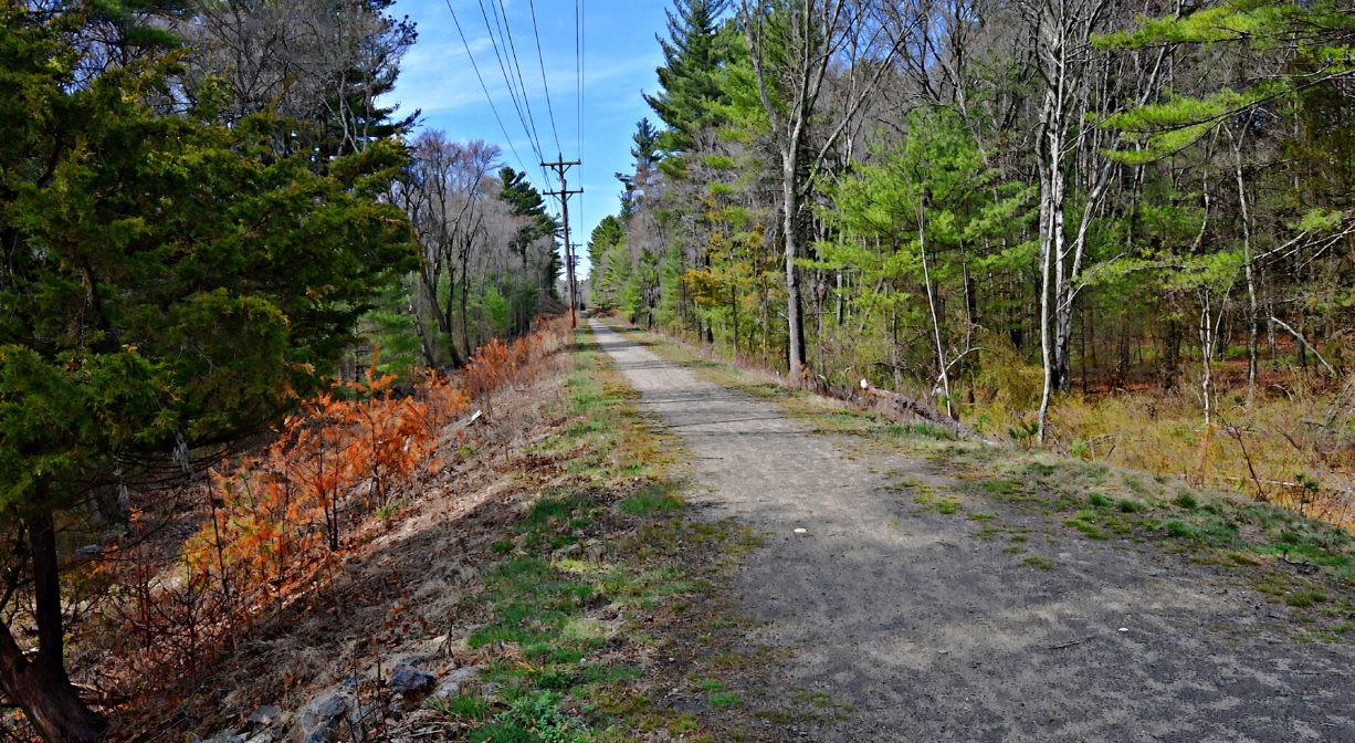
The approx. 2.5-mile section of the trail between Pinehurst Road and South River Street is known as the Bridle Path. Years ago, the Town of Marshfield declared that the trail would remain open for equestrian access in perpetuity. It extends through the woods and at the edge of farmland to the Carolina Hill Reservation. Continuing along the base of Carolina Hill, the Bridle Path crosses Ferry Street and soon after, crosses Clay Pit Road and South River Street. Along the way, it skirts the boundaries of some sand & gravel pits as well as the Marshfield Fairgrounds. The Bridle Path is wide, evenly graded, and finished with stone dust. Predominantly flat, it is bordered mostly by woods. It’s an easy, quiet trail through the heart of Marshfield. Informational kiosks were installed 2023.
In the Town Of Marshfield’s report, “Promoting Connection and Protection: A Comprehensive Trails Plan,” the Bridle Trail is likened to a “spine stitching together many of the other trail system(s), open spaces and neighborhoods,” and cited as “the most important existing trail resource in town.” Not only is it easily accessible to walkers, runners, mountain bikers and horseback riders, it provides connections among Marshfield’s commercial, residential and recreational areas.
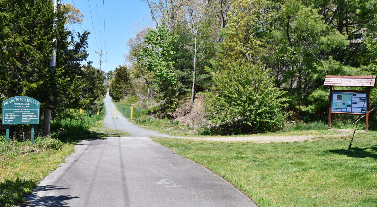
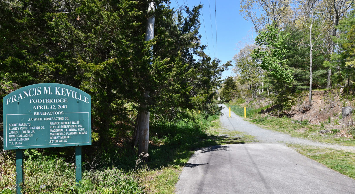
The half-mile section of the trail between South River Street and Ocean Street is known simply as the Rail Trail. From South River Street, the trail passes along the eastern edge of Pratt Farm, a Marshfield Conservation property. A quarter mile farther, it reaches the Keville Bridge, which crosses the South River. And after another 0.15 miles, the trail terminates at Dandelion Park. Look for a kiosk directly behind the CVS on Ocean Street. For a map of this section, please visit the listing for Keville Bridge or Dandelion Park.
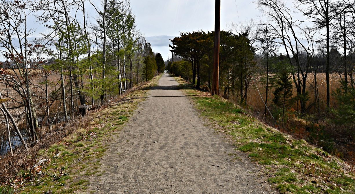
In addition, Rail Trail South (currently unmarked) extends as a sidewalk from Dandelion Park, along Webster Street, to Red Gold Farm, tracing and occasionally overlapping the original path of the railroad. Within Red Gold Farm, a 500-foot boardwalk leads to the southernmost section of the railroad bed, which extends to Careswell Street, and connects with both the Hoyt-Hall Preserve and the historic Pilgrim Trail along the way.
Trail access at Station Street, Pinehurst Road, Carolina Hill Reservation, Ferry Street, Clay Pit Road, South River Street, Pratt Farm, Ocean Street/Dandelion Park and Webster Street. The Francis Keville Bridge crosses the South River. The section of the Rail Trail between Dandelion Park and the Keville Bridge is ADA accessible.
Approximate mileage for each trail section:
Station Street to Pinehurst Road: 0.2 miles
Pinehurst Road to Ferry Street: 1.25 miles
Ferry Street to Clay Pit Road: 0.5 miles
Clay Pit Road to South River Street: 1 mile
South River Street to Dandelion Park: 0.4 miles
Dandelion Park to Red Gold Farm (via sidewalk): 0.6 miles
Red Gold Farm to Stagecoach Drive (via trails): 1.05 miles
Stagecoach Drive to Careswell Street: 0.5 miles
Habitats and Wildlife
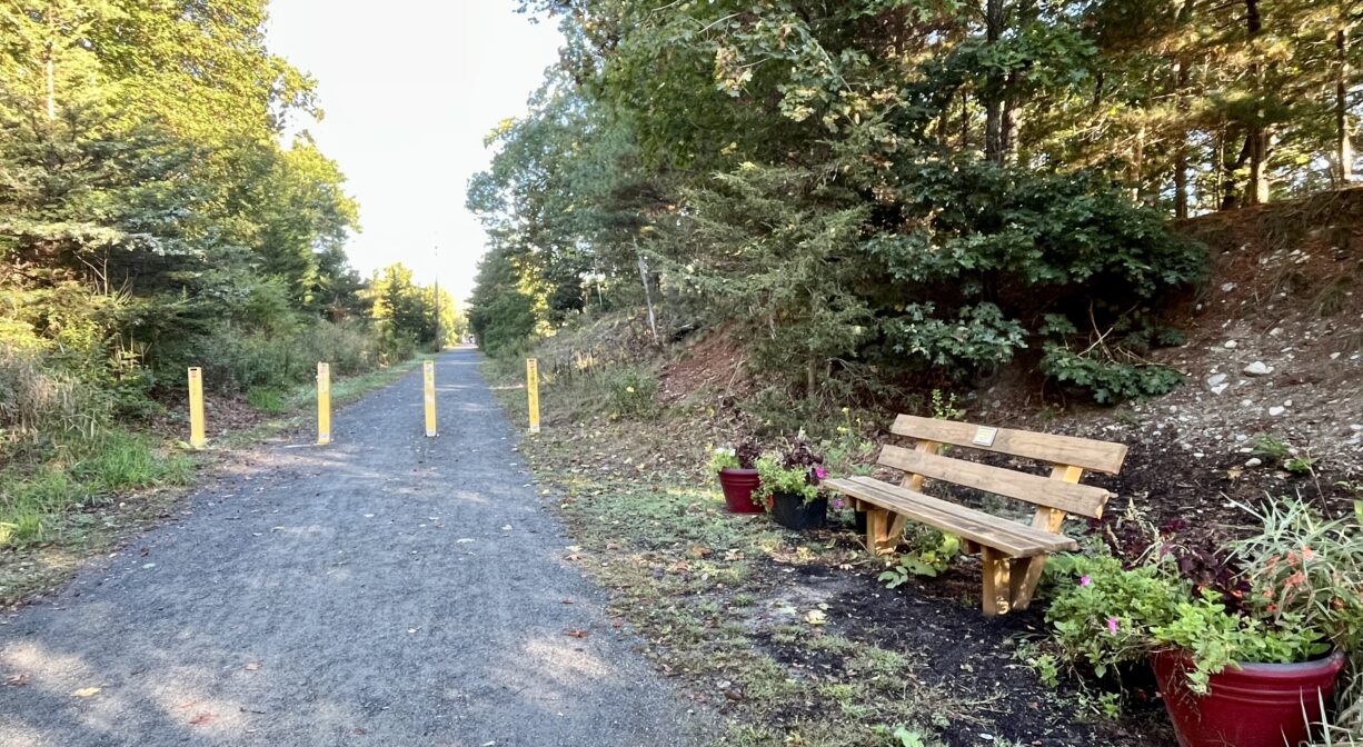
The forests bordering the Bridle Trail and Rail Trail are predominantly pine and oak. The trail crosses the South River at the Francis Keville Footbridge, where a memorial bench offers a beautiful view downstream. Especially at the northern end of the trail, between Ferry Street and Pinehurst Road, look for blackberries and grapes in the summertime. Much of the trail is within the watershed of Little’s Creek, which flows into the South River downstream of Humarock. A smaller portion is within the watershed of the South River itself.
The South River originates deep in Duxbury. Its source is in the Round Pond area, and from there it winds unobtrusively through the woods for several miles. Although one can view it from Route 3, and also from both the South River Bog and the Camp Wing Conservation Area, it remains a narrow and mostly un-navigable stream until just below Veterans Memorial Park. From there it flows through South River Park, behind the playground of South River School, and under the Willow Street and Francis Keville Bridges. Wider at that point, and navigable at most tides, its course winds through the marshes as it runs parallel to Route 139, all the way to Rexhame. From there the river turns northward. It flows for 3 miles between Humarock and the mainland to Fourth Cliff, where it joins the North River at its outlet to the sea.
Rail Trail South crosses into two additional watersheds. The Red Gold Farm property is primarily cranberry bogs, along with some ponds and freshwater wetlands that are part of the Green Harbor River watershed. The river itself flows through the property! In the wooded sections, there are some oak, birch, pine and maple trees as well as the occasional cedar, along with fern, sweet pepper bush and viburnum. In and around the bogs, look for cardinal flowers and bog orchids. Some of the many avian species spotted here include great blue heron, green heron, killdeer, and wood duck. It’s also a great spot to see turtles!
The Green Harbor River flows along two sides of Red Gold Farm. The river originates in springs and ponds southwest of the property, in Duxbury. Beyond Red Gold Farm, it flows through the Green Harbor Golf Club, the Daniel Webster Wildlife Sanctuary, property owned by the Marshfield Municipal Airport, and Peter Igo Park. Just downstream of the Dyke Road bridge (and dike) it flows into the Atlantic Ocean at Green Harbor.
The southernmost section of Rail Trail South is within the watershed of the Duxbury Back River, which enters Duxbury Bay at the Powder Point Bridge, and empties into Cape Cod Bay.


Historic Site: No
Park: No
Beach: No
Boat Launch: No
Lifeguards: No
Size: 3.5 miles on the Bridle Path and Rail Trail plus 2.5 miles on Rail Trail South
Hours: Dawn to Dusk
Parking: Park in the unpaved lot beside the Bridle Path at 505 Ferry Street, by the kiosk at 1880 Ocean Street, or in Library Plaza (1837 Ocean Street). No parking on Station Street.
Cost: Free
Trail Difficulty: Easy
Facilities:
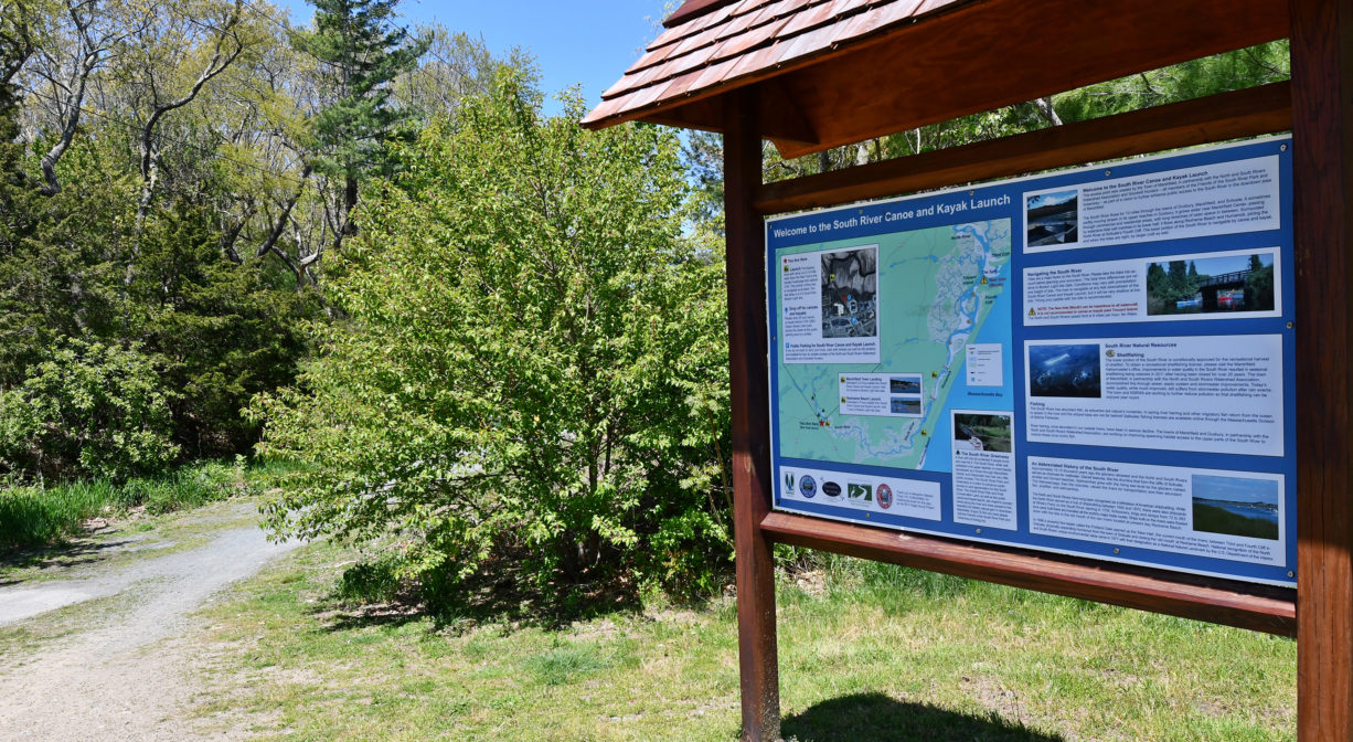
Benches, 5 informational kiosks. The Keville Bridge crosses the South River, offering a beautiful view. Also at Keville Bridge, there is a launch ramp and float for canoes and kayaks. Numerous geocache locations along the trail, such as this one. Red Gold Farm features two footbridges, plus a 500-foot boardwalk that leads to Rail Trail South.
Dogs: Dogs must remain on leash. Always clean up after your dog!
Boat Ramp: No
ADA Access: The section of the Rail Trail between Dandelion Park and the Keville Bridge is ADA accessible.
Scenic Views: Yes
Waterbody/Watershed: Little's Creek, South River (North & South Rivers watershed)