
Town of Marshfield: (781) 834-5563
Owned By: Town of Marshfield
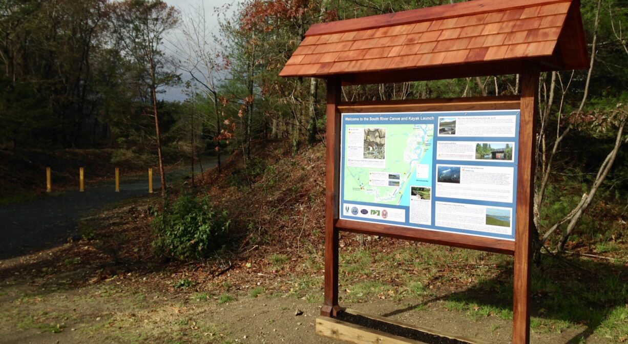
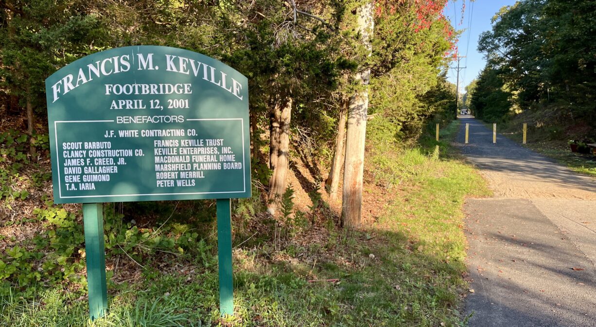
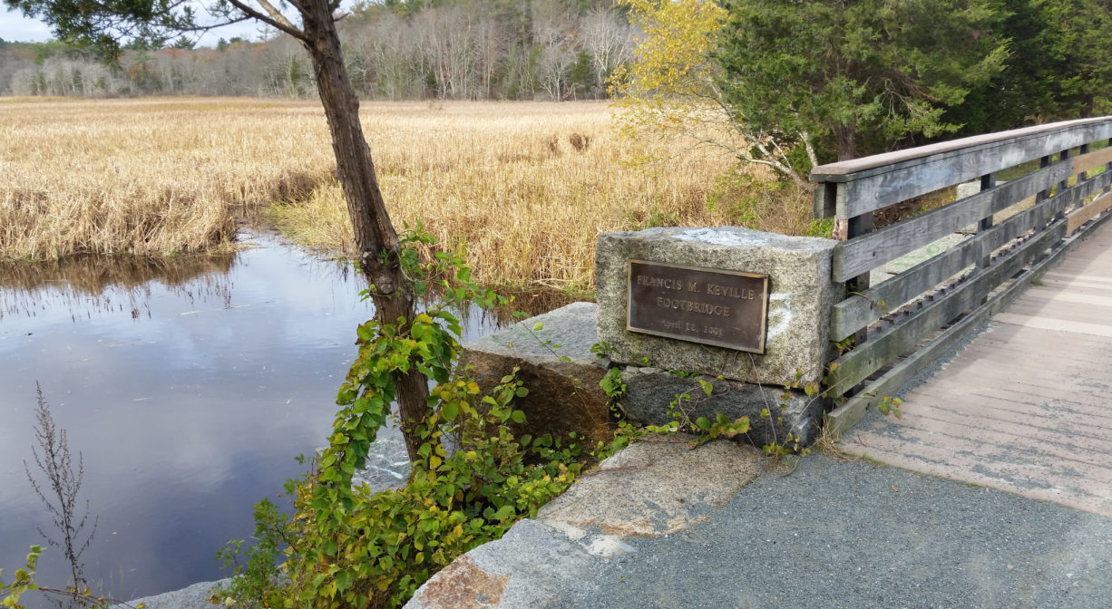
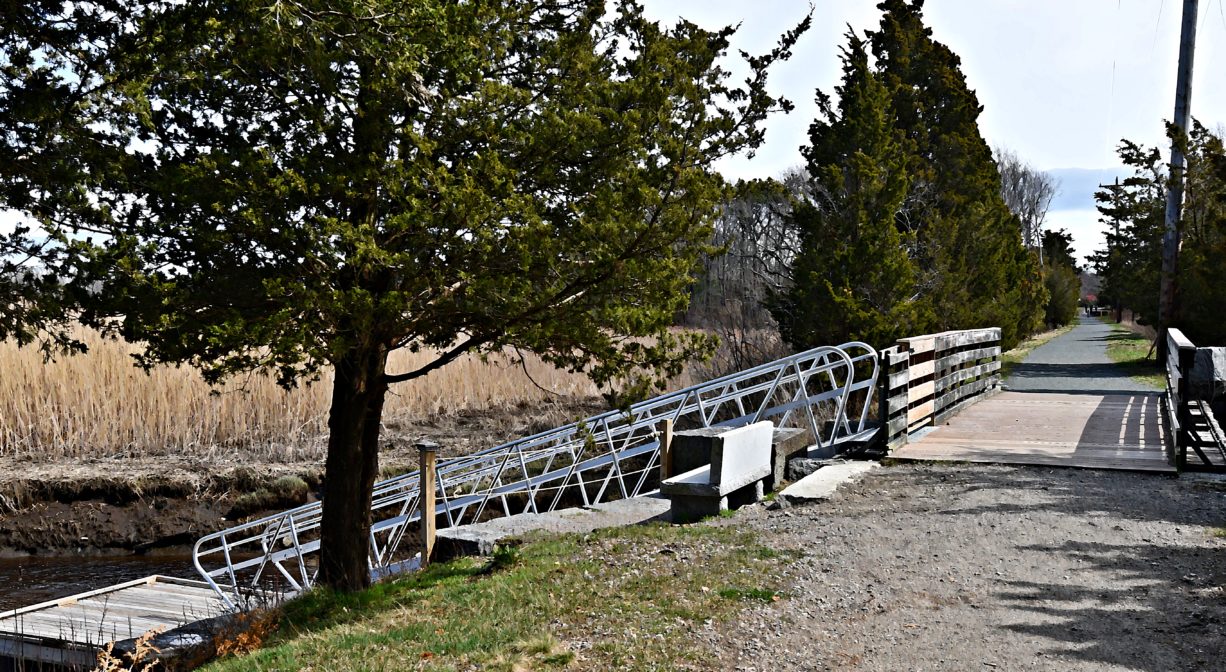
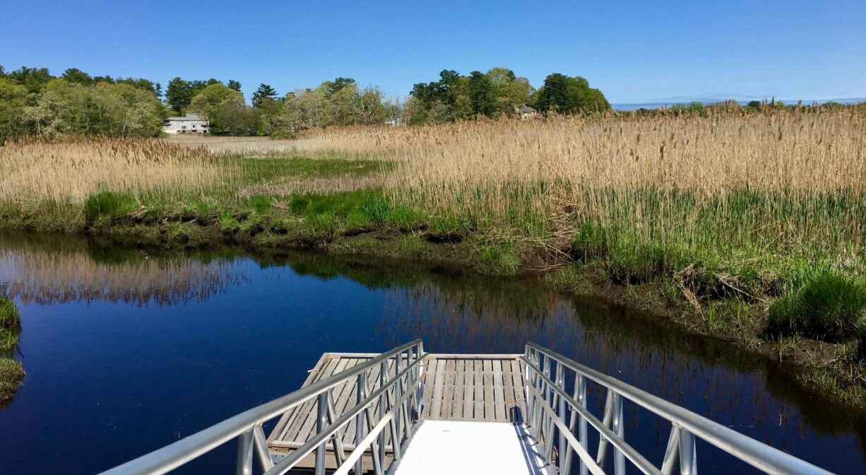
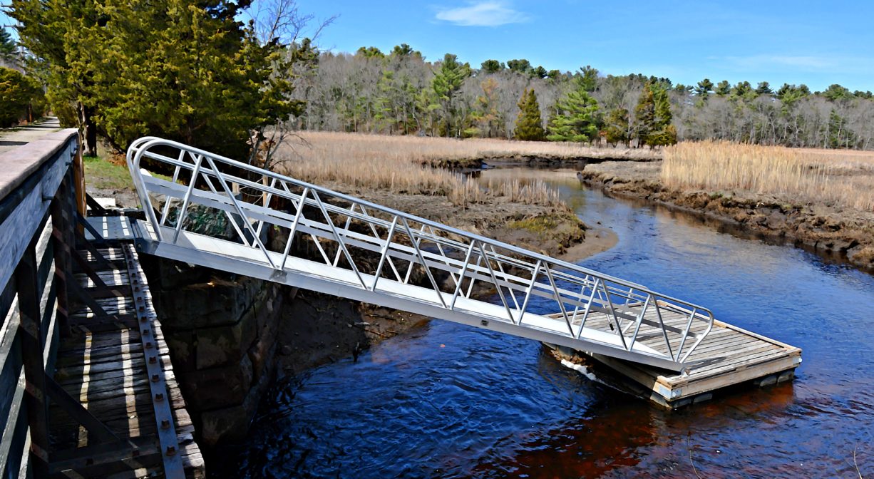
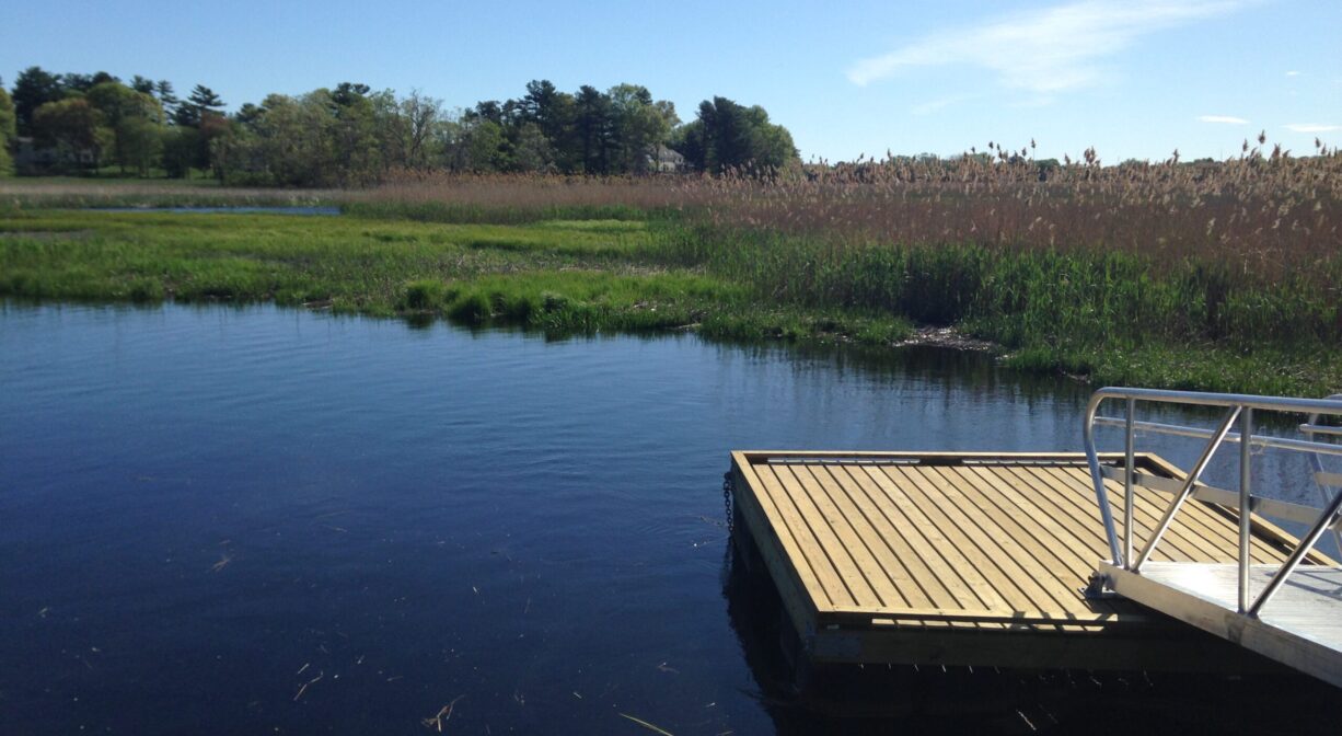
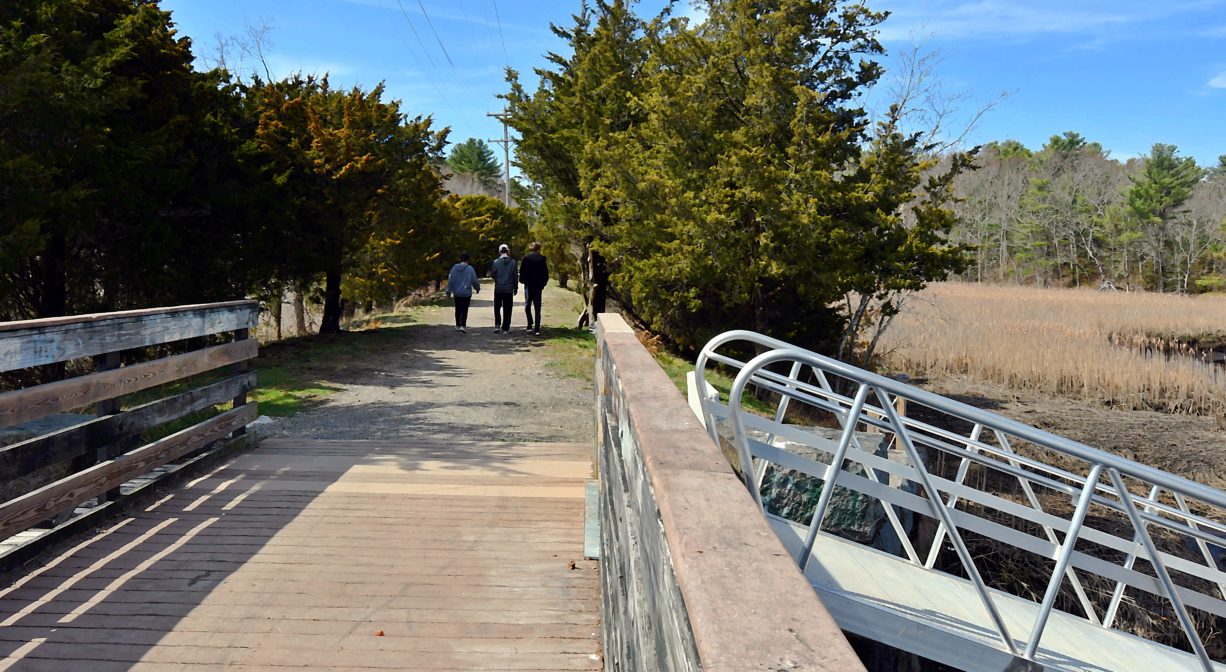
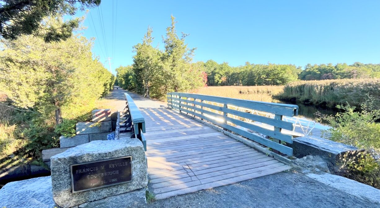
The Francis Keville Footbridge is located on the South River in Marshfield Center. Look for the informational kiosk in the parking area for the CVS at 1880 Ocean Street and follow the Rail Trail beside it 0.15 miles to the bridge, which is situated at a beautiful spot overlooking the river and its marshes. A ramp and float provide seasonal access for small non-motorized boats.
The Rail Trail from CVS to Keville Footbridge is accessible for wheelchairs and strollers. Also nearby, on the Rail Trail, is Dandelion Park.
Tide Math: High tide at the Francis Keville Footbridge is about 3-3.5 hours after the Boston high tide.
Hunting is not allowed on this property.
FISHING ADVISORY: It’s important to know that some of our freshwater fisheries are contaminated with mercury, PFAS and/or other concerning substances. The Massachusetts Department of Public Health maintains an online database with up-to-date advisories regarding fish consumption, sorted by location. We recommend you consult this valuable resource when planning a fishing excursion.
Features
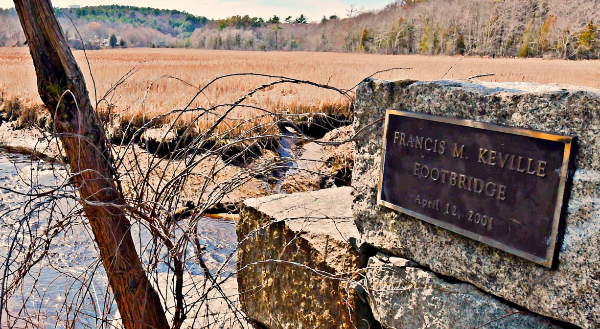
Established in 2017 by the Town of Marshfield, Goodwill Hunters, and NSRWA, this launch site for canoes, kayaks, SUPs and other small boats provides access to the upper navigable portion of the South River. The Keville Footbridge was constructed in 2001. It provides a vital link between Marshfield’s downtown area and the Bridle Path & Rail Trail that extends for 3 miles across town.
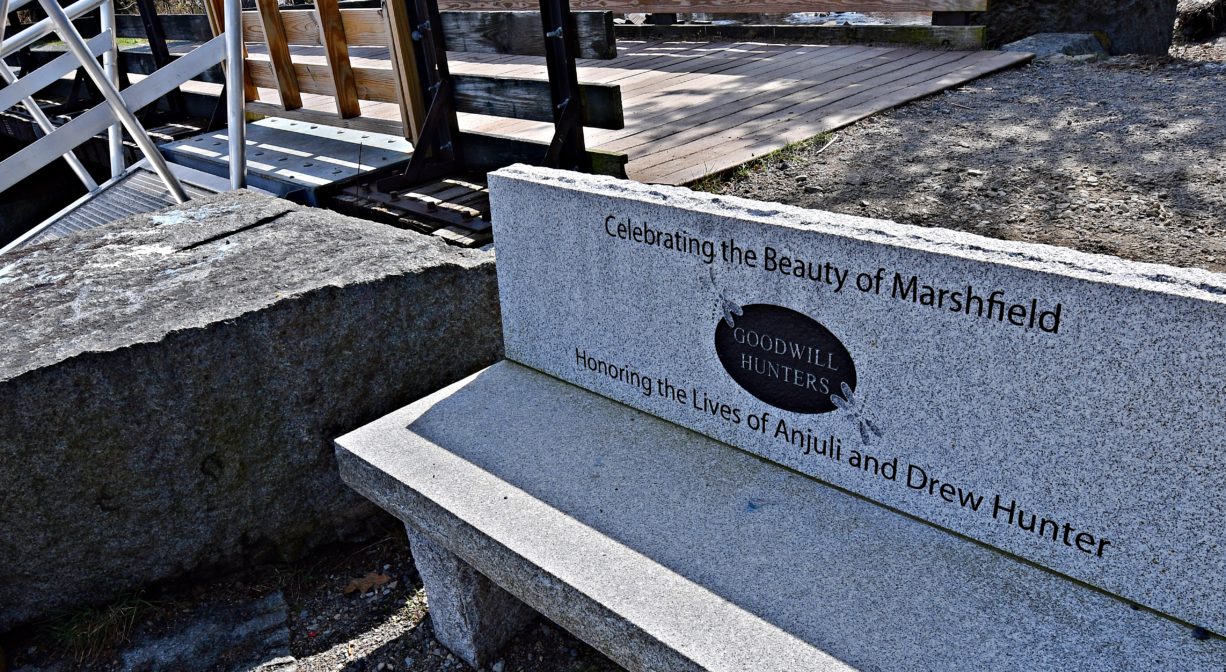
Even if you’re not interested in launching a boat from the Keville Footbridge, it’s worth visiting. Goodwill Hunters installed a granite bench at the water’s edge – a tribute to the late Drew and Anjuli Hunter — and the view is really something.
The Francis Keville Footbridge is part of the South River Greenway, an interconnected set of properties in Marshfield’s downtown, including Veterans Memorial Park, South River Park, Pratt Farm, the Keville Footbridge, Dandelion Park and the Bridle Path & Rail Trail.
This land is within the region of the Massachusett (or Massachuseuk) and Wampanoag Native American tribes. To learn more about local tribes, we encourage you to interact with their members. The Mattakeeset band of the Massachusett, the Massachusett tribe at Ponkapoag, the Mashpee Wampanoag, and the Herring Pond Wampanoag also share information on their websites.
Trail Description
The trail begins as pavement but soon turns to gravel. It is intended to be accessible for wheelchairs and strollers all the way to the Keville Bridge.
To access the Keville Footbridge, follow the wide 0.15-mile portion of the Rail Trail that extends behind the CVS at 1880 Ocean Street, adjacent to Dandelion Park. (Or follow the 0.25-mile section of the Rail Trail south from South River Street). Paddlers should be aware that launching a boat here requires carrying it first. It’s worth it, though! In season, there is a gate in the middle of the bridge that opens onto a tall metal ramp. The ramp is steep, but it has railings and a non-slip walkway . . . and it is wide enough to accommodate a person carrying a kayak. It leads to a wooden float, which sits on the water’s surface.
Once you get your boat on the water, you are in for a treat. This is a quiet section of the river – bordered on both sides by salt marsh. Those familiar with the lower portion of South River at Humarock and Rexhame will find this section to have significantly less traffic. Especially in the summer, when the grasses have grown tall, it’s hard to believe that civilization is close-by.
One of the many nice things about the lower portion of the South River is that it is wide and deep enough to be navigable at any tide. The upper portion is another story. You can still launch a canoe or kayak from the Keville Footbridge at low tide, but you are likely to encounter sandbars as you proceed. (With a SUP, you should be able to glide around, or over, even the shallowest sections). Be sure to consult a tide chart before you go, and bear in mind that when it’s high tide at the ocean, it will be another 3-4 hours before it’s high tide at the Keville Bridge. The height of the tide itself, and the amount of rainfall in the days and weeks prior, also affect water level.
Heading upstream, the South River remains navigable by canoe or kayak at some tides between the Keville Bridge and Veterans’ Memorial Park, however it may not be accessible at all tides due to bridge clearance at Willow Street and water levels.
Suggested paddling excursions from this location (timing is approximate and depends quite a bit on wind, tide, and your own strength and stamina):
• Put your kayak in the water 2-3 hours before ocean high tide. Paddle downstream to the Kent Park area or to Bourne Island Lagoon and then return to your starting place. (3-4 hours)
• Stage a second vehicle at Rexhame Beach or the Marshfield Town Landing. Return to Keville Bridge and put your kayak in the water 3 hours after ocean high tide. Ride the receding tide to your second vehicle. (2-4 hours)
Habitats and Wildlife
At the Keville Footbridge, you’re likely to see all sorts of wildlife – turtles sunning, river otters playing, any number of fish. Look for shorebirds, gulls, hawks, cormorants, egrets, heron, and osprey — all of which will become more common as you head downstream through the marshes. See if you can spot marsh wren nests in the tall grass.
This is a Head of Tide ecosystem. While 8.5 miles from the ocean, there is still a tidal influence, and a mix of salt and fresh water. Plant species are typical of freshwater wetlands, including pickerelweed, sweet pepperbush and bulrushes. You may see diadromous fish (which migrate between fresh and salt water) such as herring, American shad and American eel.
The South River originates deep in Duxbury. Its source is in the Round Pond area, and from there it winds unobtrusively through the woods for several miles. Although one can view it from Route 3, and also from both the South River Bog and Camp Wing conservation areas, it remains a narrow and mostly un-navigable stream until it makes its first “public” appearance at Veterans Memorial Park in Marshfield. From there it flows under Route 3A, through South River Park, and behind the playground of South River School, emerging again at Willow Street. But due to fences, dense vegetation, traffic, and relative navigability none of these are ideal places to access the river by boat.
Here at the Keville Bridge, the river is wider, and navigable at most tides. It winds through the marshes, running parallel to Route 139, all the way to Rexhame. From there the river turns northward. It flows for 3 miles between Humarock and the mainland to Fourth Cliff, where it joins the North River at its outlet to the sea.


Historic Site: No
Park: No
Beach: No
Boat Launch: Yes
Lifeguards: No
Hours: Dawn to Dusk
Parking: Limited parking at 1880 Ocean Street, near the informational kiosk. Or drop off your boat and park across the street, in Library Plaza.
Cost: Free
Trail Difficulty: Easy
Facilities:
Canoe & kayak launch, float, benches, informational kiosk.
Dogs: Dogs must remain on leash. Always clean up after your dog!
Boat Ramp: No
ADA Access: Yes
Scenic Views: Yes
Waterbody/Watershed: South River (North & South Rivers watershed)