
67 Bridge St, Norwell, MA 02061, USA
Owned By: Town of Norwell, Town of Marshfield
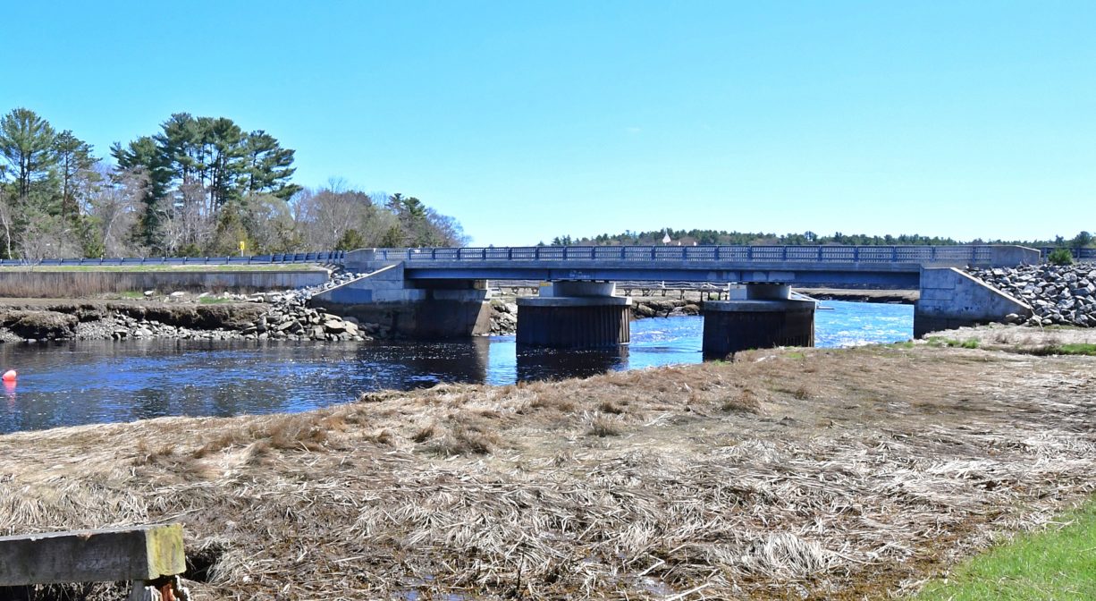
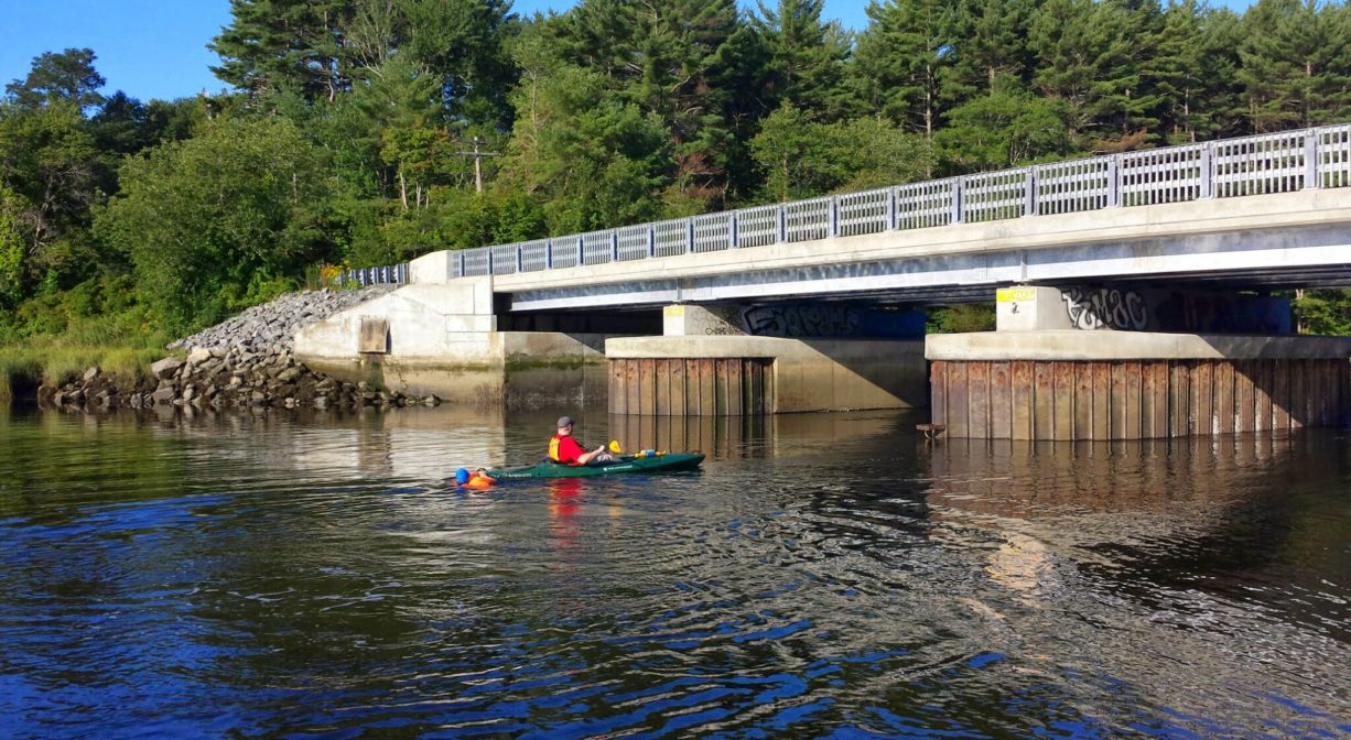
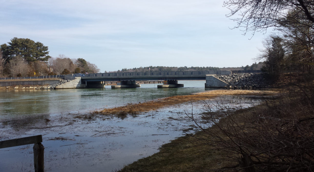
The Union Street Bridge spans the North River from Union Street in Marshfield to Bridge Street in Norwell. On the Marshfield side, there is a launch for canoes and kayaks and a picnic table. On the Norwell side, there is a Town Landing with a ramp for boats (residents only). On the water in this area, be aware of swift currents and low bridge clearance.
For related information, please see the listing for Norwell Town Landing and Marshfield Launch / Brooks & Tilden Shipyard. This is also the starting line for the NSRWA’s annual Great River Race.
Tide Math: High tide at the Union Street Bridge is about 60-90 minutes after the Boston high tide. Set off from here to go clamming!
SHELLFISHING: The shellfish beds in both the North and South Rivers are now closed for the season. They are typically open from November 1 to May 31st. Please visit our Shellfishing page for maps and permit info.
Hunting is not permitted on this property.
FISHING ADVISORY: It’s important to know that some of our freshwater fisheries are contaminated with mercury, PFAS and/or other concerning substances. The Massachusetts Department of Public Health maintains an online database with up-to-date advisories regarding fish consumption, sorted by location. We recommend you consult this valuable resource when planning a fishing excursion.
Features
Beginning around 1644, Elisha Bisbee of Scituate operated a ferry at this site. His son kept a tavern nearby. Bisbee’s Ferry was also known as The Upper Ferry. Later, when the Oakman family took over, it was known as Oakman’s Ferry (1760-1770). John Tolman was the last person to operate the ferry, beginning in 1770. The site was also a landing for packet ships.
Tolman became the toll keeper when the first bridge at this site was constructed, in 1801. It was a drawbridge, which was necessary to permit the passage of the large vessels built in the shipyards upriver. After Tolman, Hatch Tilden became the toll collector. He lived in a house to the east of the bridge on the Marshfield side, and held this position for 40 years.
In 1850, when sufficient tolls had been collected to settle any remaining construction debts, a jubilee was held, and crossing the bridge became free of charge. The bridge was replaced in 1898, and rebuilt again in 1917, after sustaining significant storm damage. A subsequent bridge, constructed in 1961 or 1972, stood for many years. It was a drawbridge, but the draw mechanism did not actually work! Today’s bridge was constructed in 2010.
The remains of a North River ferry boat are visible from the northern bank of the river, just upstream from here on the Norwell side, at dead low tide. (Water access only.) The landings on both sides of the Union Street Bridge are ideal places to launch your canoe or kayak. Be aware that there is a tide delay — 1 to 1.5 hours after the Boston high tide.
Bisbee’s Ferry/Union Street Bridge was also a packet landing — one of many on the North River. Packet ship lines were established prior to 1670, and thrived until railroads came to the South Shore in the mid-to-late 1800s. Over time, White’s Ferry, Little’s Bridge (Route 3A), Union Bridge, Hobart’s Landing, Foster’s Landing, Job’s Landing, Brick-Kiln Yard, and the North River Bridge in Hanover became regular stops. Farmers would meet the packet ship and barter their home-grown vegetables and dairy products for goods from China and Mediterranean, such as coffee, sugar and spices. In addition to home-grown goods, packet pilots also bought wood, fish, pot iron, and charcoal from locals, and sold them lumber and ship supplies. A typical packet run, up and down the river, could take three or four days.
Above the Union Street Bridge is a section of river known as “The Rapids” and “Rocky Reach.” Power boats first arrived on the North River in 1894, and their captains quickly discovered that this rocky section of the river presented numerous hazards. Alfred L. Lincoln of Marshfield led an effort to compel the state to improve the river’s navigability.
In Old Time Anecdotes of the North River and the South Shore,” Joseph Foster Merritt described the situation as such: “In the stretch of river known as ‘Rocky Reach,’ not over a quarter of a mile in length, there were more rocks than there were in the whole length of the river outside of this reach. At low tide many of them showed out of the water and countless others were just below the surface making it extremely difficult to navigate.”
Merritt goes on to describe how “for over two hundred and fifty years the old settlers picked their way through these rocks, and vessels built above, some of five hundred tons were floated down through this reach on their way to the sea, many of the old river men gaining reputations as skillful pilots if they were fortunate enough to avoid all of them,”and comments on how captains of “the gasoline pleasure craft” found these rocks to be “very annoying” as they were “very liable to break the shaft or damage the propellor.” He continued, “What had been borne by generations in the way of business could not be tolerated by pleasure seekers for a single year, if there was a way to overcome it.”
Ultimately, the towns of Marshfield, Norwell, Pembroke and Hanover appropriated funds. There was a special hearing with considerable support from citizens and congressmen, and before long a steam derrick was at work removing the rocks. The cost was $15,432.08. Once the rocks were removed, power boating gained momentum and many new boats were added to the area’s recreational fleet.
This land is within the region of the Massachusett (or Massachuseuk). To learn more about local Native American tribes, we encourage you to interact with their members. The Massachusett tribe at Ponkapoag and the Mattakeeset band of the Massachusett share information on their websites.
Trail Description
Boat ramp on the Norwell side. Short woodland trail on the Marshfield side.
Suggested paddling excursions from this location (timing is approximate and depends quite a bit on wind, tide, and your own strength and stamina):
• Put your boat in the water around the time of ocean low tide and paddle downstream to Cove Creek. Explore the creek and then return with the rising tide upstream to your starting place. (2+ hours)
• Put your boat in the water about 2 hours before ocean low tide and paddle downstream to Damon’s Point and the North River estuary. Then ride the rising tide back upstream to your starting place. (2.5+ hours)
• Put your boat in the water 1-2 hours before ocean high tide and head upstream to Couch Beach. Stretch your legs at Couch Beach and then return with the slack/receding tide. (3+ hours)
• Stage a second vehicle at Damon’s Point or Driftway Conservation Park. Return to Marshfield Launch and put your boat in the water 2-3 hours after ocean high tide, then take a one-way trip with the outgoing tide to your second vehicle. (1-2 hours)
• Stage a second vehicle at Pembroke Town Forest. Return to Marshfield Launch and put your boat in the water 2-4 hours before ocean high tide, then take a one-way trip with the incoming tide to your second vehicle. (3-4 hours)
Habitats and Wildlife
The North River rises from marshes and springs in Weymouth, Rockland and Hanson. It is approximately 10 miles in length, with its source at the confluence of the Indian Head River (Hanover) and Herring Brook (Pembroke). From there it flows through the towns of Hanover, Pembroke, Marshfield, Norwell, and Scituate to the Atlantic Ocean between Third and Fourth Cliffs, draining approximately 59,000 acres along the way.


Historic Site: Yes
Park: No
Beach: No
Boat Launch: Yes
Lifeguards: No
Hours: Bridge is a public roadway and thus is always open. Launch sites on both sides are open dawn to dusk.
Parking: Limited parking on Marshfield side. Limited on-site parking on the Norwell side with Norwell residents with green recycling sticker.
Cost: Free on Marshfield side. Free with sticker on Norwell side.
Facilities:
Picnic table on Marshfield side; bench and trash receptacle on Norwell side.
Dogs: Dogs must remain on leash. Please clean up after your pet!
Boat Ramp: Yes
ADA Access: No
Scenic Views: Yes
Waterbody/Watershed: North River